Say “Helo” to the Sea Ice: Helicopter Flight Over McMurdo Sound

Helicopter taking off from McMurdo
A helicopter taking me to New Harbor on Nov. 21st lifts off from McMurdo. Riding in a helicopter never got old. Photo: Elaine Hood.
New Harbor from helicopter
The New Harbor team gathered outside the Jamesway huts to see me off when I flew out a few days later.

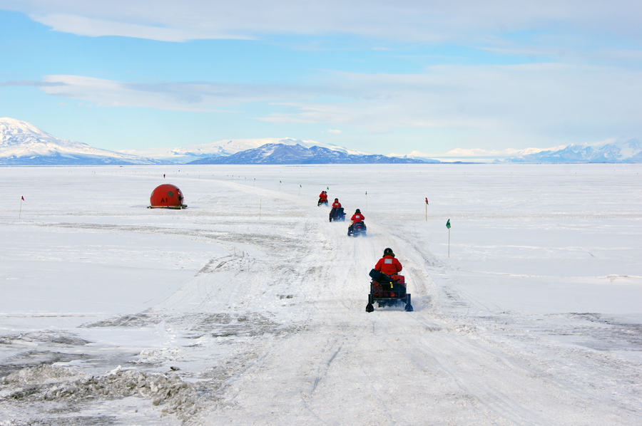
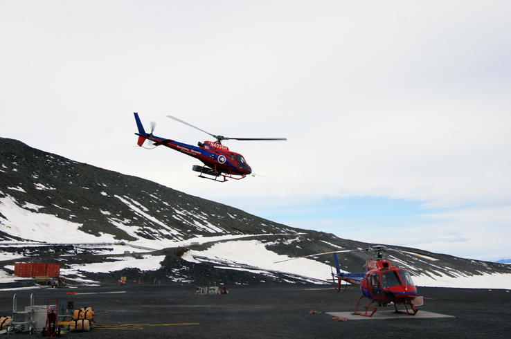
To travel to the four field camps I visited during my stay in Antarctica I took a total of eight helicopter trips. Traveling by “helo,” as they say there, or watching them take off, land, and pick up sling loads never got old. I don’t think it was just because I was an Antarctic newbie; even at the field camps where helicopters took off and landed a few times a week, or in the case of Lake Hoare, a couple of times a day, camp residents would stand at the hut window or just outside the door to watch.

Since all fresh water, fuel and food is brought into the field camps, and all waste is packed out, the helo pilots are busy all day during the field season. And when I say all waste is packed out, I mean everything: gray water (water left from washing hands, faces, and dishes), human waste (metal drums for the pee, five-gallon plastic buckets for the poop), trash (sorted into recyclables, non-recyclables, and food waste). By treaty, all traces of human presence are to be removed from the environment, which as you can imagine, demands a lot more thoughtfulness in sorting and disposing of trash than we’re used to, not just in the field, but at McMurdo, too. Heavy items are suspended under the helicopter as a sling load. Laura Von Rosk has posted a short video of sling load take-offs from New Harbor on the Bravo! 043 Facebook page (see December 9, 2015 post).

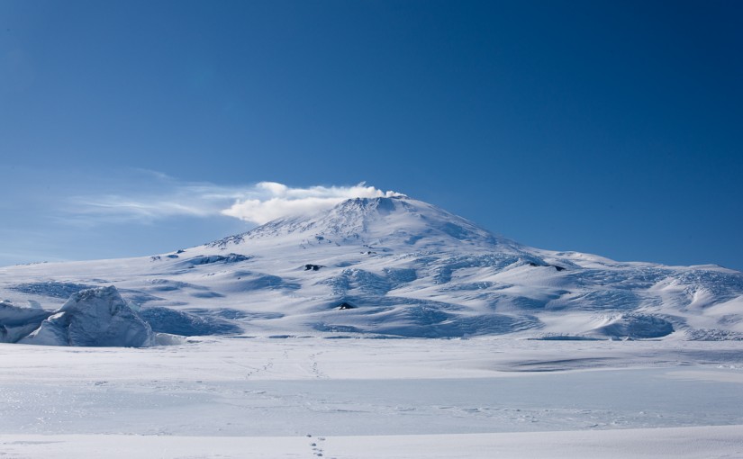
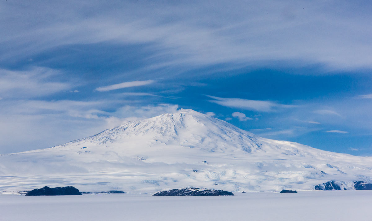
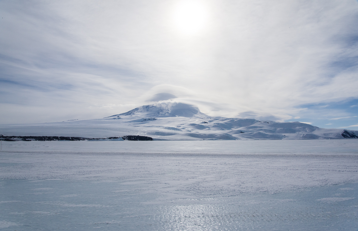
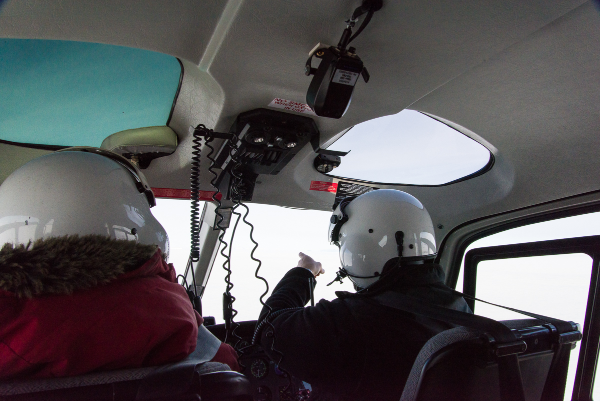
Helicopters take off and land vertically, which is a different sensation than the headlong forward motion of an airplane liftoff. On December 16th, a brilliantly sunny day, I shot this video of the helo take off (posted on YouTube) from McMurdo Station on the way to Blood Falls in the Dry Valleys. (I’ve already discussed Blood Falls in the previous post.) The video starts just after the helo has risen off the ground and is turning around to head out over the sea ice. Mt. Discovery is in the distance.

Helmets are equipped with microphones so passengers can communicate with the pilots during the trip. McMurdo pilots like pointing out the sights. On this trip, returning from New Harbor, I was sitting in the back seat of a four-seat helicopter.
Helmets are equipped with microphones and earphones so passengers can communicate with the pilots during the trip, because helicopters are noisy. That’s one of Mike’s colleagues pointing out the sights on the return trip from New Harbor. I was sitting in the back seat of a four-seat helicopter.

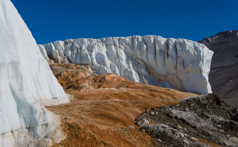
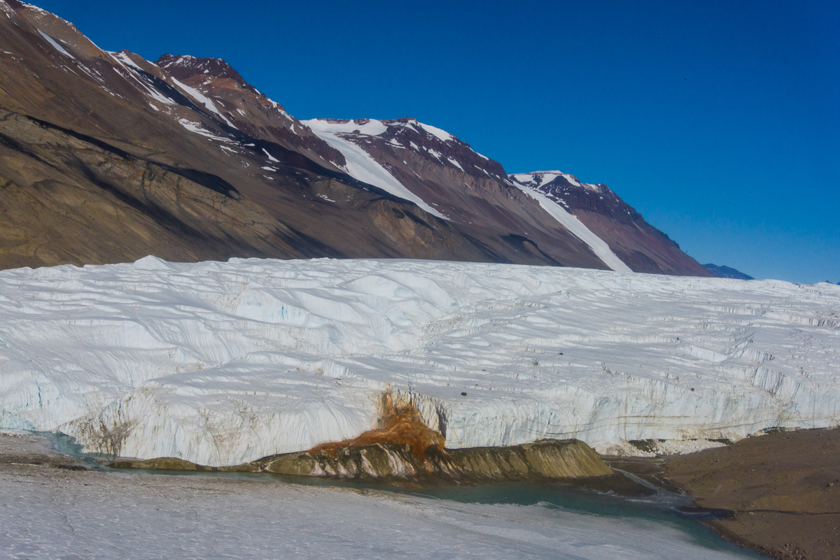
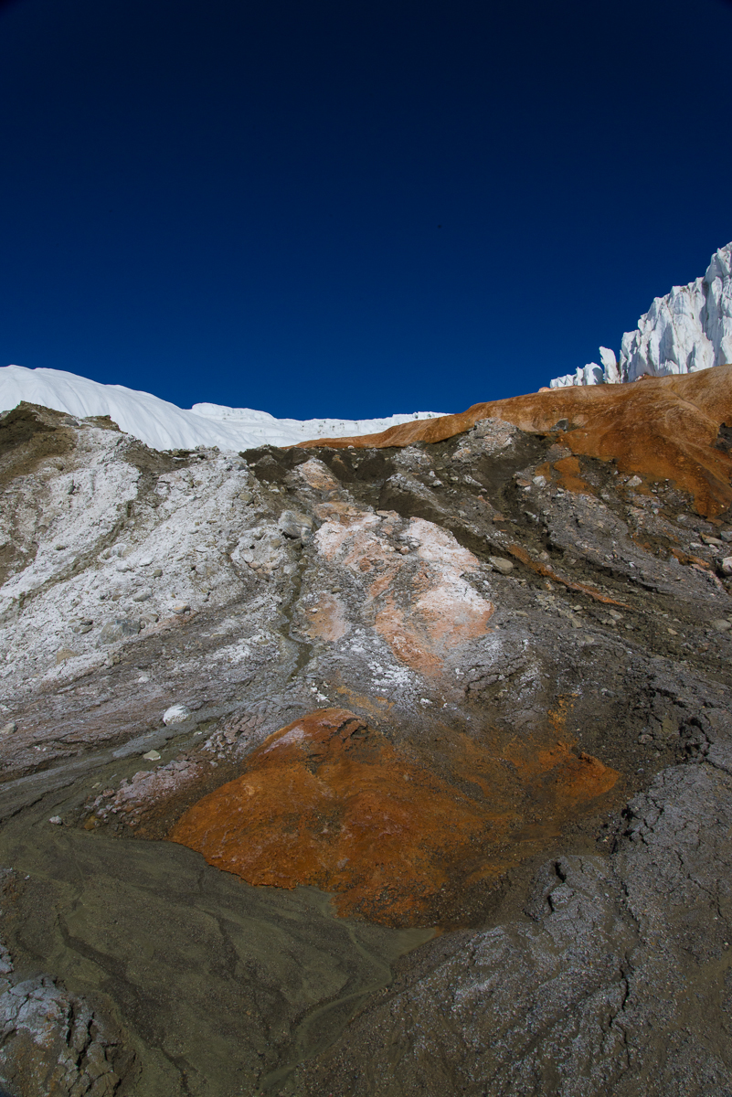
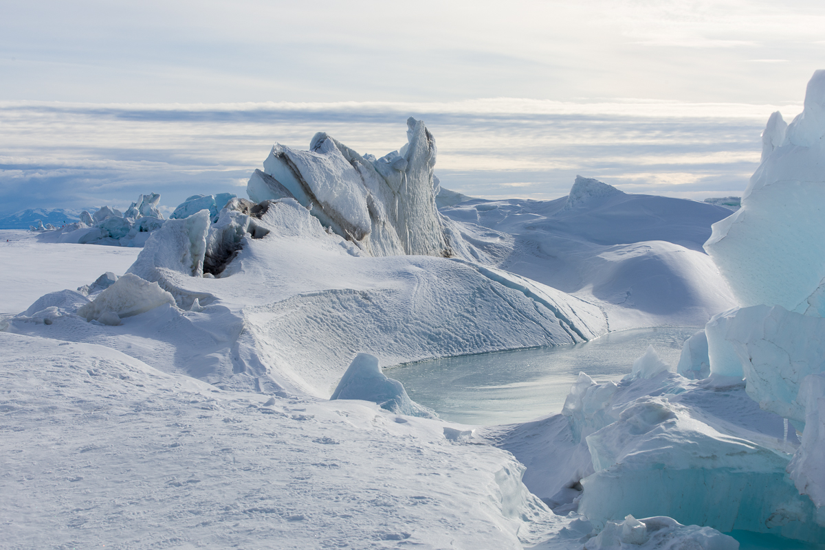
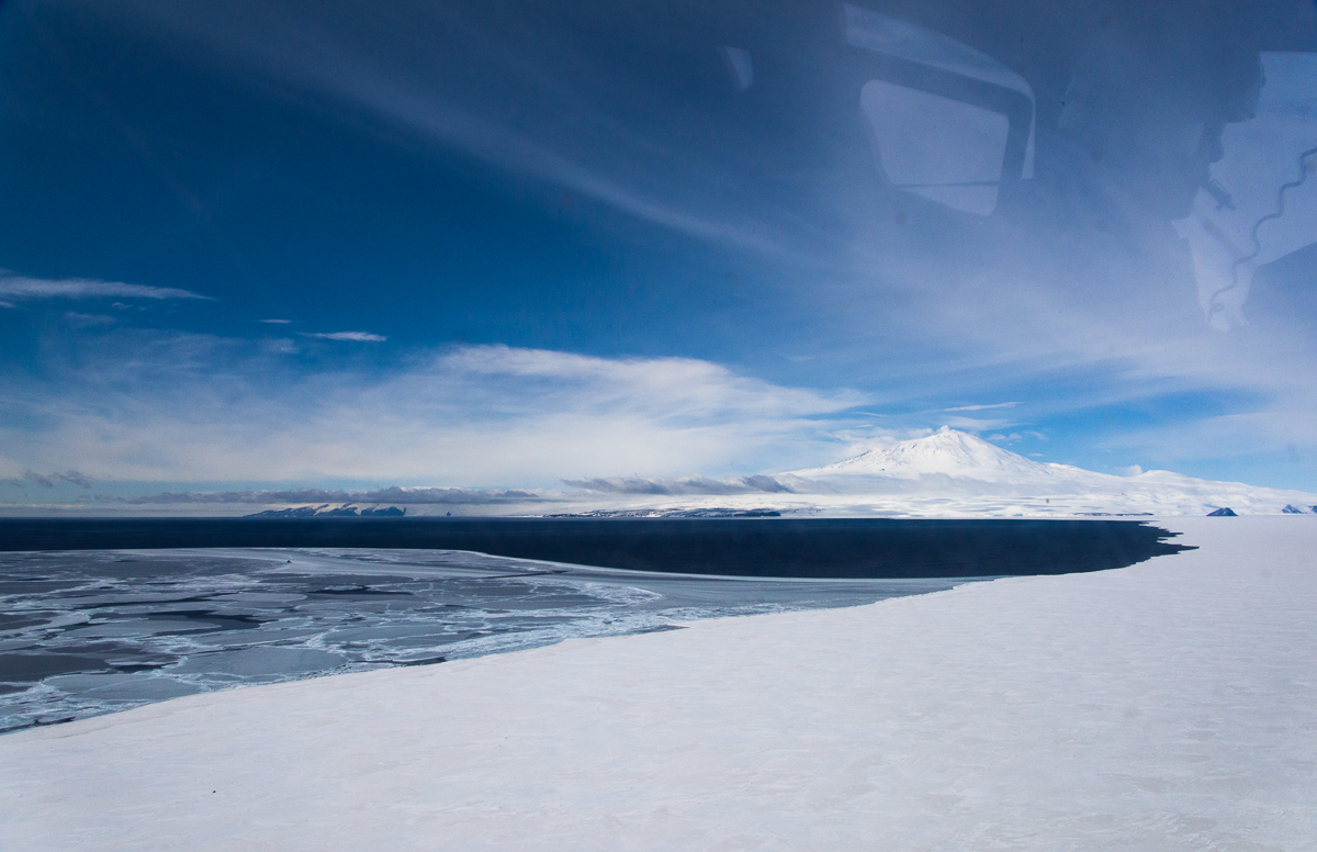
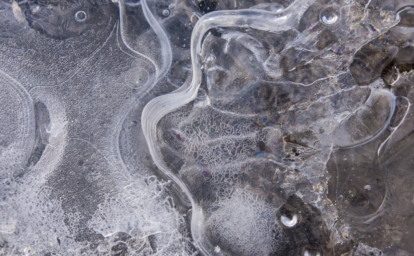
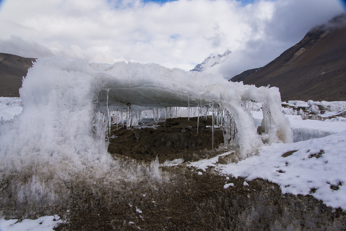
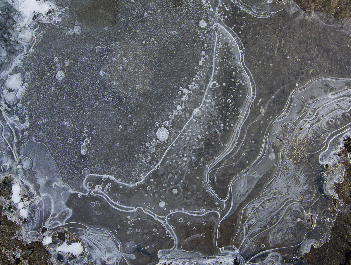
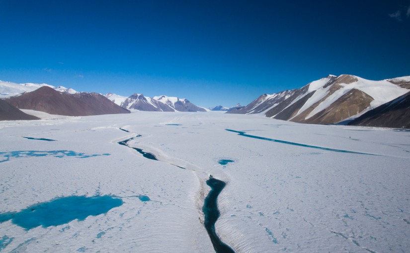
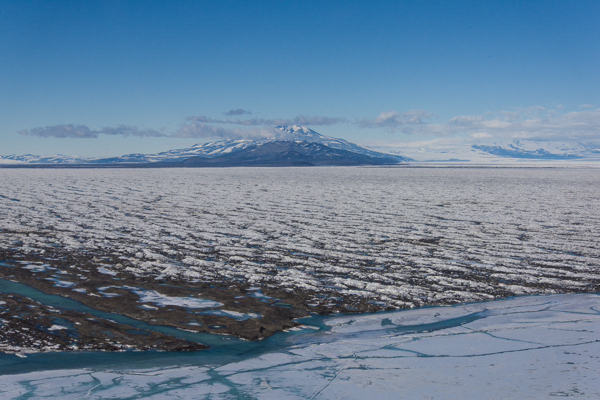
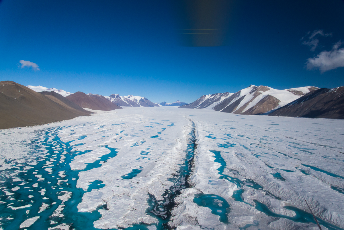
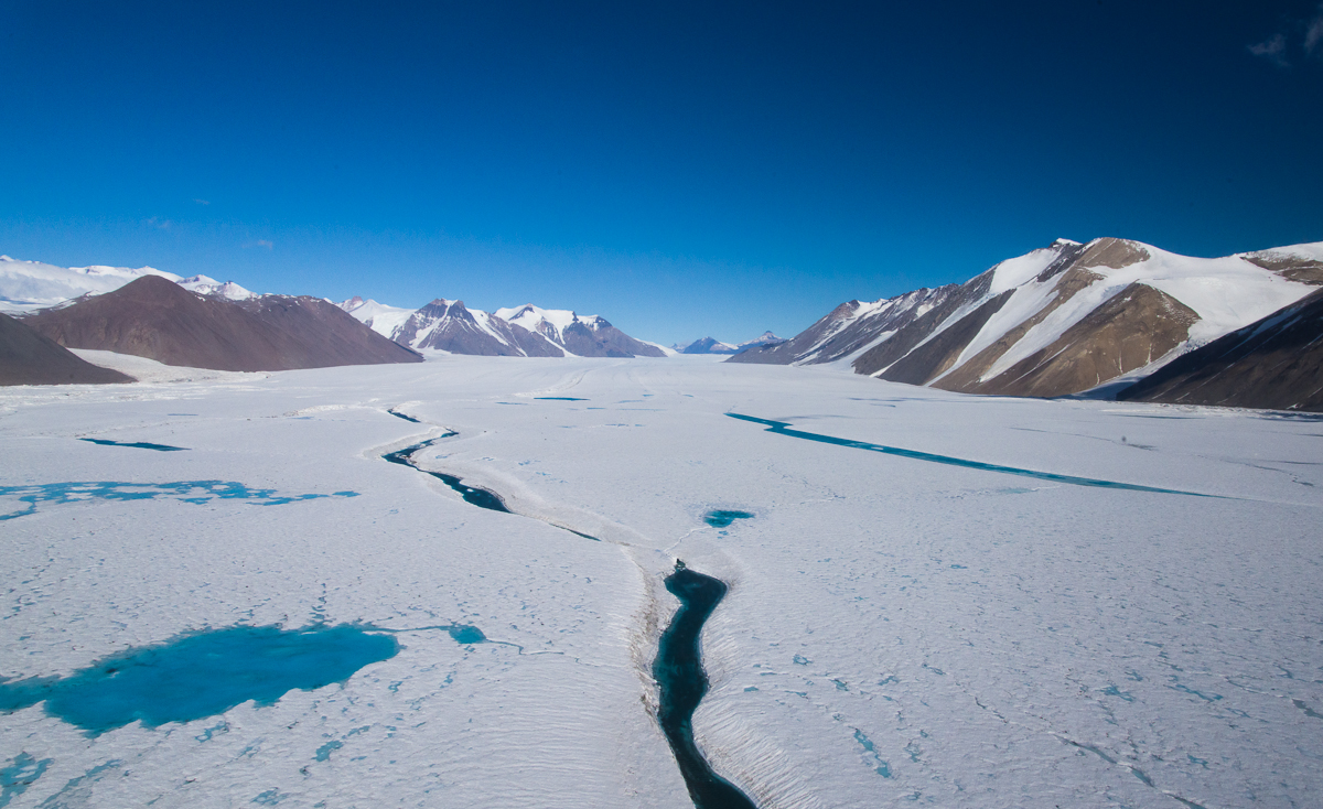
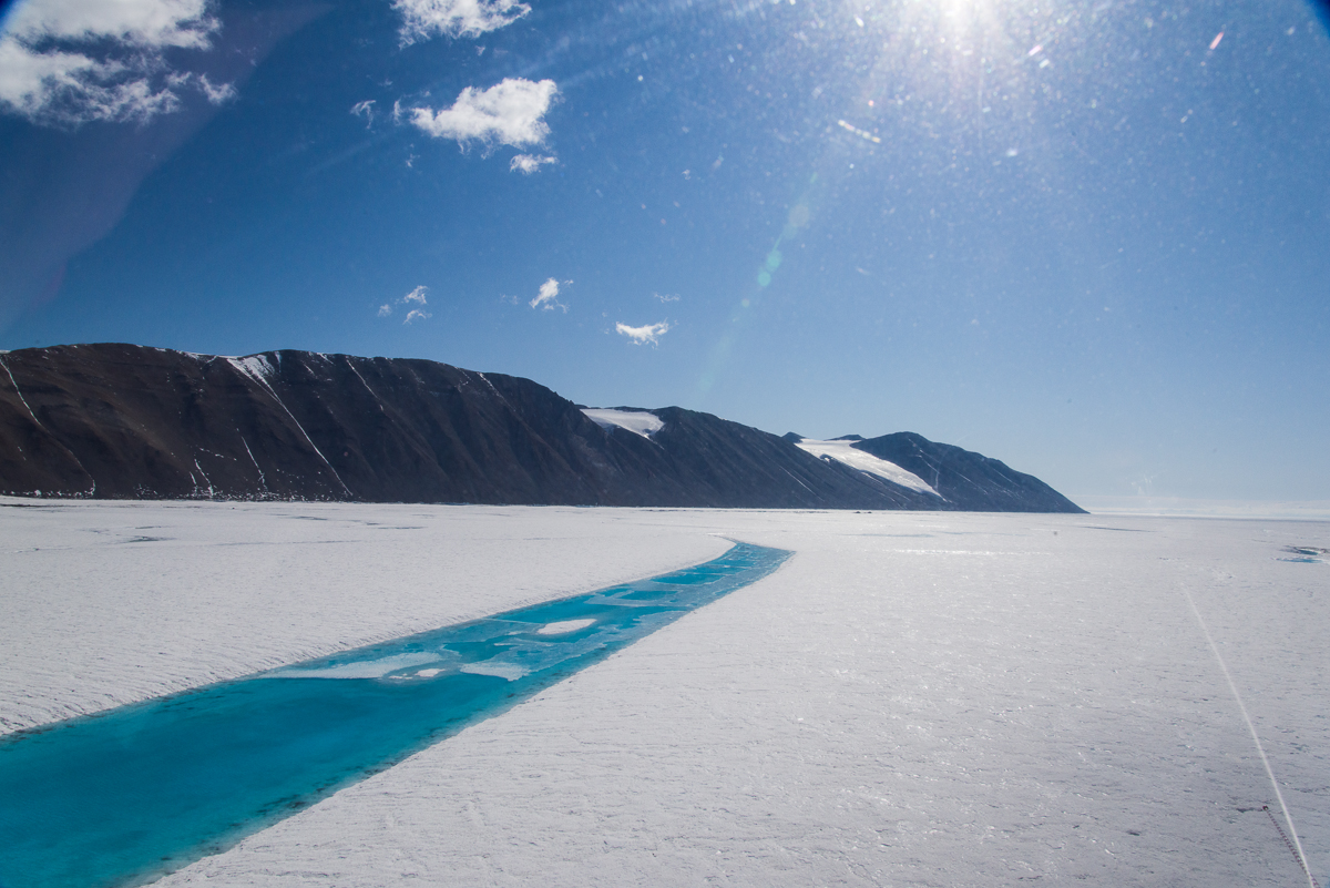
Mike, the helo pilot that day, knew that I was interested in ice, and asked if I’d like to see the recent changes to the edge where the sea ice meets the ice shelf. Well, yeah! The last time I’d flown across the sea ice to the Dry Valleys had been almost a month before, and it was indeed different. Meltpools filled with blue water streaked the surface of the ice shelf, including a stream flowing to the sea ice. The rest was a corrugated pattern of white ice and snow outlined by dark brown sediment that had blown there from the surrounding mountains, carried by fierce Antarctic winds.

Sea ice meets ice shelf, McMurdo Sound
The Edge: On December 16, Mike showed me the recent changes in the edge where the sea ice meets the ice shelf. Mt. Discovery is in the distance.

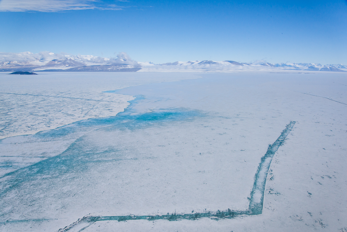
We flew over a large crack in the sea ice that was remarkably regular in shape: three fairly straight segments at close to right angles. When I showed this photo to glaciologists Doug MacAyeal [pron. mac-hale] and Ian Willis, they told me that it was the result of movement analogous to that of the tectonic plates of the earth’s crust, where forces were pulling the sea ice away from the ice shelf, creating the two cracks that are vertical in the photo. The horizontal crack had then opened between those two cracks, connecting them; Doug pointed out how its edges were jagged, rather than clean.

Cracks in sea ice, McMurdo Sound
Zigzag: This crack resulted from ice dynamics where the two parallel cracks separated and the horizontal one formed between them.

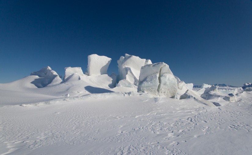
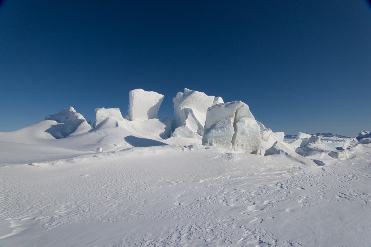
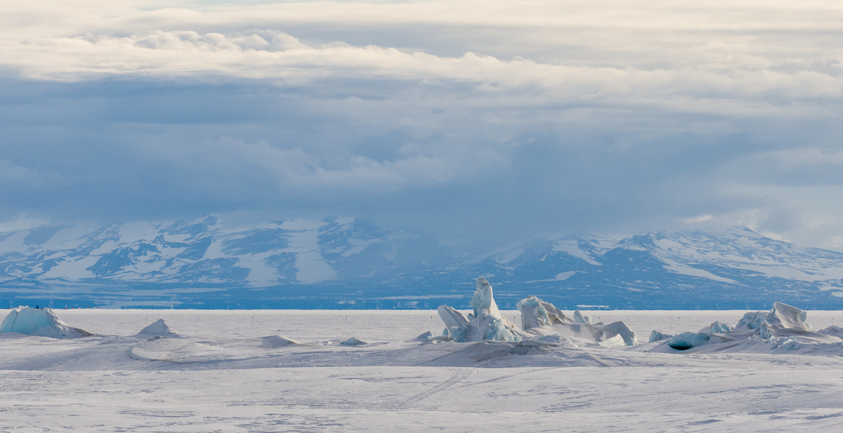
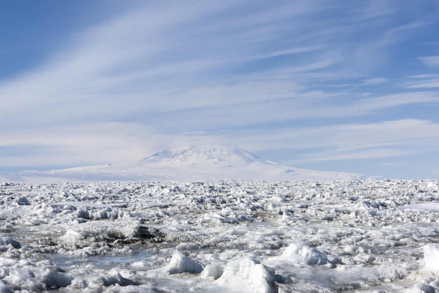
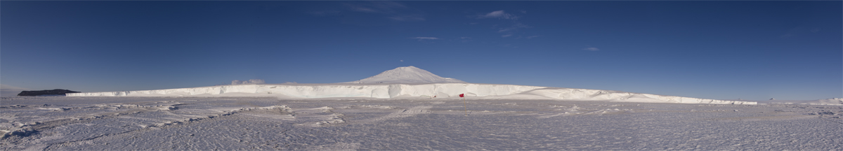
As we headed across McMurdo Sound toward the Kukri Hills and the Dry Valleys a low white object appeared in the distance, resembling those gift boxes they give you at a department store. It was a huge tabular iceberg that has been frozen in the sea ice for at least a few years, according to another of the helo pilots. I had flown over it once before, on the way to New Harbor.

Iceberg stuck in sea ice
At a distance, the iceberg stuck in the sea ice of McMurdo Sound looks like a department store gift box.

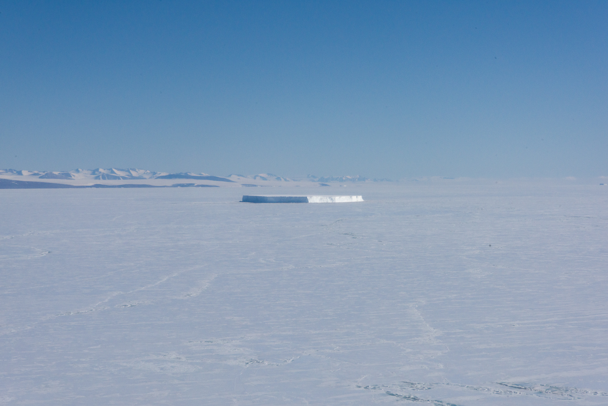
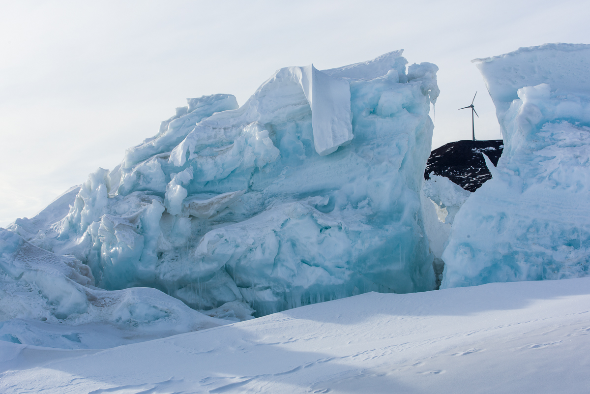
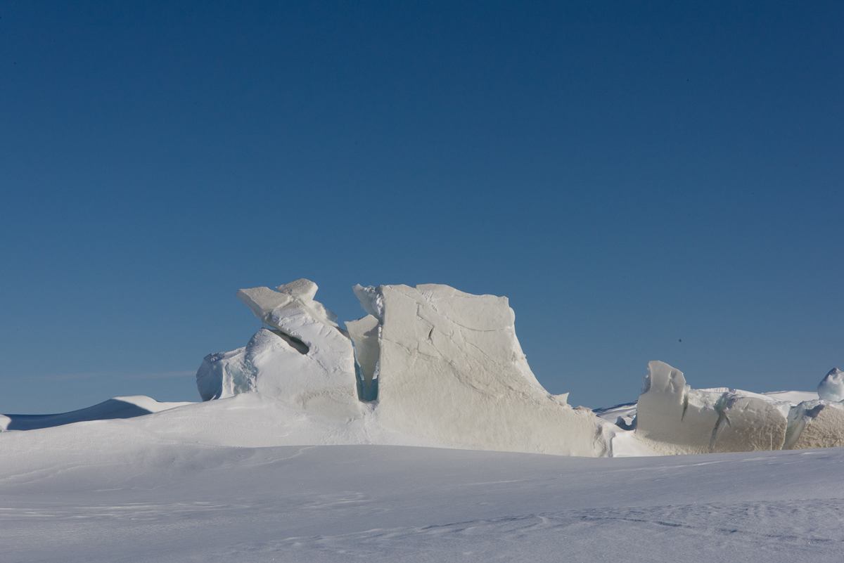
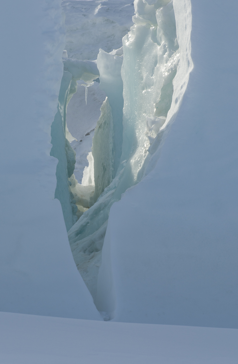
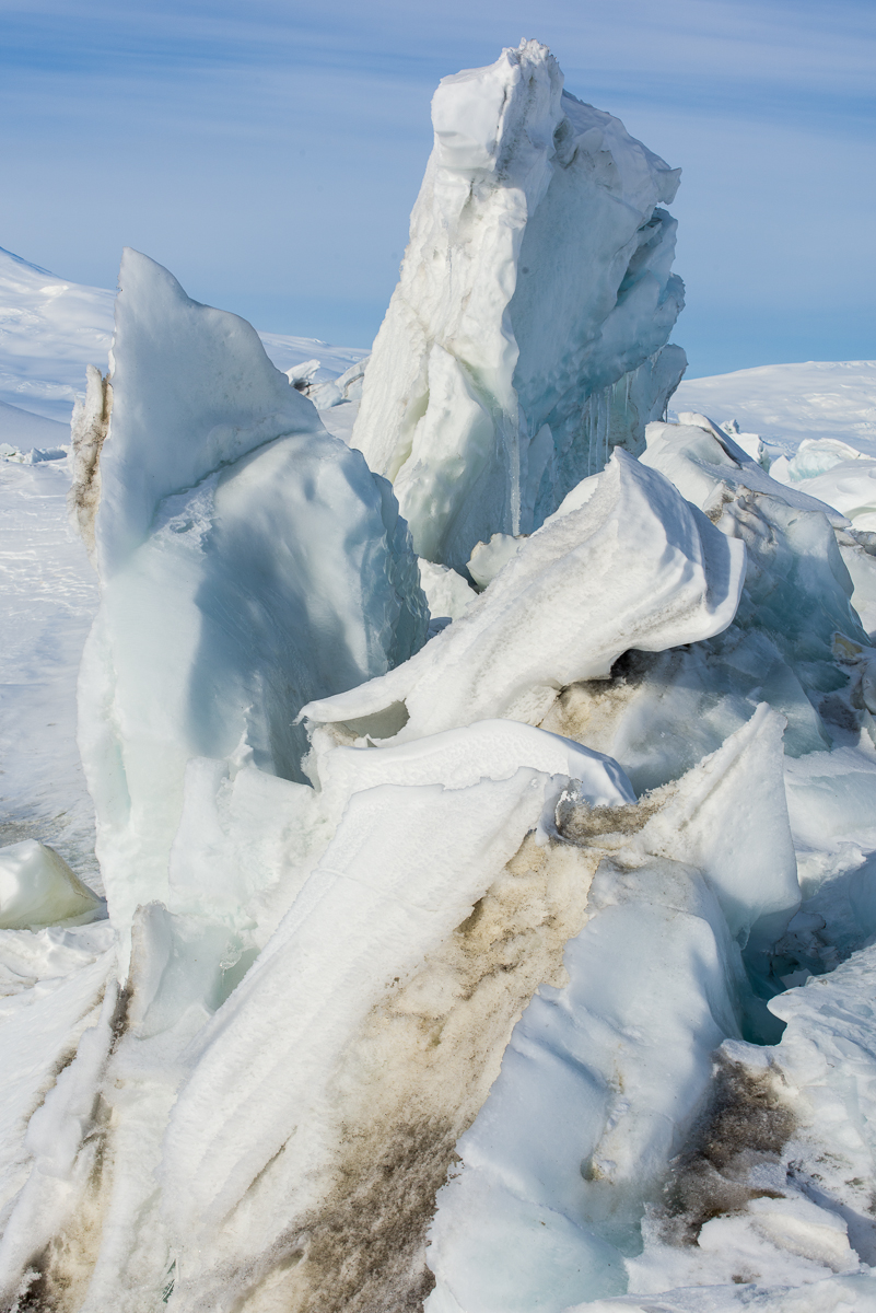
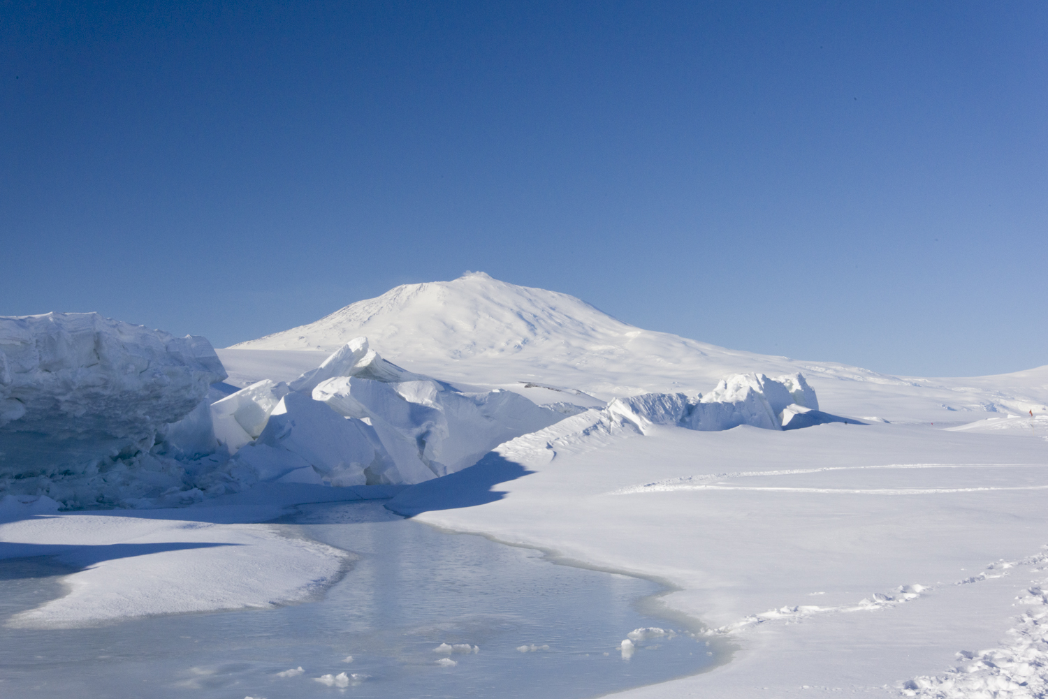
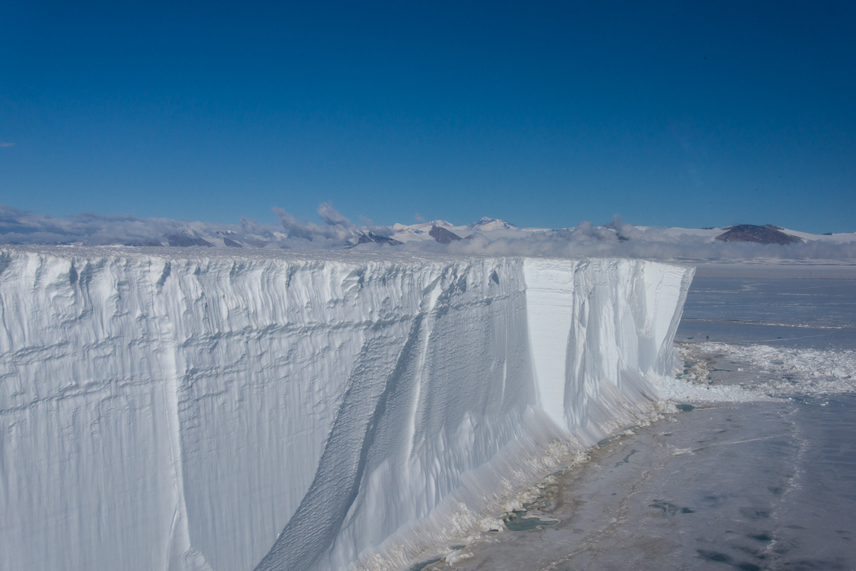
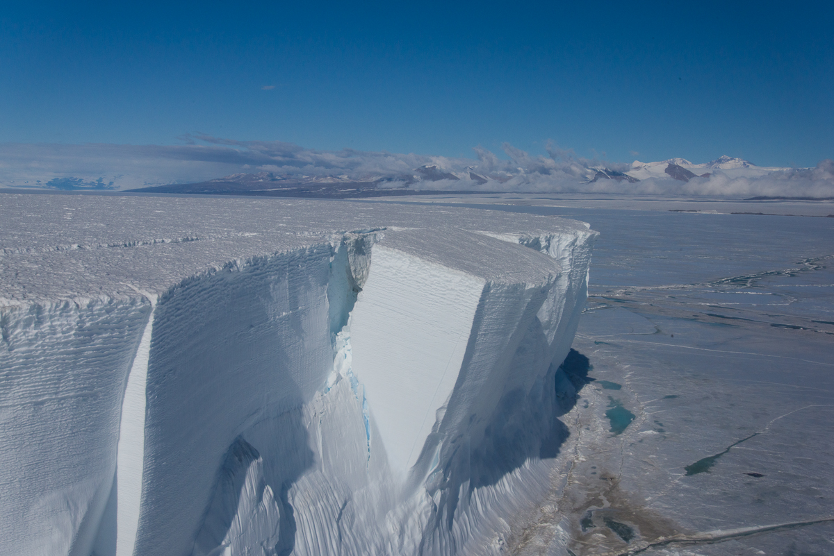
As we got closer, the immense scale became evident. What looked like a perfectly flat top and planar sides from a distance was inflected with vertical ridges and horizontal lines. Tabular icebergs have flat tops and steep sides, and are created by breaking off from ice sheets or ice shelves, so presumably this one was once part of the ice shelf.

Tabular iceberg, McMurdo Sound
Approaching the tabular iceberg. It is not as rectangular as it appeared from a distance. That’s part of the helicopter in the right foreground.


Tabular iceberg, McMurdo Sound
And an even closer view of the side.

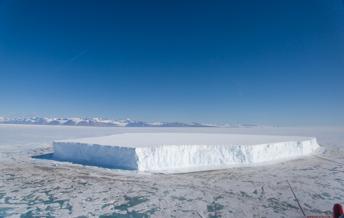
At one corner, a huge chunk is poised to fall. The helo pilots have been watching it all season: “I’d love to be flying over it when that happens,” one told me. That will be quite dramatic when it gives way and tons of ice come crashing onto the sea ice, though odds are nobody will be around to see it. The McMurdo helicopter pilots enjoy the ever-evolving panorama beneath them as a perk of the job. On my last flight I asked the pilot about that and he said, absolutely — flying over other locations can be very monotonous by comparison.

Tabular iceberg, McMurdo Sound
Leaning Tower: One day that enormous chunk will come crashing to the ground.

As we began to enter the area of the Dry Valleys, we saw a variety of other patterns in the ice below: an area where it had broken into large, roughly rectangular sheets; turquoise melt pools and a stream between sparkling white ridges; and a long blue melt pool with parallel sides as if someone had built a canal there. The way the sea ice could fracture along long straight lines into almost rectangular shapes intrigued me.

Sea ice formations, McMurdo Sound
Roughly rectangular blocks of ice are outlined by turquoise melt water. Beside them, more irregular patches resemble a flagstone path.
McMurdo Sound sea ice
Further along were these gorgeous turquoise and white patterns as we headed between the hills. The helicopter rotor is a blur in the top center.
Sea ice stream, McMurdo Sound
That view gave way to narrow streams and a few melt pools.
Melt pool in sea ice, McMurdo Sound
A sea ice “canal” with parallel sides that are so evenly spaced it looks manmade.

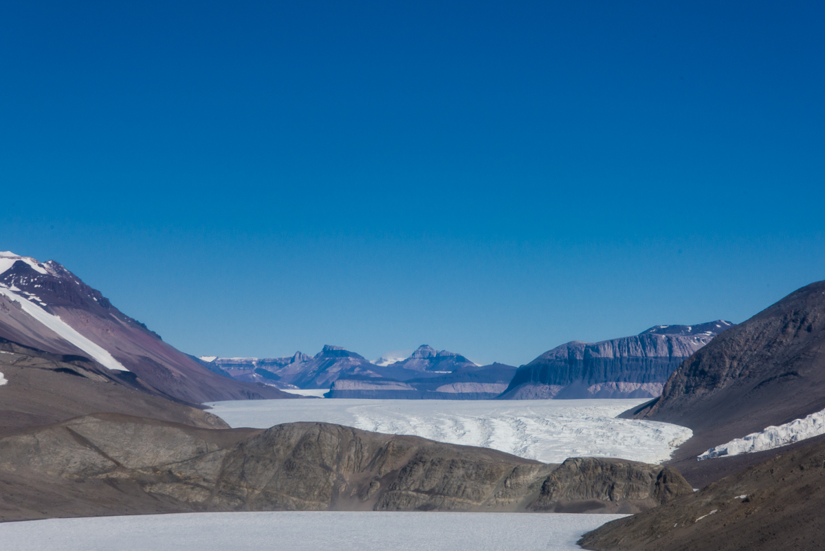
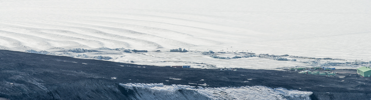
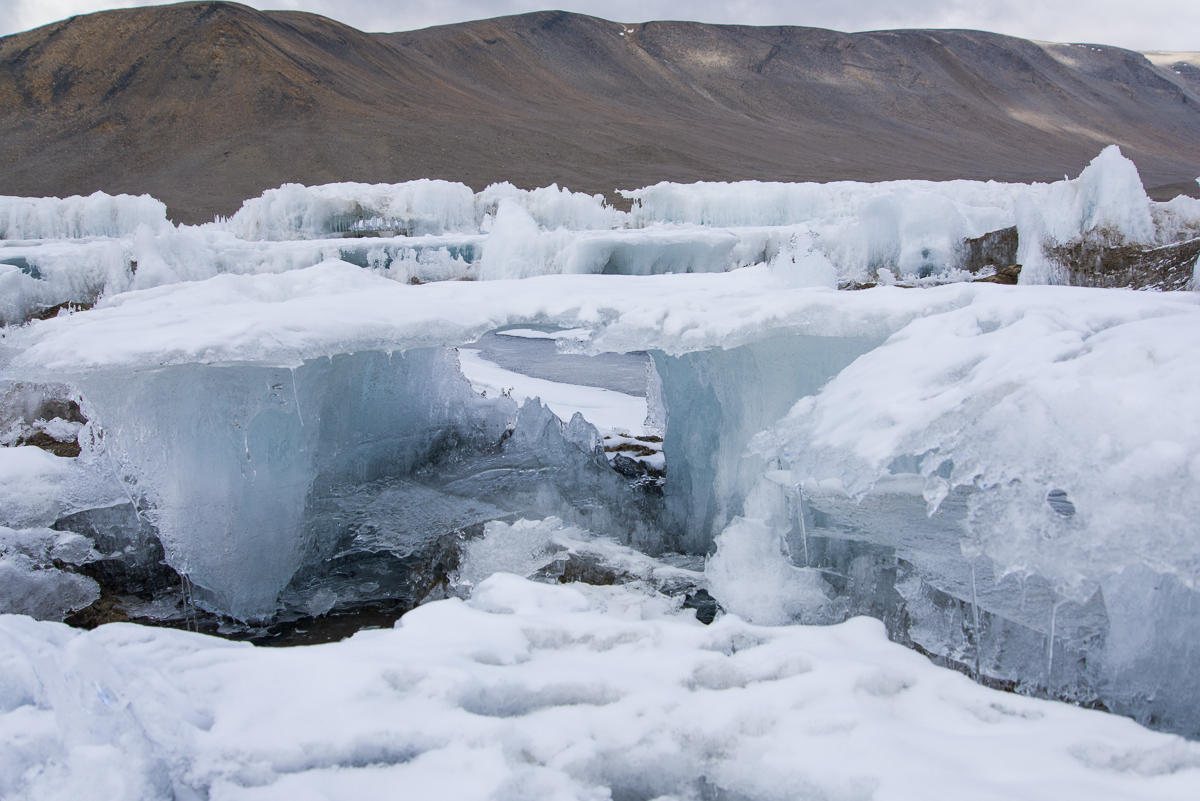
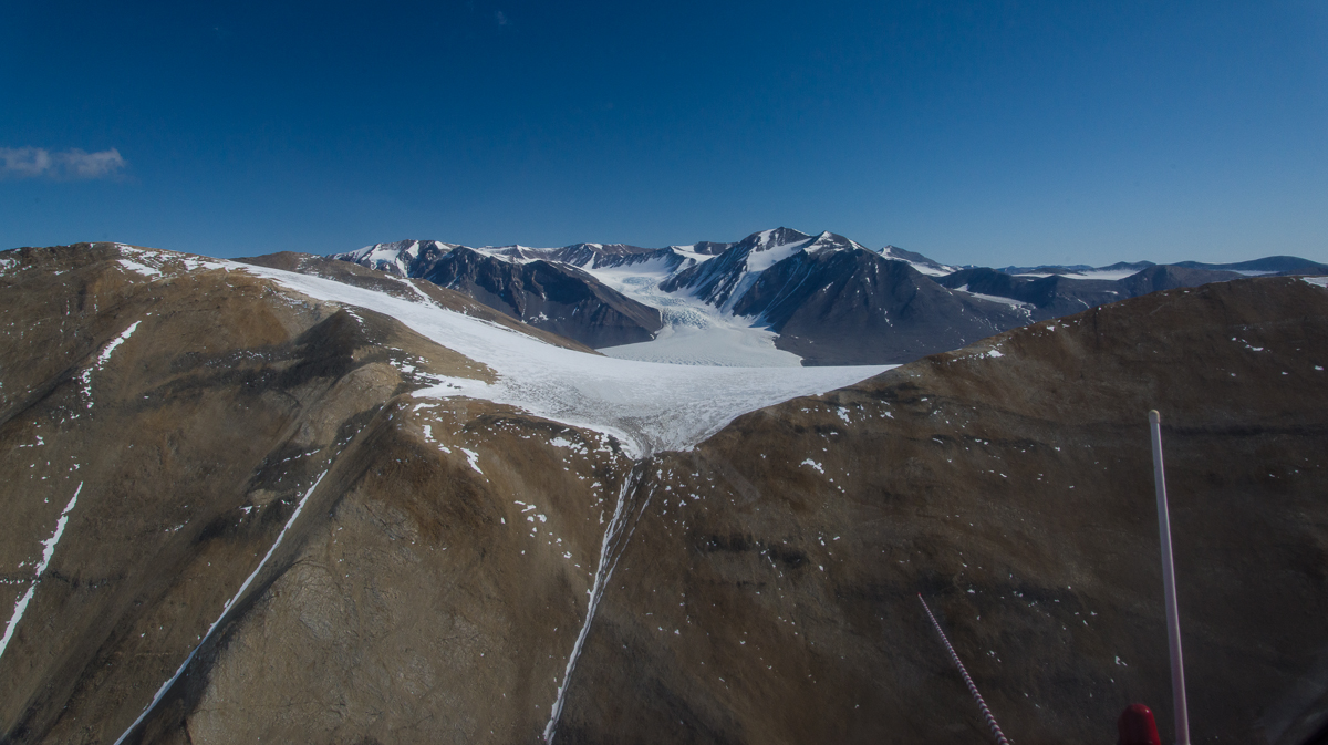
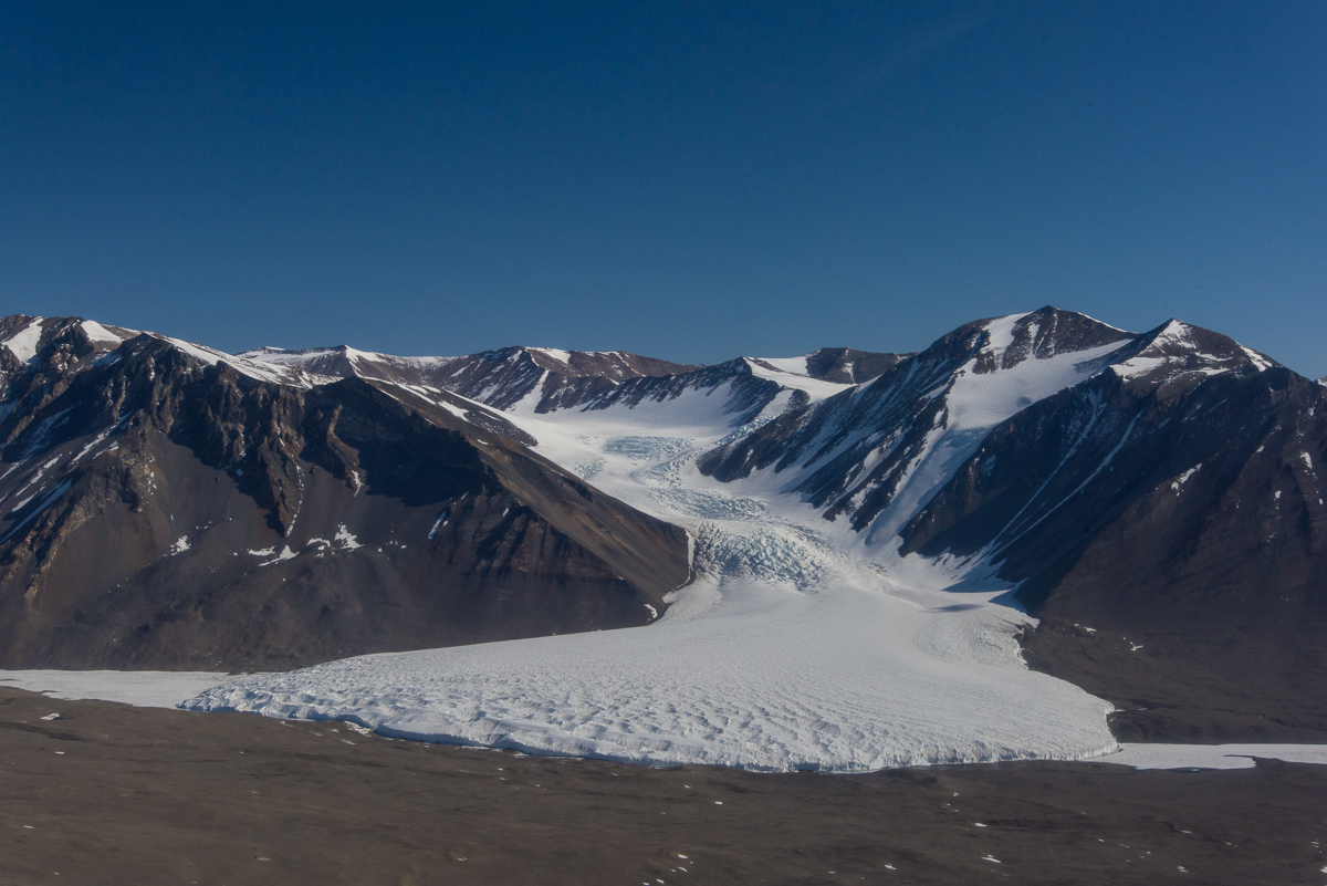
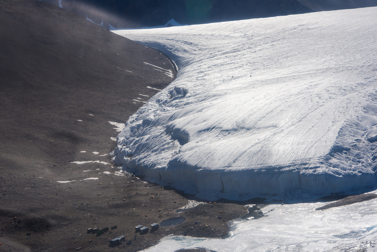
Our helo flight to Blood Falls turned and crossed over the steep gravel Kukri Hills. On the other side of the valley, you could see the Canada Glacier spilling down to Lake Fryxell, which was on the right, and Lake Hoare, on the left. We landed briefly at Lake Hoare to drop off some supplies before continuing to Blood Falls. That was my first view of the field camp where I would return a few days later and spend five nights. If you check out my earlier blog post about Lake Hoare, you’ll see ground level views of the camp. From the air, it’s clear how tiny the main hut, lab buildings and tents are in relation to the Canada Glacier.

Helicopter view of Canada Glacier
Flying over the hill, the Canada Glacier in the distance, with helicopter antennas in the right foreground.
Canada Glacier, Aerial View
The Canada Glacier comes into view, with the frozen surfaces of Lake Fryxell to its right and Lake Hoare to its left. The light was perfect for capturing the rugged texture of the ice falls further uphill. A few days later, I hiked to the bottom of the lower ice falls, over the top of the glacier, and down to Fryxell. I’ll write up that trip in a later blog post.
Lake Hoare field camp
In this aerial view of the Lake Hoare camp, you see a portion of the Canada Glacier looming over the main hut, three labs, smaller outbuildings, and if you look really closely (click image to enlarge), small tents where the scientists and camp personnel sleep. For a ground level view see my earlier post.

The final photo in this sequence was taken just before we got to Blood Falls, looking into the Taylor Valley toward the distinctive striped hills resembling chocolate sandwich cookies, yet another unexpected sight in a trip that was full of them.

Taylor Glacier, Dry Valleys, aerial view
Sandwich Cookies?: The Taylor Glacier is bordered on one side by distinctive striped hills. Lake Bonney is in the foreground. The hill in the foreground blocks the view of the west lobe of Lake Bonney and Blood Falls, which are on the other side.


I See Red: A Walk Around Blood Falls

Blood Falls
First sight of Blood Falls from the helicopter.
Blood Falls, Antarctica
Awesome: Looking up from the foot of Blood Falls was an “I’m-in-Antarctica” moment.

The word “awesome” has taken on a casual meaning, approximating something like, “Super cool!” or “Hey, that’s great!” But there were many times in Antarctica I was confronted by something awesome in the original sense of the word, as in awe-inspiring: difficult to grasp in its immensity and power. Even if you learn the scientific explanation, there’s something unfathomable about a large expanse of bright orange and red ice spilling from the end of the steep walls of a glacier that towers overhead. It’s one of those moments where I’d just stand there for a minute thinking, “I’m in Antarctica. I’m really in Antarctica.” That’s how I felt when I stood at the bottom of Blood Falls, at the toe of the Taylor Glacier in the Dry Valleys, overlooking the west lobe of Lake Bonney.

Blood Falls
Rust Never Sleeps: from a vantage point even with the top of the falls.

In those I’m-in-Antarctica moments I felt how privileged I was to even be standing there. Since my Antarctic Artists and Writers Program project involved photographing ice formations to recreate in 3D I was among the fortunate few granted a permit to walk around it, not to mention a helicopter ride to the site. Blood Falls is among the highly protected zones of Antarctica because it is both a rare natural phenomenon and harbors delicate mineral deposits, which in turn harbor unusual microbes, all of which one must take care not to trample. National Geographic’s Blood Falls web page offers a good overview of where the minerals and and their colors come from, and the scientific significance of the site. In brief, the iron oxide salts percolate up into the glacier from a hypersaline lake (i.e. super-concentrated salty water) trapped beneath it from geological processes occurring over a period between two and five million years ago. When the iron salts hit the air, they oxygenate and turn red and orange. This is a dynamic process, and I’m told that the depth of the colors varies from year to year.

Blood Falls detail
The X-Philes live here.

National Geographic goes on to explain that scientists from a variety of disciplines are interested in the microbes who live in the unusually harsh conditions of these deposits: glaciologists (who study glaciers), limnologists (who study lakes), microbiologists (who study microbes) and astrobiologists (who speculate about the presence of life on other planets). As a group, the microbes fall into the broader category of extremophiles because they “are able to withstand and even thrive in extremely harsh environments.” The extremophiles (I like to think of them as the X-philes) of Blood Falls manage the trick of converting sulfur and iron compounds into energy under freezing conditions. Hence the interest on the part of astrobiologists, since this may be the closest Earth can come to approximating conditions on a freezing planet.

Blood Falls
What does the fashionably dressed Antarctican wear to a visit to Blood Falls? Mountaineer guide Forrest McCarthy and I chose Sulfur Orange and Blood Red.

I visited Blood Falls with mountaineer Forrest McCarthy, a veteran of about 20 seasons “on the ice” in the US Antarctic Program. We flew in a helicopter and were joined by Mike Jackson, the National Science Foundation science representative on station for that period. Since Mike’s trip was spur of the moment due to their being room in the helo, he had not obtained a permit. Even an NSF administrator isn’t allowed to walk all the way to the falls without one, so he stayed on a nearby trail overlooking the site, while Forrest and I waded across the shallow but wide melt waters of the Taylor Glacier at the edge of Lake Bonney, which was ankle deep in some places. I had changed into hiking boots instead of bunny boots, so I splashed through the freezing water as fast as I could, hoping my boots were as waterproof as advertised. (They did reasonably well. Lowa boots, in case you’re wondering, from REI. They’re the only ones that come in true narrow widths, so I didn’t have much choice. But they turned out to be great boots.) This was my first view of Bonney, and I knew it was a frozen lake, but I didn’t realize the edges would be swiftly moving water. Or that streams of water would be spilling off the top of the glacier in little waterfalls. I’d never seen a glacier do that before; it seems to be a particularly Dry Valleys phenomenon, where the glaciers are basically grounded rather than actively moving out to sea. (I’ve posted a 13-second video to YouTube.) It was a cold and windy, but sunny day, with a brilliant blue sky.

West Lobe of Lake Bonney
Looking across the west lobe of Lake Bonney from Blood Falls. The water closest to the shore was shallow meltwater coming off the Taylor Glacier.
Taylor Glacier
The side of the Taylor Glacier that is to the right of Blood Falls if you’re facing it from the lake. You can see how massive it is compared to Mike, walking below it (in red parka lower center).


If all goes well, the photos I took during my walk-around can be processed into a 3D file after I return home to recreate this special place as a sculptural form.

Blood Falls
Blood Falls and the Taylor Glacier are in the foreground. Beyond them on the right are the smaller Rhone Glacier and part of Lake Bonney.


Under Pressure Ridges

Scott Base pressure ridges
The Scott Base pressure ridges present an undulating landscape of unending variety. In the center of this photo is a melt pool.

If you’ve been following this blog, you’ve been introduced to the pressure ridges near the Double Curtain Glacier, which is across McMurdo Sound from McMurdo Station in the New Harbor/Explorer’s Cove area of the Dry Valleys. During the seven weeks that I was based at the US Antarctic Program’s McMurdo Station, I also made two trips to visit the extraordinary pressure ridges at Scott Base, which neighbors McMurdo and is operated by New Zealand’s Antarctic program. If you’ve seen Anthony Powell’s excellent documentary film, Antarctica: A Year on the Ice, you may have noticed the Scott Base pressure ridges among the time-lapse photography sequences.

Observation Hill view of Scott Base
From the 754-foot-high summit of Observation Hill at McMurdo Station, you can see an aerial view of the Scott Base pressure ridges, including the undulations in the ice shelf that have helped form them. The little black dots on the ice a little left of center are Weddell seals. (Click on photo to see enlargement.) I also photographed the prominent formation in the center from the ground (next image) and made a 3D file of it (shown further down in this post):
Scott Base pressure ridge
This formation is large enough to stand out even from the top of Observation Hill (see panoramic photo above). I also made a 3D file of it from 53 photographs taken while walking around it (scroll down further below).
Scott Base pressure ridge
Scott Base pressure ridge with Scott Base in the background.

In Antarctica, the interaction of permanent thick ice shelf (that constantly floats atop the sea), sea ice (that is subject to melt cycles, and some years even melts to the point where it breaks up and floats out to the ocean) and the stationary rock of the coastline, can cause the ice near the shore to buckle and push up chunks into formations called pressure ridges. The pressure ridges are dynamic and constantly changing due to the action of the forces described above along with the 24-hour summer sun. Summertime temperatures at McMurdo when I was there mostly stayed in the 15 to 30 degree Fahrenheit range, and only a few times that I recall got into the upper 30s (and once a balmy 43 degrees — a few of the young guys took advantage of that heat wave to walk around in shorts!). But even in below-freezing air temperatures, when the sun beats down on the ice, it softens and sometimes melts. Then there are icicles, large chunks splitting off and falling, or gravity sometimes causes a chunk of snow to bend and flop over like a draped cloth.

Scott Base pressure ridge
By November 30th, long icicles had formed beneath this this sheet of ice.
Scott Base pressure ridge
The underside of this large chunk of ice was a deep blue and decorated with icicles. In the background are the green buildings of Scott Base.
Scott Base pressure ridges
A thick mat of softened ice can bend like a draped cloth (lower right) and form graceful curved shapes.

Because of the ice shelf and sea ice dynamics, there are also cracks in the ice and melt pools on the surface that widen and deepen as the air warms (one of those was prominently featured in my post about Mt. Erebus). So there is a small window of time from November until mid-December when it is safe to walk out on the ice to get close to the pressure ridges. The McMurdo Recreation Department leads evening tours for the workers and others in residence there during that rare period. I went on two such trips, on November 24th and 30th. These photographs are, essentially, documentations of ephemeral formations: even though these photo sessions were only six days apart some of the ice had already changed in that brief time.

Scott Base pressure ridge
Another spot where the snow has drooped over like a towel on a rack (upper center).

Where there is a nice-sized crack in the sea ice near the shore of McMurdo Sound or one of its islands, chances are you’ll find a group of Weddell seals laying out along it. Cracks give them a head start in chewing out a seal-sized hole in the ice where they can haul themselves out of the water for a break from non-stop swimming and foraging for food. I’ve never seen an animal that sleeps more soundly than a Weddell seal! They also give birth and nurse their pups on the ice. At least one of the Scott Base seals had a pup:

Weddell seal and pup at Scott Base pressure ridges
Baby Seal!: A Weddell seal and her pup chill out at the Scott Base pressure ridge.


From the shoreline, the ice formations are flatter and some have straight lines and more angular profiles:

Scott Base pressure ridge
Looking out from the Scott Base shoreline at angular pressure ridge formations. On the horizon is Willy Field, one of the airstrips that serves McMurdo and Scott Base. It’s probably about a 15- to 20-minute drive from that spot, i.e., not as close as it looks! It’s pretty much impossible to judge distances in Antarctica. You learn to not even try.
Scott Base pressure ridge
Planar ice formations close up.

From other angles there were other formations to see, as in the two vertical photos below. I also did a few walk-arounds for photogrammetry captures. I’ve processed one of those files for a potential sculpture (horizontal image below those).

Scott Base pressure ridges
Peering through a crevice at the Scott Base pressure ridges results in a puzzling and ambiguous spatial reading.
Scott Base pressure ridges
Another unexpected sculptural ice formation.
Scott Base pressure ridges
A 3D file made from 53 photographs walking around a portion of the Scott Base pressure ridges. I need to edit out a few extraneous forms, but the capture came through mostly intact, with great detail and very few gaps.

At the end of this post is a photograph of another fascinating phenomenon we saw on the November 30th trip to Scott Base: a type of mirage called a fata morgana. It has nothing to do with pressure ridges, but it does have to do with looking across the wide flat expanse of the sea ice toward a distant shore. A young man in our group noticed it first. In a fata morgana, a strip at the bottom of the land seems to be stretched like Silly Putty. This one was subtle, but unmistakable. There are more dramatic examples online. Just search Google Images for “fata morgana Antarctica” or read this explanation.

Fata morgana, McMurdo Sound
Across the sea ice from the Scott Base pressure ridge there was a fata morgana effect that made the bottom strip of the Transantarctic Mountains across McMurdo Sound appear to be stretched into a horizontal band at the bottom. Fata morganas appear in Antarctica when a band of air just above the sea ice is a different temperature than the air above it, causing a temperature inversion and distorted reflection at the horizon. Fun fact: the name comes from the Italian for Morgan Le Fay, half-sister of King Arthur.


Erebus, the Mini-Series

Erebus from the sea ice
On occasion, if the wind isn’t blowing too hard, you can see the smoke rising from the volcano. This view is from the sea ice near the Dellbridge Islands. The sun threw the crevasses on the slopes into relief.

At almost 12,500 feet high, Mt. Erebus dominates the landscape of the western side of Ross Island, where I spent my time in Antarctica. It’s an active volcano, and not part of a range, so it stands apart from other mountains. Also, its western slope ends at the flat sea ice, even though its summit was about 50 miles away from New Harbor, which is on the opposite side of McMurdo Sound, it was a prominent feature of the horizon. I found myself photographing it from a variety of locations. The cap and banner cloud formation on top of Mt. Erebus featured in the last post is just one of them. I ended up with a small series of photos of its snow-covered slopes in different weather as well as different vantage points. The funny thing about Erebus is that it doesn’t look as big as it is. Distances are incredibly difficult to judge in Antarctica anyway. I kept trying to figure out what was messing with that perception. Part of it must be that there are no trees or other cues to help provide scale. And with Erebus, I think because the profile of it is rather spread out and horizontal rather than steep and vertical, you don’t realize how gigantic it is.

To get an idea where we’re talking about, here’s a Google Earth Map of McMurdo Sound:

Map of McMurdo Sound
Google Maps satellite view of McMurdo Sound (click to enlarge): The black spot labeled “Ross Island” on the right is the summit of Mt. Erebus. McMurdo Station is labeled below it, at the end of the peninsula. Scott Base is just around the corner from McMurdo. The Erebus glacier ice tongue is the sawtoothed shape on the sea ice and those dark specks above it are the Dellbridge Islands. Cape Evans is on the other side of the ice tongue from McMurdo Station, and Cape Royds is the larger dark area north of that. If you draw a horizontal line from the summit of Erebus, through Cape Royds and across the sound to the indentation in the dark shoreline of the Dry Valleys opposite, that’s where the New Harbor camp is.
Erebus from Cape Royds
Erebus adds drama to the view from the field camp at Cape Royds, which is on top of a tall hill.
Erebus from New Harbor
Far away, across the sound from Cape Royds at New Harbor, Erebus stands out. In the foreground is multi-year sea ice.


Erebus from Scott Base
I made two different visits to the pressure ridges in the sea ice near Scott Base, which is New Zealand’s Antarctic outpost and close neighbor to McMurdo. One evening the sky was hazy.
Erebus from Scott Base pressure ridges
Revisiting the same site the following week, the sky was clear, the landscape a study in graphic blue and white shapes.
Erebus from Hut Point
The hills around McMurdo Station block the view of Erebus until you get up on a ridge above the base, like this one on the Hut Point trail. You can glimpse Erebus behind one of the “golf balls” as people call them — geodesic domes that house satellite dishes.


Erebus ice tongue
Erebus in the background of a panorama of one side of the Erebus glacier ice tongue. The red flags mark the entrance to the ice cave. The dark rock on the left is one of the Dellbridge Islands. Click to enlarge.
Erebus and sea ice edge
On the flight back from New Harbor, the helo pilot showed us the sea ice edge with Erebus in the distance…
Erebus from helicopter
…and flew closer so we had a good view from the air. The Dellbridge Islands are in the foreground.
Erebus from Observation Hill
One of the last days at McMurdo I climbed to the top of Observation Hill. This is the last photo I took of Erebus.


January 2016 Cloud of the Month, or Super-Encounters of the Antarctic Kind

Cap and banner cloud over Mt. Erebus
12:15 p.m. My photo of a cap and banner cloud atop Mt. Erebus from Cape Evans is the Cloud Appreciation Society January 2016 Cloud of the Month. The cap is on the right and the banner is the streaming cloud on the left.

The above photo of a cloud formation known as “cap and banner” is the Jan. Cloud of the Month on the Cloud Appreciation Society’s web site. You can also see it on their web site. I photographed it in Antarctica on November 25th, after traveling by snowmobile over sea ice for about 90 minutes to the historic Terra Nova Hut at Cape Evans.

Snowmobiles on McMurdo Sound sea ice.
Here we are heading out onto the sea ice for a snowmobile trip to Cape Evans. I’m the 3rd one in line. One of the many aspects of the Antarctic experience I never anticipated was that I’d be driving a snowmobile.

The hut was built in 1911 for the 1910-13 expedition, led by British explorer Robert F. Scott, and eventually I’ll post some photos of the fascinating interior, which is filled with period tools and supplies the explorers left behind, including snowshoes for ponies (they brought ponies to Antarctica! on a ship! alas, it did not work out well), a taxidermy penguin, piles of 100-year-old cans of food and bottles of medicine, fur boots, old socks, etc.

The Cloud Appreciation Society, a project started by Gavin Pretor-Pinney, the best-selling author (at least in England) of The Cloudspotter’s Guide has amassed a huge online library of cloud images sent in by cloud enthusiasts all over the world for the last several years. I submitted the photo after looking up Erebus on Google Images and finding nothing else like it. I thought it likely they’d post it eventually, but was pleasantly surprised to see they not only posted it immediately, but featured it. They’ve classified this particular cloud as a “cap and banner”.

Although going inside the hut was the purpose of the trip, I couldn’t help but notice that a picture-perfect lenticular cloud was forming above nearby Mt. Erebus. I knew it was a lenticular cloud, because I learned about the different types of formations while photographing clouds intensively a few years ago. Lenticulars often form right above isolated mountain peaks, and if they form a base low enough to cover the summit they’re known as cap clouds. Banner clouds are more like a stream of vapor — but not snow — flowing off the mountaintop. (More info about both types here.) About two-and-a-half hours before I took the photo there was no indication that anything special was brewing:

Mt. Erebus, Antarctica
Erebus at 10:24 a.m. When we stopped for a break en route to Cape Evans that day, it was bathed in a glowing haze. In retrospect, I can see there was a little bit of a cap above the peak, but no hint of the drama to come.

I just looked at my photo catalog on my hard drive and realized I must have taken a few thousand photographs of cloud formations between 2007 and 2012 — I’ve got a few hundred digital negatives on my hard drive and those are only the ones I didn’t delete! It did get to the point where I’d look at the sky and think, yeah, that’s nice, but I’ve already taken that picture 50 or 100 times. So when I saw this, I thought it was cool, but knew I should keep an eye on it in case it got even better:

Mt. Erebus an hour earlier
11:50 a.m. The Terra Nova Hut exterior was the subject of this photo, but the two clouds over the summit in the background caught my attention. I ate my lunch and walked around outside, keeping an eye on it.


Banner cloud over Mt. Erebus
1:00 p.m. Ten minutes after what turned out to be the best shot the cap cloud was spreading out and losing its lenticular shape. Still an impressive banner on the other side of the volcano, though.

So, in between two walks through the hut, taking pictures, and a climb to the hilltop memorial cross to explorers who lost their lives, I kept checking on it. Looking back at the time stamps of the photos, I can see that I took my first photo of that cloud almost exactly an hour before I took the January Cloud of the Month photo, which I decided was most perfectly formed, and just 9 minutes after that, it was starting to flatten and become much less interesting. In between the first and last photo, I kept checking on it, because prior experience alerted me to the fact that (a) this was an unusual formation and (b) being a cloud, it wouldn’t last long. The fact that it had even drawn my attention when it was not the purpose of the trip, occurred to me as I read “How to Cultivate the Art of Serendipity” a thought-provoking New York Times article on how inventions come about by Pagan Kennedy, which was published a few days ago, on January 2nd.

Kennedy notes that often major inventions or discoveries come about because of an accident, while the inventor was looking for something else entirely (50% of the time, according to one survey of patent holders). While this may look like luck, she cites a researcher named Sanda Erdelez who posits that there is something more going on: that people who make new discoveries may be especially inclined to notice things that were not on their agenda and to take a detour to investigate when that happens. Also that such people enjoy encountering odd bits of information for no particular reason than to see if anything interesting turns up. Kennedy calls that process “gathering string.” String gatherers/detourers are what Erdelez calls “super-encounterers.” I recognize that tendency in myself. Kennedy is very upbeat about the trait, suggesting it nourishes creativity. But I can attest like any personality trait, digressive wandering has its downside that it behooves one to be aware of lest you look up at the clock and notice you just spent way more time “string gathering” than you’d intended, let commitments outside your normal routine totally slip your mind, or exasperate people you’re recounting something to, leading them to plead, “Could you get to the point?” (Yes, if you are one of those people, you may feel free to stop me.)

After reading Kennedy’s article, it occurred to me that the only reason I knew to attend to what was going on above Erebus that day was that when I was taking all those cloud photos I was reading everything I could get my hands on to understand how they formed and moved through space. The information stuck in my head, even though I never saw a lenticular cloud in person until November 25, 2015 when I took these photos. So was I lucky that the cloud came together while I happened to be there? Yes. But without the prior intellectual wandering which was really just because I found it personally enriched my experience of the natural world, I would probably have taken the shot above at 11:51 with the hut in the foreground and gone back inside, and missed the really great moment an hour later.

On January 4th, I left the ice, as the expression goes in the US Antarctic Program. I’m sitting in a hotel room in New Zealand typing this post. The last week I was in Antarctica it started to hit me that it was the last week I was in Antarctica. Travel for me is always a period of “super-encountering” that I simply need periodically, to recharge my batteries. But this is the longest trip I’ve been on in 40 years, and in the most alien, unfamiliar place I’ve ever visited. I generally had an idea what to expect, except that nothing quite prepared me for any of it. I wasn’t sure if it would be what I hoped; it was way more than what I hoped. I haven’t even finished posting material to this blog. There’s more coming as I work my way through it.

And I found myself rising to the occasion to handle everything from being dropped into a field camp to live in a tent with people I had never met, to sleeping in a tent in 20-degree weather, to driving a snowmobile, seven hour hikes in cold weather, to realizing I could indeed make 3D captures of really, really large things — way larger than I’d expected. I met wonderful people and I also navigated the sometimes-quirky McMurdo social scene, a subculture with its own mores and routines shaped by communal living of adults of widely different ages and backgrounds living in a remote place. I couldn’t take anything for granted or predict what sight I’d come upon next. Along would come delicate designs in the lake ice, boulders carved into a surrealist sculpture garden, or even, for five minutes, a perfectly poised cap and banner cloud, spinning above a volcano.


Through Thick and Thin: Ice Designs on Lake Hoare

Ice atop Lake Hoare
This isn’t the shore of Lake Hoare, this is what large sections of the lake surface looks like when you walk onto it, especially at the end closest to the Canada Glacier. You wander between flat-topped structures two to three feet high, the tops having formerly been the surface of the lake. The rest of the lake has ablated (vaporized into the air) leaving this peculiar world of glass-like ice architecture and thin, delicately etched pieces on the sediment around them.

As I mentioned in a previous post, the lakes in the Dry Valleys have a permanent crust of ice that’s on average four meters thick, a thickness that stays constant from year to year. The lakes themselves can be as much as 30 to 112 feet deep. The thick ice layer is added to by water freezing from the bottom, while the top is lost to ablation — that is, it goes from solid to gas. Scientists who studied the lakes used to think that 30 cm was added to the bottom and 30 cm was lost from the top each year, but recent research suggests that the average rate is more like 75 cm.

Ice structure on Lake Hoare
Some of the tops cantilever out so far without much support you wonder how they haven’t collapsed yet.
Lake Fryxell
Lake Fryxell has some flat-topped ice structures at the end near the Canada Glacier, but they aren’t as extensive or complex as the Lake Hoare ones, and are spaced farther apart. Most of Fryxell looks like this. Researchers routinely drive an ATV across it with ease.

In December, even with temperatures that never get much above freezing, under the 24-hour summer sun a moat melts around the shallow areas of shoreline. The width of the melted water and adjoining thin ice varies and camp manager Rae cautioned that it can change from day to day. So getting out onto the ice on Lake Bonney while I was there only necessitated about a six foot walk on a plank of wood the limnology team placed there, while to get on Hoare a more substantial (although still pretty makeshift) bridge of lumber lashed to pipes was needed, and at Fryxell there was a rowboat with a rope pulley rigged up to cross the much wider moat of shallow water. Once you get onto the lake ice, any ice that’s rough and crunchy is a better bet to walk on than ice that’s smooth and blue, because it’s older and likely to be thicker. Both Bonney and Fryxell were relatively level and stable to walk on once you got across the moat. In fact, on both those lakes, the researchers drive around on an ATV if they have a distance to travel.

Ice structure, Lake Hoare
Sometimes it’s difficult to know what’s under the fresh snow surrounding something like this structure (doesn’t it look like a little pavilion?): more sand, firm crunchy ice, or a coating of ice hiding six inches of water.

Hoare is different. Ice that has a thick layer of sediment blown onto it is generally firm to walk on, but you still have to watch where you step or you may end up in ankle-deep — or mid-calf-deep water, as Mari (a McMurdo field center worker who was helping out at the camp the week I was there) and I discovered when we returned from a hike to the other end of Lake Hoare one day. We had hiked down to the Suess Glacier via a little footpath that followed the shoreline, and had been told if we could get onto the ice down there, we could just walk down the middle of the lake on the way back as long as we had on ice crampons, so we wouldn’t slip. We started back on the trail, then after about 10 minutes we saw a spot where we could just take a giant step across the moat onto the lake. This appeared quicker and more direct than the land route we’d taken earlier. Turns out, slipping on slick ice was not the problem. After about 15 or 20 minutes, Mari tripped when her foot abruptly punched through to her mid-calf. She scrambled to her feet. We were both a little spooked, but it seemed to make sense to continue rather than double back. Seemed. Some parts were solid, while others made an ominous hollow sound, and they looked pretty much the same from the top with the slight coating of snow remaining from the storm a few days before, which definitely obscured thin areas that would otherwise have been more obvious. We zigged and zagged from one highly uneven patch of sediment to another, sometimes making good progress, but punching through up to our ankles periodically. This was unexpected after my experiences on Lakes Bonney and Fryxell. I had already walked out onto Hoare with Dave, one of the scientists, and hadn’t encountered this much difficulty. That’s when I took some of these photos — the others I took on another walk onto the lake with him the day after Mari’s and my adventure. But Dave’s been coming here for several years and can size up where to walk pretty readily. At one point, Mari said, “I just remembered, in case you don’t know this, if you fall in, you’re supposed to stick out your arms straight in front of you like this and catch the edge.” Then we started laughing at the absurdity of the situation.

Icicles on Lake Hoare
When thin sheets of ice break, they look and sound like broken glass. You can see how some of these ablated areas get hollowed out underneath, and continually melt and refreeze into layers of thin ice.

None of the areas of thin ice were more than a foot deep before you hit the permanent lake ice, but it still was unnerving. Also, sometimes there was no water under the ice, but it shattered with the sound of breaking glass, which I think we’re all hard-wired to find jarring even when we’re not worried about stepping in the wrong place. We didn’t see any narrow moats to cross back to the shore, so we ended up walking cautiously down the middle of the lake, and kept camp manager Rae informed over the two-way radio of our progress. Our “shortcut” ended up taking an extra hour over the path. Boy, were we relieved when we stepped off the bridge onto the shore.

Ice structures on Lake Hoare
Antarctica continually surprised me. One phenomenon — in this case ablated lake ice — has surprising permutations in one relatively small section of one lake.

Icicles, Lake Hoare

As long as I knew I would not end up in freezing water up to my armpits, I enjoyed walking around with my camera looking for interesting formations and peering inside the taller ones, which were about knee high. There is no shortage of oddities and we didn’t have to walk far to find a wide variety. Some were like thick glass pillars. The ones at left looked like part of a chandelier. Then there was a whole other world of fascinating designs that looked drawn or painted on thin layers of ice that had formed on the surface of the sediment.


Interference pattern on thin iceI’ve zoomed in on the formation at left so you can see how a thin ice layer has formed a rainbow-colored interference pattern.

We saw ice embellished with concentric curving lines, overlapping dots, and so-called Tyndall figures, which are pale shapes separated by straight and curved lines. And sometimes there were combinations of any or all of the above as in the following photos:


Tyndall figures, Lake Hoare
A lake ice trifecta of Tyndall figures, bubbles, and a rainbow-colored interference pattern upper right.
Skua shaped ice formation
I call this one, “The Skua.” Kind of looks like a bird in profile, right? There actually was a skua that sometimes came around the Lake Hoare camp, which the staff and scientists had nicknamed Taylor, since the camp is in the Taylor Valley. Though a lot of people at McMurdo view skuas as pesky, the Hoare camp always got a kick out of seeing Taylor, since he/she was the only bird in the area. Otherwise, the only animals in the Dry Valleys are microbes and nematodes.
Lake Hoare ice formation
More abstract art from ice.
Dave holds an ice formation
You can see how thin many of these formations lying on the sediment are.
Dots in the ice
A series of drips freezing a leaving a white outline? A drop leaving traces of its path as it moved? However these formed, the result is delicate and lovely.