Frozen in Place: The Mystery of the Mummified Seals

Weddell seal near Cape Bernacchi
Seals? Yes. Polar bears? No: A young Weddell seal raises its head to check us out before continuing its nap on the sea ice near Cape Bernacchi. It probably got onto the ice via a hole several yards away that was cut earlier in the season by Sam Bowser’s dive team.

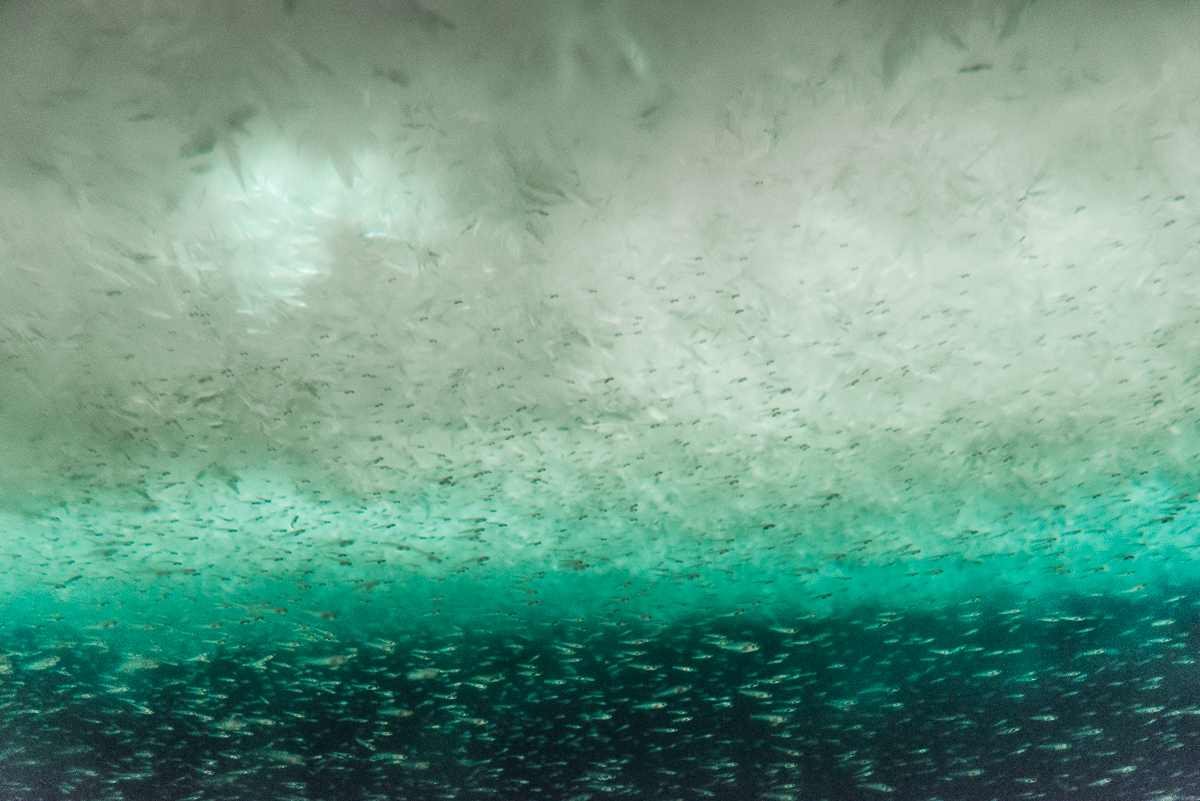
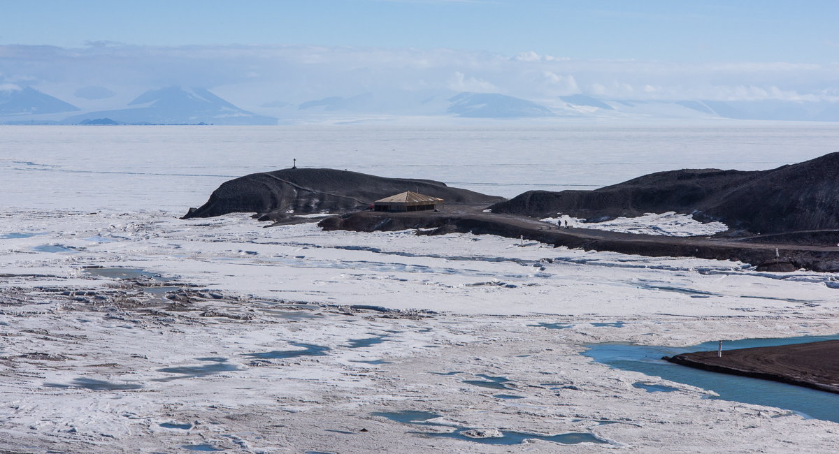
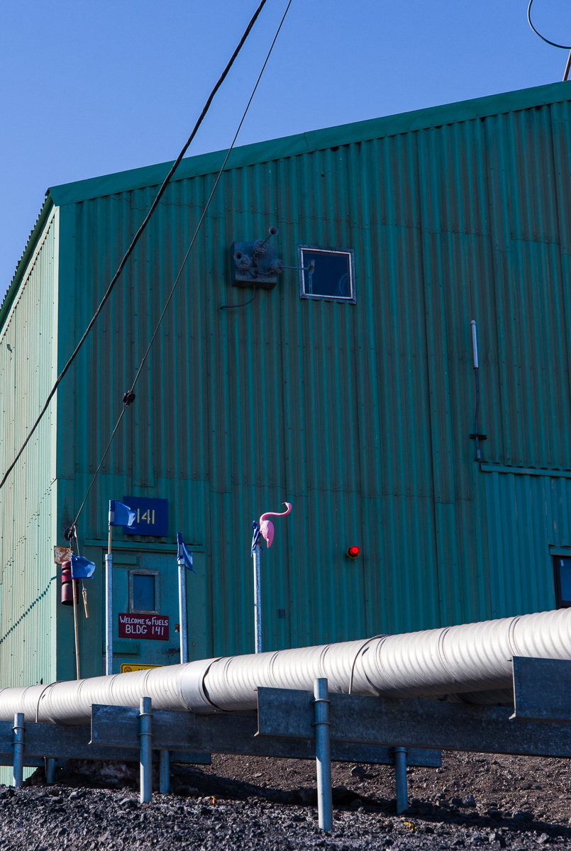
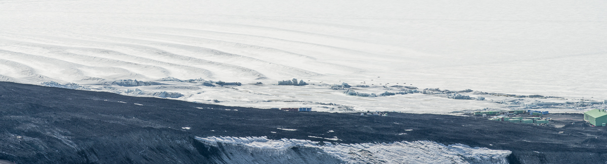
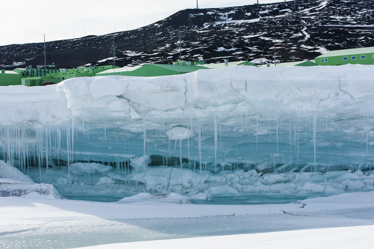
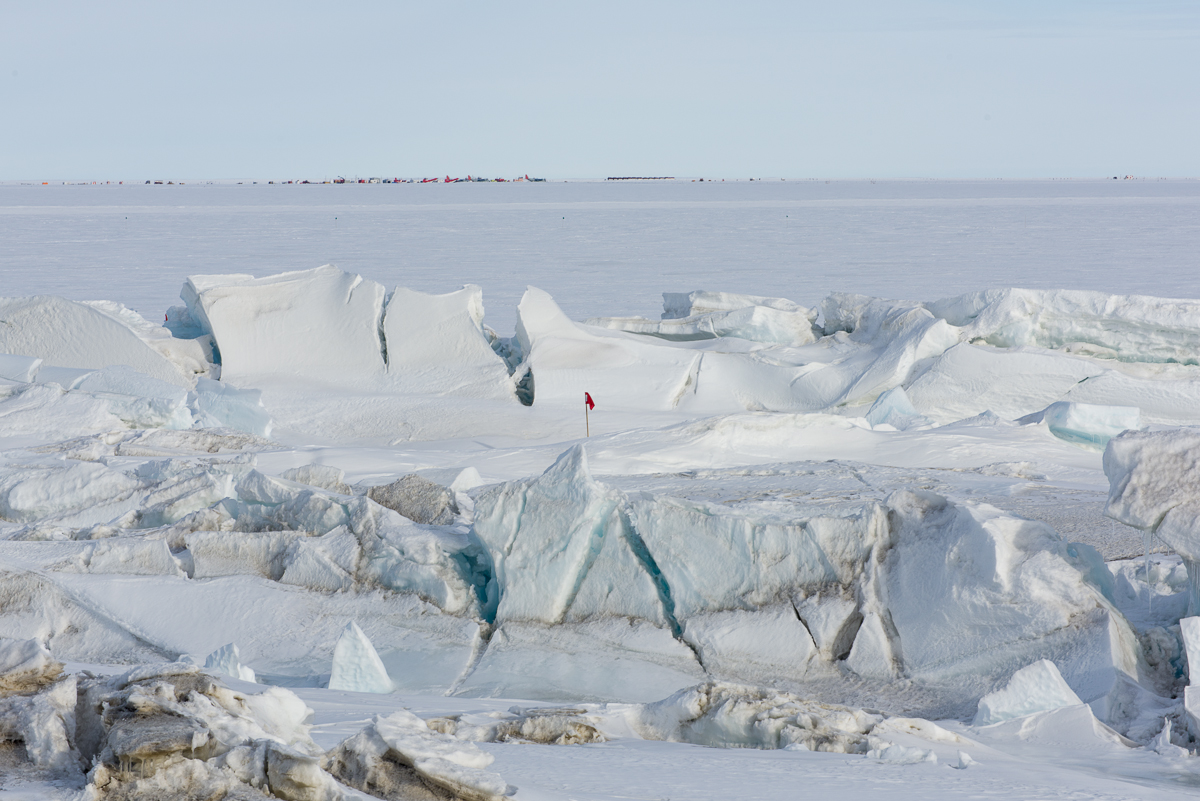
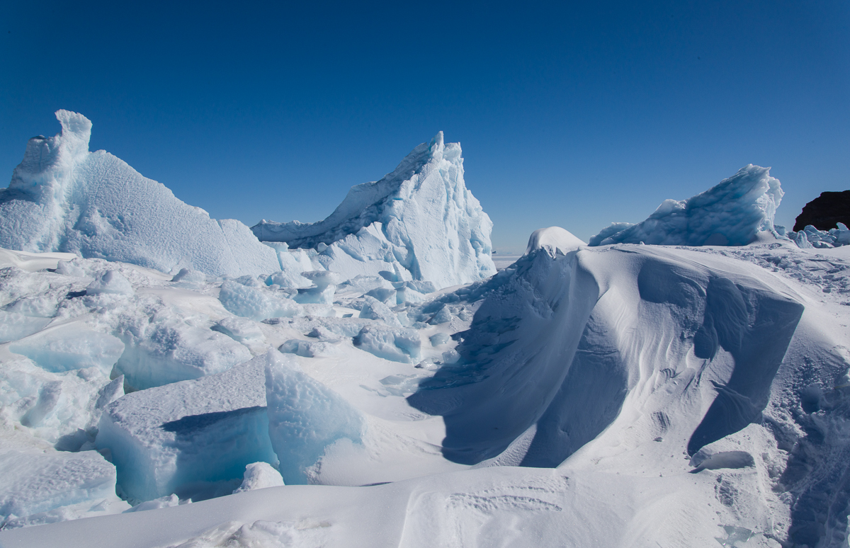
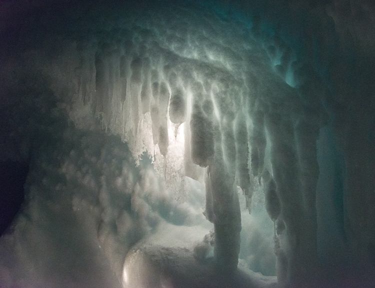
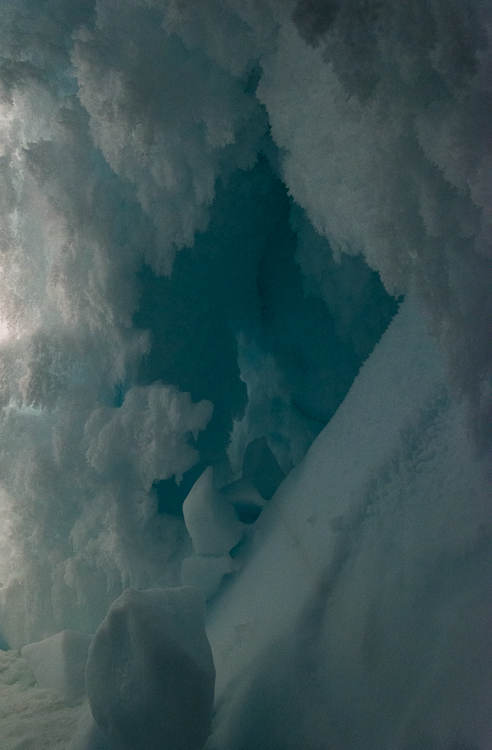
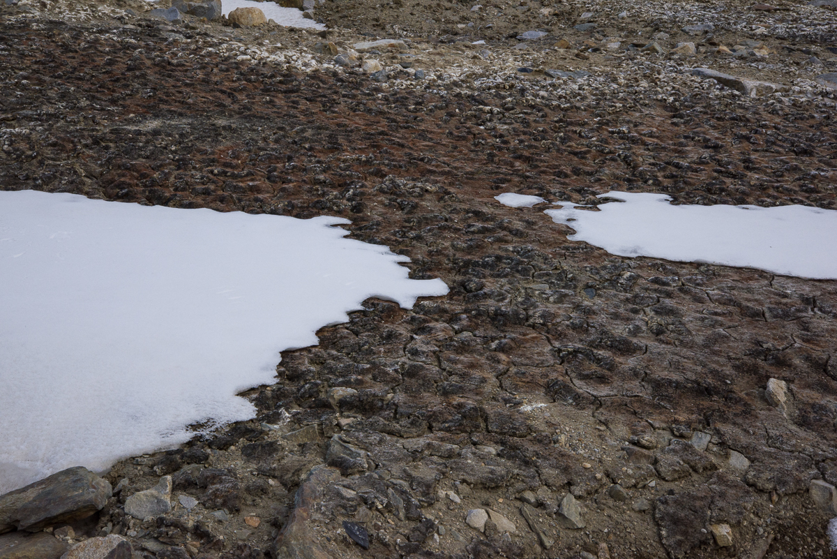
Let’s clear up one thing that I get asked a lot: there are no polar bears in Antarctica. That’s the Arctic. The only mammals are marine mammals, found along the coasts: seals — which I saw on a number of occasions — and whales —which I did not see at all. The only birds I saw were skuas, which are feisty brown birds related to gulls, and Adélie penguins. Uphill from the sea ice pressure ridges in New Harbor beneath the Double Curtain Glacier was a highly unusual sight — several square yards of gray and tan moss — the only plant life I saw growing in soil the entire seven weeks I was in Antarctica. Further inland, walking the gravel hills and ice-covered lakes of the Dry Valleys, you and your companions are the only living things in sight — nothing green, feathered, scaly or furry. The exception was a lone skua occasionally spotted in the vicinity of the Lake Hoare field camp, nicknamed Taylor by the field camp residents. The major life forms of the Dry Valleys are microscopic organisms in the lakes, streams and soil that scientists sample and study as part of the long-term ecological research study, but of course, they’re not visible without a microscope.

Moss in the Dry Valleys
A rare sign of life: This patch of moss on a hill between the Double Curtain Glacier and a pressure ridge was the only plant I saw growing in the Dry Valleys.

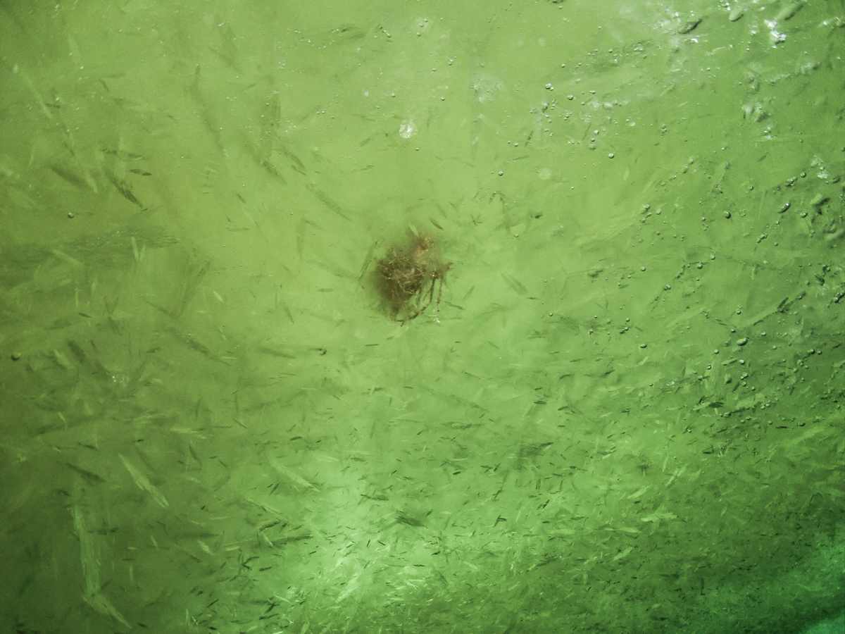
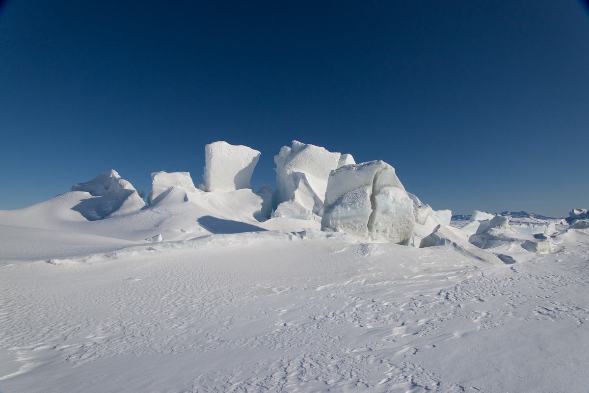
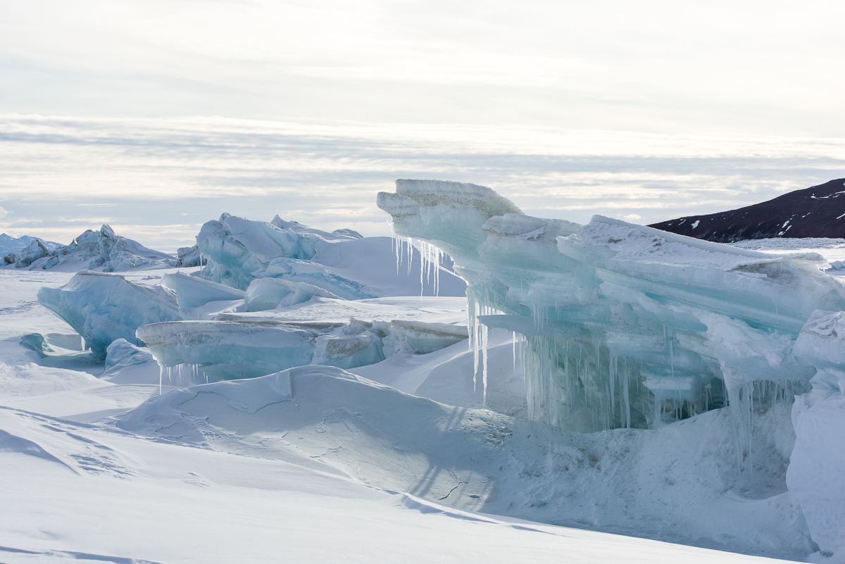
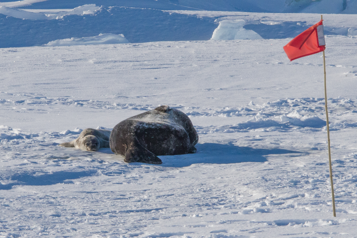
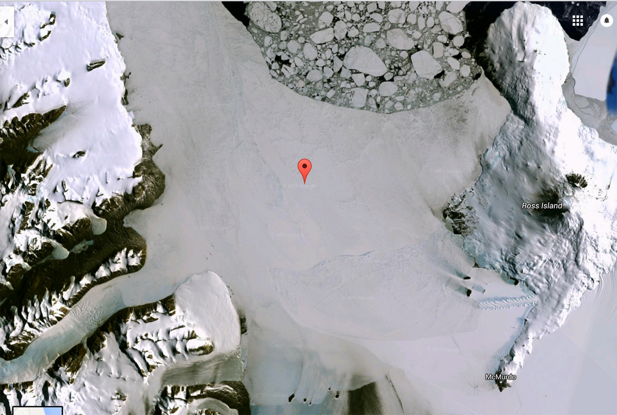
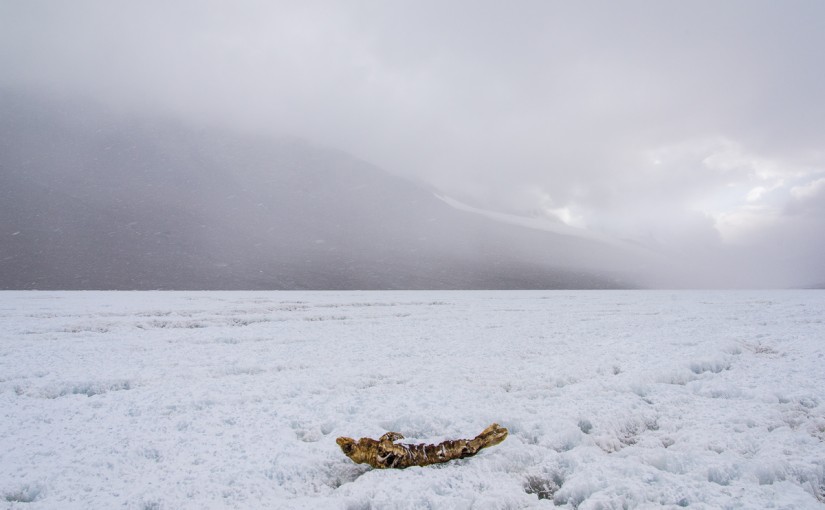
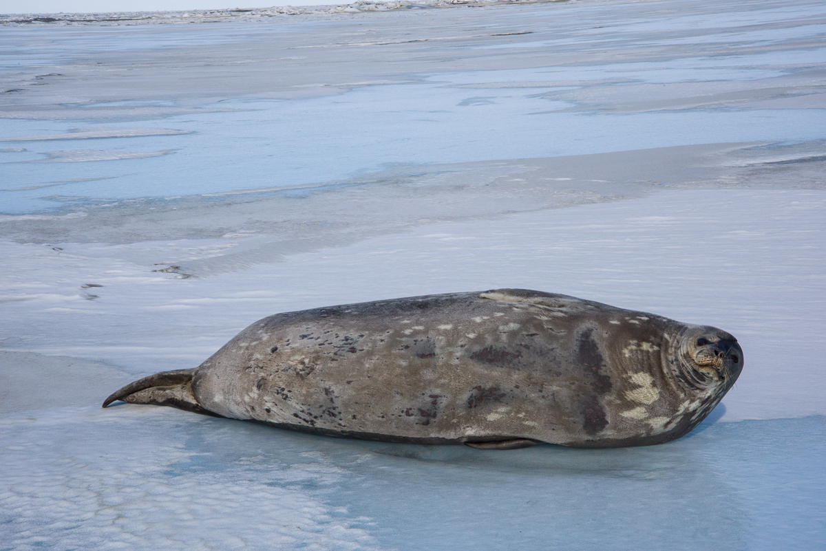
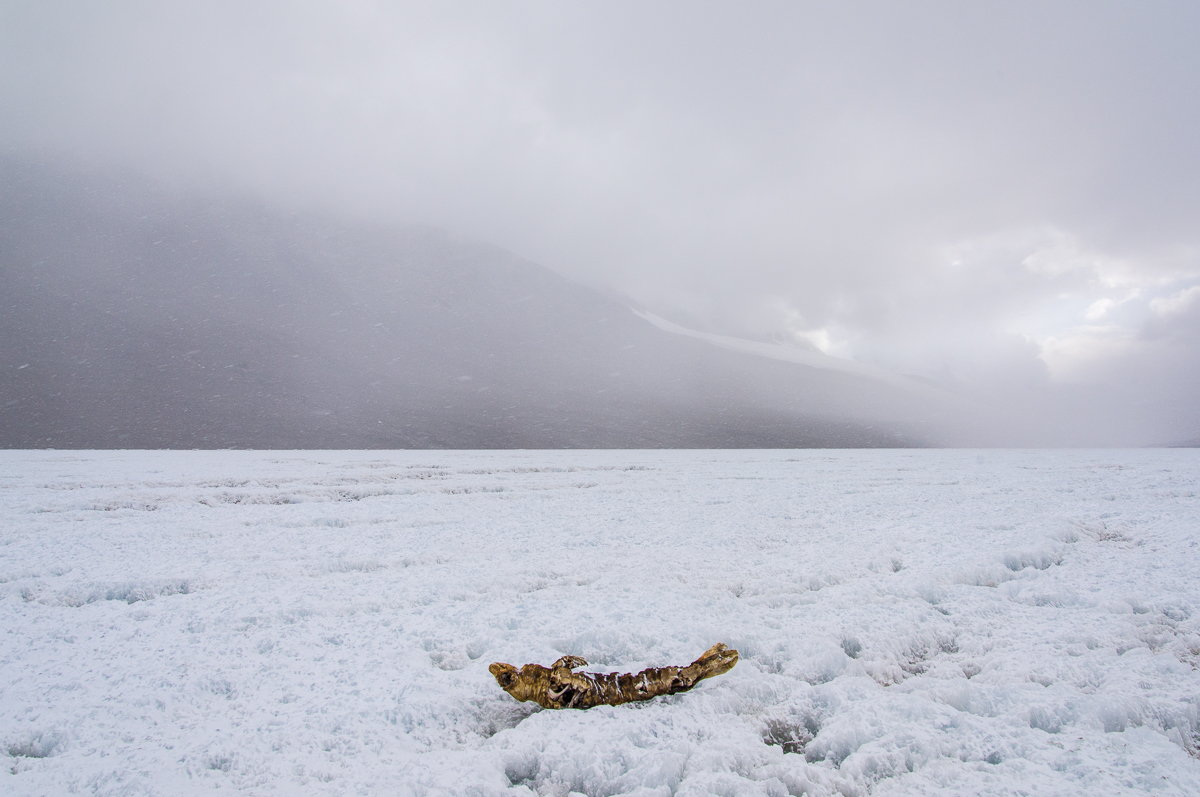
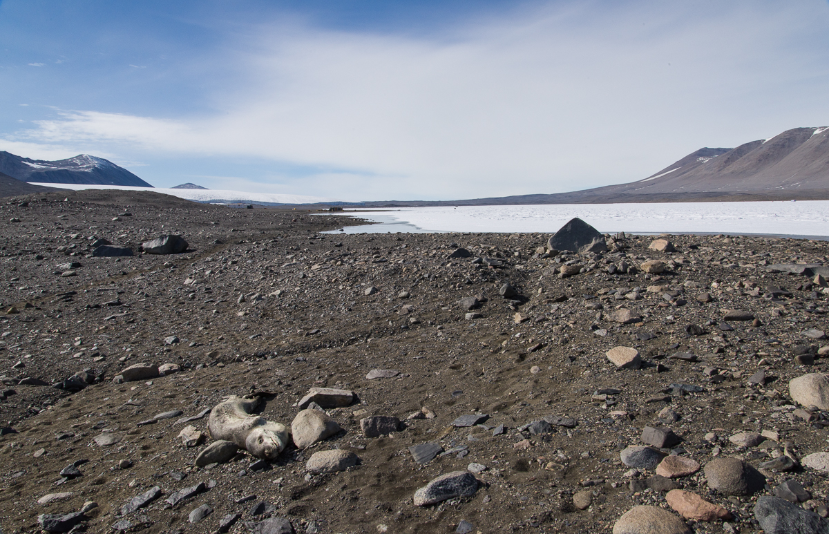
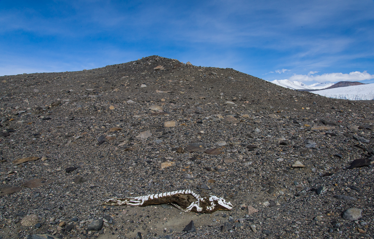
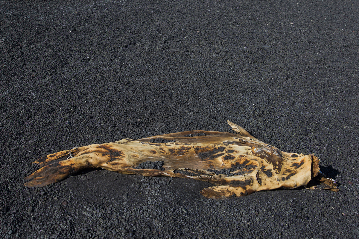
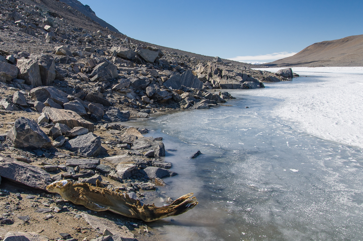
Against that backdrop, it was startling to periodically come across the bodies of mummified seals in the Dry Valleys, several miles from the ocean. Seals are built for swimming. Underwater footage shows even 10-foot-long, 1,200-pound Weddell seals gracefully gliding along. They spend most of their time in the water, occasionally poking their heads out to take a few breaths. Periodically, they laboriously haul themselves onto the ice to rest, like the young Weddell seal in the photo at the top of this post. The ellipsoidal body shape, wing-like flippers and tail that serve them underwater are definitely not made for walking. Once you’ve seen a seal galumphing with great difficulty across the ice like a giant slug, it’s even more remarkable to imagine how they could travel for miles on their bellies, dragging their rotund bodies over ragged lake ice and gravel hills. An oft-quoted statistic is that mummified seals have been documented as far inland as 41 miles. If that’s the case, this one at Lake Bonney must be one of them, since that’s about how far the lake is from McMurdo Sound:

Mummified seal, Lake Bonney
This mummified seal atop Lake Bonney traveled about as far as any have managed — around 41 miles from the sea.
Mummified seal, Lake Bonney
A closer look at the Lake Bonney seal, lying on its back atop ablated lake ice.

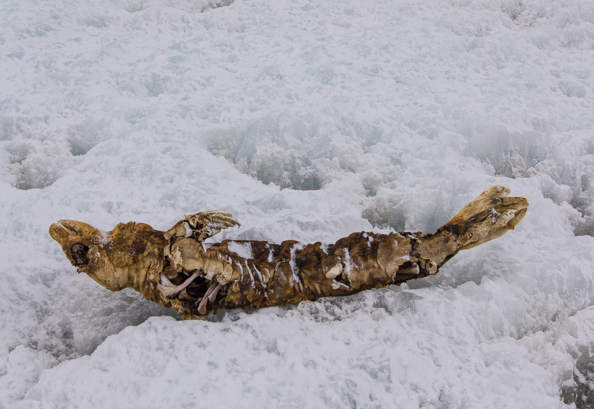
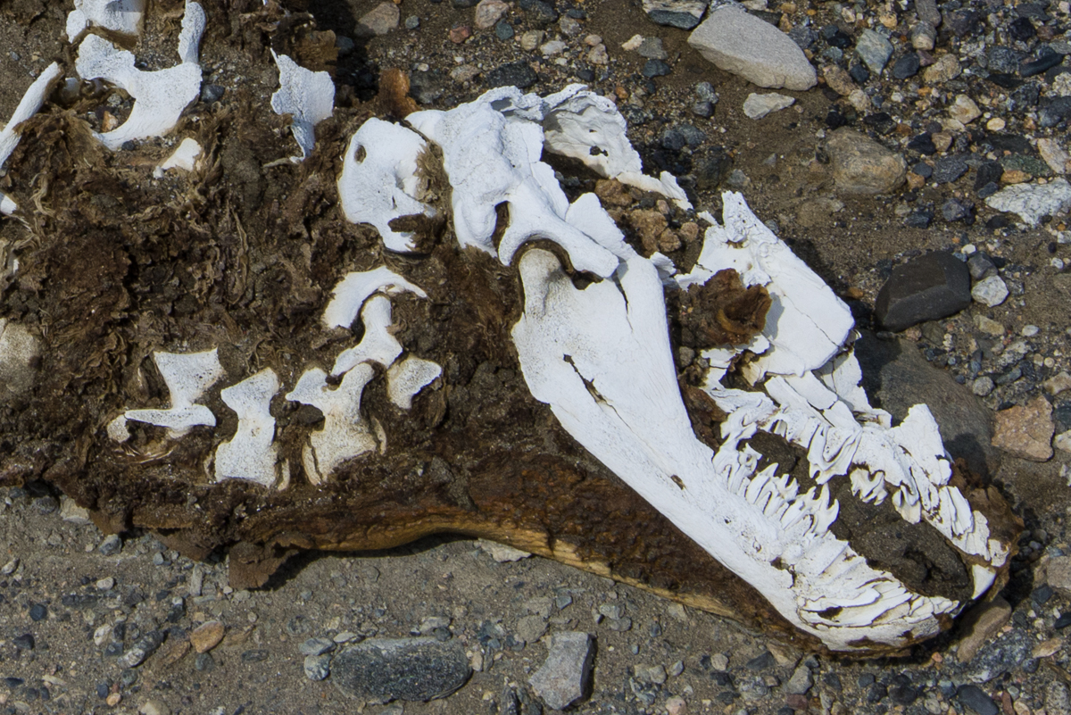
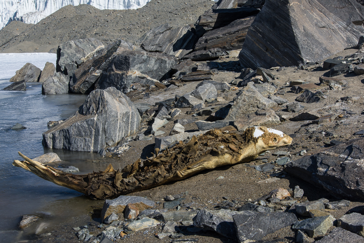
The dry, freezing climate and lack of bacteria and invertebrates that break down carcasses in warmer regions leave the seals in varying states of preservation that make it impossible to tell how long they’ve been lying there by their appearance just by sight. Some are mostly skeletal, some still have a substantial amount of leathery skin attached, but you can’t tell if they’re a few years old or several hundred without doing a laboratory analysis of carbon and nitrogen isotopes.

A research team led by Paul Koch and Brenda Hall in the 2012-13 and 2013-14 seasons has done just that. They saw these seals not as a weird curiosity, but as a way to investigate the history of seal populations over the past 1,500 years, and how they adapted to changing amounts of ice in McMurdo Sound in terms of their diet, which is also revealed by the chemical analysis. Up until about 500 years ago, McMurdo Sound had far less ice than it did afterwards, when ice shelves formed. Knowing how the seals responded and how their diet changed would help predict how warming oceans might affect them in the future. To that end, the scientists a undertook a comprehensive inventory of Dry Valleys mummified seals and took over 400 samples to be analyzed (read more about the study in the Antarctic Sun and this press release). “Studies of fossils let us see how species do or don’t adapt to environmental shifts. Here, we are using that approach to explore the adaptability and vulnerability of different Antarctic seal species to less icy conditions in the near future,” said Koch.

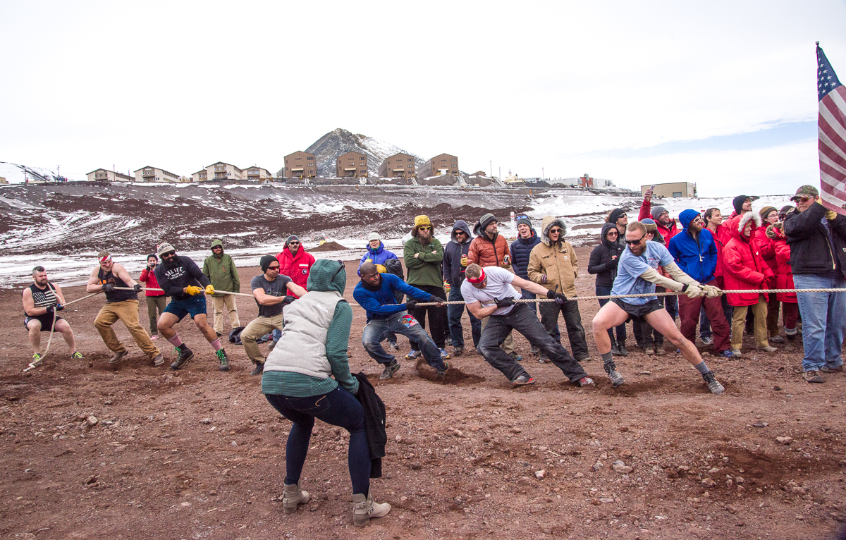
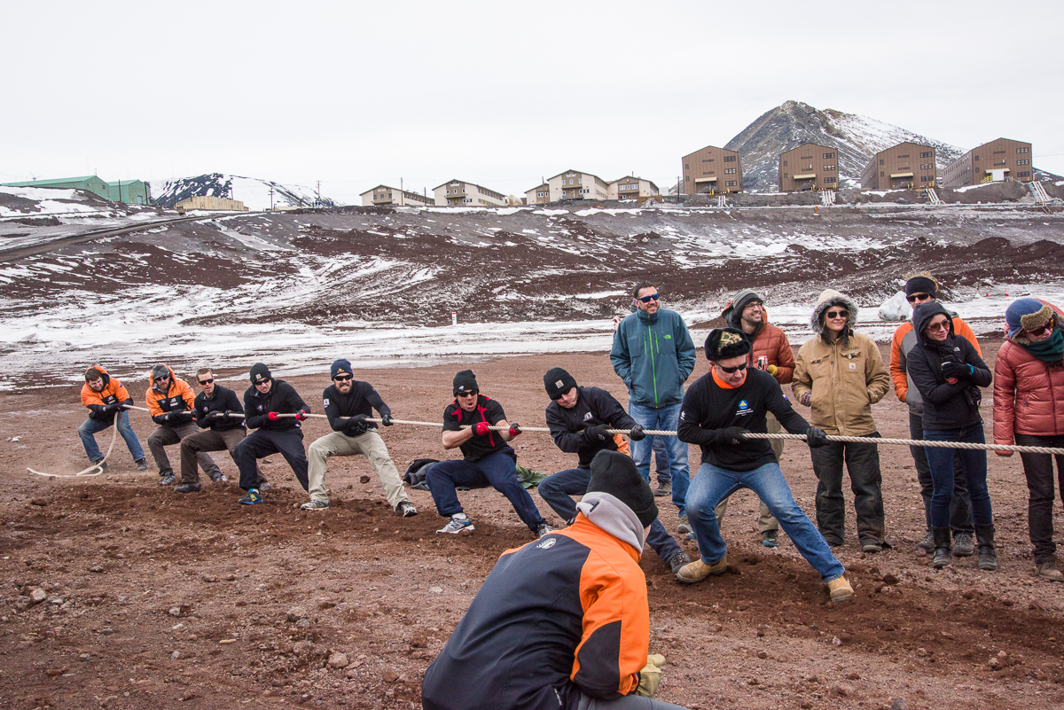
If you’ve read every single one of my Antarctica blog posts, you’ve encountered a few of the following scenes before, but I thought it would be interesting to bring them all together in one place, along with some information about what is known about them.

Ferrar Glacier, seal skeleton and pressure ridge
This seal near the Double Curtain Glacier didn’t get very far uphill before succumbing. The Ferrar Glacier is in the distance.
Mummified seal skeleton
Close-up of the seal skeleton. The flipper anatomy is very clear on the right.

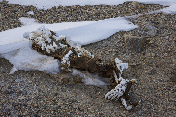
The presence of mummified seals has posed a scientific mystery since the first explorers of the region in the early 1900s ran across them. They’re generally small, and I have run across only one account of researchers encountering a live seal in the Dry Valleys. The current assumption is that these are young seals that get lost during whiteout conditions in the harsh Antarctic winter, when the seals usually stay near cracks in the sea ice. Without visual cues, they get turned around and crawl along in a futile search for the sea until they expire. As of October 2015, Koch’s team published that it had reported identified mummies of over 300 crabeater seals, 100 Weddell seals and around 20 leopard seals, a proportional breakdown roughly corresponding to their current numbers in the sound. That sounds like a significant number of wayward seals, but the mummies can be as much as 1,500 years old. Koch told the Antarctic Sun that it may be that only one or two lose their way each year.

The leopard seal shown below, on the Lake Fryxell side of the Canada Glacier, is a rare sight on a few counts. Leopard seals make up less than 5% of the mummified seals. This one is pretty much intact, including fur, which is unusual. And unlike the vast majority of the mummies, we know for sure that this one is a recent arrival, because this area is frequently traversed by Dry Valleys researchers and they took note of its appearance a couple of years ago.

Leopard seal near Lake Fryxell
A mummified leopard seal is a rare sight. This one made it past Lake Fryxell, which is in the background.
Mummified leopard seal
A closer look at the leopard seal.
Mummified seal near the Canada Glacier
This seal skeleton was in the general vicinity of the leopard seal, on the Fryxell side of the Canada Glacier. Odds are it’s a crabeater seal, which are far more commonly found than leopard seals. (The remaining teeth look right for it to be a crabeater, too.) The top of the seal has been sandblasted off over the years by winds ripping through the valley, but you can see that the part facing the ground is probably in one piece.
Mummified seal near Canada Glacier
The same seal as above, with the Canada Glacier behind it to the right.

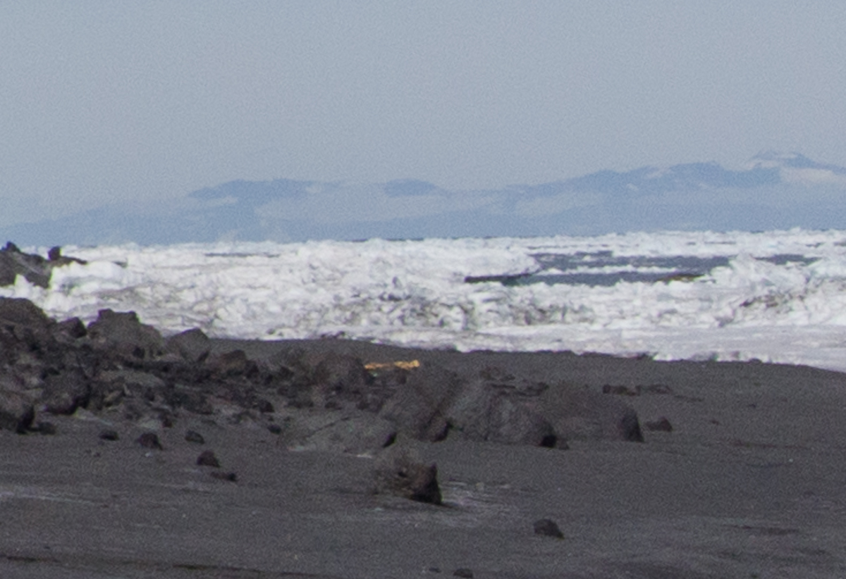
Mummified seals are not only found in the Dry Valleys. There’s one on the black sand beach at Cape Royds. It’s notably well preserved, but it’s right by the sea ice so there is no mystery as to how it ended up there:

Mummified seal, Cape Royds
On the black sand beach at Cape Royds, the tan object in the center of the photo is the mummified seal shown below. (Photo is slightly blurry because it is a detail of a broader vista.)
Mummified seal, Cape Royds
Mummified seal on the black sand beach at Cape Royds.

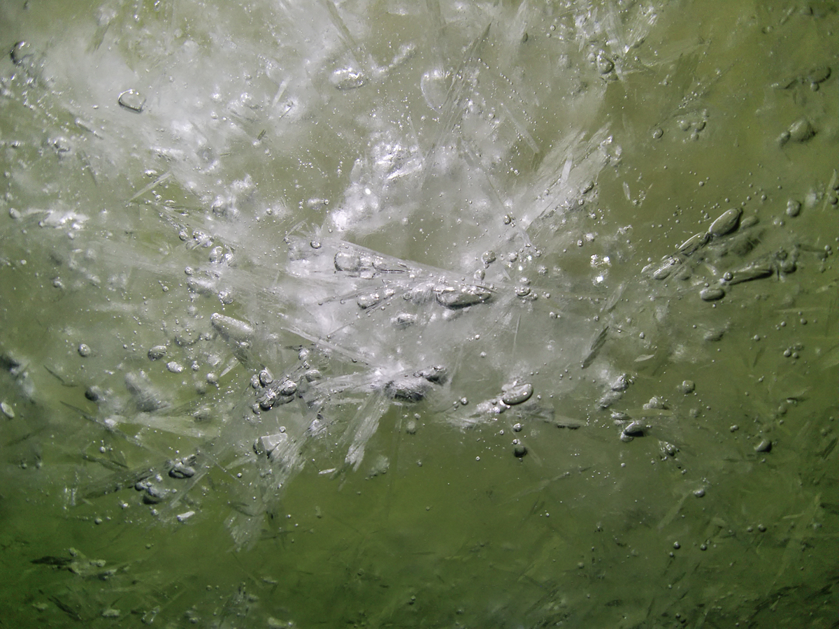
I photographed all the mummified seals I encountered, with the exception of one that had remarkably made it the length of Lake Hoare and part way up a hill near the Suess Glacier. It was dismembered into two halves, lying in the dirt side by side, which for some reason struck me as more grotesque and disturbing than a dead seal in one piece. I just didn’t want to look at that again! But probably the strangest one I saw was also near the Suess Glacier: rather than lying on its back or its side, it’s perched on its belly, tail curving upwards and head lifted as if flash-frozen in mid motion.

Mummified seal, Lake Hoare
This mummified seal at the west end of Lake Hoare is unusual for coming to rest in a pose that gives it a strangely animated look. Rae, the Lake Hoare camp manager, suggested that it was underwater for a long time, and revealed by a retreating shoreline. This view faces the direction the seal came from. It would have to have crawled around the Commonwealth Glacier, down the length of Lake Fryxwell, around the Canada Glacier and down the length of Lake Hoare to reach this point!
Seal near Suess Glacier
Close up of the seal near the Suess Glacier, looking west toward the glacier, which is in the upper left corner.

The scientists who have studied these seals are interested in them as a fossil record and a way of understanding the history of ocean ecology. What drives the seals to travel for miles over land and how they survive the journeys is ultimately beside the point in terms of their research. The lack of information about that aspect is a reminder, though, of how little we still know about what Antarctic animals do during the long, dark winters — that includes seals and penguins. At one of the science lectures, I asked Jennifer Burns, who has been studying Weddell seals for over 20 years, if she had seen any changes in behavior related to climate change. She responded that she hesitates to make comparisons because monitoring and tracking hardware is so much better quality now than 20 years ago. Devices are smaller and less intrusive to attach to the animal — in the past they were bulky and generally didn’t stay on long. In years to come, perhaps more seals will be tracked and shed some light on the mystery of the lost seals.


The Ob Tube: A Peek Beneath the Sea Ice

Ob Tube cover.
The entrance to the Ob Tube.

Biologists who study the creatures that live on the ocean floor in McMurdo Sound do their work during the first part of the summer research season. That’s when the sea ice is strong enough to support the heavy tractors that tow the dive huts onto and off the ice. Huts on the sea ice are removed by mid-December, when air temperatures warm and cracks in the ice widen and deepen. In a previous blog post, I’ve already written about my stay at Sam Bowser’s field camp at New Harbor, which is across the sound from McMurdo at the edge of the Dry Valleys. Other scientists collect samples right by the base, from a dive hut set up on the sea ice that’s a short downhill walk from the Crary Lab and the helicopter pad.

Helen in Ob Tube
Ready to climb inside the Ob Tube. Photo: Shaun O’Boyle.

Near the hut, a smaller hole is drilled in the ice and the Observation Tube is installed. Known around town as the “Ob Tube,” it’s basically an underwater manhole with windows, dating back to the days when the U.S. Navy ran McMurdo. Anyone living on the station is permitted to go to the station firehouse any time of day or night and pick up the key, as long as they are accompanied by at least one other person. I went with Shaun O’Boyle, the other Antarctic Artists and Writers Program participant at McMurdo while I was there, on the morning of November 27th, timing our visit for a morning when we knew biologist Gretchen Hofmann’s dive team would be working there.

Inside the Ob Tube
Getting down: looking up at the handholds inside the Ob Tube.

A visit to the Ob tube is not for the claustrophobic. I’m not a large person, but climbing down the tube via metal handholds while wearing a down parka didn’t leave much room to maneuver. You descend the last few feet via a rope ladder, which is visible in the background of my inadvertent selfie below. Standing at the bottom, you are surrounded by windows and looking up at crystal chandeliers of sea ice. Schools of tiny fish scoot past.

Ob tube interior
Inadvertent selfie: I tried using my flash, but just ended up with a photo of my reflection. Instead, I had to set the ISO to Auto and photograph by available light. You can see the rope ladder in the background.

The Ob Tube provides a unique view of the underside of the sea ice, which is covered with mounds of platelet ice, clusters of thin, irregularly shaped slivers of ice, each a few millimeters thick and around one to four inches in diameter, that attach together at apparently random angles.  Composed of 80% seawater and 20% fresh water, platelet ice is a peculiarly polar phenomenon that Encyclopaedia Britannica’s sea ice article calls “perhaps the most exotic form of sea ice besides marine ice.” A scientific paper based on research at McMurdo explains that these “semi-consolidated” layers of ice can be anywhere from a few inches to several meters thick and in Antarctica are “commonly observed beneath sea ice in regions adjacent to floating ice shelves.” Located not far from the ice shelf/sea ice border, the Ob Tube is perfectly situated to observe platelet ice.

Platelet ice
Mounds of platelet ice have formed beneath the sea ice above the Ob Tube. Exotic? Encyclopaedia Britannica thinks so.


Fish beneath platelet ice
Outside the Ob Tube, large schools of tiny fish swam past.

Gretchen Hofmann is based at the University of California Santa Barbara and is studying the impact of ocean acidification on the Antarctic pteropod and the Antarctic sea urchin. (Read more about her research on the Hofmann lab page.) Umi, a doctoral student and member of her dive team, swam up to the Ob Tube and helpfully wiped the frostiness off the outside of the windows with his gloves, which did making it easier to see out!:

Diver outside Ob Tube
Umi, a doctoral student from UCSB, was diving for pteropods.

A pulsing, glowing form the size of a dinner plate drifted past — a jellyfish:

Jellyfish under the sea ice
A passing jellyfish.


Platelet ice disk
A closer look at a single platelet.

It’s a good thing Shaun and I got to the Ob Tube when we did, because a few days later, it was decided that it was time to pull it out and haul the dive hut back to dry land. I went back to dive area on December 5th, when Gretchen’s team was making their last dive. Steve Rupp, one of the two dive supervisors on staff at McMurdo each season, offered to take some photos of the outside of the Ob Tube for me, and to bring up some platelet ice for me to photograph up close. Elaine, my logistics coordinator, came along to help me. The plan was to scatter the platelets on some pieces of discarded tent fabric I’d borrowed from the McMurdo Craft Room as a backdrop, but periodic gusts of wind over 25 mph didn’t make that easy. What you can’t see in this photo is Elaine, who is truly a good sport, comically sprawled on her stomach holding down the fabric with both arms, while I scattered handfuls of platelet ice from a plastic bucket and took pictures.

Platelet ice
A quantity of platelet ice spread out on a cloth.

After the dive was finished, I went inside the dive hut, and Steve leaned over the edge of the dive hole, shining underwater lights to illuminate the surface of loose, floating platelets for me, and throw them into low relief. These are a few of the photos I took inside the hut:

Dive hole, McMurdo
The dive hole inside the hut is where the scientific team divers enter and exit the water.
Floating platelet ice
Close-up of floating platelet ice inside the dive hole.
Platelet ice
More floating platelet ice, illuminated from below by a light Steve was holding, and resembling a palette knife painting.

During his dive, Steve took some photos of the outside of the Ob Tube for me, which give a diver’s-eye view:

Platelet ice around the Ob Tube
Platelet ice also attaches to the bottom of the Ob Tube during the time it’s submerged. Photo: Steve Rupp.
Ob Tube
A grad student looks out the window of the Ob Tube. Photo: Steve Rupp.
Item frozen into platelet ice
Not sure what this spiky ball stuck in the platelet ice is — a sea urchin? Photo: Steve Rupp.
Platelet ice
A closeup of the platelet ice beneath the sea ice surface. Photo: Steve Rupp.

Steve tried to make a series of photos circling the outside of the Ob Tube for a 3D capture, but it proved too difficult for him to keep it in focus. However, I was able to take a series of photos of the surface of the platelet ice inside the dive hole while he held the lights underwater, and to make a 3D file from them. This is a screenshot of a detail of that file, rendered in yellow and blue shading to show the form:

Platelet ice 3D scan
3D scan of the surface of loose platelet ice.

Three days later, I happened to be in the Crary Lab Library overlooking McMurdo Sound when I saw workers loading the Ob Tube onto a truck in sections. The orange dive hut had also been put on a trailer to be towed to the spot where it spends the offseason:

Ob Tube removal
By December 8th, the sea ice was beginning to soften, so the observation tube at McMurdo Station was removed while they could still take heavy equipment onto the ice.
Ob Tube removal
Close-up of the Ob Tube removal. The orange dive hut is in the foreground.


Walking McMurdo, from Ridge to Ridge

Our Lady of the Snows Shrine
The Our Lady of the Snows shrine is one of the many memorials atop hills along McMurdo Sound to men who lost their lives in Antarctica. This view of the statue is framed by Observation Hill in the background.

It was late in my stay at McMurdo when I finally got around to walking the hiking trails at two places I could see every time I walked out of my dormitory: Hut Point and Observation Hill — Ob Hill as the McMurdites call it. These photos were taken on two different days. When I arrived in November, the Ob Hill loop trail that circles it about one-third the way up was open, but the trail to the steep summit was closed due to ice. On December 29, six days before I left, I took advantage of a mild day (i.e. it was 20 degrees F with no wind — that counts as mild at McMurdo) and walked up to the top of Ob Hill, which has an elevation of about 750 feet. There it is on the right in the photo below.

McMurdo Station, Antarctica, vista
Panorama of McMurdo from the Hut Point ridge, with Observation Hill on the right.


It took 15 minutes to walk to the Ob Hill loop from my dormitory (I lived in one of the four identical brown buildings near the large blue building that you can see in the photos above and below; click any photo to see an enlargement). It took 20 more minutes to get to the summit on a progressively narrower trail that is very steep with a lot of loose, gravelly volcanic rock surrounded by larger volcanic rocks. If you see the shaded ridge up the center of the hill in the photo above, that’s pretty much the line of the trail. The further up you climb, the steeper it gets. I had flashes of mental images of myself skidding off it and bouncing off rocks on the way down like a playground ball, so I tread carefully, pausing frequently to make sure I was on the best path, and reassuring myself periodically, “You’ve got this.” A few days earlier the annual Ob Hill Uphill, a competitive race to the top, had taken place. Hopefully, the racers spread out before they got to the upper part, because I cannot imagine how you’d pass someone on that trail. No, I don’t have that need for speed. But hey, I’ve got this. I made it to the top without a mishap. There, wedged between two rocks, I found a new black water bottle with a McMurdo emblem that sold in the station store for $30 (left from the race?). As my good deed of the day, I brought it down and handed it in to the Recreation Office. If that was your bottle, you’re welcome!

From the summit, you have an excellent view that encompasses McMurdo, New Zealand’s Scott Base, the golfball-shaped observatories, the Dellbridge Islands and Mount Erebus.

McMurdo Station from Observation Hill
Looking down at McMurdo from the opposite direction, standing on the Observation Hill summit, with Hut Point on the left.
Scott Base from Observation Hill
The green buildings of Scott Base from Observation Hill. Beside the base are the Scott Base pressure ridges. The black dots are Weddell seals.
View from Observation Hill
Beyond the hills topped with “golf balls,” one of the Dellbridge Islands is silhouetted against the sea ice.


Memorial cross atop Observation Hill
The wooden cross atop Observation Hill.

At the top of Observation Hill is a nine-foot wooden cross, built in 1913 and hauled there by sledge by the crew of the Terra Nova, the ship that carried British explorer Robert F. Scott and his party to Antarctica for their attempt to become the first to reach the South Pole. Scott and four men reached the pole in January 1912, only to find that Norwegian Roald Amundsen had beat them to the record by five weeks. All five of them died in March on the return trip. Their tent, containing their bodies and belongings, was discovered by a search party eight months later, including Scott’s last diary, where he recorded their final days and ended his last entry, “For God’s sake look after our people.” The sad story is summarized here.

McMurdo Hut Pt 2015-1226-18
George Vince’s cross at Hut Point memorializes another unfortunate explorer from the early Antarctic expeditions.

The other place to take in a view of McMurdo is from Hut Point, so named for the historic Discovery Hut that sits at the end of it, which was built in 1902 for Scott’s first Antarctic expedition, in 1903-07 and used by subsequent exhibitions until 1917. Below is the view of Hut Point from the back door of my dormitory. You can see the hut and another melancholy monument, this one dedicated to George Vince, a member of Scott’s party who died in an accident in 1904, when he fell off the cliffs into the McMurdo Sound while trying to make his way back to the hut during a blizzard.

Hut Point from McMurdo
Hut Point extends out into the sea ice, which by late December had numerous melt pools. In the right foreground is part of the ice pier where the cargo ship brings supplies to McMurdo in January.


The Hut Point Trail winds along the top of the ridge you see to the right of the hut in the photo above. I walked the trail on a cold Sunday afternoon. It was around 20 degrees that day, too, but strong gusts of wind made it feel much colder, unlike the mellow morning I climbed Ob Hill. As you climb the trail, the most prominent landmarks ahead of you are the “golf balls.”

McMurdo, "The Golf Ball"
Tee time: the large white geodesic dome housing one of the observatories is known around town as “the Golf Ball.”


Looking back toward the sea ice gave me a good look at the cracks and melt pools that were developing as the ice thawed. A large number of Weddell seals had congregated there. Shaun O’Boyle, who was also photographing in McMurdo this season for an Antarctic Artists and Writers Program project, arrived before I did and has posted his photos from these two hikes. Comparing his photos from late October and early November to mine, you can see the changes in the landscape and the sea ice that took place within about two months.

Hut Point sea ice
Looking down at Hut Point from the trail. Cracks had opened in the sea ice, leaving ample room for Weddell seals to come out of the ocean and rest.


Climbing further up the ridge, I looked down at the other side and found a small pond with three glowing green spots. You seldom — or never — see anything green in the Antarctic landscape, so it was a weird sight. I assume there is some algae growing there, because no green plants grow in Antarctica.

Pond from Hut Point Trail
A small pond seen from the Hut Point Trail has three glowing green spots of what I assume is algal growth.
Pond near Hut Point
A closer look at the luminous green Rothko-esque patches from the pond’s shore made them no less mysterious.

Another oddity I spotted: a small volcanic rock that had been eroded and hollowed out to the point of resembling a sponge:

Ventifact
A  volcanic rock on the windswept Hut Point Trail has an intricate pattern of perforations.

The ridge trail leads to the small, dark “golf ball” and then winds back into town. I planned to walk the entire loop, but the wind kicked up with 20-knot gusts coming from the sea ice. Not only was it making my eyes water, but as I walked along the top of the ridge, I had to brace myself to keep my footing. I decided that it was time to turn back. As I headed back, I came upon another hilltop memorial, Our Lady of the Snows. A statue of the Madonna on a ironwork frame topped by a cross, and held in place by a pile of volcanic rocks. Beside it, a plaque explains that during the construction of McMurdo in 1956, Petty Officer Richard T. Williams of the U.S. Navy Seabees was part of a crew bringing supplies across the sea ice from a ship anchored 30 miles away, when the tractor he was driving broke through the sea ice north of Cape Royds and “plunged 350 fathoms to the bottom of McMurdo Sound. His body was never recovered.” I hadn’t realized until reading the plaque that Willy Field, one of two airfields used by the U.S. and New Zealand Antarctic Programs, was named for him. It’s formal name is the Williams Air Operating Facility.

Our Lady of the Snows shrine
Our Lady of the Snows gazes northwest across the sea ice, where a Navy construction worker drowned 60 years ago during the building of McMurdo Station. This shrine was erected the following year, in 1957.

I walked back to the dorms, following the road up from the ice pier. Now that the sea ice was breaking up near shore, the colorful fishing huts used by seal researchers and dive teams studying underwater creatures during the first part of the research season had been pulled off the ice and stored along the road:

Fishing hut, McMurdo Station
A fishing hut is stored uphill from the ice pier during the off-season.


I also noticed for the first time that there was a pink flamingo outside the Fuels Building:

Pink flamingo, McMurdo Station
Paging John Waters: a pink flamingo perches on a pipe outside the Fuels building.

Nearby is a perky welded sculpture along the road overlooking Hut Point and the ice pier of what I take to be a whale, made by an anonymous worker out of chains and rods. While clearly playful in intent, it struck me as in its own way congruent with the other monuments erected around McMurdo by grieving men. The wooden cross dedicated to Scott and his comrades is inscribed with a quote from a poem by Alfred Lord Tennyson: “To strive, to seek, to find, and not to yield.” Made from discarded found objects, the whale embodies a similar ingenuity, optimism and creativity that the people on base find within themselves. Sometimes, you just have to smile and say, “I’ve got this.”

Whale sculpture, McMurdo Station
An anonymous worker made a sculpture of a whale that sits on a berm beside the road from the ice pier to the main area of the station.

Under Pressure Ridges

Scott Base pressure ridges
The Scott Base pressure ridges present an undulating landscape of unending variety. In the center of this photo is a melt pool.

If you’ve been following this blog, you’ve been introduced to the pressure ridges near the Double Curtain Glacier, which is across McMurdo Sound from McMurdo Station in the New Harbor/Explorer’s Cove area of the Dry Valleys. During the seven weeks that I was based at the US Antarctic Program’s McMurdo Station, I also made two trips to visit the extraordinary pressure ridges at Scott Base, which neighbors McMurdo and is operated by New Zealand’s Antarctic program. If you’ve seen Anthony Powell’s excellent documentary film, Antarctica: A Year on the Ice, you may have noticed the Scott Base pressure ridges among the time-lapse photography sequences.

Observation Hill view of Scott Base
From the 754-foot-high summit of Observation Hill at McMurdo Station, you can see an aerial view of the Scott Base pressure ridges, including the undulations in the ice shelf that have helped form them. The little black dots on the ice a little left of center are Weddell seals. (Click on photo to see enlargement.) I also photographed the prominent formation in the center from the ground (next image) and made a 3D file of it (shown further down in this post):
Scott Base pressure ridge
This formation is large enough to stand out even from the top of Observation Hill (see panoramic photo above). I also made a 3D file of it from 53 photographs taken while walking around it (scroll down further below).
Scott Base pressure ridge
Scott Base pressure ridge with Scott Base in the background.

In Antarctica, the interaction of permanent thick ice shelf (that constantly floats atop the sea), sea ice (that is subject to melt cycles, and some years even melts to the point where it breaks up and floats out to the ocean) and the stationary rock of the coastline, can cause the ice near the shore to buckle and push up chunks into formations called pressure ridges. The pressure ridges are dynamic and constantly changing due to the action of the forces described above along with the 24-hour summer sun. Summertime temperatures at McMurdo when I was there mostly stayed in the 15 to 30 degree Fahrenheit range, and only a few times that I recall got into the upper 30s (and once a balmy 43 degrees — a few of the young guys took advantage of that heat wave to walk around in shorts!). But even in below-freezing air temperatures, when the sun beats down on the ice, it softens and sometimes melts. Then there are icicles, large chunks splitting off and falling, or gravity sometimes causes a chunk of snow to bend and flop over like a draped cloth.

Scott Base pressure ridge
By November 30th, long icicles had formed beneath this this sheet of ice.
Scott Base pressure ridge
The underside of this large chunk of ice was a deep blue and decorated with icicles. In the background are the green buildings of Scott Base.
Scott Base pressure ridges
A thick mat of softened ice can bend like a draped cloth (lower right) and form graceful curved shapes.

Because of the ice shelf and sea ice dynamics, there are also cracks in the ice and melt pools on the surface that widen and deepen as the air warms (one of those was prominently featured in my post about Mt. Erebus). So there is a small window of time from November until mid-December when it is safe to walk out on the ice to get close to the pressure ridges. The McMurdo Recreation Department leads evening tours for the workers and others in residence there during that rare period. I went on two such trips, on November 24th and 30th. These photographs are, essentially, documentations of ephemeral formations: even though these photo sessions were only six days apart some of the ice had already changed in that brief time.

Scott Base pressure ridge
Another spot where the snow has drooped over like a towel on a rack (upper center).

Where there is a nice-sized crack in the sea ice near the shore of McMurdo Sound or one of its islands, chances are you’ll find a group of Weddell seals laying out along it. Cracks give them a head start in chewing out a seal-sized hole in the ice where they can haul themselves out of the water for a break from non-stop swimming and foraging for food. I’ve never seen an animal that sleeps more soundly than a Weddell seal! They also give birth and nurse their pups on the ice. At least one of the Scott Base seals had a pup:

Weddell seal and pup at Scott Base pressure ridges
Baby Seal!: A Weddell seal and her pup chill out at the Scott Base pressure ridge.


From the shoreline, the ice formations are flatter and some have straight lines and more angular profiles:

Scott Base pressure ridge
Looking out from the Scott Base shoreline at angular pressure ridge formations. On the horizon is Willy Field, one of the airstrips that serves McMurdo and Scott Base. It’s probably about a 15- to 20-minute drive from that spot, i.e., not as close as it looks! It’s pretty much impossible to judge distances in Antarctica. You learn to not even try.
Scott Base pressure ridge
Planar ice formations close up.

From other angles there were other formations to see, as in the two vertical photos below. I also did a few walk-arounds for photogrammetry captures. I’ve processed one of those files for a potential sculpture (horizontal image below those).

Scott Base pressure ridges
Peering through a crevice at the Scott Base pressure ridges results in a puzzling and ambiguous spatial reading.
Scott Base pressure ridges
Another unexpected sculptural ice formation.
Scott Base pressure ridges
A 3D file made from 53 photographs walking around a portion of the Scott Base pressure ridges. I need to edit out a few extraneous forms, but the capture came through mostly intact, with great detail and very few gaps.

At the end of this post is a photograph of another fascinating phenomenon we saw on the November 30th trip to Scott Base: a type of mirage called a fata morgana. It has nothing to do with pressure ridges, but it does have to do with looking across the wide flat expanse of the sea ice toward a distant shore. A young man in our group noticed it first. In a fata morgana, a strip at the bottom of the land seems to be stretched like Silly Putty. This one was subtle, but unmistakable. There are more dramatic examples online. Just search Google Images for “fata morgana Antarctica” or read this explanation.

Fata morgana, McMurdo Sound
Across the sea ice from the Scott Base pressure ridge there was a fata morgana effect that made the bottom strip of the Transantarctic Mountains across McMurdo Sound appear to be stretched into a horizontal band at the bottom. Fata morganas appear in Antarctica when a band of air just above the sea ice is a different temperature than the air above it, causing a temperature inversion and distorted reflection at the horizon. Fun fact: the name comes from the Italian for Morgan Le Fay, half-sister of King Arthur.


Erebus, the Mini-Series

Erebus from the sea ice
On occasion, if the wind isn’t blowing too hard, you can see the smoke rising from the volcano. This view is from the sea ice near the Dellbridge Islands. The sun threw the crevasses on the slopes into relief.

At almost 12,500 feet high, Mt. Erebus dominates the landscape of the western side of Ross Island, where I spent my time in Antarctica. It’s an active volcano, and not part of a range, so it stands apart from other mountains. Also, its western slope ends at the flat sea ice, even though its summit was about 50 miles away from New Harbor, which is on the opposite side of McMurdo Sound, it was a prominent feature of the horizon. I found myself photographing it from a variety of locations. The cap and banner cloud formation on top of Mt. Erebus featured in the last post is just one of them. I ended up with a small series of photos of its snow-covered slopes in different weather as well as different vantage points. The funny thing about Erebus is that it doesn’t look as big as it is. Distances are incredibly difficult to judge in Antarctica anyway. I kept trying to figure out what was messing with that perception. Part of it must be that there are no trees or other cues to help provide scale. And with Erebus, I think because the profile of it is rather spread out and horizontal rather than steep and vertical, you don’t realize how gigantic it is.

To get an idea where we’re talking about, here’s a Google Earth Map of McMurdo Sound:

Map of McMurdo Sound
Google Maps satellite view of McMurdo Sound (click to enlarge): The black spot labeled “Ross Island” on the right is the summit of Mt. Erebus. McMurdo Station is labeled below it, at the end of the peninsula. Scott Base is just around the corner from McMurdo. The Erebus glacier ice tongue is the sawtoothed shape on the sea ice and those dark specks above it are the Dellbridge Islands. Cape Evans is on the other side of the ice tongue from McMurdo Station, and Cape Royds is the larger dark area north of that. If you draw a horizontal line from the summit of Erebus, through Cape Royds and across the sound to the indentation in the dark shoreline of the Dry Valleys opposite, that’s where the New Harbor camp is.
Erebus from Cape Royds
Erebus adds drama to the view from the field camp at Cape Royds, which is on top of a tall hill.
Erebus from New Harbor
Far away, across the sound from Cape Royds at New Harbor, Erebus stands out. In the foreground is multi-year sea ice.


Erebus from Scott Base
I made two different visits to the pressure ridges in the sea ice near Scott Base, which is New Zealand’s Antarctic outpost and close neighbor to McMurdo. One evening the sky was hazy.
Erebus from Scott Base pressure ridges
Revisiting the same site the following week, the sky was clear, the landscape a study in graphic blue and white shapes.
Erebus from Hut Point
The hills around McMurdo Station block the view of Erebus until you get up on a ridge above the base, like this one on the Hut Point trail. You can glimpse Erebus behind one of the “golf balls” as people call them — geodesic domes that house satellite dishes.


Erebus ice tongue
Erebus in the background of a panorama of one side of the Erebus glacier ice tongue. The red flags mark the entrance to the ice cave. The dark rock on the left is one of the Dellbridge Islands. Click to enlarge.
Erebus and sea ice edge
On the flight back from New Harbor, the helo pilot showed us the sea ice edge with Erebus in the distance…
Erebus from helicopter
…and flew closer so we had a good view from the air. The Dellbridge Islands are in the foreground.
Erebus from Observation Hill
One of the last days at McMurdo I climbed to the top of Observation Hill. This is the last photo I took of Erebus.


Grounded Icebergs Near the Dellbridge Islands

McM2015-1201-304-2
Am I the only one who sees a face on the left?

On December 1st, before visiting the Erebus ice cave, Evan and I went to see some icebergs that are stuck in the sea ice near the Dellbridge Islands. The Dellbridge Islands include Tent Island, Big Razorback and Little Razorback. The iceberg I photographed first is nearest to the island in the group with my favorite name, Inaccessible Island, named by the famous British Antarctic explorer Robert F. Scott because it was hard to reach. Of course, he didn’t have a Haagland tractor, which made the trip much easier. Not that a Haagland is a luxury vehicle by any means, but it’s great for traveling on ice and it gets warm inside. Big Red (as everyone calls the heavy parkas we were issued) comes off when you get in a Haagland. You’ll see the islands in the background of some of these photos. Also nearby was Mt. Erebus, but it’s so huge (over 13,000 ft.) that Erebus seems nearby wherever you go around here. The angle of the sun showed up the large crevasses on its lower slopes.

Crevasses on Mt. Erebus
It was so clear that even from a distance you could see the crevasses on Erebus’s lower slopes.

The plan was for me to circle the iceberg nearest Inaccessible Island, to take photos for a 3D file, which I did. I selected 162 to process and since there were so many, I carefully masked them in the software, which took several hours, and I’m processing the file as I type this. I’m optimistic it’ll come out, because the first stage of processing where I aligned the photos showed a generally recognizable shape, and the second stage, under way now, originally showed it would take a total of 12 hours, but it is now almost 60% finished and the estimated total is down to 7 1/2, so the fact that it’s going faster than the original estimate is a good sign. Stay tuned for the next post…

Iceberg, two kinds of ice
Two kinds of ice, matte and glossy, side by side. Click this and the other images to see larger views.

In the meantime, I’ll share with you photos I took after we left that iceberg and stopped at a spot where we could walk around a couple of smaller ones. One in particular had a lot of drifted snow around it, so I’m not sure if I’ll be able to get a 3D file of the whole thing, but it sure had a wide variety of ice formation and profiles that changed as you walked around it. The photos here show some of my favorite views.

Iceberg in sea ice with melt pool
A little pool of water had melted around one end. Our Haagland vehicle is in the distance on the right.
Iceberg frozen in sea ice
Wind-whipped snow and ice.
Iceberg and drifted snow
The drifting snow had curved into smooth, rounded forms.
Iceberg stuck in sea ice
A slight change in perspective shows a different view than the one above, although you can see the same large forms on the left.
Icerberg stuck in sea ice
But the opposite side of the iceberg looks totally different from the side catching the drifting snow.


Iceberg stuck in sea ice
This is the only shot I’ve included of the smaller of the two icebergs, because it wasn’t as interesting, although the hook-shaped protrusion popping from the top in this view is certainly quirky.


Little Razorback Island
The two smaller icebergs were closer to Little Razorback Island. You can see where pressure ridges have formed near the island.

Erebus Ice Cave: The Sequel

Ice cave
On my second visit to the ice cave, I experimented with indirect lighting and got some otherworldly images.
Mt. Erebus
Smokin’ hot: Tuesday you could see that Mt. Erebus is an active volcano, with a little puff of white smoke rising above the crater at the summit.

Tuesday I went out with Evan, one of the mountaineers on staff here, whose assignment for the day was to take me to any icebergs frozen in the sea ice that interested me and back to the ice cave in the Erebus Ice Tongue. We went in Gretel, the same Haagland tractor featured in my sea ice training blog post, so it was lot easier riding around than driving a snowmobile. Snowmobiles are fun, but they get somewhat less fun when you have to travel for an hour on one — your right hand gets tired from being on the throttle, and it’s obviously colder, too, though aside from inside the cave, it was a nice day with little wind. I photographed three icebergs that are frozen in the ice, so you can walk right up to and around them, certainly impossible when they’re floating because it’s too dangerous — a floating iceberg can flip unexpectedly. I’ll post those photos another time, because I haven’t really had time to go through them yet, but I’m certain I’ll get some 3D files from them. Also got to see Mt. Erebus with no clouds and little wind, so you could see a puff of smoke rising above it.

Hexagonal ice crystals
Evan checks out some unusually large hexagonal ice crystals.

Then we went back to the ice cave, and this time, it was just me and him instead of a group of 15 people, and he brought a couple of good lights, which helped me get some better results. It also was a few hours earlier in the day, and it seemed to me there was more light coming through the small opening (very small — you have to crawl through it on your belly). I had learned from the first visit that the flash lit things too evenly. They were nice exposures, but you couldn’t see the depth. Even when I tried notching the flash down, it didn’t look so great. So, we experimented with having him point the lights he’d brought in different places to see what would work best for photography, and I discovered that indirect light worked the best — bouncing it off a wall, backlighting formations, or aiming it so the center of the beam was hidden behind a feature. Aiming the lights in that manner, we lit up some crystalline formations that I hadn’t even noticed the last time I was there, including some very large hexagonal crystals, an inch or more across! This is Evan’s first season here in Antarctica, but he leads winter mountaineering and backcountry ski camping trips in Idaho and Wyoming, and though he was familiar with hexagonal ice crystals he was astonished by the size of these.

Ice cave, hexagonal crystals
A closer look at the giant hexagonal crystals.

Ice cave entrance

Being inside the cave was literally being inside a walk-in freezer so I had to pause periodically to warm up my hands — my glove liners are usually pretty good for photographing but it was very cold in there after a while. Evan showed me some tricks that helped — swinging arms or pumping your hands up and down with your palms facing down. But after we’d been in there for a little over an hour, my fingers and toes had had enough, so it was time to go. But I left with some magical and strange images. They did remind me of some of the photographs I’ve made of cloud formations:

Ice cave

Ice cave

McM_2015-1201-486

Ice cave

Ice cave
A change in the lighting makes this formation look different — see next photo.
Ice cave
A change in the lighting makes this formation look different — see previous photo.

Ice cave

Ice cave entrance
Approaching the entrance there’s a blue glow from the sunlight outside.
Sunlight illuminates the cave walls near the entrance
Leaving the ice cave


Antarctic Sports News

McMurdo tug of war team
Team USA with their captain and referee.
McMurdo tug of war
Part of the USA fan section.

ESPN isn’t here, but luckily for you, I am, to give you the latest Antarctic sports news. Last night was the annual tug-of-war competition between McMurdo Station and our New Zealand neighbors (aka the Kiwis) at Scott Base, which is a short drive away. Apparently New Zealand always wins. Could the Americans break their losing streak?

It was a total bro fest, at least on the American side, with much boisterous pre-game banter. There was a lengthy weigh-in before the competition, to make sure the teams were each 115 stone — New Zealand originally set up the competition, so that’s a British measurement. (“What’s a stone?!” someone called out during that announcement. Answer: 14 lbs.)


Weigh-in at tug of war
Our big man weighs in.

To make weight, or maybe just because bros will be bros, some of our guys stripped down to short pants and tanks or t-shirts, while the New Zealand team members were low-key in demeanor and stayed sensibly dressed for the 20-degree weather in long pants and jackets. Our biggest guy weighed in at 303 lbs. (A New Zealand guy standing nearby remarked, “Wow, that’s two of me.”)


McMurdo tug of war
Pull!

There were three pulls, so whichever team won two out of three would win. We definitely had the burlier team, with seven Americans facing off against eight Kiwis. Either they had better technique, or maybe distribution of weight between more guys gives the group better traction, because they won the first pull fairly quickly. And during the second pull the American team was on the verge of winning, until one of the Americans lost his footing and the Kiwis hauled it in. So New Zealand took home the trophy for yet another season.

McMurdo tug of war
The methodical and decidedly less flamboyant Kiwis got the job done for Team New Zealand.