Frozen in Place: The Mystery of the Mummified Seals

Weddell seal near Cape Bernacchi
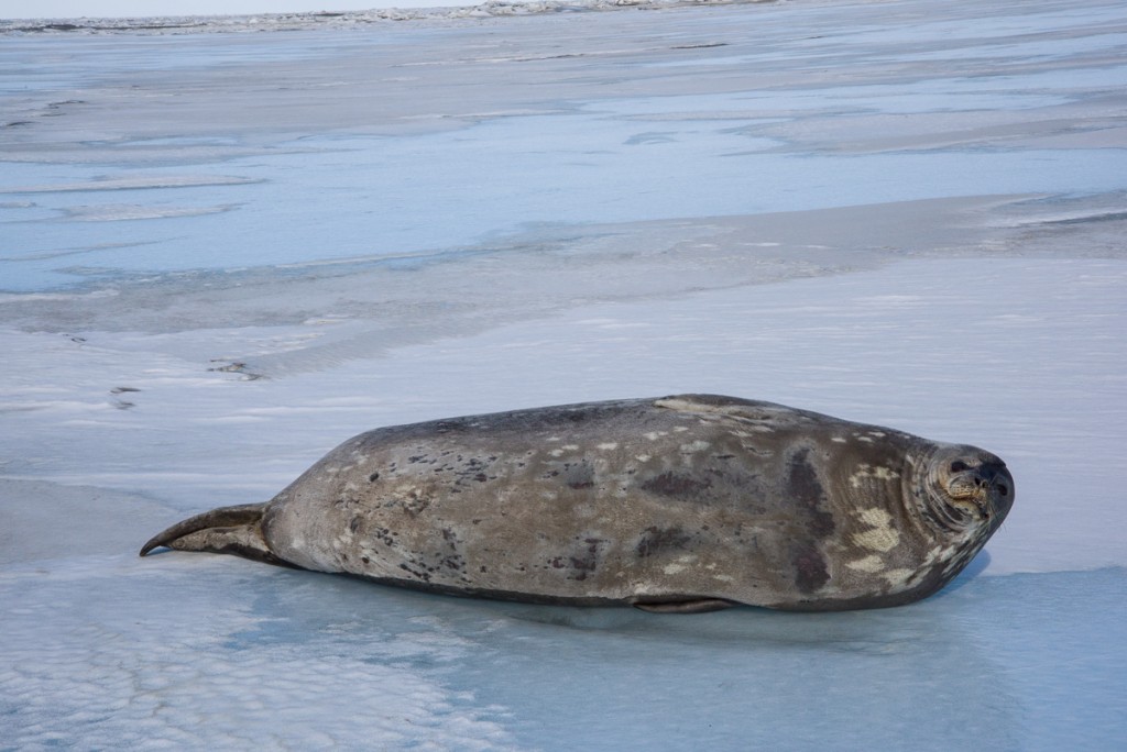
Seals? Yes. Polar bears? No: A young Weddell seal raises its head to check us out before continuing its nap on the sea ice near Cape Bernacchi. It probably got onto the ice via a hole several yards away that was cut earlier in the season by Sam Bowser’s dive team.

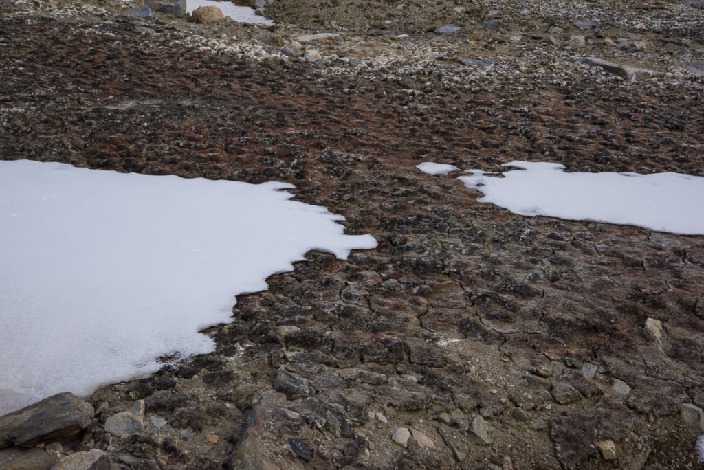
Let’s clear up one thing that I get asked a lot: there are no polar bears in Antarctica. That’s the Arctic. The only mammals are marine mammals, found along the coasts: seals — which I saw on a number of occasions — and whales —which I did not see at all. The only birds I saw were skuas, which are feisty brown birds related to gulls, and Adélie penguins. Uphill from the sea ice pressure ridges in New Harbor beneath the Double Curtain Glacier was a highly unusual sight — several square yards of gray and tan moss — the only plant life I saw growing in soil the entire seven weeks I was in Antarctica. Further inland, walking the gravel hills and ice-covered lakes of the Dry Valleys, you and your companions are the only living things in sight — nothing green, feathered, scaly or furry. The exception was a lone skua occasionally spotted in the vicinity of the Lake Hoare field camp, nicknamed Taylor by the field camp residents. The major life forms of the Dry Valleys are microscopic organisms in the lakes, streams and soil that scientists sample and study as part of the long-term ecological research study, but of course, they’re not visible without a microscope.
Moss in the Dry Valleys
A rare sign of life: This patch of moss on a hill between the Double Curtain Glacier and a pressure ridge was the only plant I saw growing in the Dry Valleys.

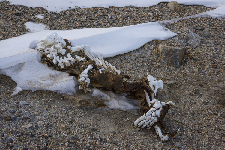
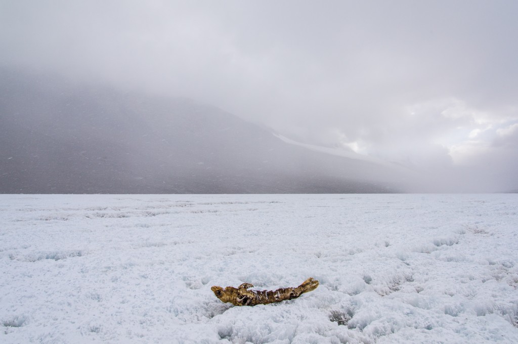
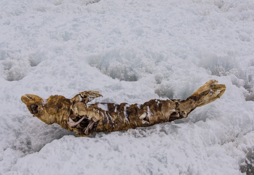
Against that backdrop, it was startling to periodically come across the bodies of mummified seals in the Dry Valleys, several miles from the ocean. Seals are built for swimming. Underwater footage shows even 10-foot-long, 1,200-pound Weddell seals gracefully gliding along. They spend most of their time in the water, occasionally poking their heads out to take a few breaths. Periodically, they laboriously haul themselves onto the ice to rest, like the young Weddell seal in the photo at the top of this post. The ellipsoidal body shape, wing-like flippers and tail that serve them underwater are definitely not made for walking. Once you’ve seen a seal galumphing with great difficulty across the ice like a giant slug, it’s even more remarkable to imagine how they could travel for miles on their bellies, dragging their rotund bodies over ragged lake ice and gravel hills. An oft-quoted statistic is that mummified seals have been documented as far inland as 41 miles. If that’s the case, this one at Lake Bonney must be one of them, since that’s about how far the lake is from McMurdo Sound:
Mummified seal, Lake Bonney
This mummified seal atop Lake Bonney traveled about as far as any have managed — around 41 miles from the sea.
Mummified seal, Lake Bonney
A closer look at the Lake Bonney seal, lying on its back atop ablated lake ice.

The dry, freezing climate and lack of bacteria and invertebrates that break down carcasses in warmer regions leave the seals in varying states of preservation that make it impossible to tell how long they’ve been lying there by their appearance just by sight. Some are mostly skeletal, some still have a substantial amount of leathery skin attached, but you can’t tell if they’re a few years old or several hundred without doing a laboratory analysis of carbon and nitrogen isotopes.

A research team led by Paul Koch and Brenda Hall in the 2012-13 and 2013-14 seasons has done just that. They saw these seals not as a weird curiosity, but as a way to investigate the history of seal populations over the past 1,500 years, and how they adapted to changing amounts of ice in McMurdo Sound in terms of their diet, which is also revealed by the chemical analysis. Up until about 500 years ago, McMurdo Sound had far less ice than it did afterwards, when ice shelves formed. Knowing how the seals responded and how their diet changed would help predict how warming oceans might affect them in the future. To that end, the scientists a undertook a comprehensive inventory of Dry Valleys mummified seals and took over 400 samples to be analyzed (read more about the study in the Antarctic Sun and this press release). “Studies of fossils let us see how species do or don’t adapt to environmental shifts. Here, we are using that approach to explore the adaptability and vulnerability of different Antarctic seal species to less icy conditions in the near future,” said Koch.

If you’ve read every single one of my Antarctica blog posts, you’ve encountered a few of the following scenes before, but I thought it would be interesting to bring them all together in one place, along with some information about what is known about them.
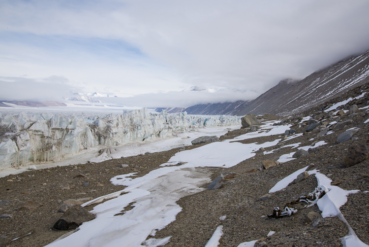
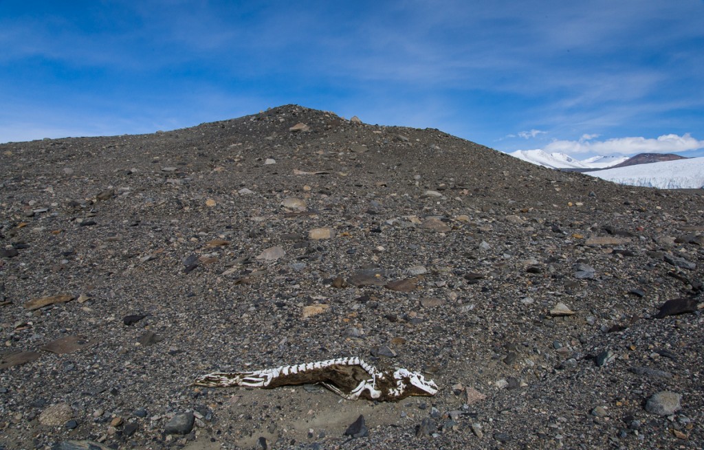
Ferrar Glacier, seal skeleton and pressure ridge
This seal near the Double Curtain Glacier didn’t get very far uphill before succumbing. The Ferrar Glacier is in the distance.
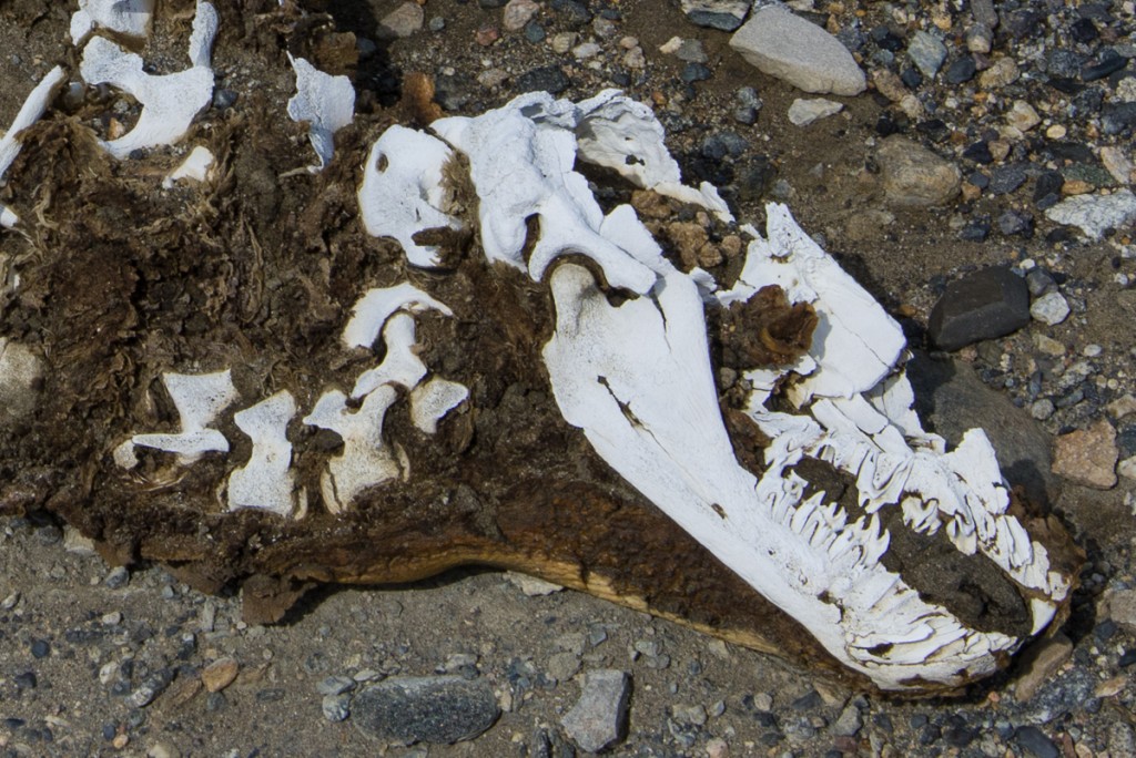
Mummified seal skeleton
Close-up of the seal skeleton. The flipper anatomy is very clear on the right.

The presence of mummified seals has posed a scientific mystery since the first explorers of the region in the early 1900s ran across them. They’re generally small, and I have run across only one account of researchers encountering a live seal in the Dry Valleys. The current assumption is that these are young seals that get lost during whiteout conditions in the harsh Antarctic winter, when the seals usually stay near cracks in the sea ice. Without visual cues, they get turned around and crawl along in a futile search for the sea until they expire. As of October 2015, Koch’s team published that it had reported identified mummies of over 300 crabeater seals, 100 Weddell seals and around 20 leopard seals, a proportional breakdown roughly corresponding to their current numbers in the sound. That sounds like a significant number of wayward seals, but the mummies can be as much as 1,500 years old. Koch told the Antarctic Sun that it may be that only one or two lose their way each year.

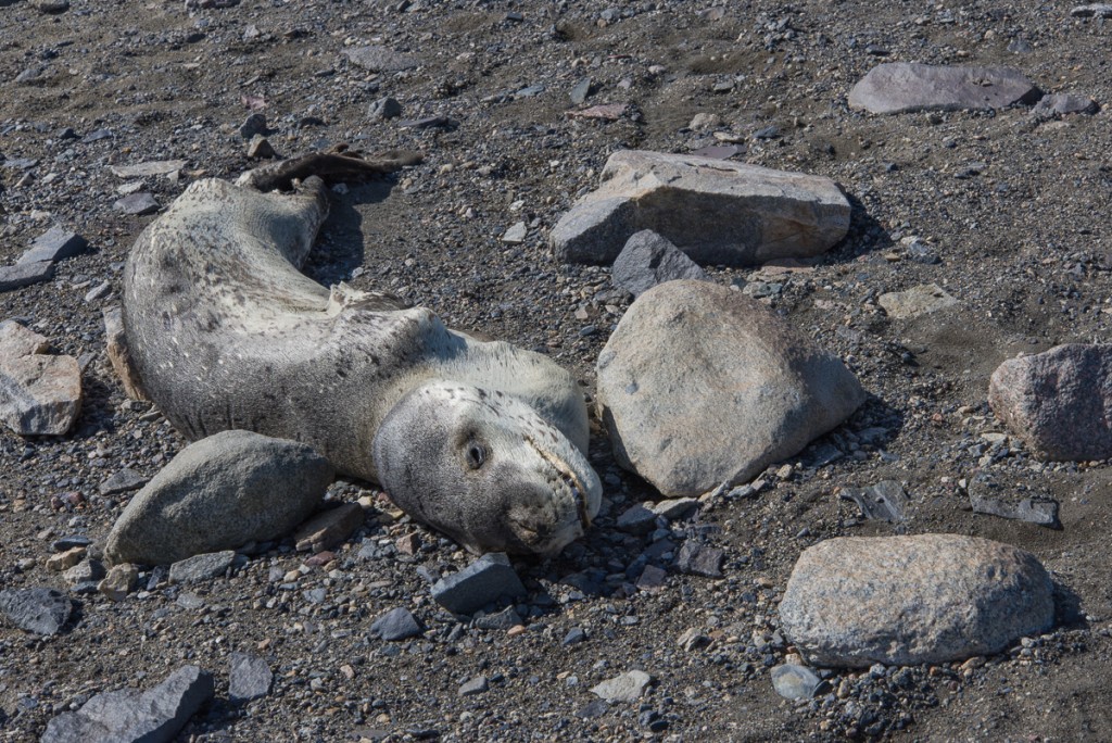
The leopard seal shown below, on the Lake Fryxell side of the Canada Glacier, is a rare sight on a few counts. Leopard seals make up less than 5% of the mummified seals. This one is pretty much intact, including fur, which is unusual. And unlike the vast majority of the mummies, we know for sure that this one is a recent arrival, because this area is frequently traversed by Dry Valleys researchers and they took note of its appearance a couple of years ago.
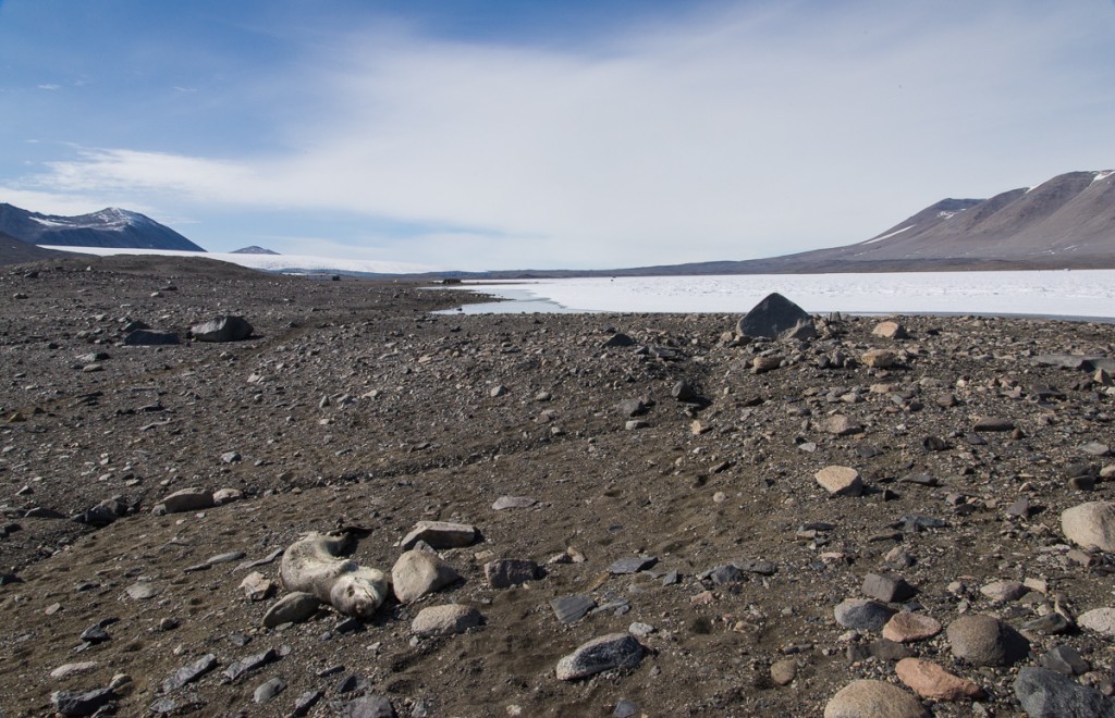
Leopard seal near Lake Fryxell
A mummified leopard seal is a rare sight. This one made it past Lake Fryxell, which is in the background.
Mummified leopard seal
A closer look at the leopard seal.
Mummified seal near the Canada Glacier
This seal skeleton was in the general vicinity of the leopard seal, on the Fryxell side of the Canada Glacier. Odds are it’s a crabeater seal, which are far more commonly found than leopard seals. (The remaining teeth look right for it to be a crabeater, too.) The top of the seal has been sandblasted off over the years by winds ripping through the valley, but you can see that the part facing the ground is probably in one piece.
Mummified seal near Canada Glacier
The same seal as above, with the Canada Glacier behind it to the right.

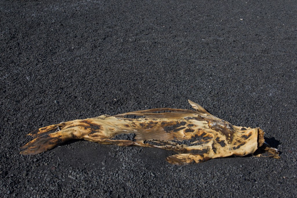
Mummified seals are not only found in the Dry Valleys. There’s one on the black sand beach at Cape Royds. It’s notably well preserved, but it’s right by the sea ice so there is no mystery as to how it ended up there:
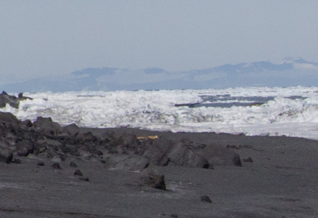
Mummified seal, Cape Royds
On the black sand beach at Cape Royds, the tan object in the center of the photo is the mummified seal shown below. (Photo is slightly blurry because it is a detail of a broader vista.)
Mummified seal, Cape Royds
Mummified seal on the black sand beach at Cape Royds.

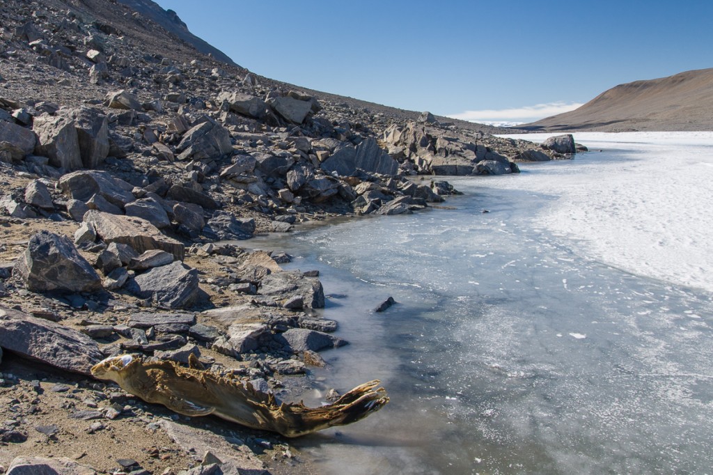
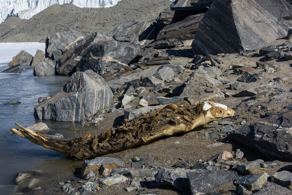
I photographed all the mummified seals I encountered, with the exception of one that had remarkably made it the length of Lake Hoare and part way up a hill near the Suess Glacier. It was dismembered into two halves, lying in the dirt side by side, which for some reason struck me as more grotesque and disturbing than a dead seal in one piece. I just didn’t want to look at that again! But probably the strangest one I saw was also near the Suess Glacier: rather than lying on its back or its side, it’s perched on its belly, tail curving upwards and head lifted as if flash-frozen in mid motion.
Mummified seal, Lake Hoare
This mummified seal at the west end of Lake Hoare is unusual for coming to rest in a pose that gives it a strangely animated look. Rae, the Lake Hoare camp manager, suggested that it was underwater for a long time, and revealed by a retreating shoreline. This view faces the direction the seal came from. It would have to have crawled around the Commonwealth Glacier, down the length of Lake Fryxwell, around the Canada Glacier and down the length of Lake Hoare to reach this point!
Seal near Suess Glacier
Close up of the seal near the Suess Glacier, looking west toward the glacier, which is in the upper left corner.

The scientists who have studied these seals are interested in them as a fossil record and a way of understanding the history of ocean ecology. What drives the seals to travel for miles over land and how they survive the journeys is ultimately beside the point in terms of their research. The lack of information about that aspect is a reminder, though, of how little we still know about what Antarctic animals do during the long, dark winters — that includes seals and penguins. At one of the science lectures, I asked Jennifer Burns, who has been studying Weddell seals for over 20 years, if she had seen any changes in behavior related to climate change. She responded that she hesitates to make comparisons because monitoring and tracking hardware is so much better quality now than 20 years ago. Devices are smaller and less intrusive to attach to the animal — in the past they were bulky and generally didn’t stay on long. In years to come, perhaps more seals will be tracked and shed some light on the mystery of the lost seals.
 

Through Thick and Thin: Ice Designs on Lake Hoare

Ice atop Lake Hoare
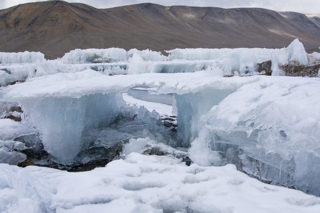
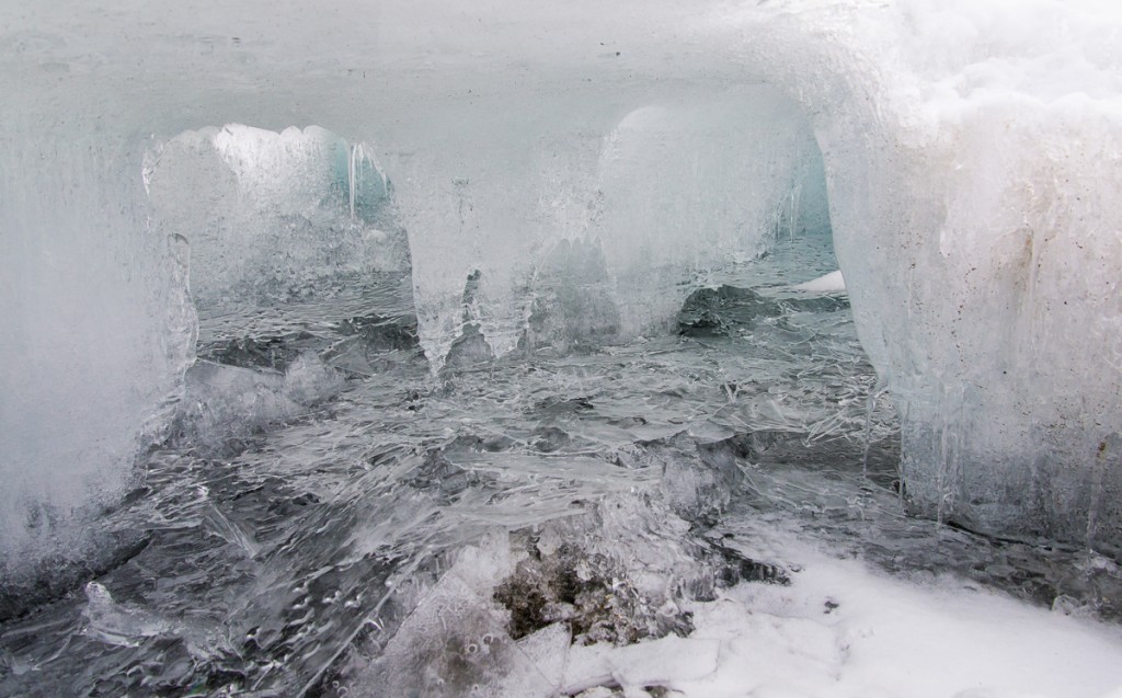
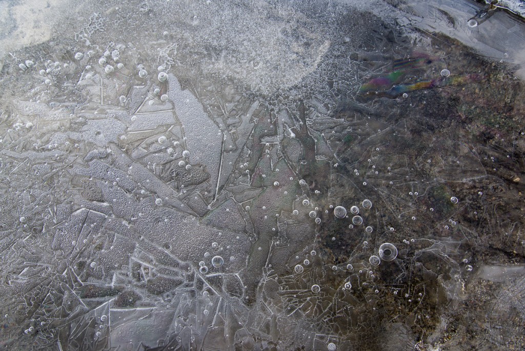
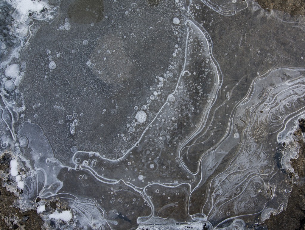
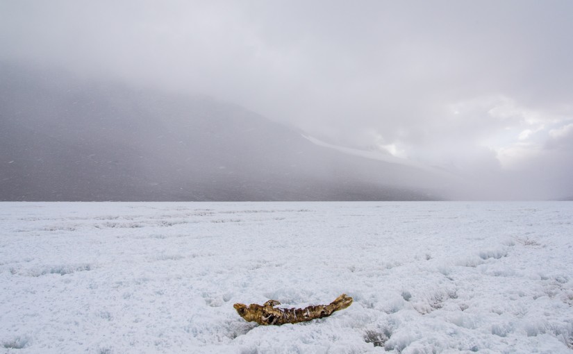
This isn’t the shore of Lake Hoare, this is what large sections of the lake surface looks like when you walk onto it, especially at the end closest to the Canada Glacier. You wander between flat-topped structures two to three feet high, the tops having formerly been the surface of the lake. The rest of the lake has ablated (vaporized into the air) leaving this peculiar world of glass-like ice architecture and thin, delicately etched pieces on the sediment around them.

As I mentioned in a previous post, the lakes in the Dry Valleys have a permanent crust of ice that’s on average four meters thick, a thickness that stays constant from year to year. The lakes themselves can be as much as 30 to 112 feet deep. The thick ice layer is added to by water freezing from the bottom, while the top is lost to ablation — that is, it goes from solid to gas. Scientists who studied the lakes used to think that 30 cm was added to the bottom and 30 cm was lost from the top each year, but recent research suggests that the average rate is more like 75 cm.

Ice structure on Lake Hoare
Some of the tops cantilever out so far without much support you wonder how they haven’t collapsed yet.
Lake Fryxell
Lake Fryxell has some flat-topped ice structures at the end near the Canada Glacier, but they aren’t as extensive or complex as the Lake Hoare ones, and are spaced farther apart. Most of Fryxell looks like this. Researchers routinely drive an ATV across it with ease.

In December, even with temperatures that never get much above freezing, under the 24-hour summer sun a moat melts around the shallow areas of shoreline. The width of the melted water and adjoining thin ice varies and camp manager Rae cautioned that it can change from day to day. So getting out onto the ice on Lake Bonney while I was there only necessitated about a six foot walk on a plank of wood the limnology team placed there, while to get on Hoare a more substantial (although still pretty makeshift) bridge of lumber lashed to pipes was needed, and at Fryxell there was a rowboat with a rope pulley rigged up to cross the much wider moat of shallow water. Once you get onto the lake ice, any ice that’s rough and crunchy is a better bet to walk on than ice that’s smooth and blue, because it’s older and likely to be thicker. Both Bonney and Fryxell were relatively level and stable to walk on once you got across the moat. In fact, on both those lakes, the researchers drive around on an ATV if they have a distance to travel.

Ice structure, Lake Hoare
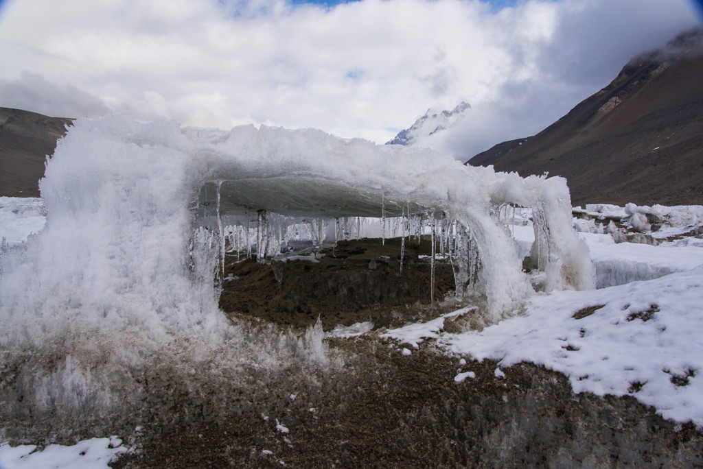
Sometimes it’s difficult to know what’s under the fresh snow surrounding something like this structure (doesn’t it look like a little pavilion?): more sand, firm crunchy ice, or a coating of ice hiding six inches of water.

Hoare is different. Ice that has a thick layer of sediment blown onto it is generally firm to walk on, but you still have to watch where you step or you may end up in ankle-deep — or mid-calf-deep water, as Mari (a McMurdo field center worker who was helping out at the camp the week I was there) and I discovered when we returned from a hike to the other end of Lake Hoare one day. We had hiked down to the Suess Glacier via a little footpath that followed the shoreline, and had been told if we could get onto the ice down there, we could just walk down the middle of the lake on the way back as long as we had on ice crampons, so we wouldn’t slip. We started back on the trail, then after about 10 minutes we saw a spot where we could just take a giant step across the moat onto the lake. This appeared quicker and more direct than the land route we’d taken earlier. Turns out, slipping on slick ice was not the problem. After about 15 or 20 minutes, Mari tripped when her foot abruptly punched through to her mid-calf. She scrambled to her feet. We were both a little spooked, but it seemed to make sense to continue rather than double back. Seemed. Some parts were solid, while others made an ominous hollow sound, and they looked pretty much the same from the top with the slight coating of snow remaining from the storm a few days before, which definitely obscured thin areas that would otherwise have been more obvious. We zigged and zagged from one highly uneven patch of sediment to another, sometimes making good progress, but punching through up to our ankles periodically. This was unexpected after my experiences on Lakes Bonney and Fryxell. I had already walked out onto Hoare with Dave, one of the scientists, and hadn’t encountered this much difficulty. That’s when I took some of these photos — the others I took on another walk onto the lake with him the day after Mari’s and my adventure. But Dave’s been coming here for several years and can size up where to walk pretty readily. At one point, Mari said, “I just remembered, in case you don’t know this, if you fall in, you’re supposed to stick out your arms straight in front of you like this and catch the edge.” Then we started laughing at the absurdity of the situation.

Icicles on Lake Hoare
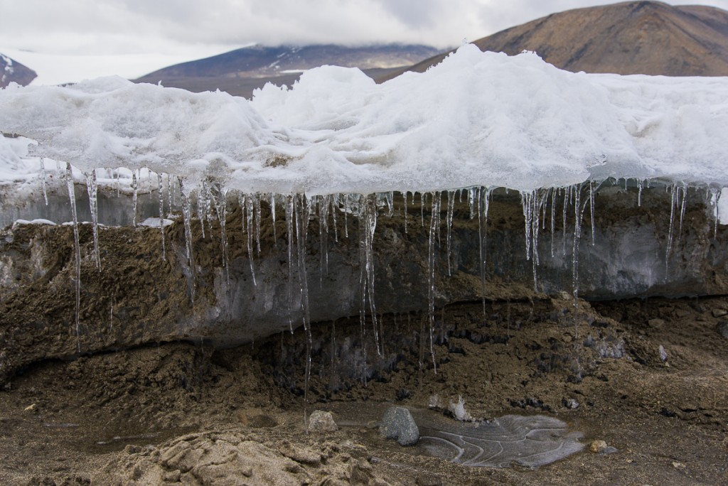
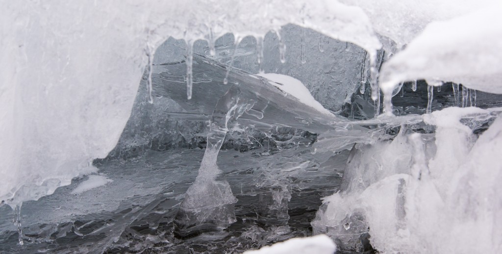
When thin sheets of ice break, they look and sound like broken glass. You can see how some of these ablated areas get hollowed out underneath, and continually melt and refreeze into layers of thin ice.

None of the areas of thin ice were more than a foot deep before you hit the permanent lake ice, but it still was unnerving. Also, sometimes there was no water under the ice, but it shattered with the sound of breaking glass, which I think we’re all hard-wired to find jarring even when we’re not worried about stepping in the wrong place. We didn’t see any narrow moats to cross back to the shore, so we ended up walking cautiously down the middle of the lake, and kept camp manager Rae informed over the two-way radio of our progress. Our “shortcut” ended up taking an extra hour over the path. Boy, were we relieved when we stepped off the bridge onto the shore.

Ice structures on Lake Hoare
Antarctica continually surprised me. One phenomenon — in this case ablated lake ice — has surprising permutations in one relatively small section of one lake.

Icicles, Lake Hoare

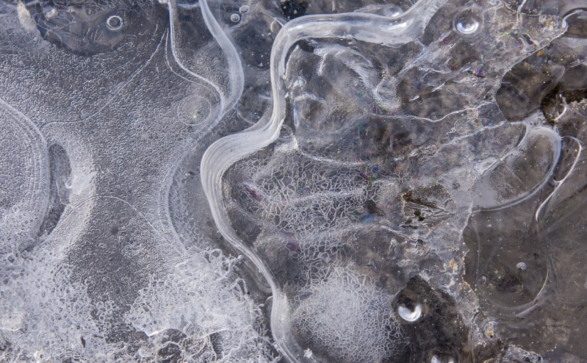
As long as I knew I would not end up in freezing water up to my armpits, I enjoyed walking around with my camera looking for interesting formations and peering inside the taller ones, which were about knee high. There is no shortage of oddities and we didn’t have to walk far to find a wide variety. Some were like thick glass pillars. The ones at left looked like part of a chandelier. Then there was a whole other world of fascinating designs that looked drawn or painted on thin layers of ice that had formed on the surface of the sediment.


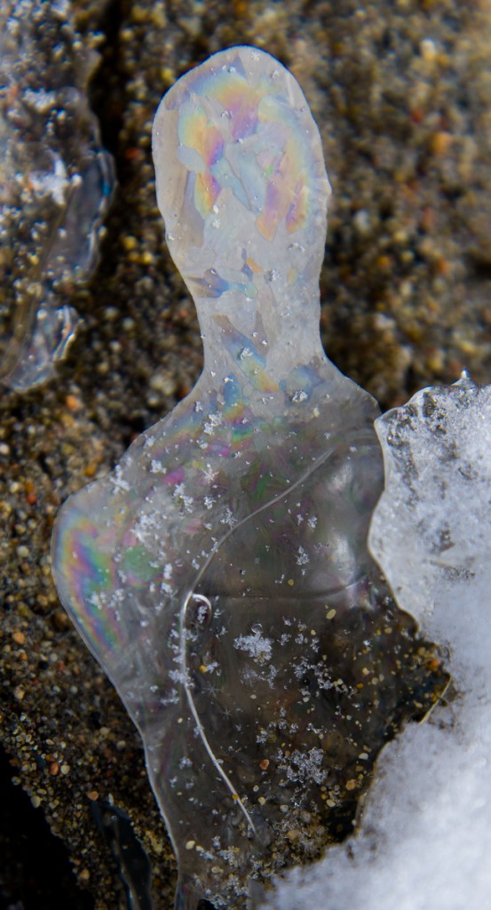
Interference pattern on thin iceI’ve zoomed in on the formation at left so you can see how a thin ice layer has formed a rainbow-colored interference pattern.

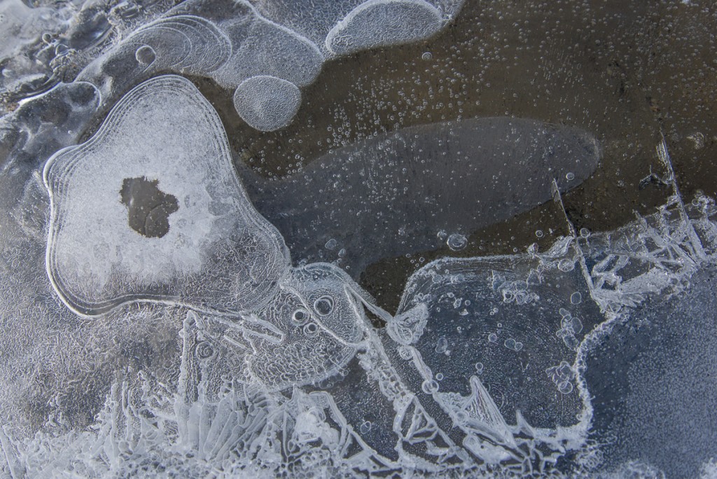
We saw ice embellished with concentric curving lines, overlapping dots, and so-called Tyndall figures, which are pale shapes separated by straight and curved lines. And sometimes there were combinations of any or all of the above as in the following photos:


Tyndall figures, Lake Hoare
A lake ice trifecta of Tyndall figures, bubbles, and a rainbow-colored interference pattern upper right.
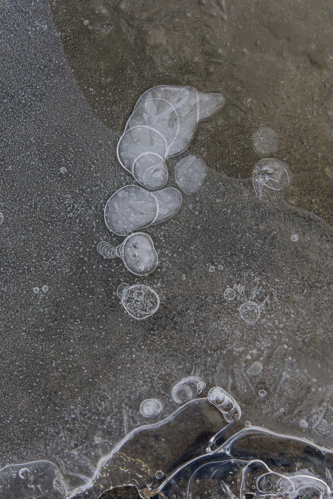
Skua shaped ice formation
I call this one, “The Skua.” Kind of looks like a bird in profile, right? There actually was a skua that sometimes came around the Lake Hoare camp, which the staff and scientists had nicknamed Taylor, since the camp is in the Taylor Valley. Though a lot of people at McMurdo view skuas as pesky, the Hoare camp always got a kick out of seeing Taylor, since he/she was the only bird in the area. Otherwise, the only animals in the Dry Valleys are microbes and nematodes.
Lake Hoare ice formation
More abstract art from ice.
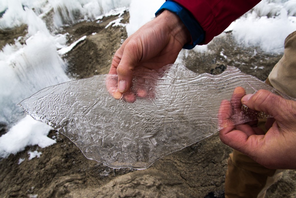
Dave holds an ice formation
You can see how thin many of these formations lying on the sediment are.
Dots in the ice
A series of drips freezing a leaving a white outline? A drop leaving traces of its path as it moved? However these formed, the result is delicate and lovely.

Ventifacts: In a Surrealist Sculpture Garden

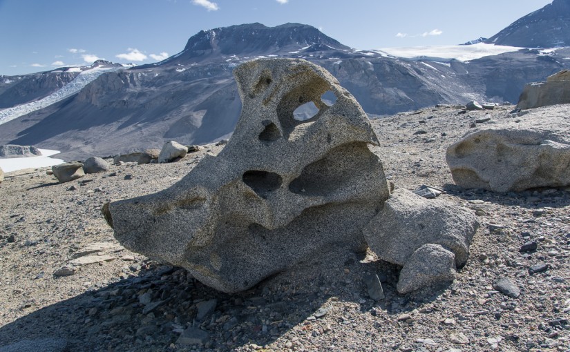
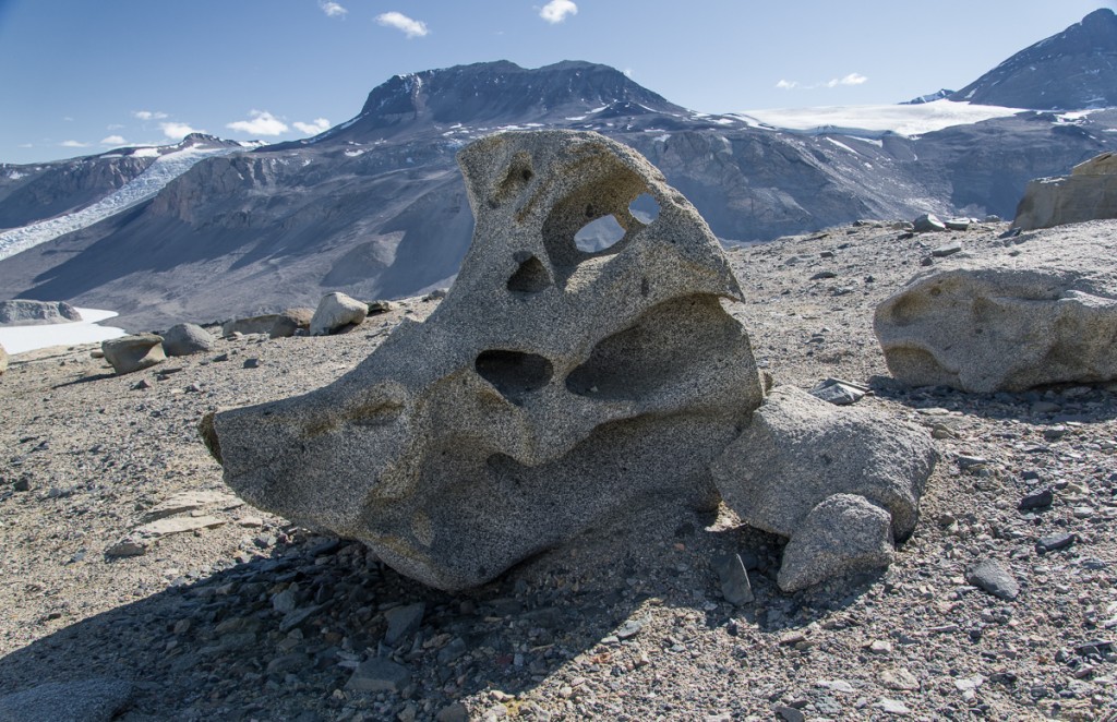
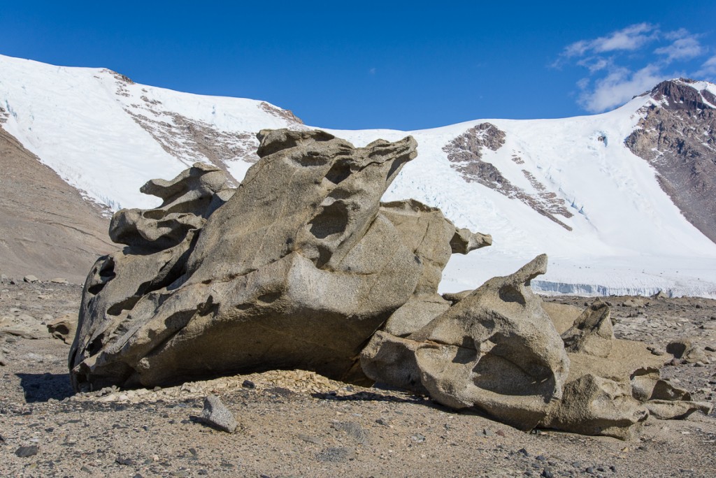
Ventifact, Antarctic Dry Valleys
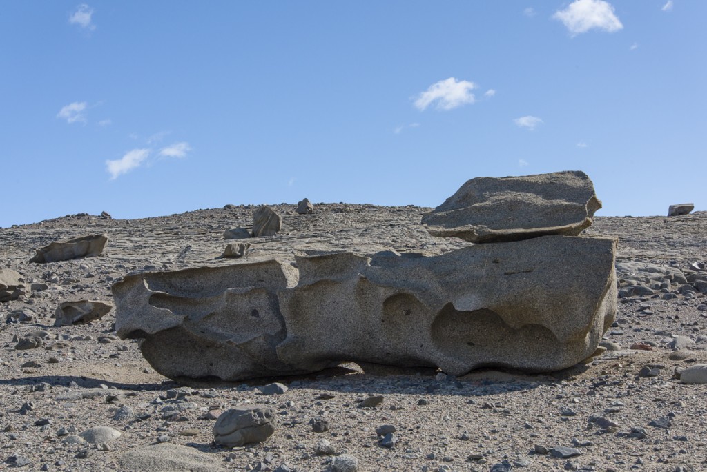
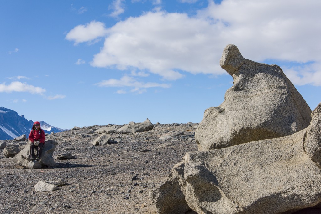
It’s a bird?: Granite boulders at the top of the ridge above Lake Bonney have been sculpted into strange shapes. From this angle, this one reminds me of a cartoon bird (beak on right).

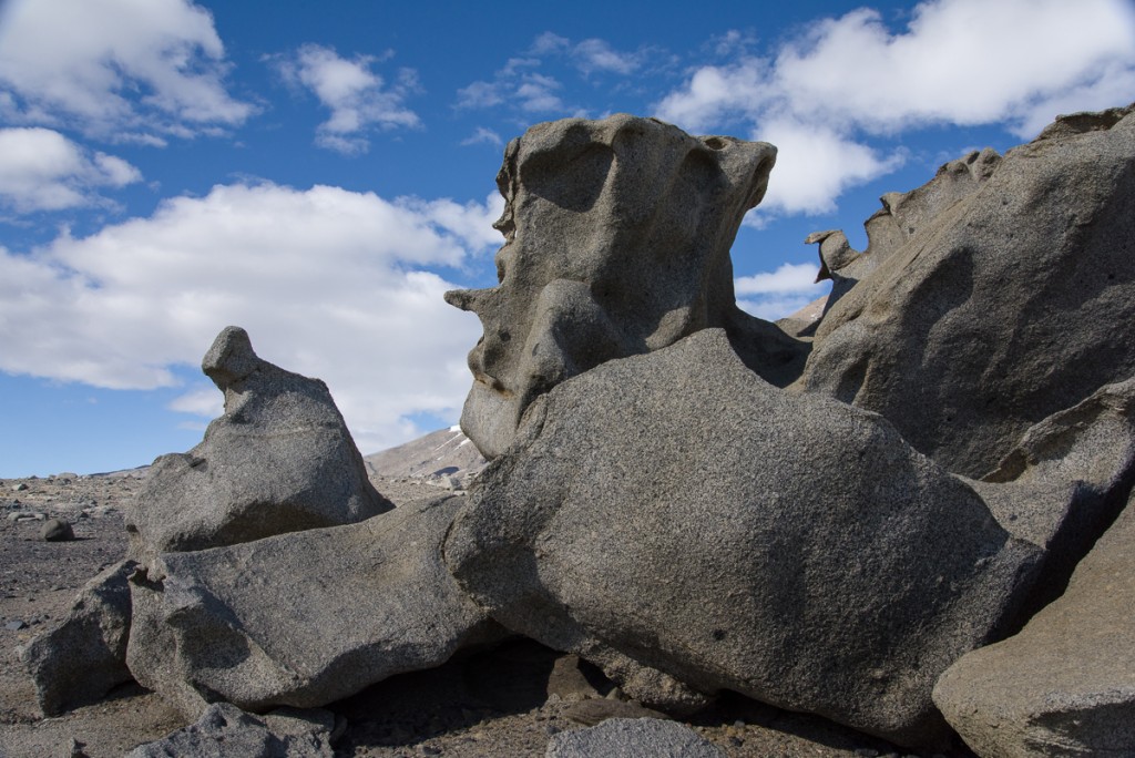
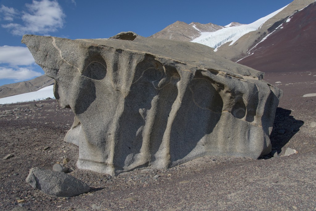
On Dec. 17th, with Forrest McCarthy as my guide, I hiked up some steep gravel inclines in the Antarctic Dry Valleys above Lake Bonney to elevated ridges and plateaus to see the ventifacts. These are large granite boulders that have been pummeled by fierce winds picking up grains of gravel — imagine a giant sandblaster over millenia.

Ventifact, Cape Royds
There are modestly-sized ventifacts at Cape Royds, carved from the black volcanic stone that dominates the landscape.

I saw smaller ventifacts at Cape Royds. Those were volcanic stone hollowed out into curved shapes, sometimes pierced with holes and generally in the one- to three-cubic-feet range, and mostly on the smaller side of that range. But nothing prepared me for the ventifacts of the Dry Valleys. It was a steady climb for some time and then we came over a ridge where the ground was strewn with huge granite boulders curved, hollowed and pierced into strange shapes. I felt like I’d entered the world’s largest Surrealist sculpture garden.

Ventifacts above Lake Bonney
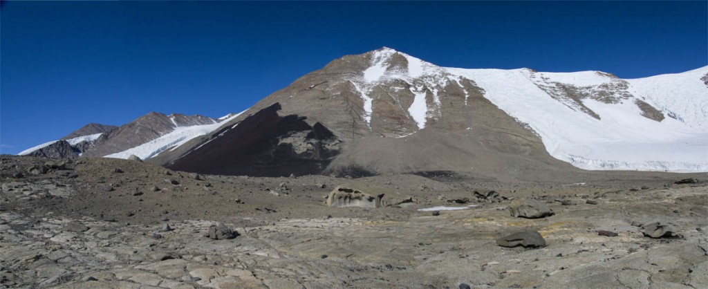
Surrealist sculpture garden: boulder-sized ventifacts are strewn across a rocky plateau. In the distance is a mountain with a huge expanse of deep black and dark red stone.
View of Lake Bonney
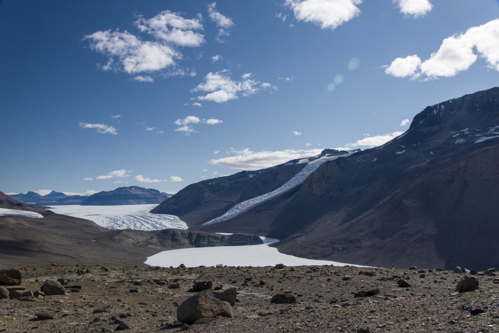
Facing the opposite direction from the above photo, you see the ventifact field in the foreground, with the white expanse of one of the lobes of Lake Bonney below (the white line in the center is the part of the lake that connects them and you can see a sliver of the other lobe, blocked by the hill in the middle). There’s also the Rhone Glacier on the right, and beyond that, the huge Taylor Glacier, The Friis Hills, with their striking large horizontal stripes of contrasting shades of brown, rise above the Taylor.


Ventifacts, Lake Bonney
Many of these forms made me think of 20th-century Modernist art. This is kind of like an Arshile Gorky abstraction come of life. Or maybe Yves Tanguy.

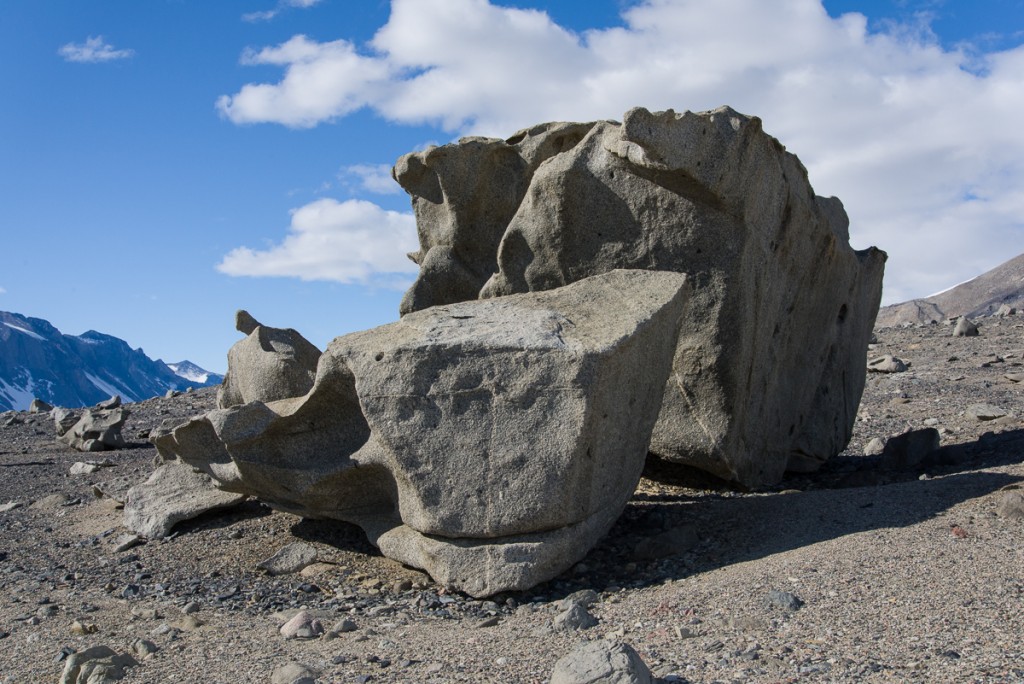
The ventifacts obey a cardinal rule of good sculpture — that it should present different forms as you walk around it. Believe it or not, these are two different views of the same ventifact:

Ventifact, Lake Bonney
One side of a ventifact grouping…
Ventifact, Lake Bonney
…around the other side it looks completely different.
Ventifact above Lake Bonney
Seated figures, real and abstracted: Forrest waits for me to walk around the ventifact making photos for the 3D file creation process. You can get an idea of the scale from this photo.
Ventifact above Lake Bonney
Here it is again. Some of the carved forms are surprisingly thin and articulated.


Ventifact above Lake Bonney
This one looks like rippled cloth with a line of a contrasting color running through it.
Ventifact above Lake Bonney
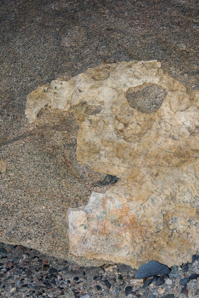
This is the only one I saw with a large shape of a different stone mixed in.
Ventifact above Lake Bonney
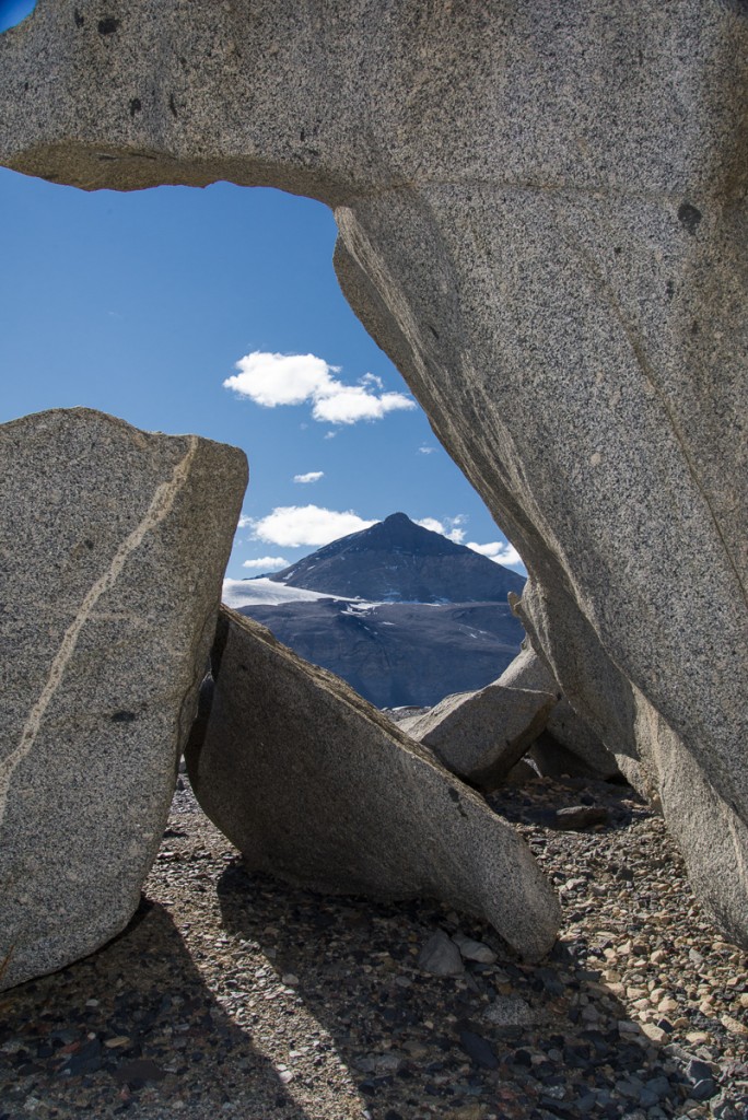
This one frames a vista of a mountain on the opposite side of Lake Bonney known as The Matterhorn.
Ventifact above Lake Bonney
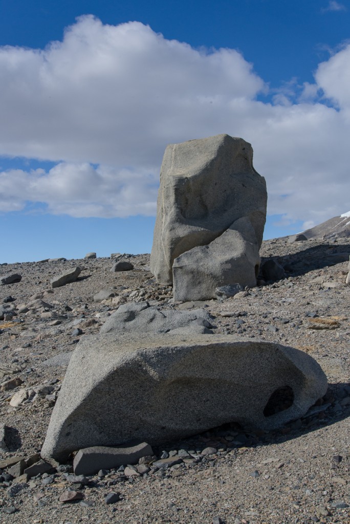
The tall one reminded us of a monolith.
Forrest on ventifact
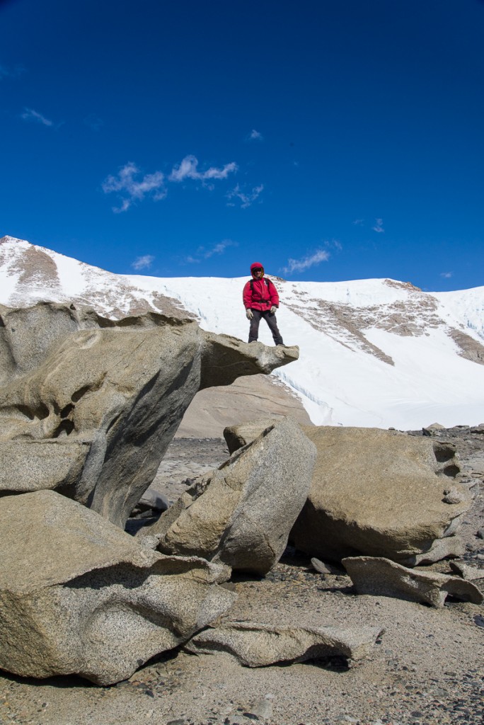
Forrest climbed up on the “diving board.”
Black stones
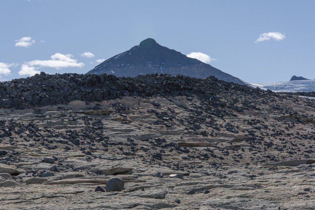
Stone wall: Black rocks piled on a ridge appear to be made of the same stone coloring the side of the mountain shown in one of the above photos. That’s the Matterhorn in the distance.
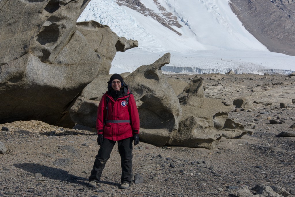
Helen and ventifact
Me among the ventifacts.
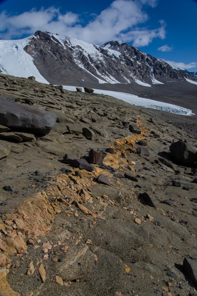
Yellow rocks
Follow the yellow brick road: On our descent we saw a vein of yellow-orange rocks that stretched across the hillside in a fairly straight line.
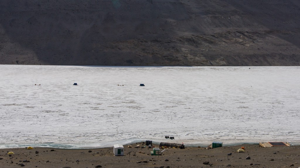
Lake Bonney camp
The Antarctic landscape makes you aware of how small you are in the scheme of things. It’s also really hard to judge distances. You walk and walk, and wonder why you aren’t there yet. Where this photo was taken we had about another 10 minutes of walking downhill to get to the camp. The second yellow tent from the left, closest to the lake edge, is mine. The main hut is in the middle near the shore, and the helo pad is on the right.