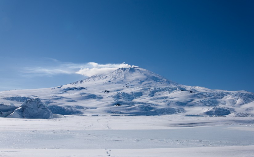
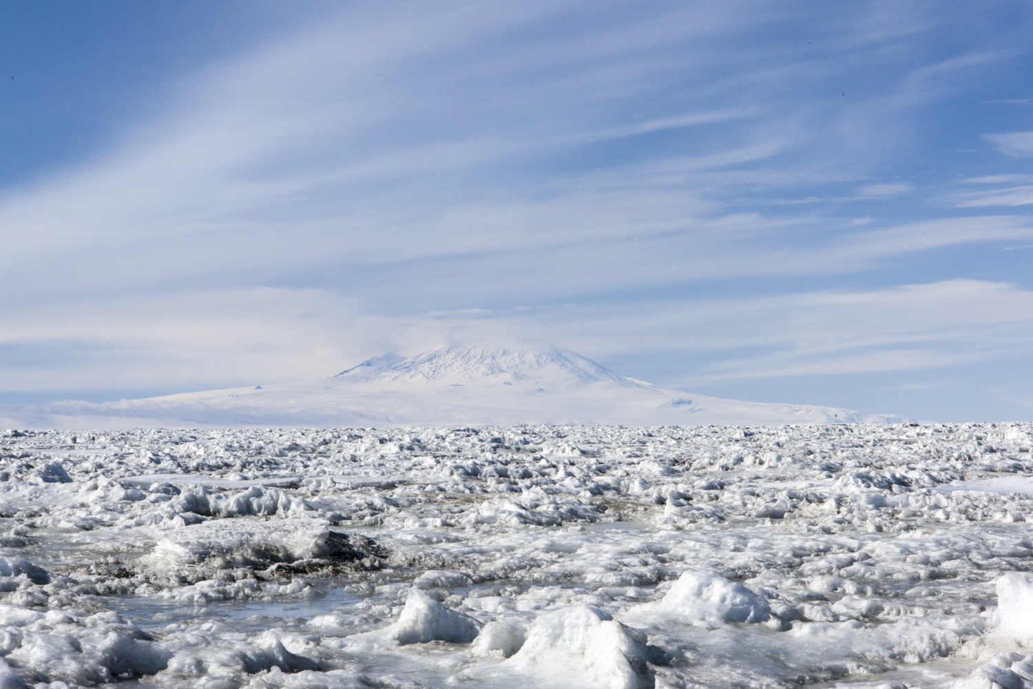
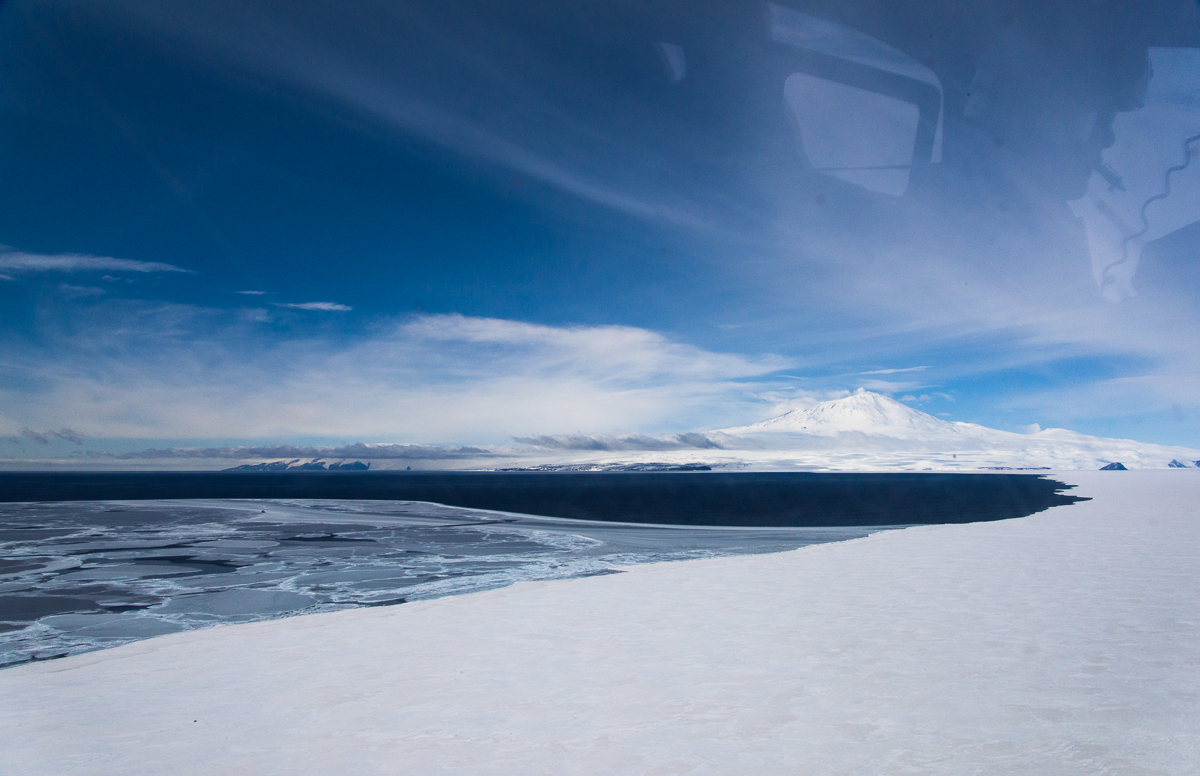
On occasion, if the wind isn’t blowing too hard, you can see the smoke rising from the volcano. This view is from the sea ice near the Dellbridge Islands. The sun threw the crevasses on the slopes into relief.
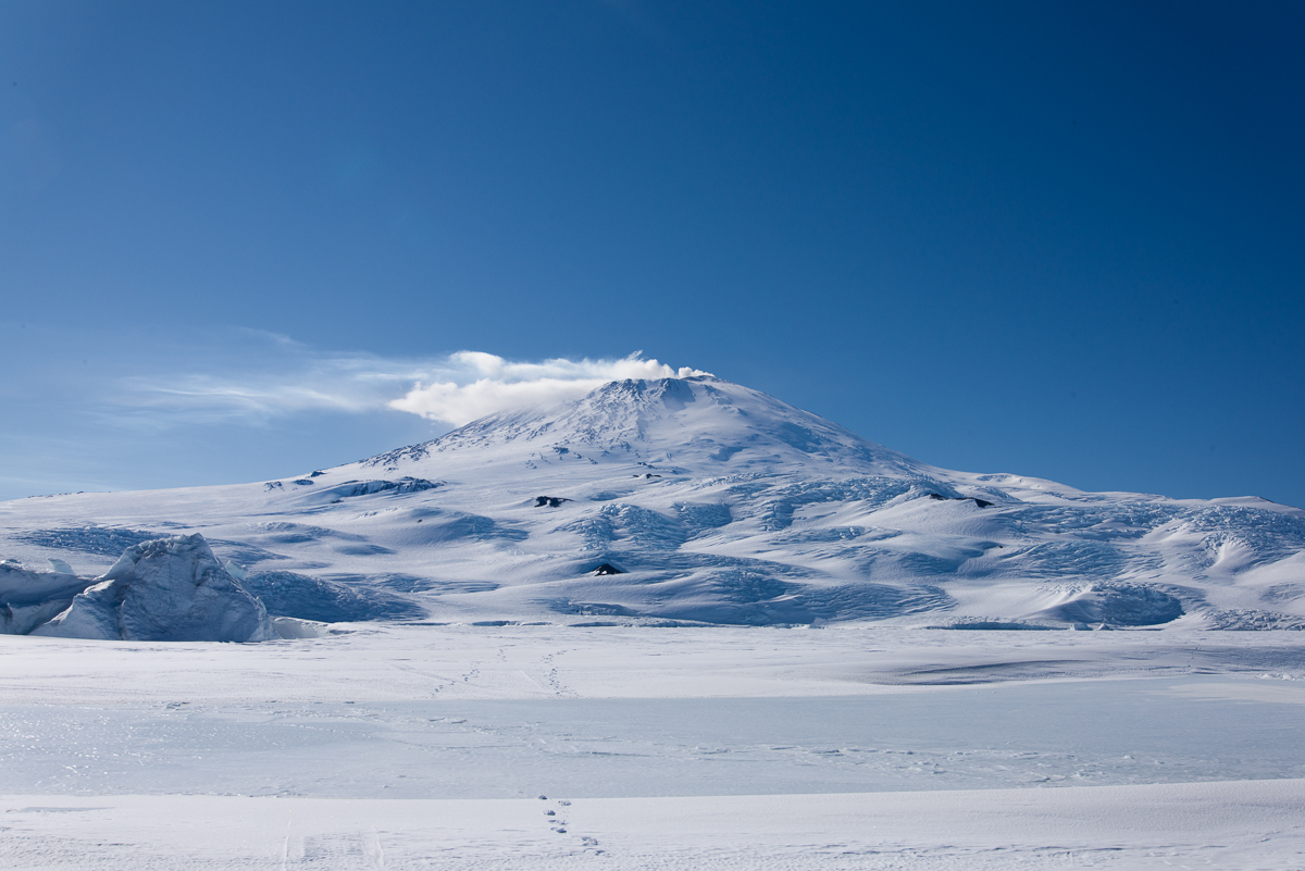
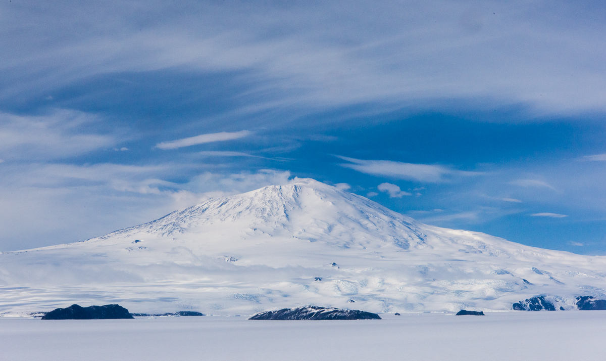
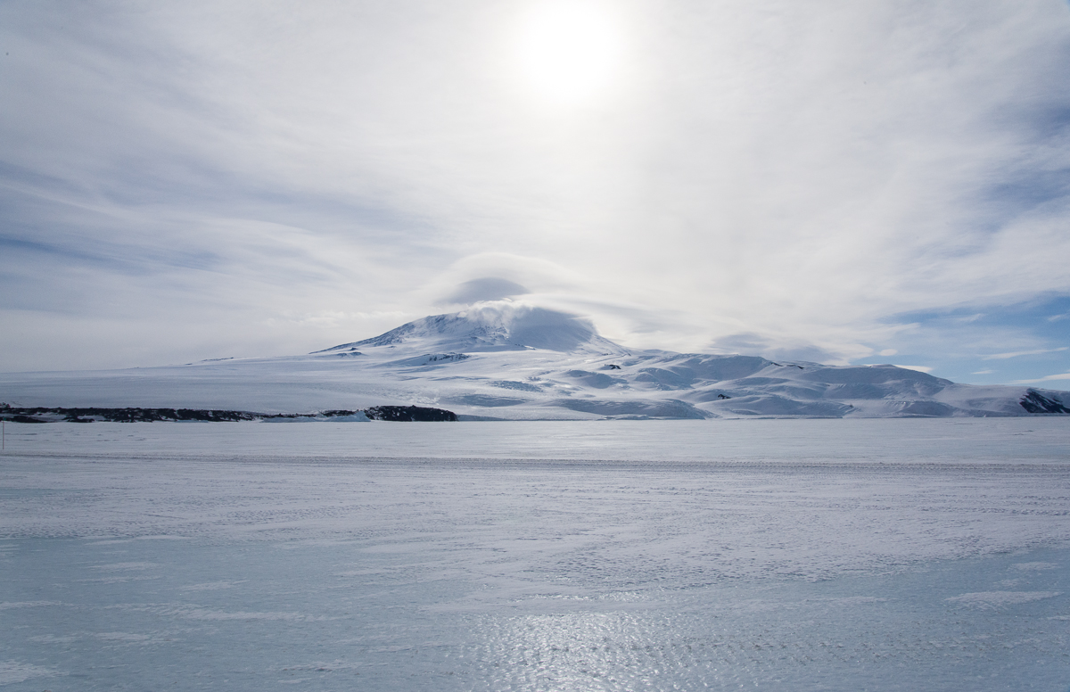
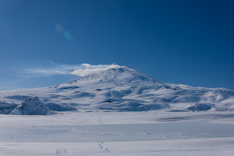
At almost 12,500 feet high, Mt. Erebus dominates the landscape of the western side of Ross Island, where I spent my time in Antarctica. It’s an active volcano, and not part of a range, so it stands apart from other mountains. Also, its western slope ends at the flat sea ice, even though its summit was about 50 miles away from New Harbor, which is on the opposite side of McMurdo Sound, it was a prominent feature of the horizon. I found myself photographing it from a variety of locations. The cap and banner cloud formation on top of Mt. Erebus featured in the last post is just one of them. I ended up with a small series of photos of its snow-covered slopes in different weather as well as different vantage points. The funny thing about Erebus is that it doesn’t look as big as it is. Distances are incredibly difficult to judge in Antarctica anyway. I kept trying to figure out what was messing with that perception. Part of it must be that there are no trees or other cues to help provide scale. And with Erebus, I think because the profile of it is rather spread out and horizontal rather than steep and vertical, you don’t realize how gigantic it is.
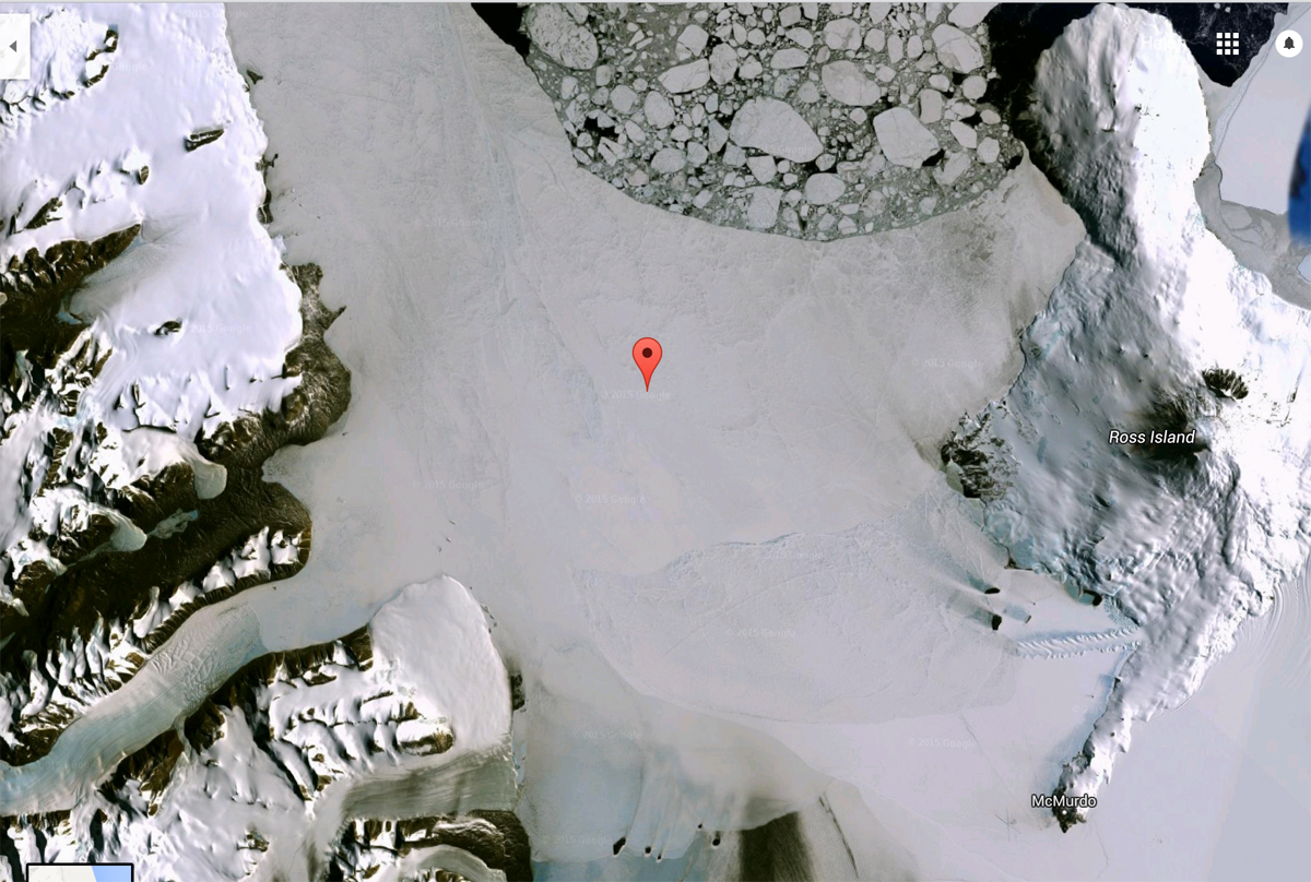
To get an idea where we’re talking about, here’s a Google Earth Map of McMurdo Sound:
Google Maps satellite view of McMurdo Sound (click to enlarge): The black spot labeled “Ross Island” on the right is the summit of Mt. Erebus. McMurdo Station is labeled below it, at the end of the peninsula. Scott Base is just around the corner from McMurdo. The Erebus glacier ice tongue is the sawtoothed shape on the sea ice and those dark specks above it are the Dellbridge Islands. Cape Evans is on the other side of the ice tongue from McMurdo Station, and Cape Royds is the larger dark area north of that. If you draw a horizontal line from the summit of Erebus, through Cape Royds and across the sound to the indentation in the dark shoreline of the Dry Valleys opposite, that’s where the New Harbor camp is.Erebus adds drama to the view from the field camp at Cape Royds, which is on top of a tall hill.Far away, across the sound from Cape Royds at New Harbor, Erebus stands out. In the foreground is multi-year sea ice.
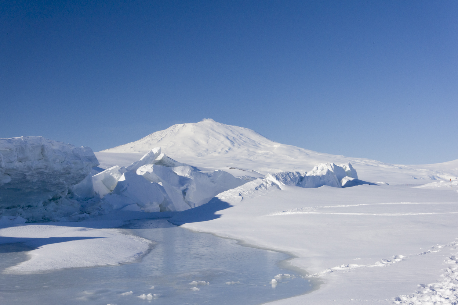
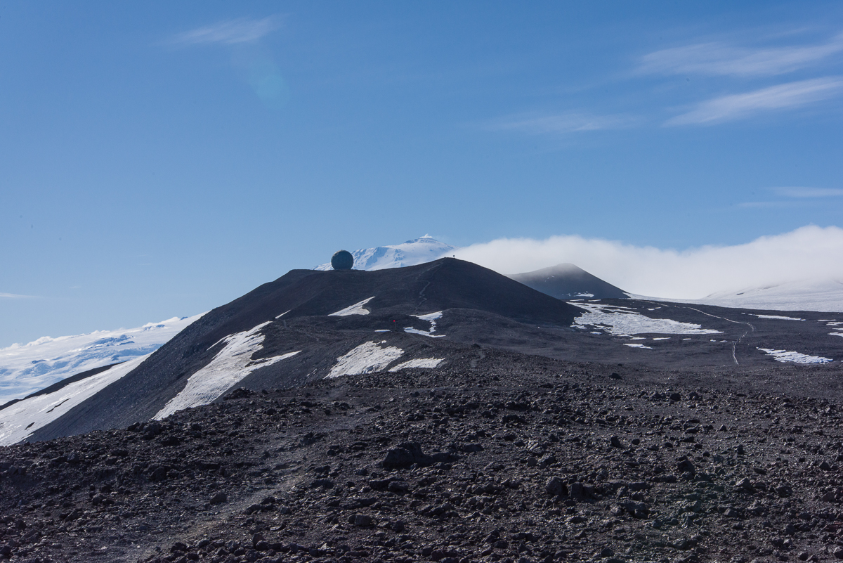
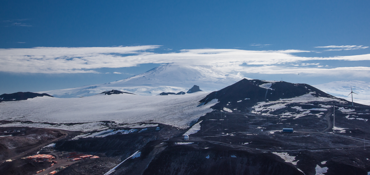
I made two different visits to the pressure ridges in the sea ice near Scott Base, which is New Zealand’s Antarctic outpost and close neighbor to McMurdo. One evening the sky was hazy.Revisiting the same site the following week, the sky was clear, the landscape a study in graphic blue and white shapes.The hills around McMurdo Station block the view of Erebus until you get up on a ridge above the base, like this one on the Hut Point trail. You can glimpse Erebus behind one of the “golf balls” as people call them — geodesic domes that house satellite dishes.
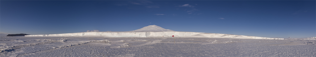
Erebus in the background of a panorama of one side of the Erebus glacier ice tongue. The red flags mark the entrance to the ice cave. The dark rock on the left is one of the Dellbridge Islands. Click to enlarge.On the flight back from New Harbor, the helo pilot showed us the sea ice edge with Erebus in the distance……and flew closer so we had a good view from the air. The Dellbridge Islands are in the foreground.One of the last days at McMurdo I climbed to the top of Observation Hill. This is the last photo I took of Erebus.
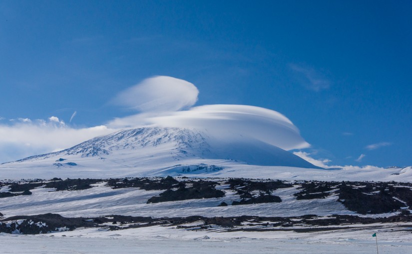
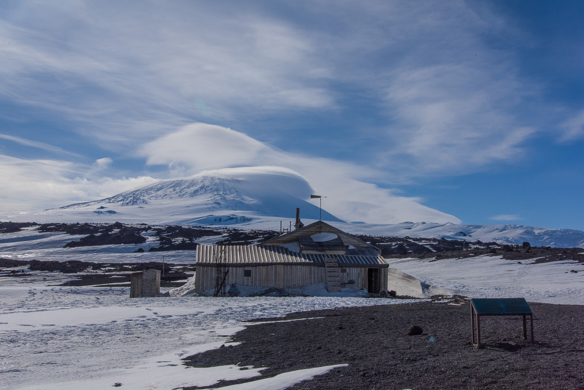
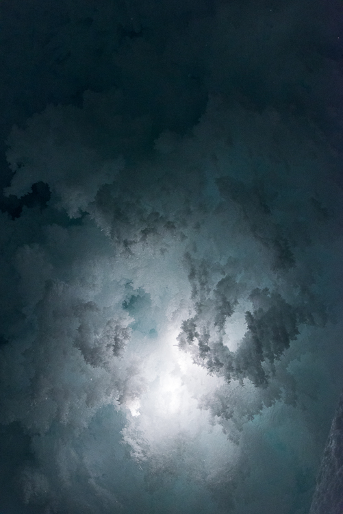
12:15 p.m. My photo of a cap and banner cloud atop Mt. Erebus from Cape Evans is the Cloud Appreciation Society January 2016 Cloud of the Month. The cap is on the right and the banner is the streaming cloud on the left.
The above photo of a cloud formation known as “cap and banner” is the Jan. Cloud of the Month on the Cloud Appreciation Society’s web site. You can also see it on their web site. I photographed it in Antarctica on November 25th, after traveling by snowmobile over sea ice for about 90 minutes to the historic Terra Nova Hut at Cape Evans.
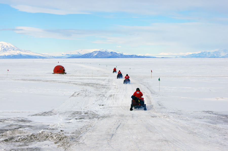
Here we are heading out onto the sea ice for a snowmobile trip to Cape Evans. I’m the 3rd one in line. One of the many aspects of the Antarctic experience I never anticipated was that I’d be driving a snowmobile.
The hut was built in 1911 for the 1910-13 expedition, led by British explorer Robert F. Scott, and eventually I’ll post some photos of the fascinating interior, which is filled with period tools and supplies the explorers left behind, including snowshoes for ponies (they brought ponies to Antarctica! on a ship! alas, it did not work out well), a taxidermy penguin, piles of 100-year-old cans of food and bottles of medicine, fur boots, old socks, etc.
The Cloud Appreciation Society, a project started by Gavin Pretor-Pinney, the best-selling author (at least in England) of The Cloudspotter’s Guide has amassed a huge online library of cloud images sent in by cloud enthusiasts all over the world for the last several years. I submitted the photo after looking up Erebus on Google Images and finding nothing else like it. I thought it likely they’d post it eventually, but was pleasantly surprised to see they not only posted it immediately, but featured it. They’ve classified this particular cloud as a “cap and banner”.
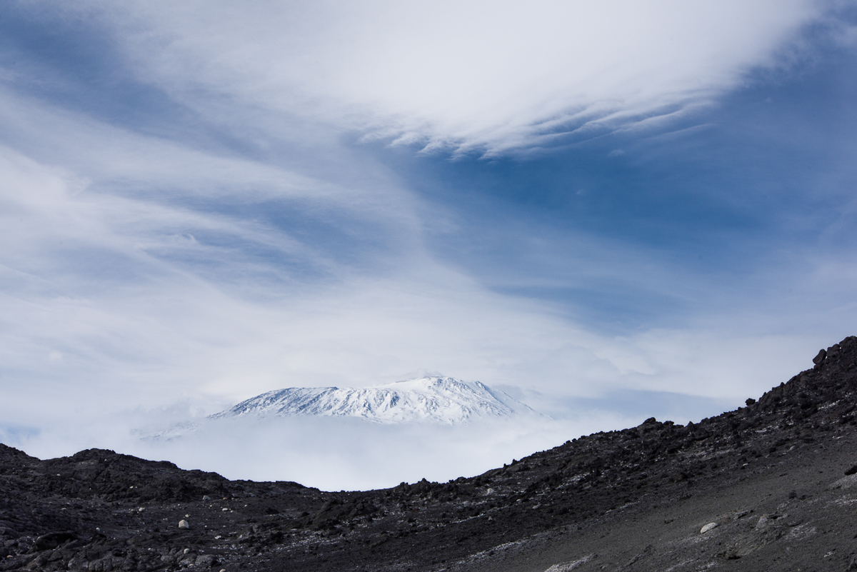
Although going inside the hut was the purpose of the trip, I couldn’t help but notice that a picture-perfect lenticular cloud was forming above nearby Mt. Erebus. I knew it was a lenticular cloud, because I learned about the different types of formations while photographing clouds intensively a few years ago. Lenticulars often form right above isolated mountain peaks, and if they form a base low enough to cover the summit they’re known as cap clouds. Banner clouds are more like a stream of vapor — but not snow — flowing off the mountaintop. (More info about both types here.) About two-and-a-half hours before I took the photo there was no indication that anything special was brewing:
Erebus at 10:24 a.m. When we stopped for a break en route to Cape Evans that day, it was bathed in a glowing haze. In retrospect, I can see there was a little bit of a cap above the peak, but no hint of the drama to come.
I just looked at my photo catalog on my hard drive and realized I must have taken a few thousand photographs of cloud formations between 2007 and 2012 — I’ve got a few hundred digital negatives on my hard drive and those are only the ones I didn’t delete! It did get to the point where I’d look at the sky and think, yeah, that’s nice, but I’ve already taken that picture 50 or 100 times. So when I saw this, I thought it was cool, but knew I should keep an eye on it in case it got even better:
11:50 a.m. The Terra Nova Hut exterior was the subject of this photo, but the two clouds over the summit in the background caught my attention. I ate my lunch and walked around outside, keeping an eye on it.
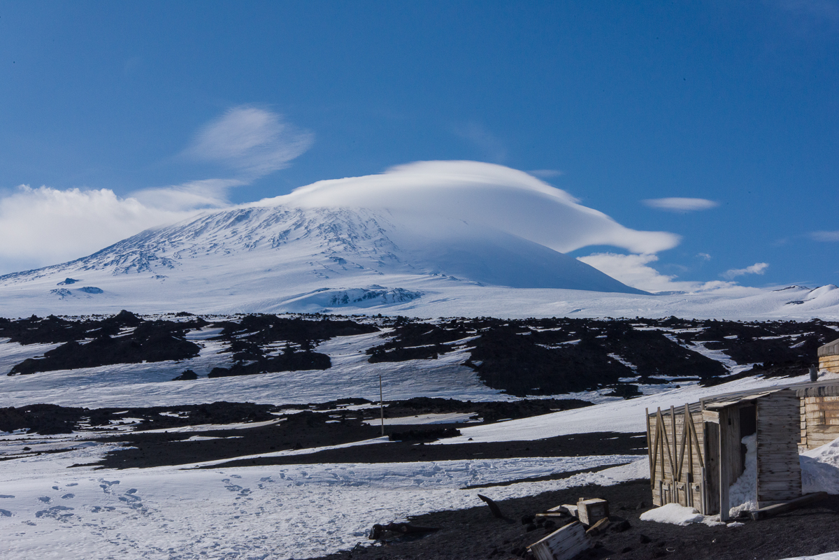
1:00 p.m. Ten minutes after what turned out to be the best shot the cap cloud was spreading out and losing its lenticular shape. Still an impressive banner on the other side of the volcano, though.
So, in between two walks through the hut, taking pictures, and a climb to the hilltop memorial cross to explorers who lost their lives, I kept checking on it. Looking back at the time stamps of the photos, I can see that I took my first photo of that cloud almost exactly an hour before I took the January Cloud of the Month photo, which I decided was most perfectly formed, and just 9 minutes after that, it was starting to flatten and become much less interesting. In between the first and last photo, I kept checking on it, because prior experience alerted me to the fact that (a) this was an unusual formation and (b) being a cloud, it wouldn’t last long. The fact that it had even drawn my attention when it was not the purpose of the trip, occurred to me as I read “How to Cultivate the Art of Serendipity” a thought-provoking New York Times article on how inventions come about by Pagan Kennedy, which was published a few days ago, on January 2nd.
Kennedy notes that often major inventions or discoveries come about because of an accident, while the inventor was looking for something else entirely (50% of the time, according to one survey of patent holders). While this may look like luck, she cites a researcher named Sanda Erdelez who posits that there is something more going on: that people who make new discoveries may be especially inclined to notice things that were not on their agenda and to take a detour to investigate when that happens. Also that such people enjoy encountering odd bits of information for no particular reason than to see if anything interesting turns up. Kennedy calls that process “gathering string.” String gatherers/detourers are what Erdelez calls “super-encounterers.” I recognize that tendency in myself. Kennedy is very upbeat about the trait, suggesting it nourishes creativity. But I can attest like any personality trait, digressive wandering has its downside that it behooves one to be aware of lest you look up at the clock and notice you just spent way more time “string gathering” than you’d intended, let commitments outside your normal routine totally slip your mind, or exasperate people you’re recounting something to, leading them to plead, “Could you get to the point?” (Yes, if you are one of those people, you may feel free to stop me.)
After reading Kennedy’s article, it occurred to me that the only reason I knew to attend to what was going on above Erebus that day was that when I was taking all those cloud photos I was reading everything I could get my hands on to understand how they formed and moved through space. The information stuck in my head, even though I never saw a lenticular cloud in person until November 25, 2015 when I took these photos. So was I lucky that the cloud came together while I happened to be there? Yes. But without the prior intellectual wandering which was really just because I found it personally enriched my experience of the natural world, I would probably have taken the shot above at 11:51 with the hut in the foreground and gone back inside, and missed the really great moment an hour later.
On January 4th, I left the ice, as the expression goes in the US Antarctic Program. I’m sitting in a hotel room in New Zealand typing this post. The last week I was in Antarctica it started to hit me that it was the last week I was in Antarctica. Travel for me is always a period of “super-encountering” that I simply need periodically, to recharge my batteries. But this is the longest trip I’ve been on in 40 years, and in the most alien, unfamiliar place I’ve ever visited. I generally had an idea what to expect, except that nothing quite prepared me for any of it. I wasn’t sure if it would be what I hoped; it was way more than what I hoped. I haven’t even finished posting material to this blog. There’s more coming as I work my way through it.
And I found myself rising to the occasion to handle everything from being dropped into a field camp to live in a tent with people I had never met, to sleeping in a tent in 20-degree weather, to driving a snowmobile, seven hour hikes in cold weather, to realizing I could indeed make 3D captures of really, really large things — way larger than I’d expected. I met wonderful people and I also navigated the sometimes-quirky McMurdo social scene, a subculture with its own mores and routines shaped by communal living of adults of widely different ages and backgrounds living in a remote place. I couldn’t take anything for granted or predict what sight I’d come upon next. Along would come delicate designs in the lake ice, boulders carved into a surrealist sculpture garden, or even, for five minutes, a perfectly poised cap and banner cloud, spinning above a volcano.
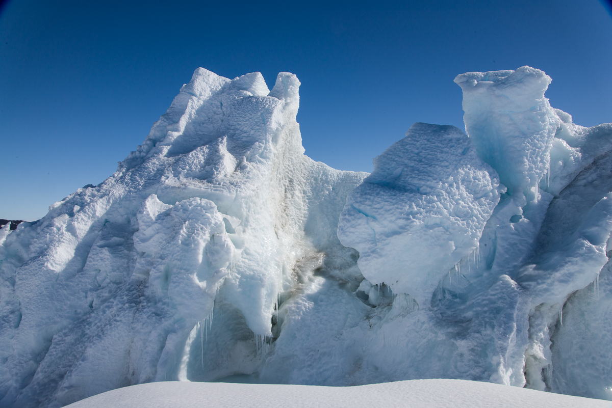
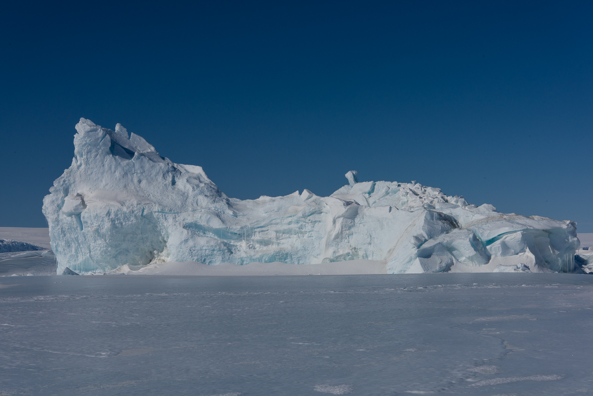
On December 1st, before visiting the Erebus ice cave, Evan and I went to see some icebergs that are stuck in the sea ice near the Dellbridge Islands. The Dellbridge Islands include Tent Island, Big Razorback and Little Razorback. The iceberg I photographed first is nearest to the island in the group with my favorite name, Inaccessible Island, named by the famous British Antarctic explorer Robert F. Scott because it was hard to reach. Of course, he didn’t have a Haagland tractor, which made the trip much easier. Not that a Haagland is a luxury vehicle by any means, but it’s great for traveling on ice and it gets warm inside. Big Red (as everyone calls the heavy parkas we were issued) comes off when you get in a Haagland. You’ll see the islands in the background of some of these photos. Also nearby was Mt. Erebus, but it’s so huge (over 13,000 ft.) that Erebus seems nearby wherever you go around here. The angle of the sun showed up the large crevasses on its lower slopes.
It was so clear that even from a distance you could see the crevasses on Erebus’s lower slopes.
The plan was for me to circle the iceberg nearest Inaccessible Island, to take photos for a 3D file, which I did. I selected 162 to process and since there were so many, I carefully masked them in the software, which took several hours, and I’m processing the file as I type this. I’m optimistic it’ll come out, because the first stage of processing where I aligned the photos showed a generally recognizable shape, and the second stage, under way now, originally showed it would take a total of 12 hours, but it is now almost 60% finished and the estimated total is down to 7 1/2, so the fact that it’s going faster than the original estimate is a good sign. Stay tuned for the next post…
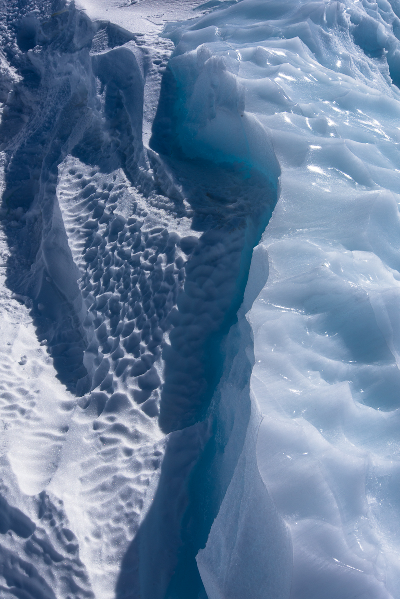
Two kinds of ice, matte and glossy, side by side. Click this and the other images to see larger views.
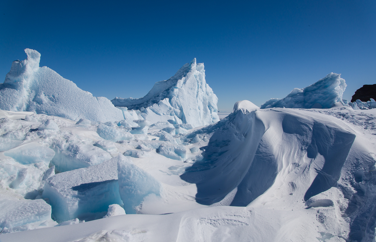
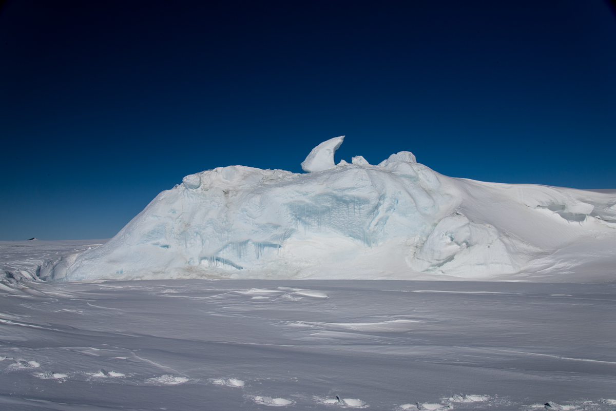
In the meantime, I’ll share with you photos I took after we left that iceberg and stopped at a spot where we could walk around a couple of smaller ones. One in particular had a lot of drifted snow around it, so I’m not sure if I’ll be able to get a 3D file of the whole thing, but it sure had a wide variety of ice formation and profiles that changed as you walked around it. The photos here show some of my favorite views.
A little pool of water had melted around one end. Our Haagland vehicle is in the distance on the right.Wind-whipped snow and ice.The drifting snow had curved into smooth, rounded forms.A slight change in perspective shows a different view than the one above, although you can see the same large forms on the left.But the opposite side of the iceberg looks totally different from the side catching the drifting snow.
This is the only shot I’ve included of the smaller of the two icebergs, because it wasn’t as interesting, although the hook-shaped protrusion popping from the top in this view is certainly quirky.
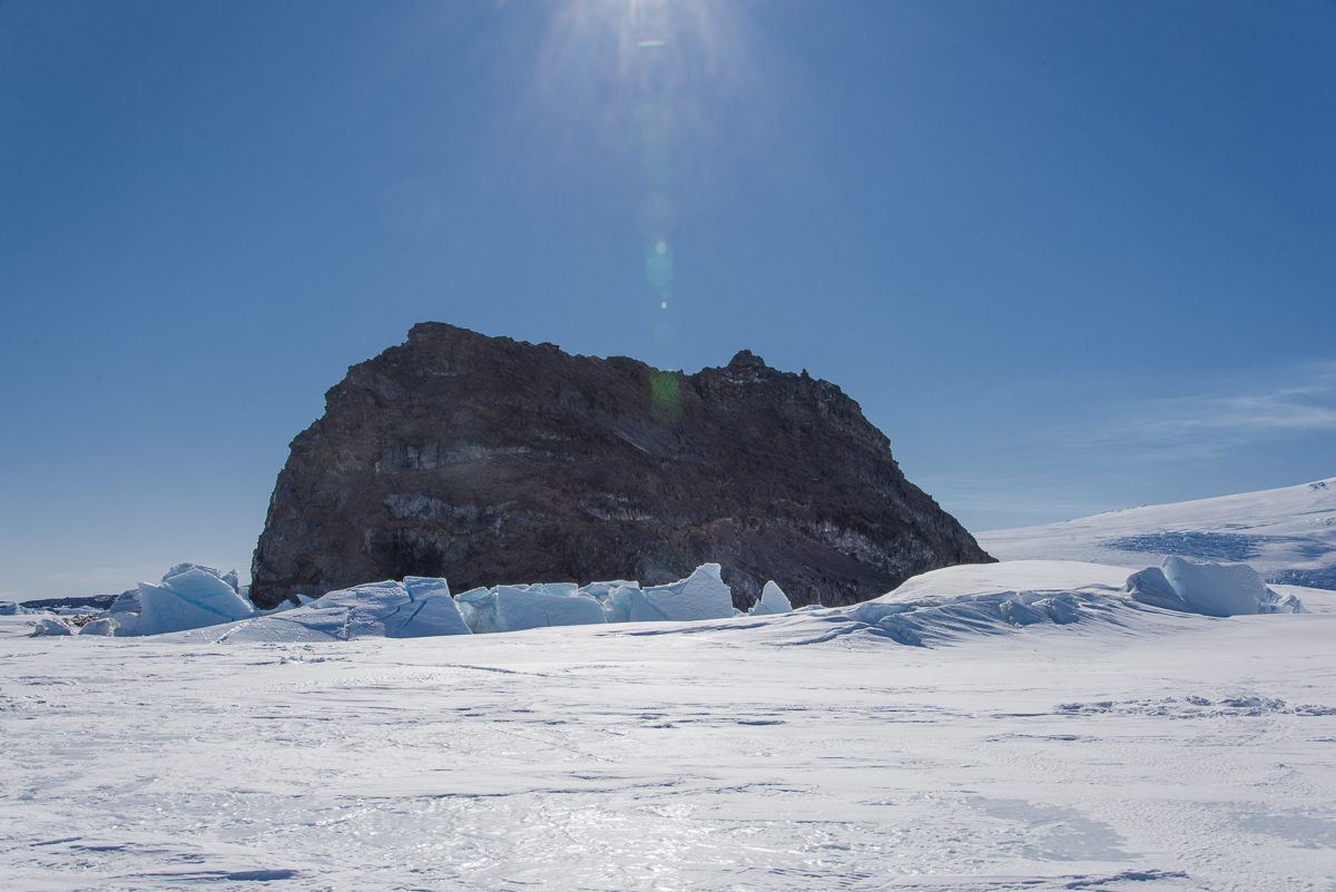
The two smaller icebergs were closer to Little Razorback Island. You can see where pressure ridges have formed near the island.
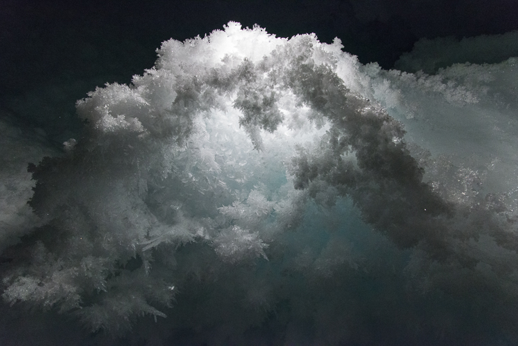
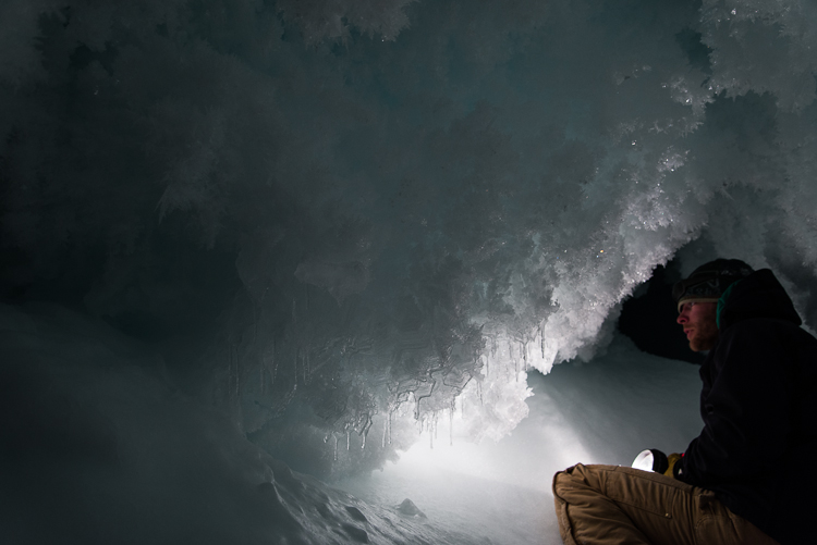
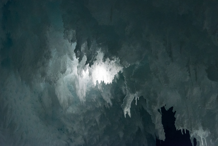
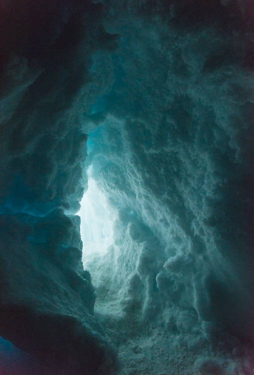
On my second visit to the ice cave, I experimented with indirect lighting and got some otherworldly images.Smokin’ hot: Tuesday you could see that Mt. Erebus is an active volcano, with a little puff of white smoke rising above the crater at the summit.
Tuesday I went out with Evan, one of the mountaineers on staff here, whose assignment for the day was to take me to any icebergs frozen in the sea ice that interested me and back to the ice cave in the Erebus Ice Tongue. We went in Gretel, the same Haagland tractor featured in my sea ice training blog post, so it was lot easier riding around than driving a snowmobile. Snowmobiles are fun, but they get somewhat less fun when you have to travel for an hour on one — your right hand gets tired from being on the throttle, and it’s obviously colder, too, though aside from inside the cave, it was a nice day with little wind. I photographed three icebergs that are frozen in the ice, so you can walk right up to and around them, certainly impossible when they’re floating because it’s too dangerous — a floating iceberg can flip unexpectedly. I’ll post those photos another time, because I haven’t really had time to go through them yet, but I’m certain I’ll get some 3D files from them. Also got to see Mt. Erebus with no clouds and little wind, so you could see a puff of smoke rising above it.
Evan checks out some unusually large hexagonal ice crystals.
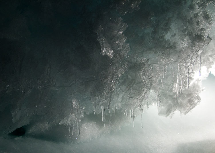
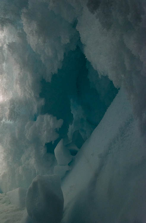
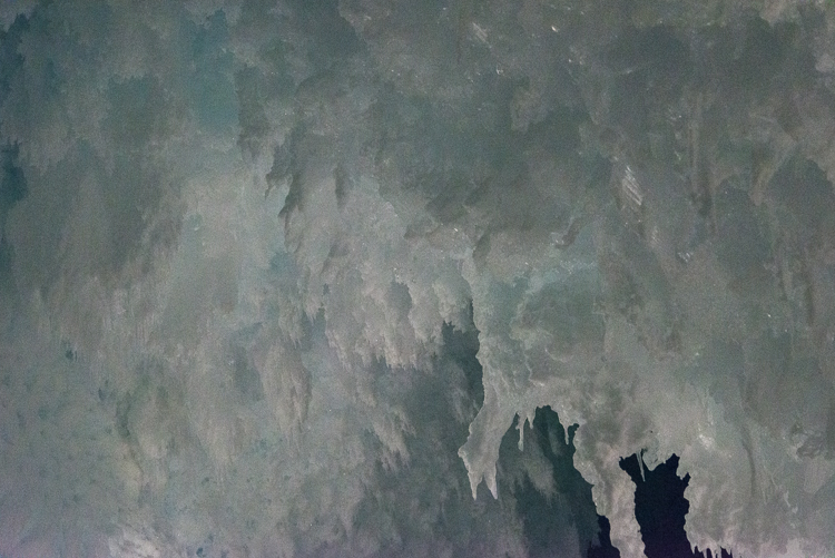
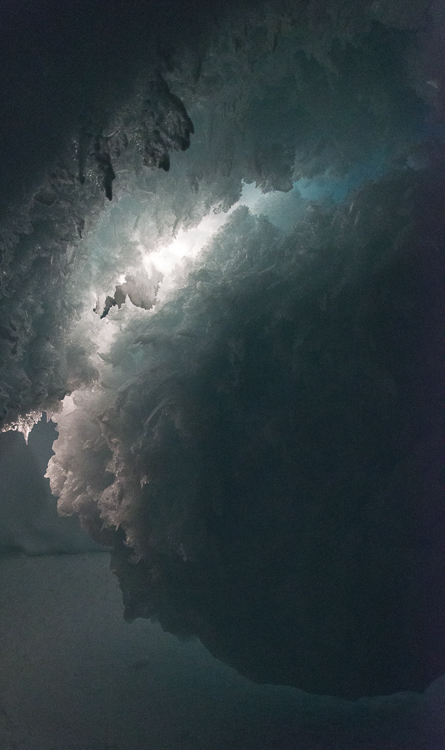
Then we went back to the ice cave, and this time, it was just me and him instead of a group of 15 people, and he brought a couple of good lights, which helped me get some better results. It also was a few hours earlier in the day, and it seemed to me there was more light coming through the small opening (very small — you have to crawl through it on your belly). I had learned from the first visit that the flash lit things too evenly. They were nice exposures, but you couldn’t see the depth. Even when I tried notching the flash down, it didn’t look so great. So, we experimented with having him point the lights he’d brought in different places to see what would work best for photography, and I discovered that indirect light worked the best — bouncing it off a wall, backlighting formations, or aiming it so the center of the beam was hidden behind a feature. Aiming the lights in that manner, we lit up some crystalline formations that I hadn’t even noticed the last time I was there, including some very large hexagonal crystals, an inch or more across! This is Evan’s first season here in Antarctica, but he leads winter mountaineering and backcountry ski camping trips in Idaho and Wyoming, and though he was familiar with hexagonal ice crystals he was astonished by the size of these.
A closer look at the giant hexagonal crystals.
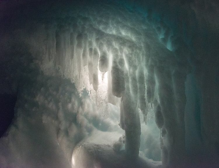
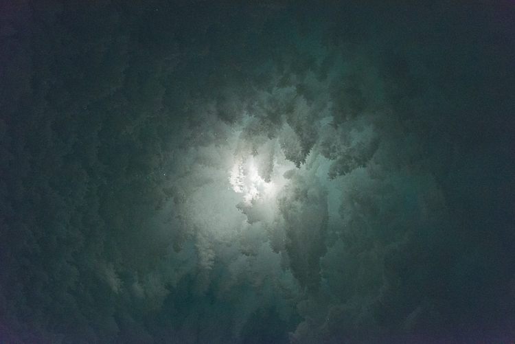
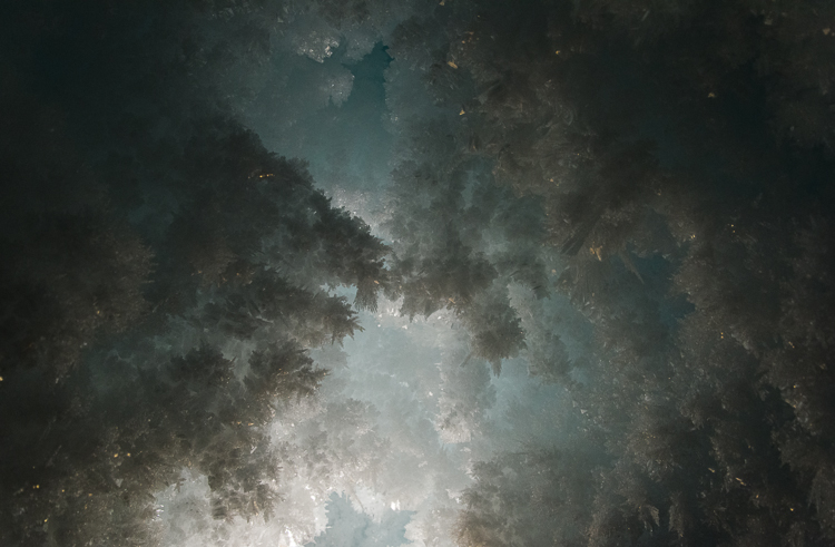
Being inside the cave was literally being inside a walk-in freezer so I had to pause periodically to warm up my hands — my glove liners are usually pretty good for photographing but it was very cold in there after a while. Evan showed me some tricks that helped — swinging arms or pumping your hands up and down with your palms facing down. But after we’d been in there for a little over an hour, my fingers and toes had had enough, so it was time to go. But I left with some magical and strange images. They did remind me of some of the photographs I’ve made of cloud formations:
A change in the lighting makes this formation look different — see next photo.A change in the lighting makes this formation look different — see previous photo.
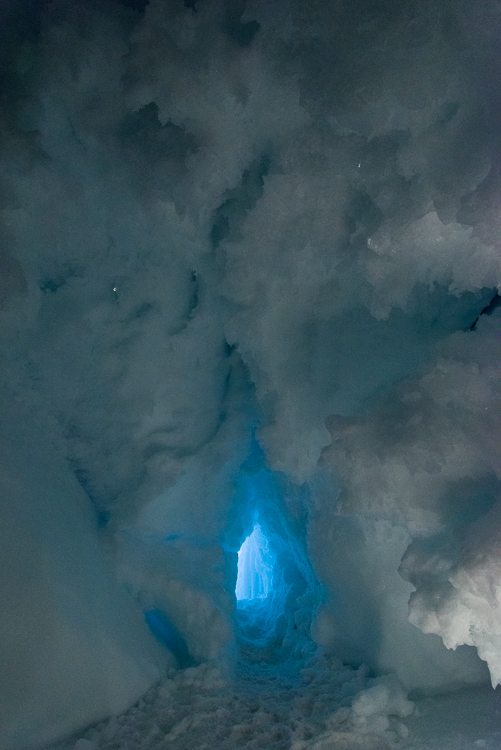
Approaching the entrance there’s a blue glow from the sunlight outside.Leaving the ice cave