The Ob Tube: A Peek Beneath the Sea Ice

Ob Tube cover.
The entrance to the Ob Tube.

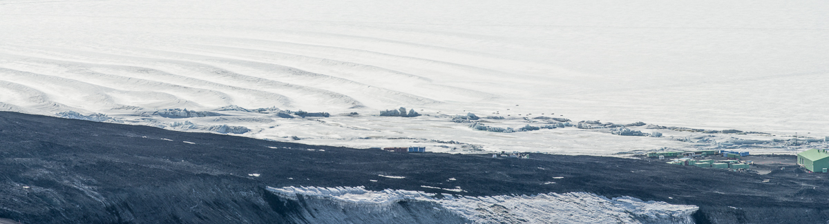
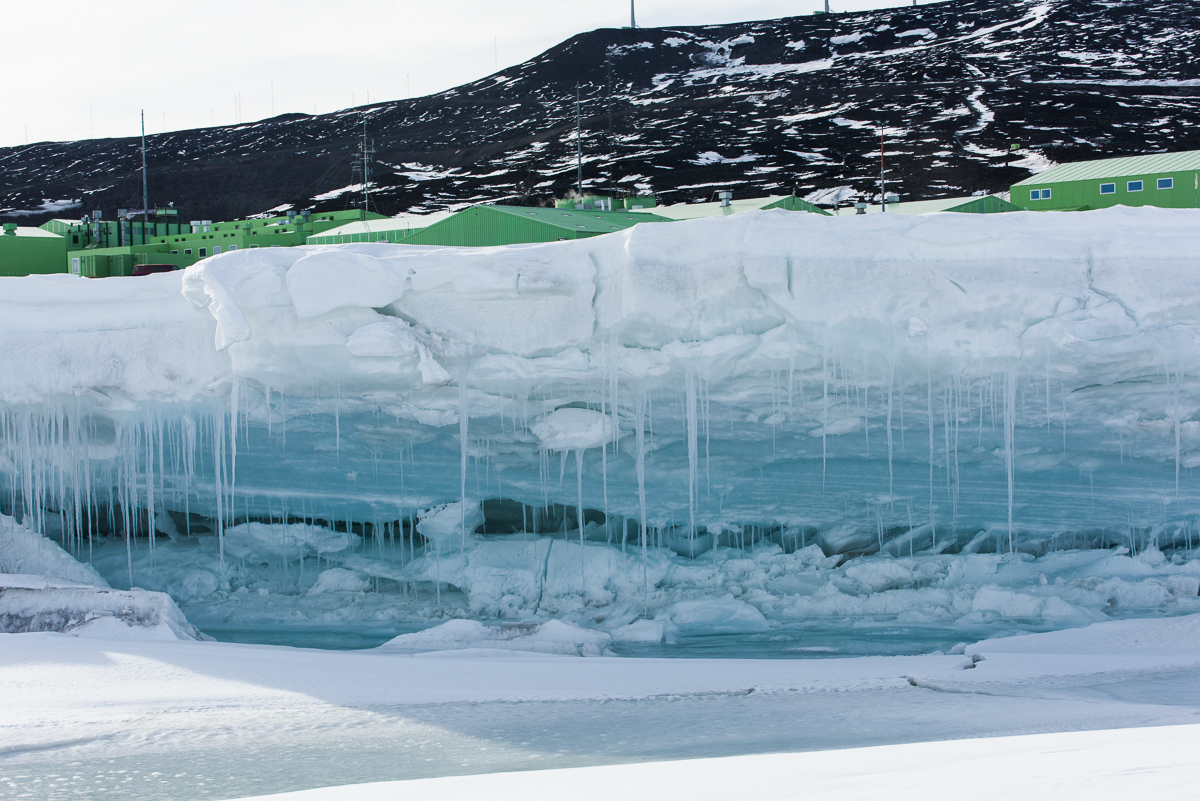
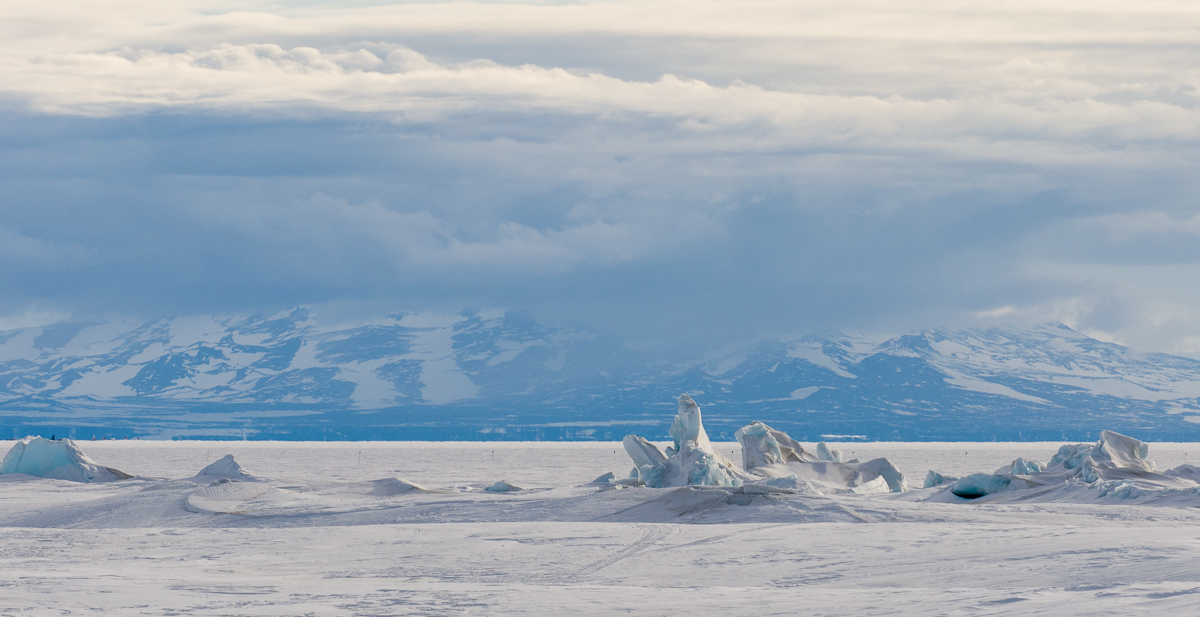
Biologists who study the creatures that live on the ocean floor in McMurdo Sound do their work during the first part of the summer research season. That’s when the sea ice is strong enough to support the heavy tractors that tow the dive huts onto and off the ice. Huts on the sea ice are removed by mid-December, when air temperatures warm and cracks in the ice widen and deepen. In a previous blog post, I’ve already written about my stay at Sam Bowser’s field camp at New Harbor, which is across the sound from McMurdo at the edge of the Dry Valleys. Other scientists collect samples right by the base, from a dive hut set up on the sea ice that’s a short downhill walk from the Crary Lab and the helicopter pad.

Helen in Ob Tube
Ready to climb inside the Ob Tube. Photo: Shaun O’Boyle.

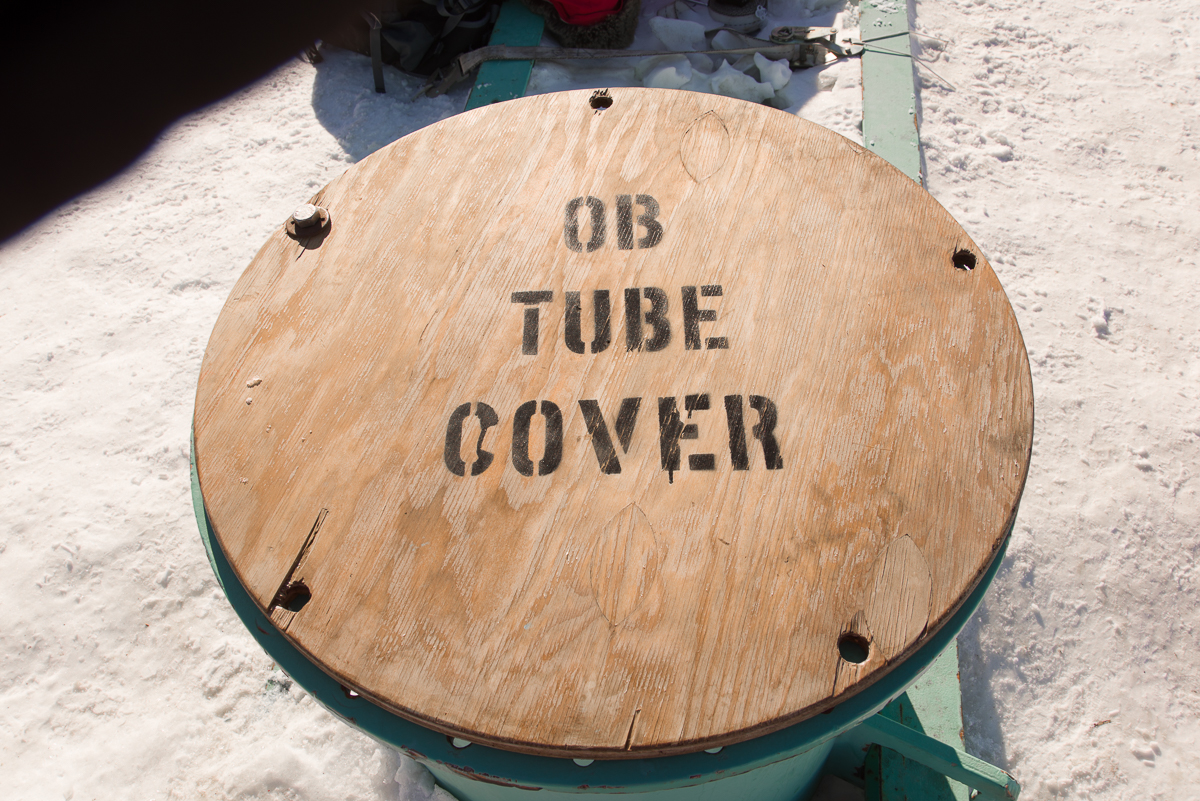
Near the hut, a smaller hole is drilled in the ice and the Observation Tube is installed. Known around town as the “Ob Tube,” it’s basically an underwater manhole with windows, dating back to the days when the U.S. Navy ran McMurdo. Anyone living on the station is permitted to go to the station firehouse any time of day or night and pick up the key, as long as they are accompanied by at least one other person. I went with Shaun O’Boyle, the other Antarctic Artists and Writers Program participant at McMurdo while I was there, on the morning of November 27th, timing our visit for a morning when we knew biologist Gretchen Hofmann’s dive team would be working there.

Inside the Ob Tube
Getting down: looking up at the handholds inside the Ob Tube.

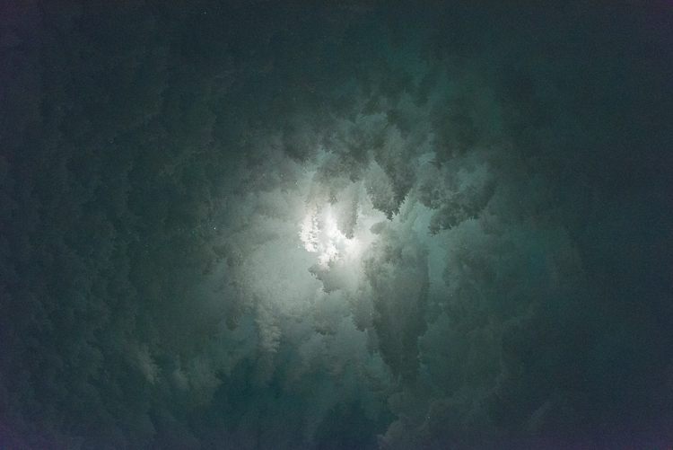
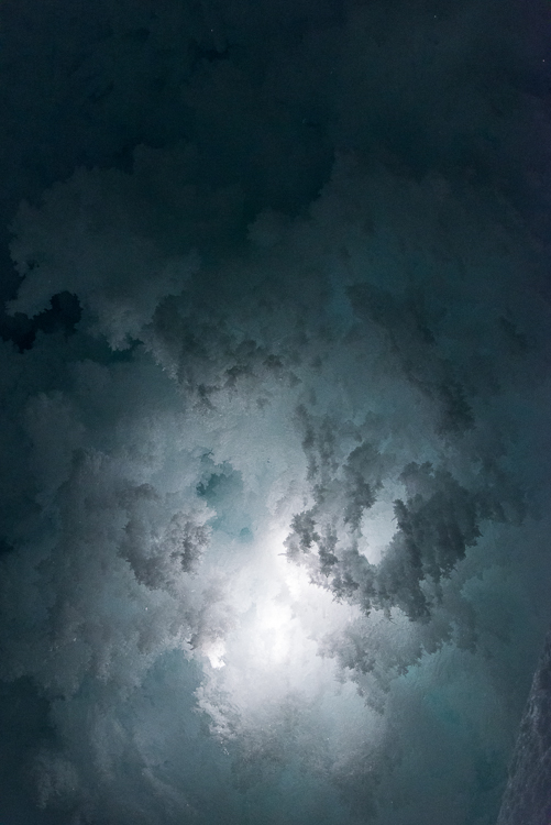
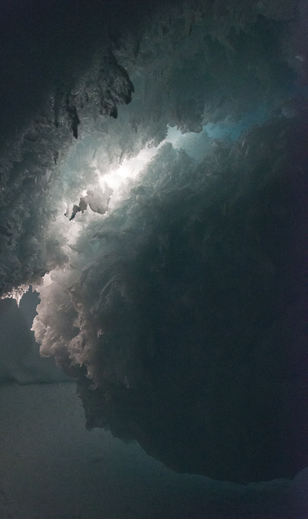
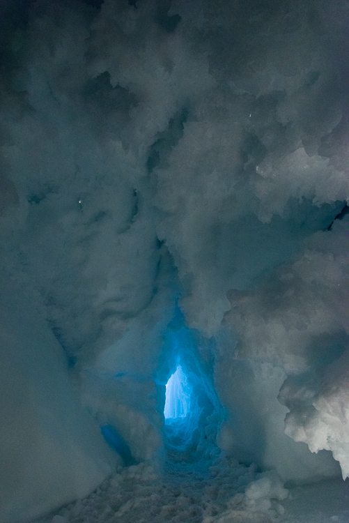
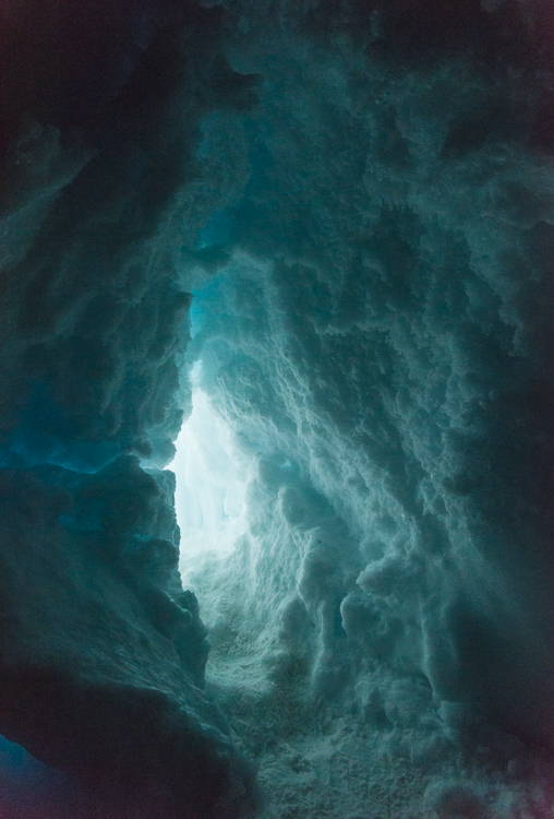
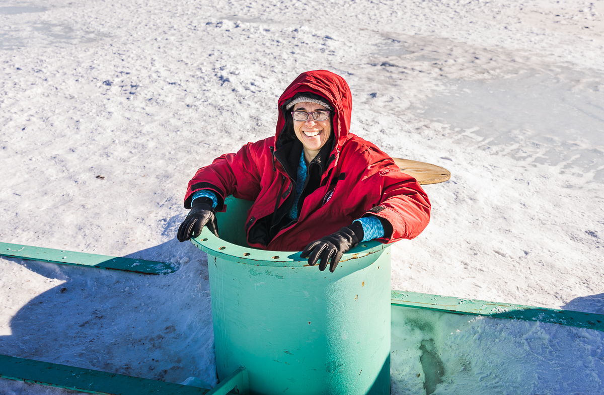
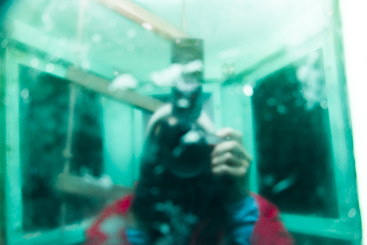
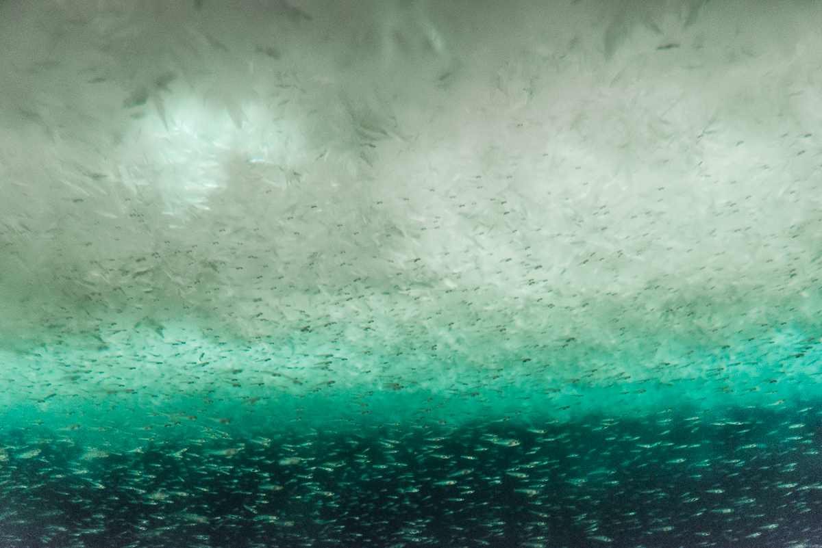
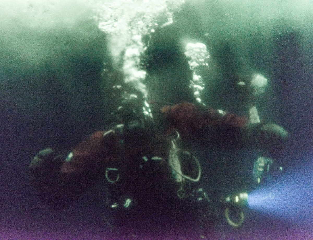
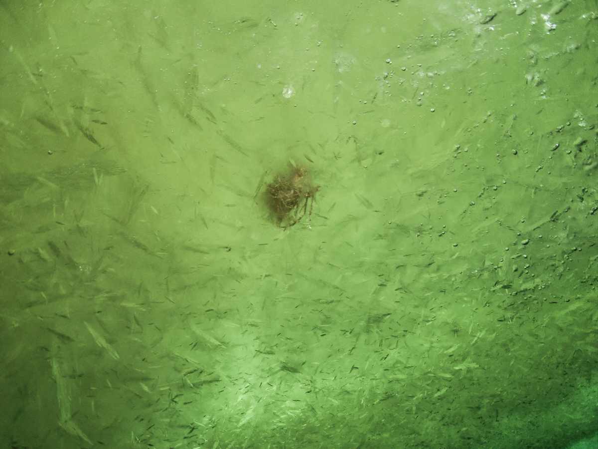
A visit to the Ob tube is not for the claustrophobic. I’m not a large person, but climbing down the tube via metal handholds while wearing a down parka didn’t leave much room to maneuver. You descend the last few feet via a rope ladder, which is visible in the background of my inadvertent selfie below. Standing at the bottom, you are surrounded by windows and looking up at crystal chandeliers of sea ice. Schools of tiny fish scoot past.

Ob tube interior
Inadvertent selfie: I tried using my flash, but just ended up with a photo of my reflection. Instead, I had to set the ISO to Auto and photograph by available light. You can see the rope ladder in the background.

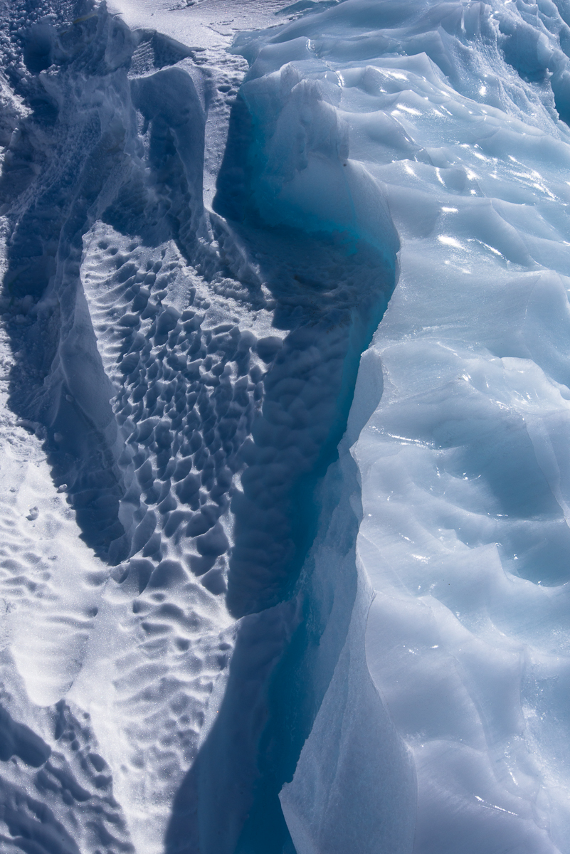
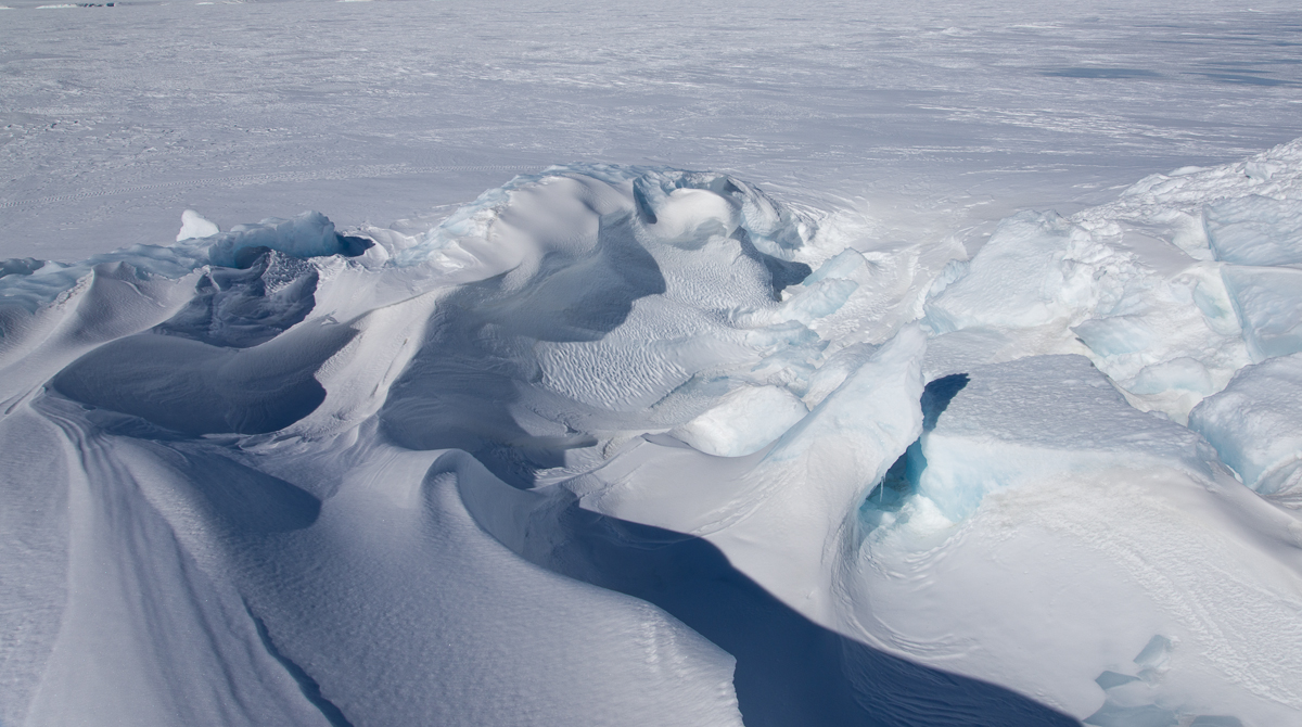
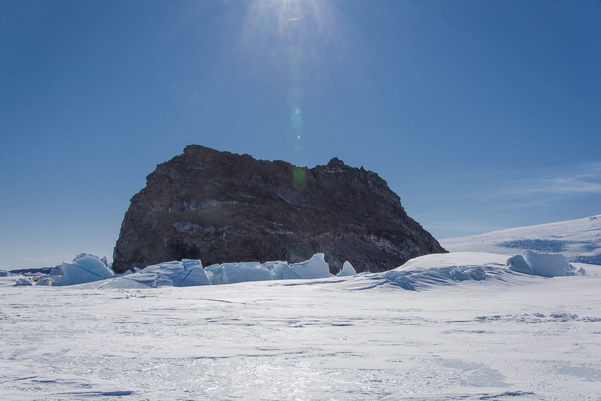
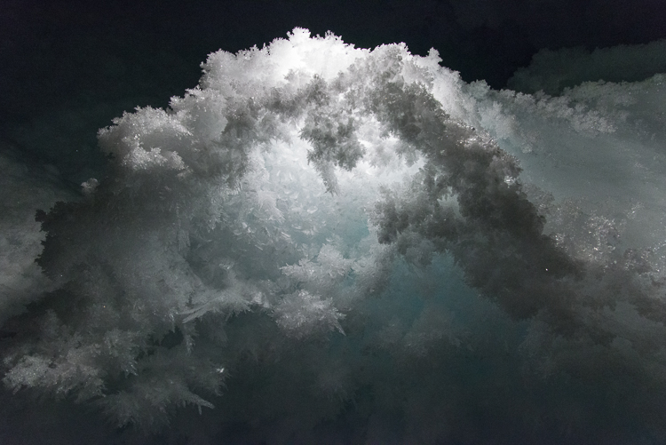
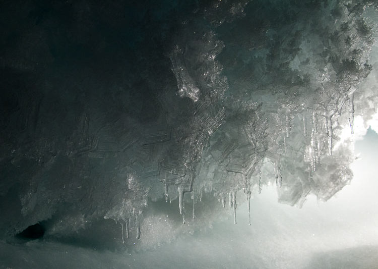
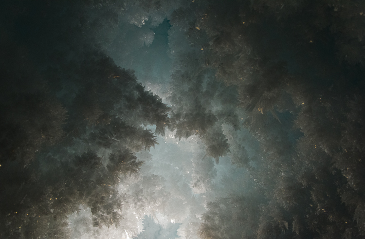
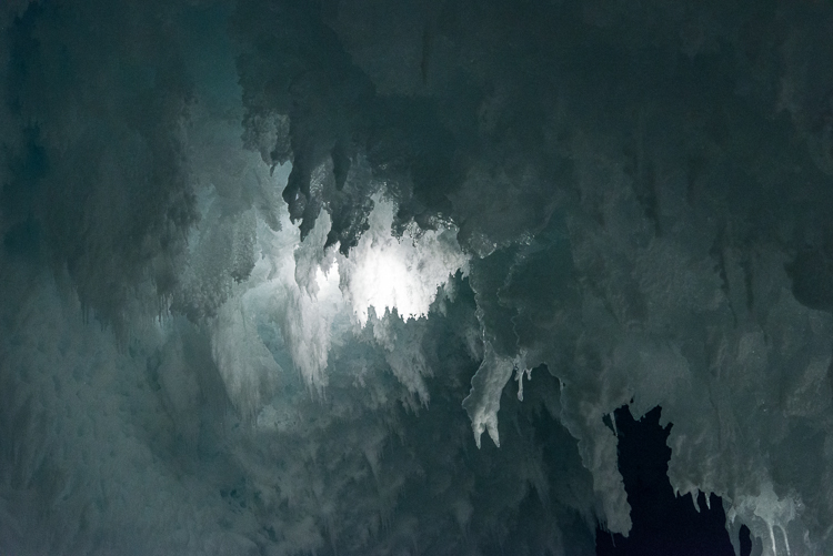
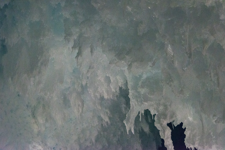
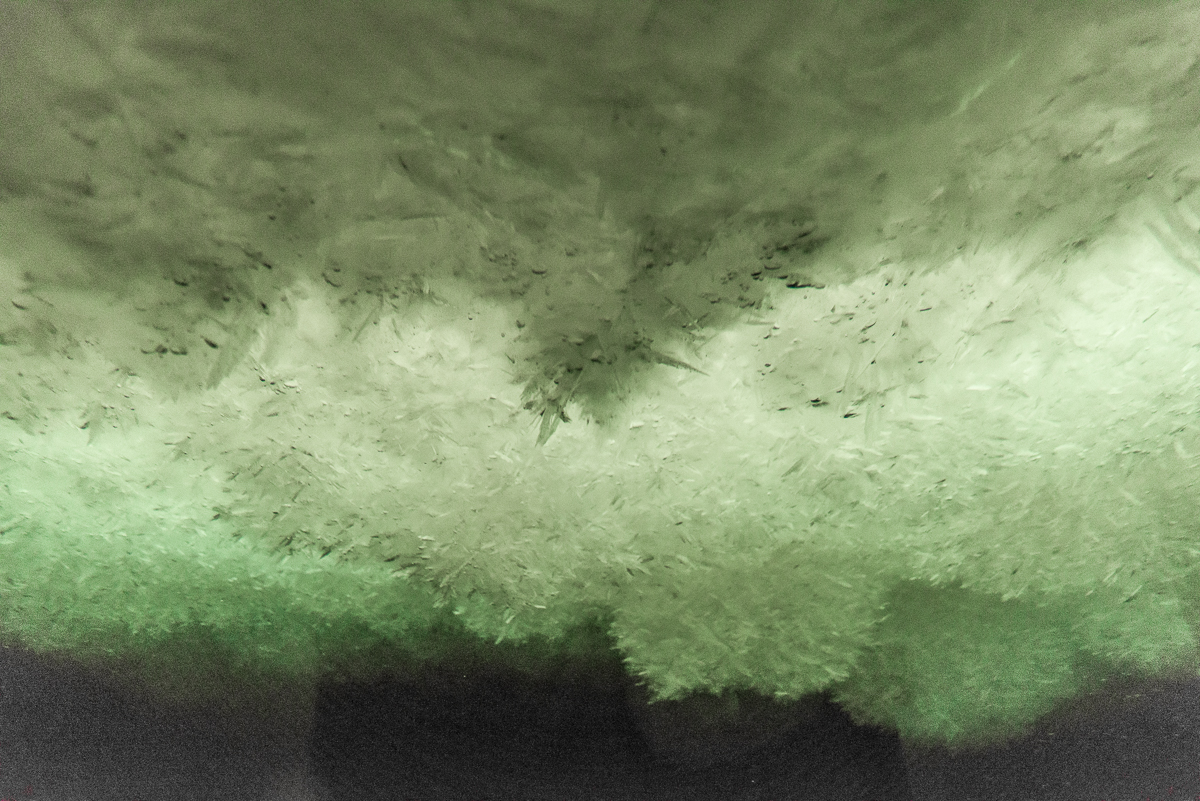
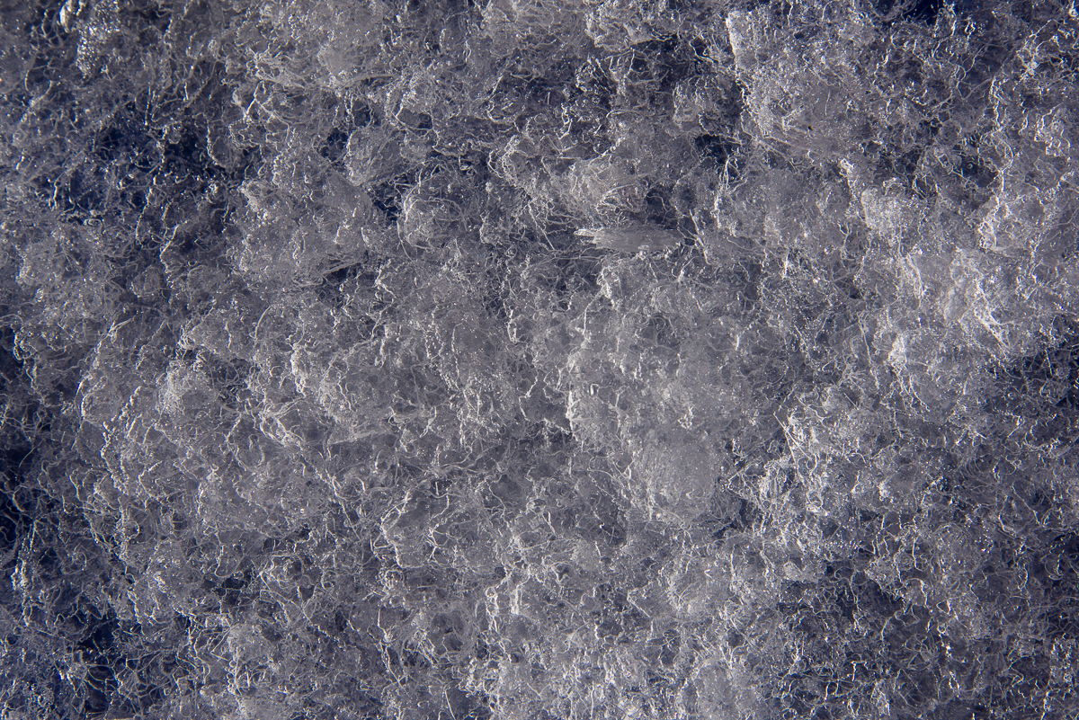
The Ob Tube provides a unique view of the underside of the sea ice, which is covered with mounds of platelet ice, clusters of thin, irregularly shaped slivers of ice, each a few millimeters thick and around one to four inches in diameter, that attach together at apparently random angles.  Composed of 80% seawater and 20% fresh water, platelet ice is a peculiarly polar phenomenon that Encyclopaedia Britannica’s sea ice article calls “perhaps the most exotic form of sea ice besides marine ice.” A scientific paper based on research at McMurdo explains that these “semi-consolidated” layers of ice can be anywhere from a few inches to several meters thick and in Antarctica are “commonly observed beneath sea ice in regions adjacent to floating ice shelves.” Located not far from the ice shelf/sea ice border, the Ob Tube is perfectly situated to observe platelet ice.

Platelet ice
Mounds of platelet ice have formed beneath the sea ice above the Ob Tube. Exotic? Encyclopaedia Britannica thinks so.


Fish beneath platelet ice
Outside the Ob Tube, large schools of tiny fish swam past.

Gretchen Hofmann is based at the University of California Santa Barbara and is studying the impact of ocean acidification on the Antarctic pteropod and the Antarctic sea urchin. (Read more about her research on the Hofmann lab page.) Umi, a doctoral student and member of her dive team, swam up to the Ob Tube and helpfully wiped the frostiness off the outside of the windows with his gloves, which did making it easier to see out!:

Diver outside Ob Tube
Umi, a doctoral student from UCSB, was diving for pteropods.

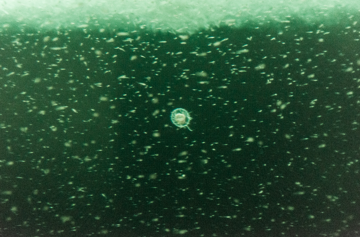
A pulsing, glowing form the size of a dinner plate drifted past — a jellyfish:

Jellyfish under the sea ice
A passing jellyfish.


Platelet ice disk
A closer look at a single platelet.

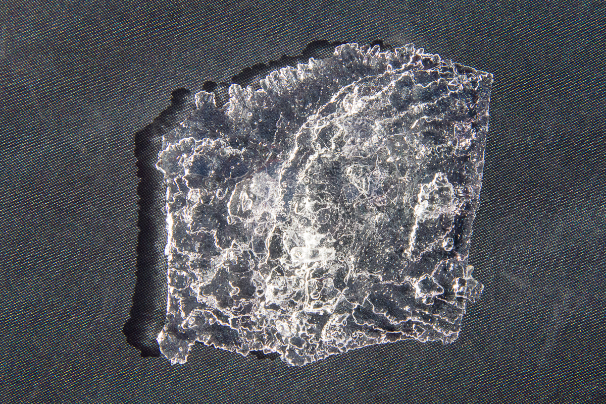
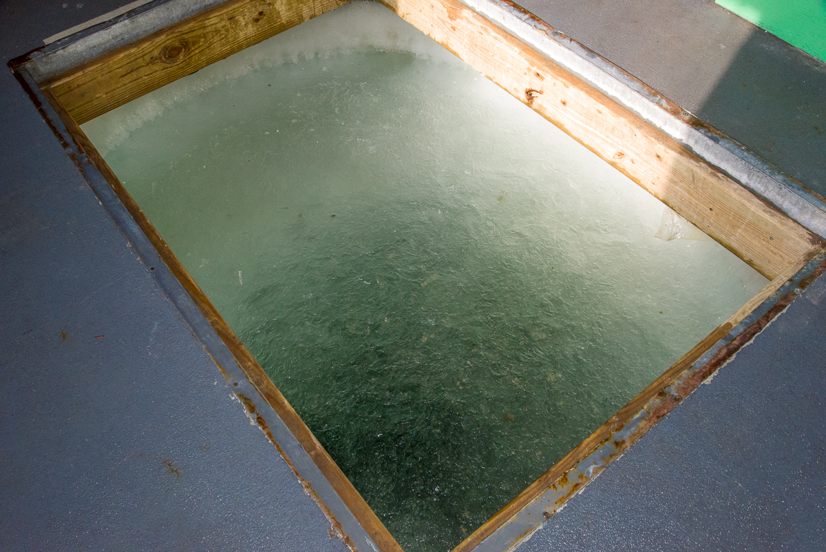
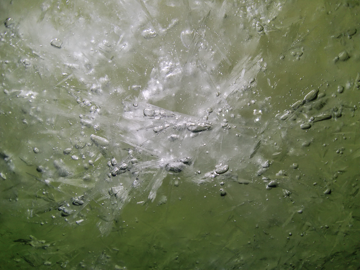
It’s a good thing Shaun and I got to the Ob Tube when we did, because a few days later, it was decided that it was time to pull it out and haul the dive hut back to dry land. I went back to dive area on December 5th, when Gretchen’s team was making their last dive. Steve Rupp, one of the two dive supervisors on staff at McMurdo each season, offered to take some photos of the outside of the Ob Tube for me, and to bring up some platelet ice for me to photograph up close. Elaine, my logistics coordinator, came along to help me. The plan was to scatter the platelets on some pieces of discarded tent fabric I’d borrowed from the McMurdo Craft Room as a backdrop, but periodic gusts of wind over 25 mph didn’t make that easy. What you can’t see in this photo is Elaine, who is truly a good sport, comically sprawled on her stomach holding down the fabric with both arms, while I scattered handfuls of platelet ice from a plastic bucket and took pictures.

Platelet ice
A quantity of platelet ice spread out on a cloth.

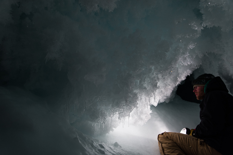
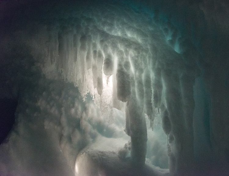
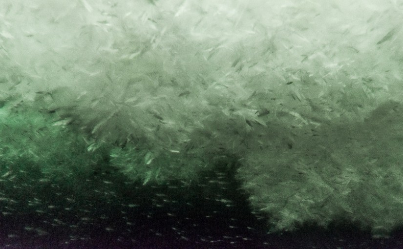
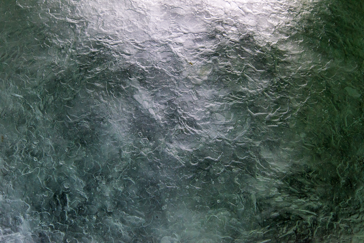
After the dive was finished, I went inside the dive hut, and Steve leaned over the edge of the dive hole, shining underwater lights to illuminate the surface of loose, floating platelets for me, and throw them into low relief. These are a few of the photos I took inside the hut:

Dive hole, McMurdo
The dive hole inside the hut is where the scientific team divers enter and exit the water.
Floating platelet ice
Close-up of floating platelet ice inside the dive hole.
Platelet ice
More floating platelet ice, illuminated from below by a light Steve was holding, and resembling a palette knife painting.

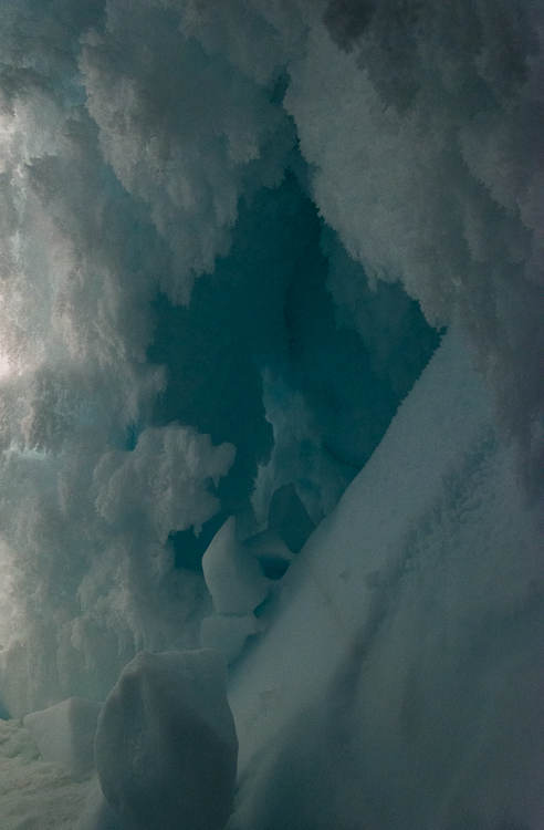
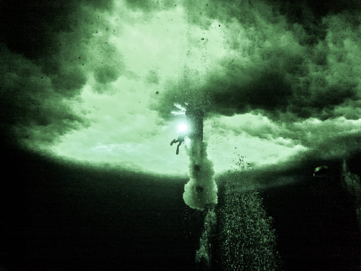
During his dive, Steve took some photos of the outside of the Ob Tube for me, which give a diver’s-eye view:

Platelet ice around the Ob Tube
Platelet ice also attaches to the bottom of the Ob Tube during the time it’s submerged. Photo: Steve Rupp.
Ob Tube
A grad student looks out the window of the Ob Tube. Photo: Steve Rupp.
Item frozen into platelet ice
Not sure what this spiky ball stuck in the platelet ice is — a sea urchin? Photo: Steve Rupp.
Platelet ice
A closeup of the platelet ice beneath the sea ice surface. Photo: Steve Rupp.

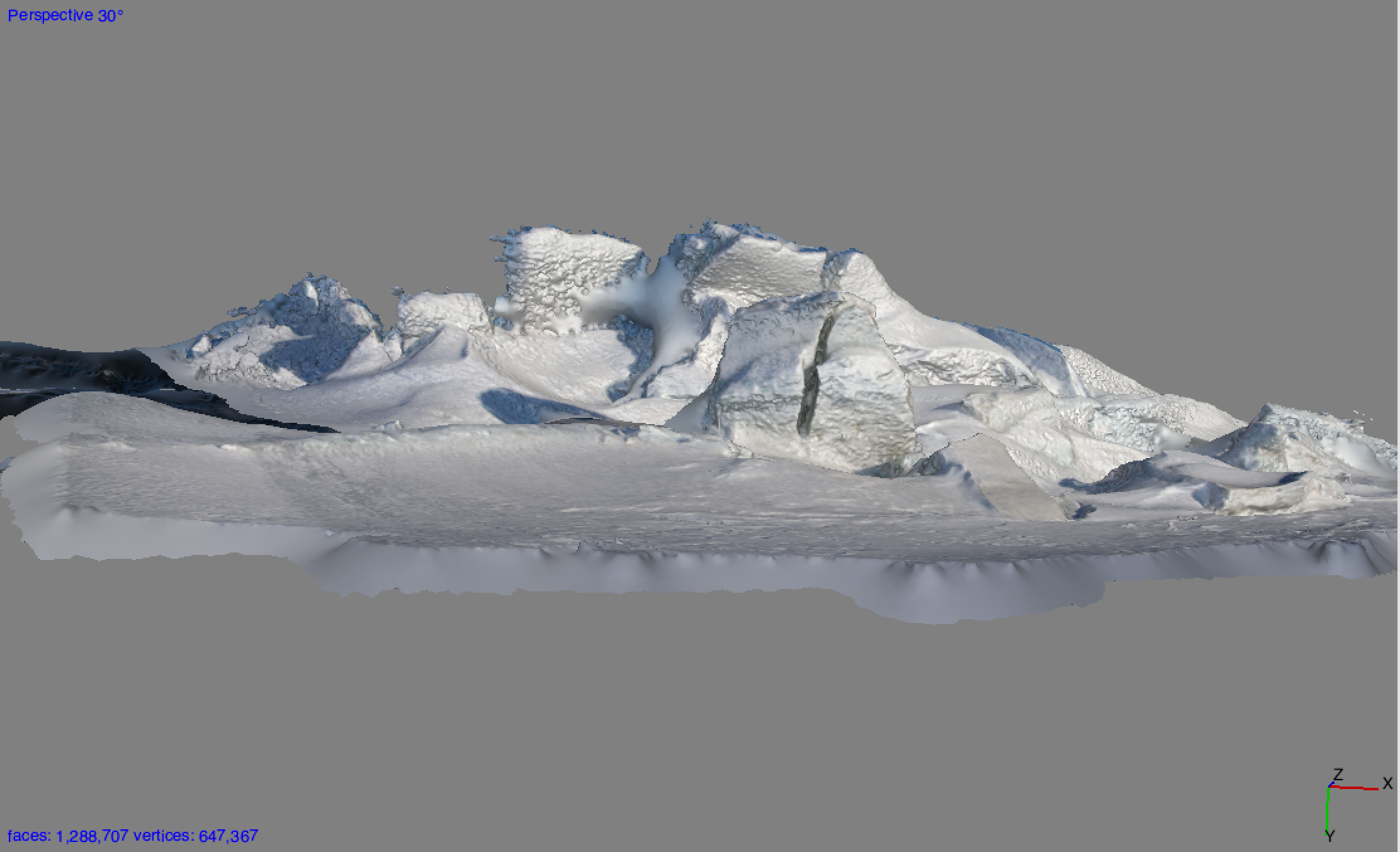
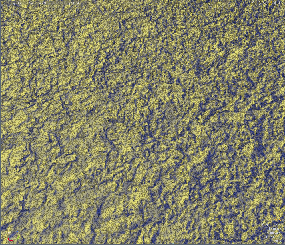
Steve tried to make a series of photos circling the outside of the Ob Tube for a 3D capture, but it proved too difficult for him to keep it in focus. However, I was able to take a series of photos of the surface of the platelet ice inside the dive hole while he held the lights underwater, and to make a 3D file from them. This is a screenshot of a detail of that file, rendered in yellow and blue shading to show the form:

Platelet ice 3D scan
3D scan of the surface of loose platelet ice.

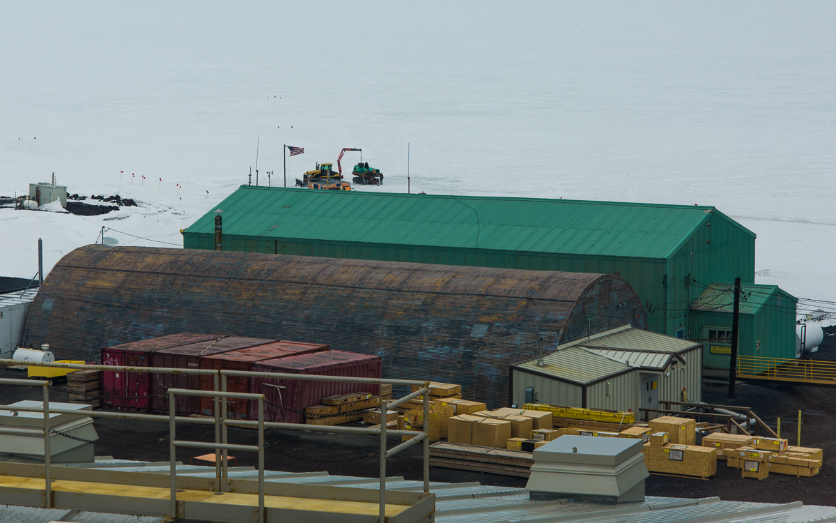
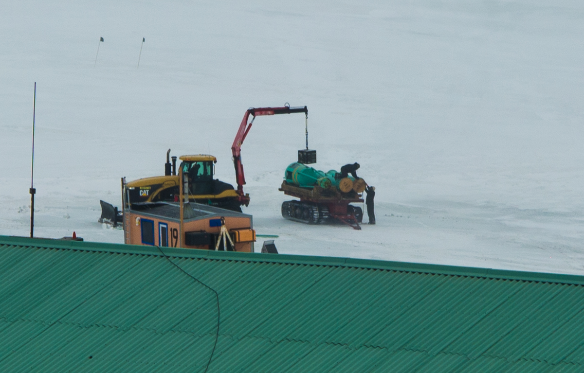
Three days later, I happened to be in the Crary Lab Library overlooking McMurdo Sound when I saw workers loading the Ob Tube onto a truck in sections. The orange dive hut had also been put on a trailer to be towed to the spot where it spends the offseason:

Ob Tube removal
By December 8th, the sea ice was beginning to soften, so the observation tube at McMurdo Station was removed while they could still take heavy equipment onto the ice.
Ob Tube removal
Close-up of the Ob Tube removal. The orange dive hut is in the foreground.


Under Pressure Ridges

Scott Base pressure ridges
The Scott Base pressure ridges present an undulating landscape of unending variety. In the center of this photo is a melt pool.

If you’ve been following this blog, you’ve been introduced to the pressure ridges near the Double Curtain Glacier, which is across McMurdo Sound from McMurdo Station in the New Harbor/Explorer’s Cove area of the Dry Valleys. During the seven weeks that I was based at the US Antarctic Program’s McMurdo Station, I also made two trips to visit the extraordinary pressure ridges at Scott Base, which neighbors McMurdo and is operated by New Zealand’s Antarctic program. If you’ve seen Anthony Powell’s excellent documentary film, Antarctica: A Year on the Ice, you may have noticed the Scott Base pressure ridges among the time-lapse photography sequences.

Observation Hill view of Scott Base
From the 754-foot-high summit of Observation Hill at McMurdo Station, you can see an aerial view of the Scott Base pressure ridges, including the undulations in the ice shelf that have helped form them. The little black dots on the ice a little left of center are Weddell seals. (Click on photo to see enlargement.) I also photographed the prominent formation in the center from the ground (next image) and made a 3D file of it (shown further down in this post):
Scott Base pressure ridge
This formation is large enough to stand out even from the top of Observation Hill (see panoramic photo above). I also made a 3D file of it from 53 photographs taken while walking around it (scroll down further below).
Scott Base pressure ridge
Scott Base pressure ridge with Scott Base in the background.

In Antarctica, the interaction of permanent thick ice shelf (that constantly floats atop the sea), sea ice (that is subject to melt cycles, and some years even melts to the point where it breaks up and floats out to the ocean) and the stationary rock of the coastline, can cause the ice near the shore to buckle and push up chunks into formations called pressure ridges. The pressure ridges are dynamic and constantly changing due to the action of the forces described above along with the 24-hour summer sun. Summertime temperatures at McMurdo when I was there mostly stayed in the 15 to 30 degree Fahrenheit range, and only a few times that I recall got into the upper 30s (and once a balmy 43 degrees — a few of the young guys took advantage of that heat wave to walk around in shorts!). But even in below-freezing air temperatures, when the sun beats down on the ice, it softens and sometimes melts. Then there are icicles, large chunks splitting off and falling, or gravity sometimes causes a chunk of snow to bend and flop over like a draped cloth.

Scott Base pressure ridge
By November 30th, long icicles had formed beneath this this sheet of ice.
Scott Base pressure ridge
The underside of this large chunk of ice was a deep blue and decorated with icicles. In the background are the green buildings of Scott Base.
Scott Base pressure ridges
A thick mat of softened ice can bend like a draped cloth (lower right) and form graceful curved shapes.

Because of the ice shelf and sea ice dynamics, there are also cracks in the ice and melt pools on the surface that widen and deepen as the air warms (one of those was prominently featured in my post about Mt. Erebus). So there is a small window of time from November until mid-December when it is safe to walk out on the ice to get close to the pressure ridges. The McMurdo Recreation Department leads evening tours for the workers and others in residence there during that rare period. I went on two such trips, on November 24th and 30th. These photographs are, essentially, documentations of ephemeral formations: even though these photo sessions were only six days apart some of the ice had already changed in that brief time.

Scott Base pressure ridge
Another spot where the snow has drooped over like a towel on a rack (upper center).

Where there is a nice-sized crack in the sea ice near the shore of McMurdo Sound or one of its islands, chances are you’ll find a group of Weddell seals laying out along it. Cracks give them a head start in chewing out a seal-sized hole in the ice where they can haul themselves out of the water for a break from non-stop swimming and foraging for food. I’ve never seen an animal that sleeps more soundly than a Weddell seal! They also give birth and nurse their pups on the ice. At least one of the Scott Base seals had a pup:

Weddell seal and pup at Scott Base pressure ridges
Baby Seal!: A Weddell seal and her pup chill out at the Scott Base pressure ridge.


From the shoreline, the ice formations are flatter and some have straight lines and more angular profiles:

Scott Base pressure ridge
Looking out from the Scott Base shoreline at angular pressure ridge formations. On the horizon is Willy Field, one of the airstrips that serves McMurdo and Scott Base. It’s probably about a 15- to 20-minute drive from that spot, i.e., not as close as it looks! It’s pretty much impossible to judge distances in Antarctica. You learn to not even try.
Scott Base pressure ridge
Planar ice formations close up.

From other angles there were other formations to see, as in the two vertical photos below. I also did a few walk-arounds for photogrammetry captures. I’ve processed one of those files for a potential sculpture (horizontal image below those).

Scott Base pressure ridges
Peering through a crevice at the Scott Base pressure ridges results in a puzzling and ambiguous spatial reading.
Scott Base pressure ridges
Another unexpected sculptural ice formation.
Scott Base pressure ridges
A 3D file made from 53 photographs walking around a portion of the Scott Base pressure ridges. I need to edit out a few extraneous forms, but the capture came through mostly intact, with great detail and very few gaps.

At the end of this post is a photograph of another fascinating phenomenon we saw on the November 30th trip to Scott Base: a type of mirage called a fata morgana. It has nothing to do with pressure ridges, but it does have to do with looking across the wide flat expanse of the sea ice toward a distant shore. A young man in our group noticed it first. In a fata morgana, a strip at the bottom of the land seems to be stretched like Silly Putty. This one was subtle, but unmistakable. There are more dramatic examples online. Just search Google Images for “fata morgana Antarctica” or read this explanation.

Fata morgana, McMurdo Sound
Across the sea ice from the Scott Base pressure ridge there was a fata morgana effect that made the bottom strip of the Transantarctic Mountains across McMurdo Sound appear to be stretched into a horizontal band at the bottom. Fata morganas appear in Antarctica when a band of air just above the sea ice is a different temperature than the air above it, causing a temperature inversion and distorted reflection at the horizon. Fun fact: the name comes from the Italian for Morgan Le Fay, half-sister of King Arthur.


Grounded Icebergs Near the Dellbridge Islands

McM2015-1201-304-2
Am I the only one who sees a face on the left?

On December 1st, before visiting the Erebus ice cave, Evan and I went to see some icebergs that are stuck in the sea ice near the Dellbridge Islands. The Dellbridge Islands include Tent Island, Big Razorback and Little Razorback. The iceberg I photographed first is nearest to the island in the group with my favorite name, Inaccessible Island, named by the famous British Antarctic explorer Robert F. Scott because it was hard to reach. Of course, he didn’t have a Haagland tractor, which made the trip much easier. Not that a Haagland is a luxury vehicle by any means, but it’s great for traveling on ice and it gets warm inside. Big Red (as everyone calls the heavy parkas we were issued) comes off when you get in a Haagland. You’ll see the islands in the background of some of these photos. Also nearby was Mt. Erebus, but it’s so huge (over 13,000 ft.) that Erebus seems nearby wherever you go around here. The angle of the sun showed up the large crevasses on its lower slopes.

Crevasses on Mt. Erebus
It was so clear that even from a distance you could see the crevasses on Erebus’s lower slopes.

The plan was for me to circle the iceberg nearest Inaccessible Island, to take photos for a 3D file, which I did. I selected 162 to process and since there were so many, I carefully masked them in the software, which took several hours, and I’m processing the file as I type this. I’m optimistic it’ll come out, because the first stage of processing where I aligned the photos showed a generally recognizable shape, and the second stage, under way now, originally showed it would take a total of 12 hours, but it is now almost 60% finished and the estimated total is down to 7 1/2, so the fact that it’s going faster than the original estimate is a good sign. Stay tuned for the next post…

Iceberg, two kinds of ice
Two kinds of ice, matte and glossy, side by side. Click this and the other images to see larger views.

In the meantime, I’ll share with you photos I took after we left that iceberg and stopped at a spot where we could walk around a couple of smaller ones. One in particular had a lot of drifted snow around it, so I’m not sure if I’ll be able to get a 3D file of the whole thing, but it sure had a wide variety of ice formation and profiles that changed as you walked around it. The photos here show some of my favorite views.

Iceberg in sea ice with melt pool
A little pool of water had melted around one end. Our Haagland vehicle is in the distance on the right.
Iceberg frozen in sea ice
Wind-whipped snow and ice.
Iceberg and drifted snow
The drifting snow had curved into smooth, rounded forms.
Iceberg stuck in sea ice
A slight change in perspective shows a different view than the one above, although you can see the same large forms on the left.
Icerberg stuck in sea ice
But the opposite side of the iceberg looks totally different from the side catching the drifting snow.


Iceberg stuck in sea ice
This is the only shot I’ve included of the smaller of the two icebergs, because it wasn’t as interesting, although the hook-shaped protrusion popping from the top in this view is certainly quirky.


Little Razorback Island
The two smaller icebergs were closer to Little Razorback Island. You can see where pressure ridges have formed near the island.

Erebus Ice Cave: The Sequel

Ice cave
On my second visit to the ice cave, I experimented with indirect lighting and got some otherworldly images.
Mt. Erebus
Smokin’ hot: Tuesday you could see that Mt. Erebus is an active volcano, with a little puff of white smoke rising above the crater at the summit.

Tuesday I went out with Evan, one of the mountaineers on staff here, whose assignment for the day was to take me to any icebergs frozen in the sea ice that interested me and back to the ice cave in the Erebus Ice Tongue. We went in Gretel, the same Haagland tractor featured in my sea ice training blog post, so it was lot easier riding around than driving a snowmobile. Snowmobiles are fun, but they get somewhat less fun when you have to travel for an hour on one — your right hand gets tired from being on the throttle, and it’s obviously colder, too, though aside from inside the cave, it was a nice day with little wind. I photographed three icebergs that are frozen in the ice, so you can walk right up to and around them, certainly impossible when they’re floating because it’s too dangerous — a floating iceberg can flip unexpectedly. I’ll post those photos another time, because I haven’t really had time to go through them yet, but I’m certain I’ll get some 3D files from them. Also got to see Mt. Erebus with no clouds and little wind, so you could see a puff of smoke rising above it.

Hexagonal ice crystals
Evan checks out some unusually large hexagonal ice crystals.

Then we went back to the ice cave, and this time, it was just me and him instead of a group of 15 people, and he brought a couple of good lights, which helped me get some better results. It also was a few hours earlier in the day, and it seemed to me there was more light coming through the small opening (very small — you have to crawl through it on your belly). I had learned from the first visit that the flash lit things too evenly. They were nice exposures, but you couldn’t see the depth. Even when I tried notching the flash down, it didn’t look so great. So, we experimented with having him point the lights he’d brought in different places to see what would work best for photography, and I discovered that indirect light worked the best — bouncing it off a wall, backlighting formations, or aiming it so the center of the beam was hidden behind a feature. Aiming the lights in that manner, we lit up some crystalline formations that I hadn’t even noticed the last time I was there, including some very large hexagonal crystals, an inch or more across! This is Evan’s first season here in Antarctica, but he leads winter mountaineering and backcountry ski camping trips in Idaho and Wyoming, and though he was familiar with hexagonal ice crystals he was astonished by the size of these.

Ice cave, hexagonal crystals
A closer look at the giant hexagonal crystals.

Ice cave entrance

Being inside the cave was literally being inside a walk-in freezer so I had to pause periodically to warm up my hands — my glove liners are usually pretty good for photographing but it was very cold in there after a while. Evan showed me some tricks that helped — swinging arms or pumping your hands up and down with your palms facing down. But after we’d been in there for a little over an hour, my fingers and toes had had enough, so it was time to go. But I left with some magical and strange images. They did remind me of some of the photographs I’ve made of cloud formations:

Ice cave

Ice cave

McM_2015-1201-486

Ice cave

Ice cave
A change in the lighting makes this formation look different — see next photo.
Ice cave
A change in the lighting makes this formation look different — see previous photo.

Ice cave

Ice cave entrance
Approaching the entrance there’s a blue glow from the sunlight outside.
Sunlight illuminates the cave walls near the entrance
Leaving the ice cave