The Suess Glacier and the Silver Lining

The Lake Hoare field camp in the McMurdo Dry Valleys, where I spent five days, sits at the east end of the lake right next to the immense Canada Glacier. At the opposite end of the lake is the smaller Suess Glacier. When I first heard the name, it would not have surprised me if a glacier in Antarctica had been named for the children’s book author Dr. Seuss, given the odd landscape features that resemble some of his fanciful illustrations. But no, the 1910-13 British Antarctic expedition led by Robert F. Scott named it for Professor Eduard Suess (1831-1914), a prominent Austrian geologist and paleontologist who helped lay the basis for paleogeography and tectonics.
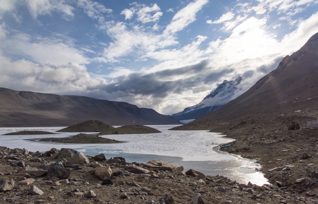
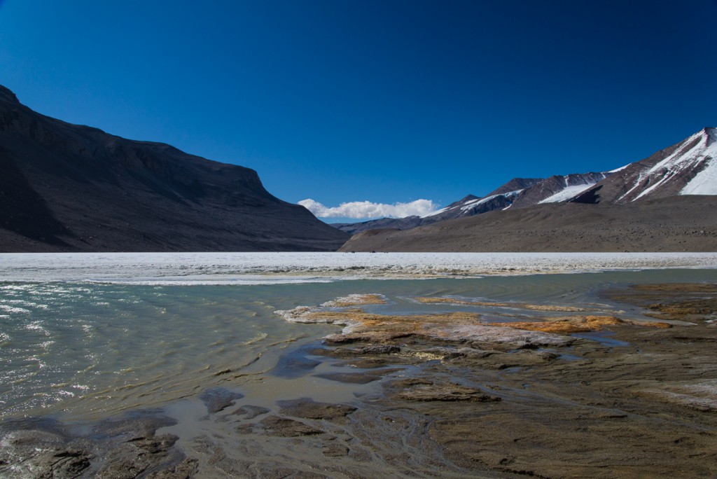
Lake Hoare looking toward Suess Glacier
View up Lake Hoare from the field camp. The tiny inverted white triangle at the end is the Suess Glacier.

One day I hiked there accompanied by Mari, a young woman who normally worked at McMurdo in the field camp supply center, but was spending a couple of weeks at the Lake Hoare camp assisting camp manager Rae during a particularly busy period of the research season. There are many people in their twenties who work 10-hour shifts, six days a week at McMurdo during the austral summer as dining hall workers, supply staff, janitors, cargo loaders, etc., but their opportunities to travel beyond the base are limited. So Mari was thrilled to be in the Dry Valleys and enthusiastic about hiking to the Suess. We followed a path of sorts that had evolved from the walks of other researchers, which wound around the perimeter of the rocky north shore of the lake (on the right in the photo above).
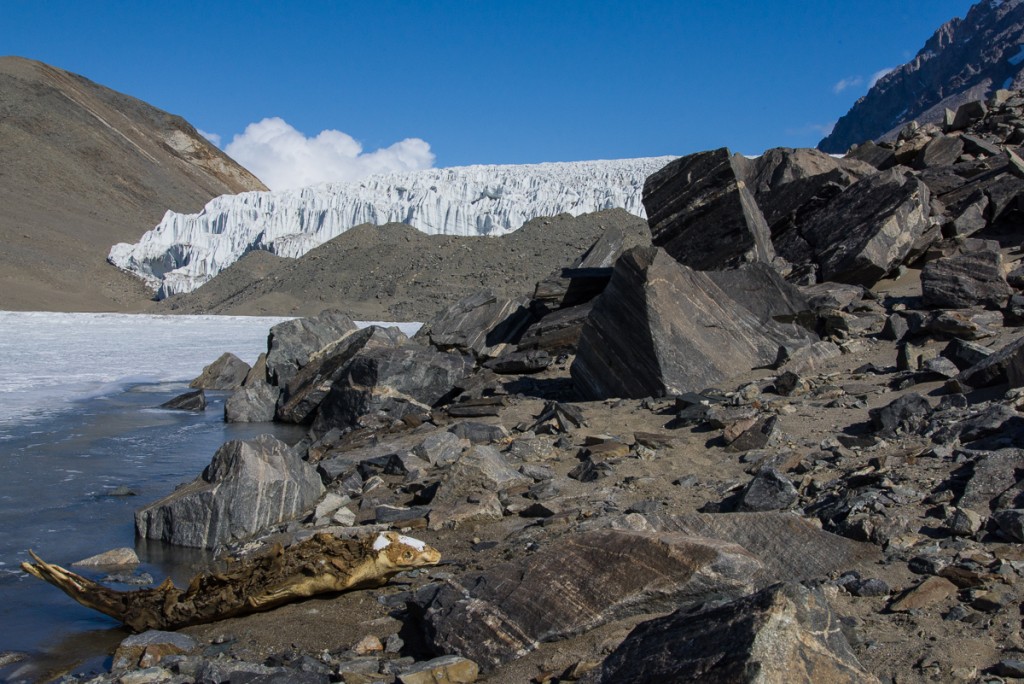
Mummified seal near Suess Glacier
As we approached the Suess Glacier, we came upon a mummified seal.

After about an hour, we came across a mummified seal. Positioned on its belly rather than laying on its side made it look curiously animated, as if it was in the process of clambering out of the water. The mummified seals strewn throughout the Dry Valleys are an enduring mystery, and one I plan to write more about in a future blog post. Suffice to say, the icy climate and lack of organisms to break down dead animals keeps them in a state of preservation such that it’s difficult to know if that seal has been there a few years or a few hundred.
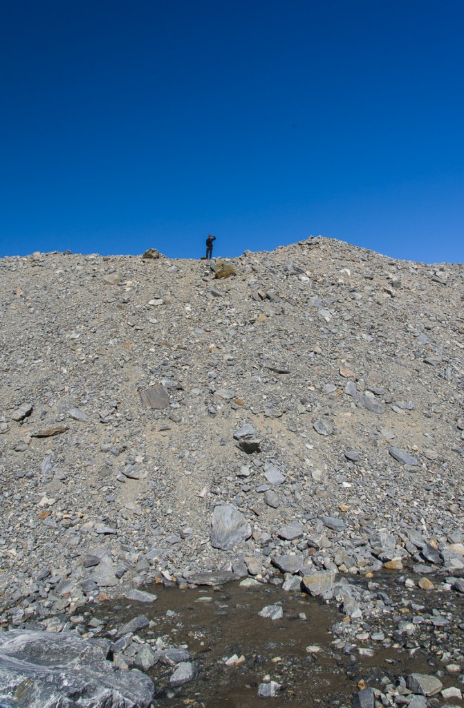
Gravel hill near Suess Glacier and Lake Hoare
Mari scouts the best path around a large hill of gravel.

As we continued following the lake’s shoreline, we soon reached a very tall gravel hill that blocked our view of the glacier. Mari climbed to the top to scout the best route around it (remarkably quickly, too — it’s hard to get a footing on steep, loose gravel). As you can see in the photo at left, a stream of water was running downhill off the glacier into the lake. Mari had determined there was no shortcut to the glacier from where we were so we continued around the lake side of the hill.


From the Lake Hoare side, the Suess glacier is not nearly as impressive as the Canada Glacier in size or height. This panorama made from three negatives is pretty much what you see as you approach from the lake:
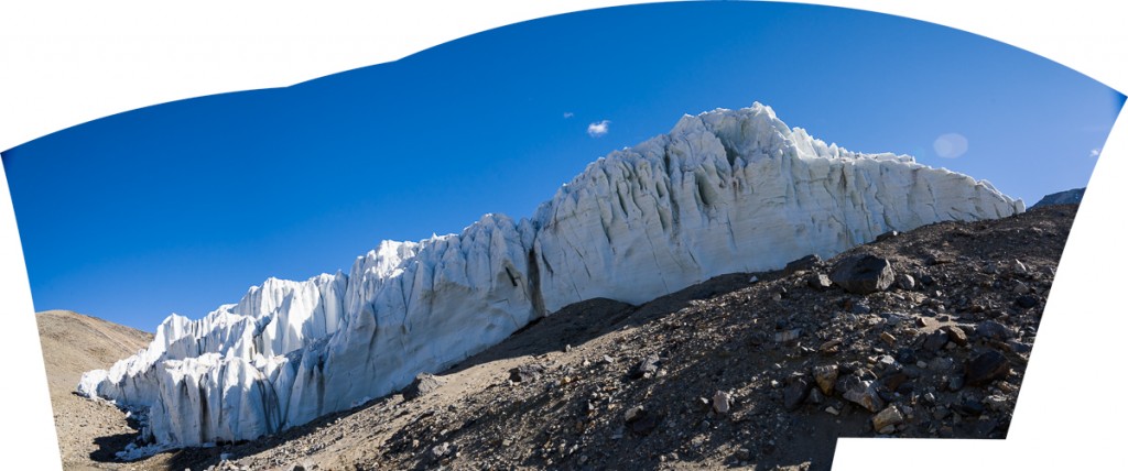
Suess Glacier from Lake Hoare
Panorama of the Suess Glacier from the end of Lake Hoare. The glacier flows downhill from the right and comes to rest against the steep gravel hill on the left.

Walk around to the left of it and you can look uphill to see it flowing from the crest of the hill on the right:
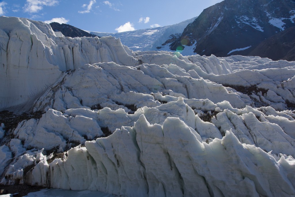
Suess Glacier
The Suess Glacier, looking uphill to where it begins.


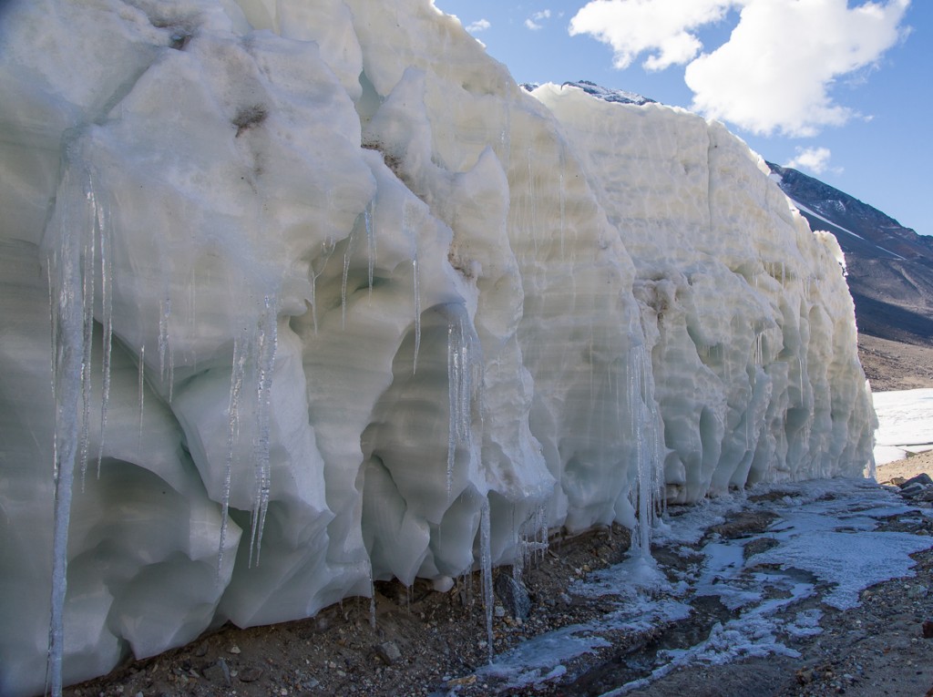
But the really good stuff was just around the corner. The Suess flows down one steep hill and comes to rest where another steep hill meets it, forming a narrow passage called a defile. Once you enter the defile, you encounter another side of the Suess, a towering wall of glistening scalloped ice. It glowed with a peachy color reflected off the gravel hill:
Suess Glacier, defile
At the beginning of the defile, looking back toward Lake Hoare, the Suess turns into a wall of wind-scalloped ice and icicles.
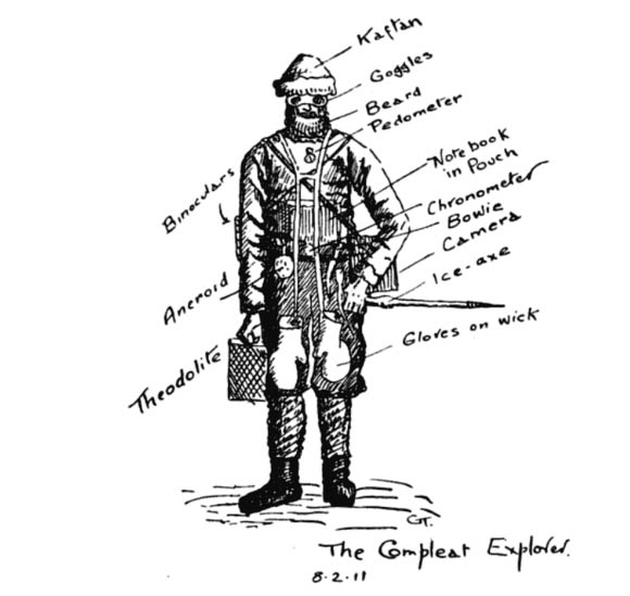
Griffith Taylor's sketch of "The Compleat Explorer."
Griffith Taylor’s sketch of “The Compleat Explorer” was made on February 8, 1911, in the midst of exploring the valley that came to be named after him.

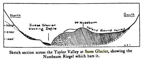
One of Scott’s party in the 1910-13 expedition, the geologist Griffith Taylor, described the discovery of the Suess in his 1916 book With Scott: The Silver Lining (you can find the section referred to here on Google Books). The title implies a motivation to spotlight the expedition’s accomplishments and successes, which had been to some degree overshadowed by its sad ending, when Scott and four of his men died on their way back from the South Pole. The following year, World War I broke out and was still raging when the book was published. As the book’s editor, Leonard Huxley, put it in the Introduction, “It is for Mr. Griffith Taylor to tell of the daily life of that company from within, to tell in careless detail its lighthearted cheerfulness lining solid effort, which the cloud of English earnestness so constantly turns out upon the night.” The section on the journey through what is now known as the Taylor Valley exudes the joy of discovery and is illustrated with Taylor’s charming drawings, including a humorous depiction of “The Compleat Explorer” wearing the state-of-the-art cold weather gear for 1911. (This includes “Beard,” which continues to be a popular male accessory in Antarctica. Once somebody said, “You know who I mean? The tall guy with the beard,” and the rest of us started laughing since that did not narrow it down at all.) At any rate, I’m guessing the Dry Valleys were associated with particularly fond memories for Taylor, because along the way Scott informed him he was naming the magnificent Taylor Glacier after him! Taylor’s book also includes his sketch of the Suess:
Suess Glacier by Griffith Taylor
Sketch of the Suess Glacier by Griffith Taylor, made in 1911 when he explored the area with Robert F. Scott.

Taylor and company approached the Suess from the west, i.e. the opposite direction we took. His description remains apt today: “a face of ice forty feet high; but just where it butted into the steep south slope of the defile, there was a narrow gap where thaw-ice had filled in the interspaces between the cliff debris.” Mari and I put on crampons (velcro sandals with spikes on the soles) over our boots to walk on the icy passage where it narrowed to the width of a typical sidewalk.

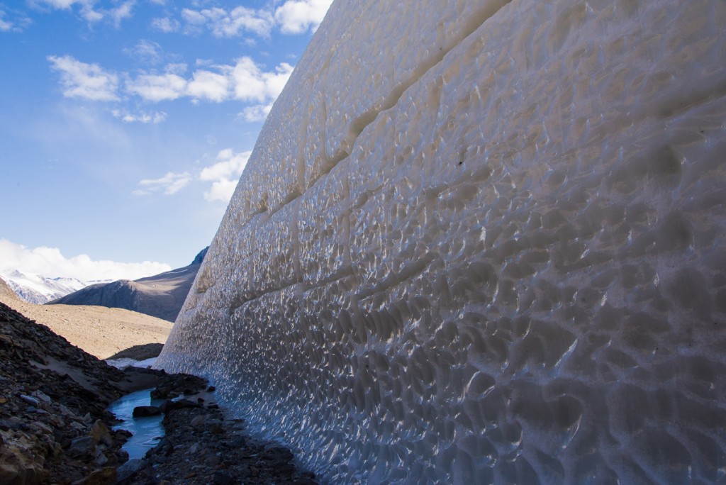
We walked alongside a wall of ice with such hard, polished surfaces that it looked like it had been cast from a mold:
Suess Glacier, defile
The side of the Suess Glacier bordering the defile is very different in appearance from any other glacier I saw: an icy, dimpled wall. Maybe it has to do with facing the defile, where it gets little sun and the wind is funneled through the narrow gap.

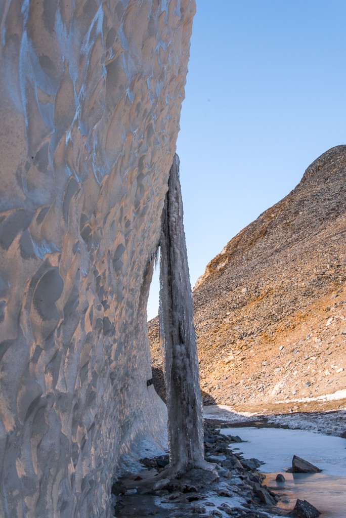
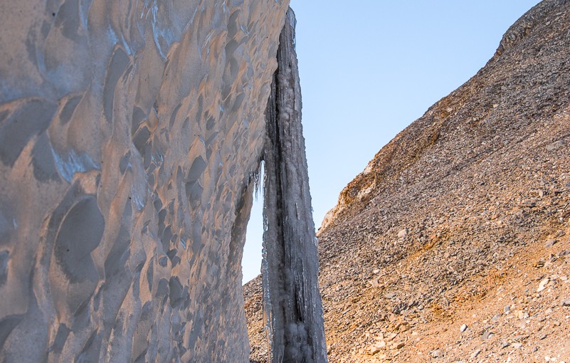
We also encountered the most impressive frozen waterfall I saw anywhere in Antarctica:
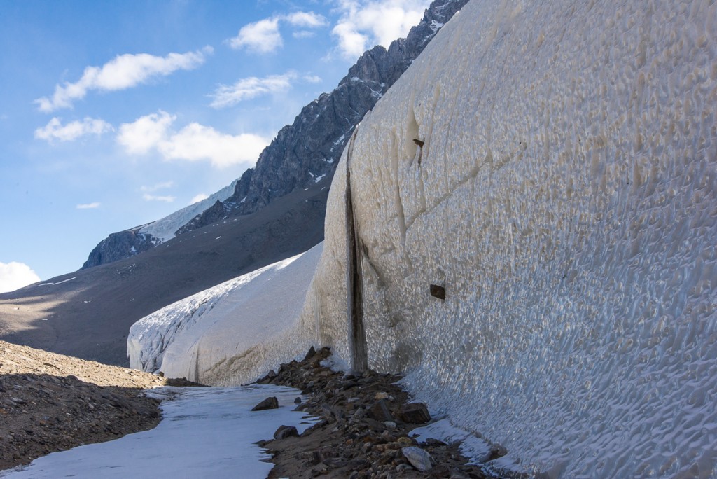
Frozen waterfall, Suess Glacier
Freezing the action: a frozen waterfall of ice and sediment was an impressive sight.
Frozen waterfall, Suess Glacier
The other side of the frozen waterfall along the defile.

I was fascinated by the large rocks protruding from the icy wall that had apparently been swept up by the slow-moving glacier long ago. You see a couple of them in the photos of the waterfall above. The one below had to weigh several hundred pounds, and yet was somehow securely frozen in place in its icy niche:
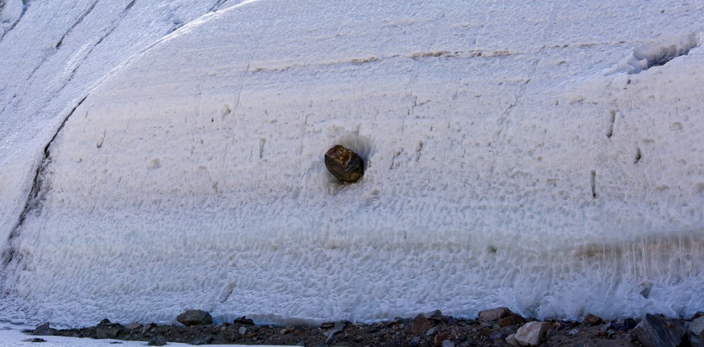
Rock embedded in Suess Glacier
That’s a big rock! And it looks like it’s not going anywhere anytime soon.

Toward the end of the defile, where the narrow space opened up and the glacier height tapered off, another frozen waterfall had formed an ice stalactite and stalagmite:
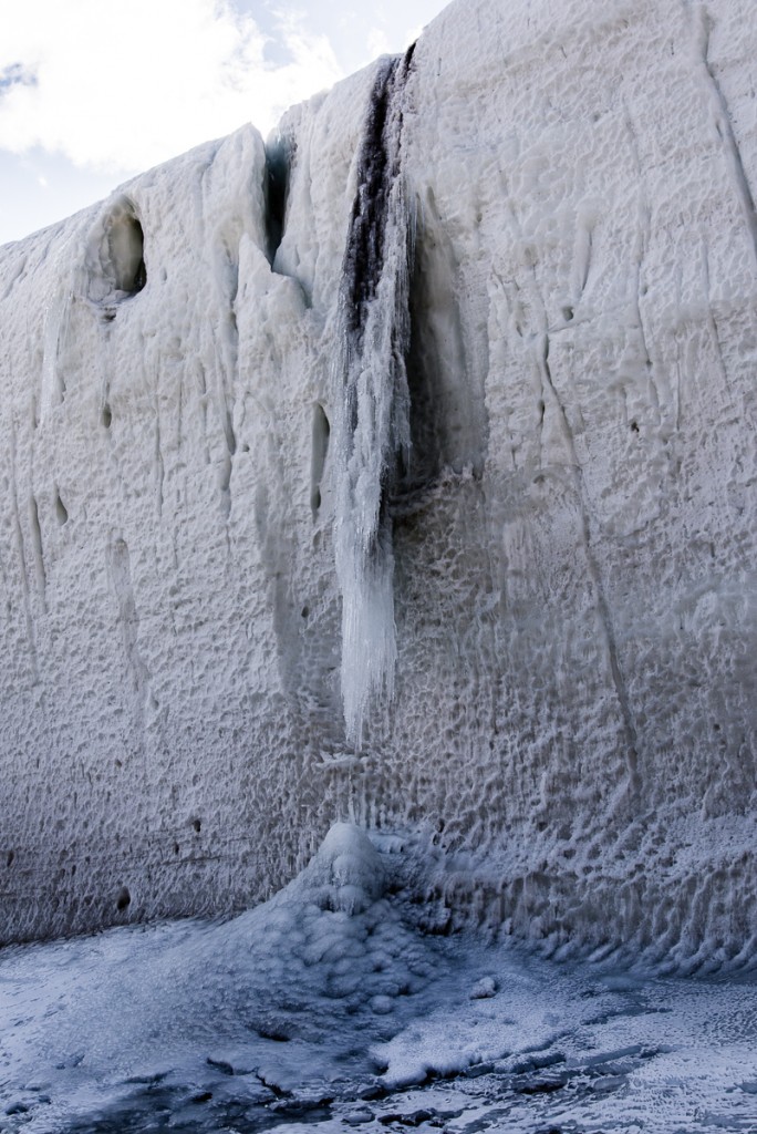
Frozen waterfall, Suess Glacier
A smaller frozen waterfall gives an idea how the larger one probably looked before it connected into a column.

Once out of the defile, the Suess presents yet another aspect, a frieze of rounded shapes:
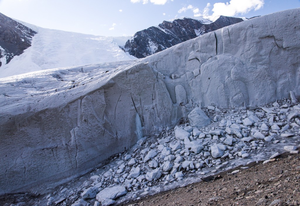
Suess Glacier looking north
The icy dimpled surface gives way to a frieze of smoother, rounded shapes.

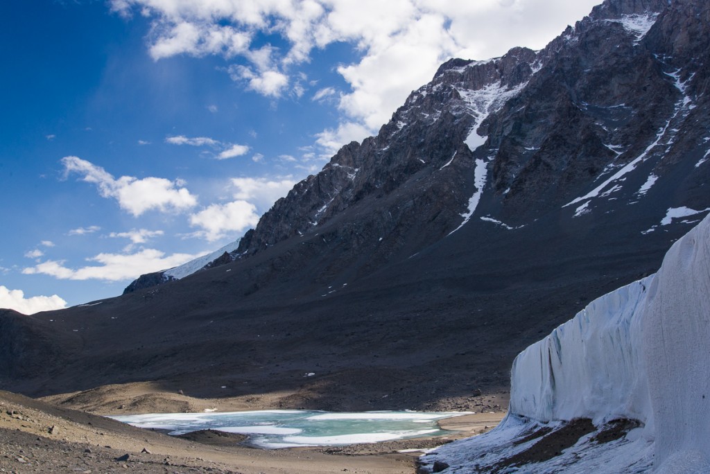
We reached the end of the defile, and looked down at the small blue lake on the other side (below). It was 5 p.m., we’d been out for four hours and decided to go back to the camp, figuring we’d be there in 90 minutes, just time for dinner. That was the time we decided to take a direct route back across the lake ice which turned out to be, ah, no shortcut at all for us lake ice rookies. If you haven’t read that story, you can find it here. Long story short, we made it back, albeit almost three hours later with wet socks. It was unnerving while we were in the middle of it, but funny once it was over: silver lining!
Suess Glacier and lake.
The west side of the Suess Glacier faces a small lake.


I See Red: A Walk Around Blood Falls

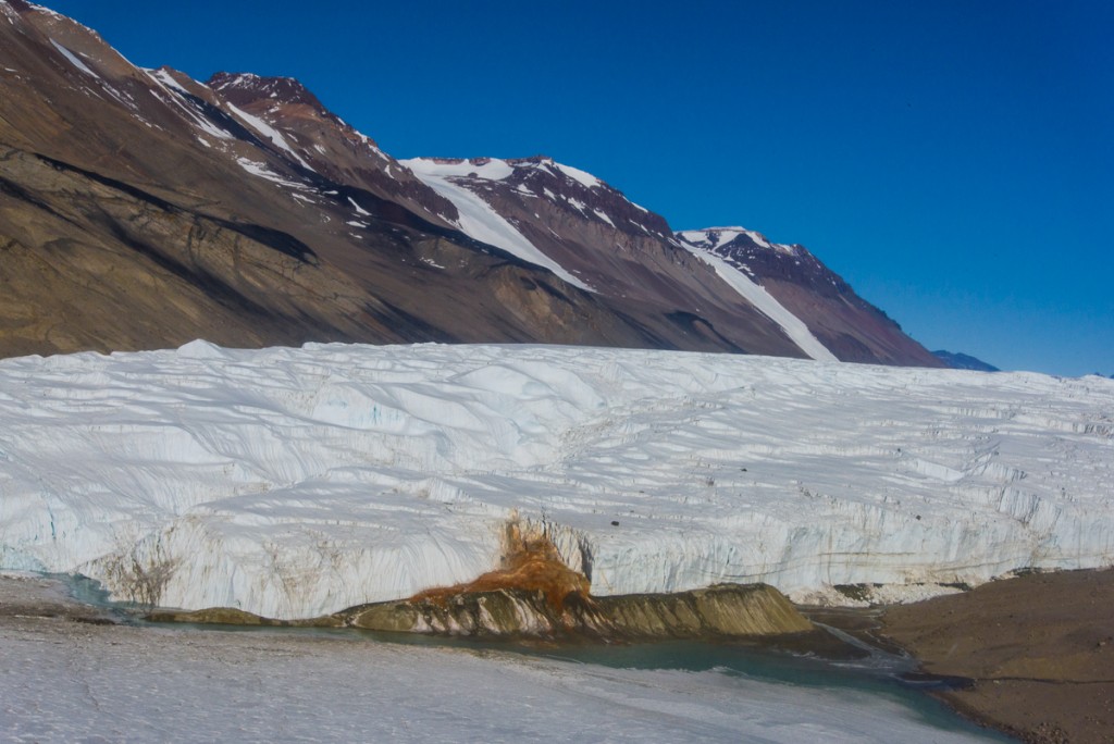
Blood Falls
First sight of Blood Falls from the helicopter.
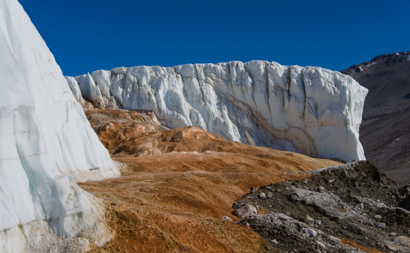
Blood Falls, Antarctica
Awesome: Looking up from the foot of Blood Falls was an “I’m-in-Antarctica” moment.

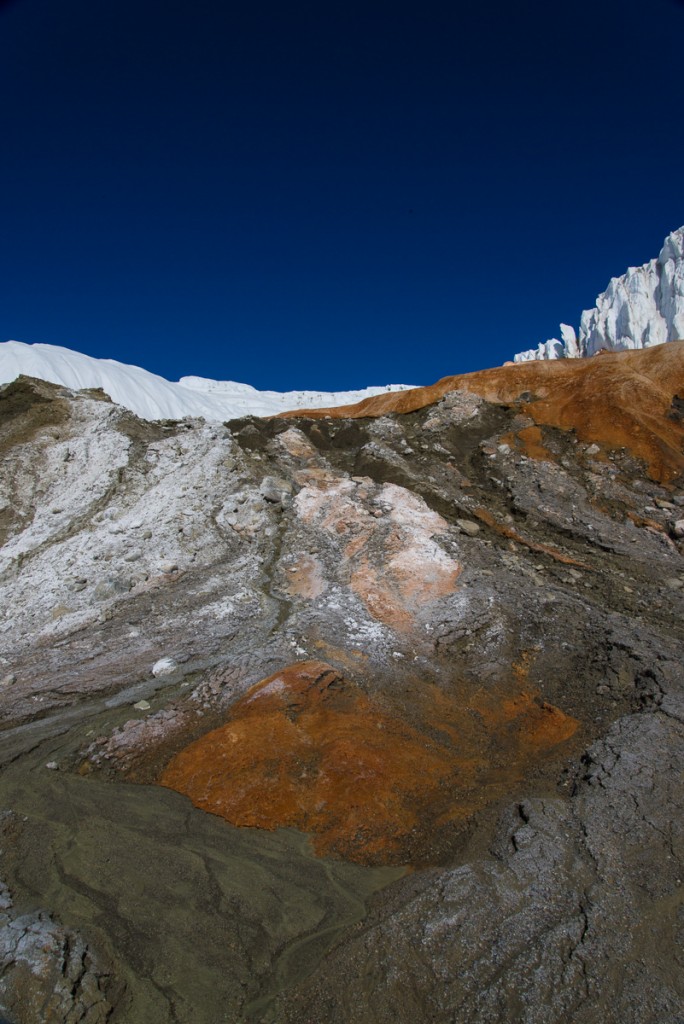
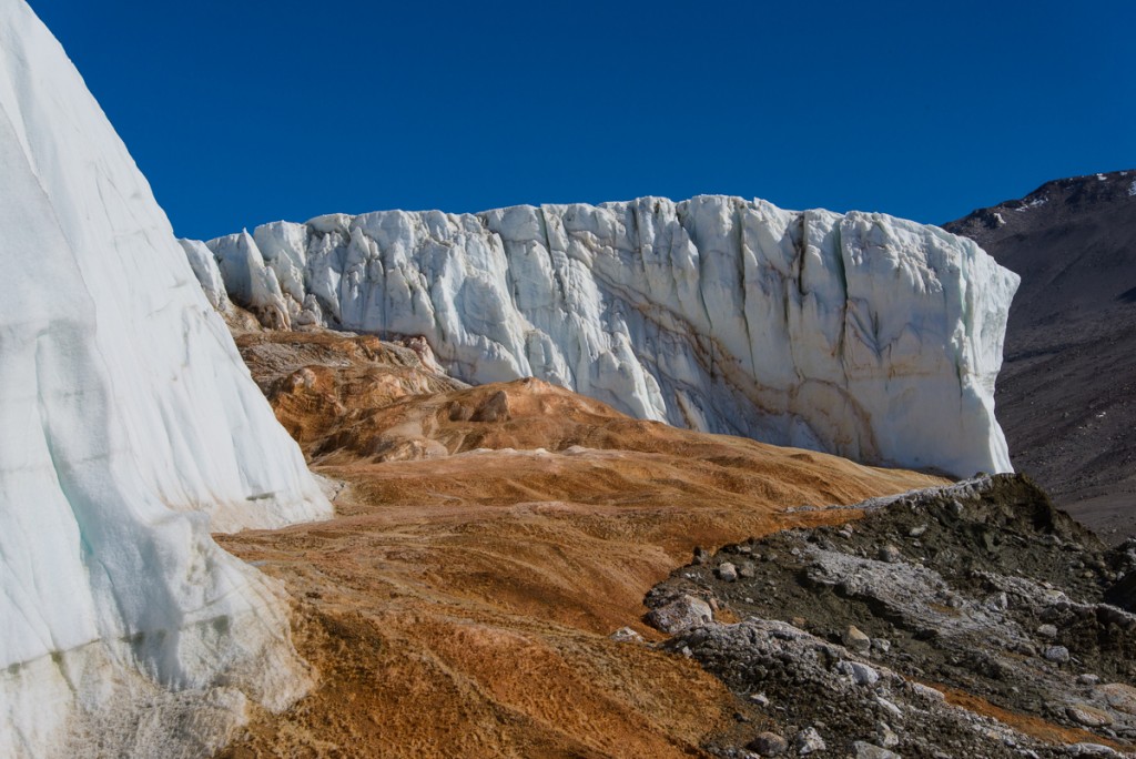
The word “awesome” has taken on a casual meaning, approximating something like, “Super cool!” or “Hey, that’s great!” But there were many times in Antarctica I was confronted by something awesome in the original sense of the word, as in awe-inspiring: difficult to grasp in its immensity and power. Even if you learn the scientific explanation, there’s something unfathomable about a large expanse of bright orange and red ice spilling from the end of the steep walls of a glacier that towers overhead. It’s one of those moments where I’d just stand there for a minute thinking, “I’m in Antarctica. I’m really in Antarctica.” That’s how I felt when I stood at the bottom of Blood Falls, at the toe of the Taylor Glacier in the Dry Valleys, overlooking the west lobe of Lake Bonney.

Blood Falls
Rust Never Sleeps: from a vantage point even with the top of the falls.

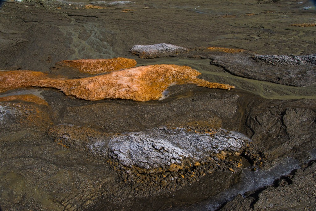
In those I’m-in-Antarctica moments I felt how privileged I was to even be standing there. Since my Antarctic Artists and Writers Program project involved photographing ice formations to recreate in 3D I was among the fortunate few granted a permit to walk around it, not to mention a helicopter ride to the site. Blood Falls is among the highly protected zones of Antarctica because it is both a rare natural phenomenon and harbors delicate mineral deposits, which in turn harbor unusual microbes, all of which one must take care not to trample. National Geographic’s Blood Falls web page offers a good overview of where the minerals and and their colors come from, and the scientific significance of the site. In brief, the iron oxide salts percolate up into the glacier from a hypersaline lake (i.e. super-concentrated salty water) trapped beneath it from geological processes occurring over a period between two and five million years ago. When the iron salts hit the air, they oxygenate and turn red and orange. This is a dynamic process, and I’m told that the depth of the colors varies from year to year.

Blood Falls detail
The X-Philes live here.

National Geographic goes on to explain that scientists from a variety of disciplines are interested in the microbes who live in the unusually harsh conditions of these deposits: glaciologists (who study glaciers), limnologists (who study lakes), microbiologists (who study microbes) and astrobiologists (who speculate about the presence of life on other planets). As a group, the microbes fall into the broader category of extremophiles because they “are able to withstand and even thrive in extremely harsh environments.” The extremophiles (I like to think of them as the X-philes) of Blood Falls manage the trick of converting sulfur and iron compounds into energy under freezing conditions. Hence the interest on the part of astrobiologists, since this may be the closest Earth can come to approximating conditions on a freezing planet.

Blood Falls
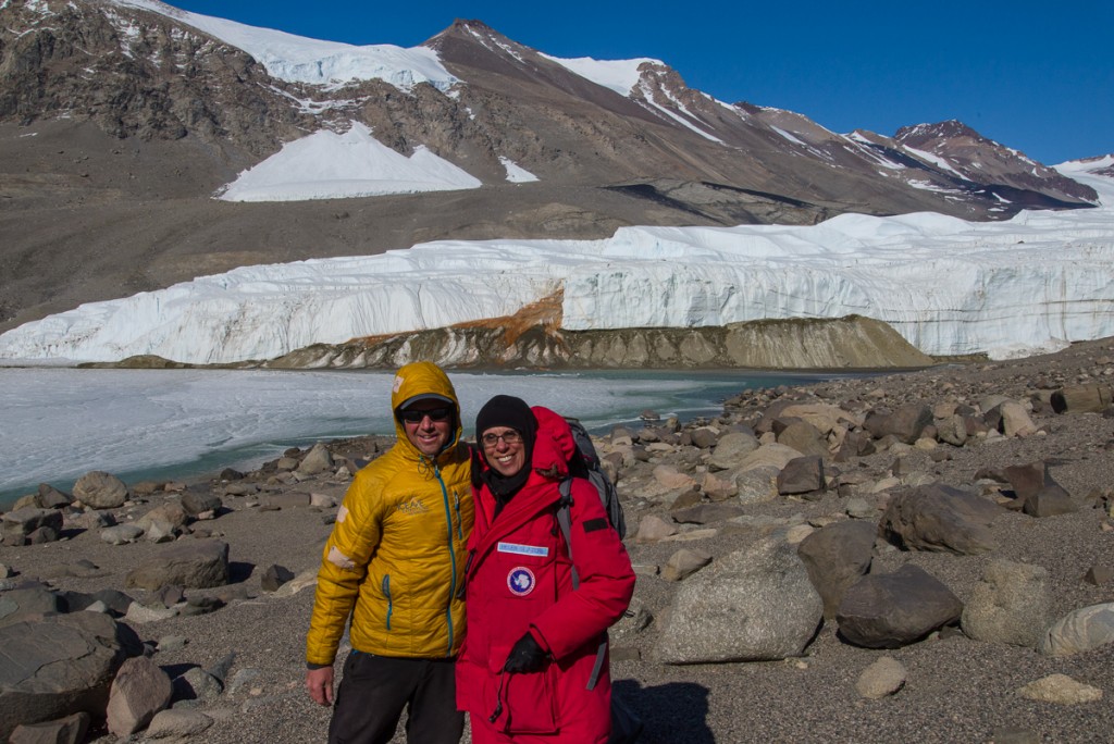
What does the fashionably dressed Antarctican wear to a visit to Blood Falls? Mountaineer guide Forrest McCarthy and I chose Sulfur Orange and Blood Red.

I visited Blood Falls with mountaineer Forrest McCarthy, a veteran of about 20 seasons “on the ice” in the US Antarctic Program. We flew in a helicopter and were joined by Mike Jackson, the National Science Foundation science representative on station for that period. Since Mike’s trip was spur of the moment due to their being room in the helo, he had not obtained a permit. Even an NSF administrator isn’t allowed to walk all the way to the falls without one, so he stayed on a nearby trail overlooking the site, while Forrest and I waded across the shallow but wide melt waters of the Taylor Glacier at the edge of Lake Bonney, which was ankle deep in some places. I had changed into hiking boots instead of bunny boots, so I splashed through the freezing water as fast as I could, hoping my boots were as waterproof as advertised. (They did reasonably well. Lowa boots, in case you’re wondering, from REI. They’re the only ones that come in true narrow widths, so I didn’t have much choice. But they turned out to be great boots.) This was my first view of Bonney, and I knew it was a frozen lake, but I didn’t realize the edges would be swiftly moving water. Or that streams of water would be spilling off the top of the glacier in little waterfalls. I’d never seen a glacier do that before; it seems to be a particularly Dry Valleys phenomenon, where the glaciers are basically grounded rather than actively moving out to sea. (I’ve posted a 13-second video to YouTube.) It was a cold and windy, but sunny day, with a brilliant blue sky.

West Lobe of Lake Bonney
Looking across the west lobe of Lake Bonney from Blood Falls. The water closest to the shore was shallow meltwater coming off the Taylor Glacier.
Taylor Glacier
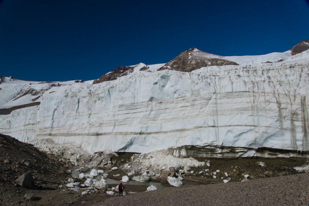
The side of the Taylor Glacier that is to the right of Blood Falls if you’re facing it from the lake. You can see how massive it is compared to Mike, walking below it (in red parka lower center).


If all goes well, the photos I took during my walk-around can be processed into a 3D file after I return home to recreate this special place as a sculptural form.

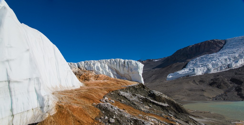
Blood Falls
Blood Falls and the Taylor Glacier are in the foreground. Beyond them on the right are the smaller Rhone Glacier and part of Lake Bonney.