Penguin Watching

Penguin and chick
Newborn penguin chick — one of the first if not the first to hatch this season — greets its parent.


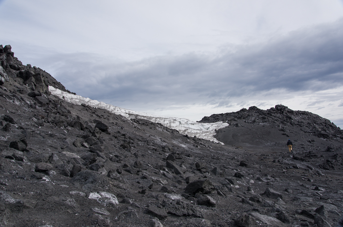
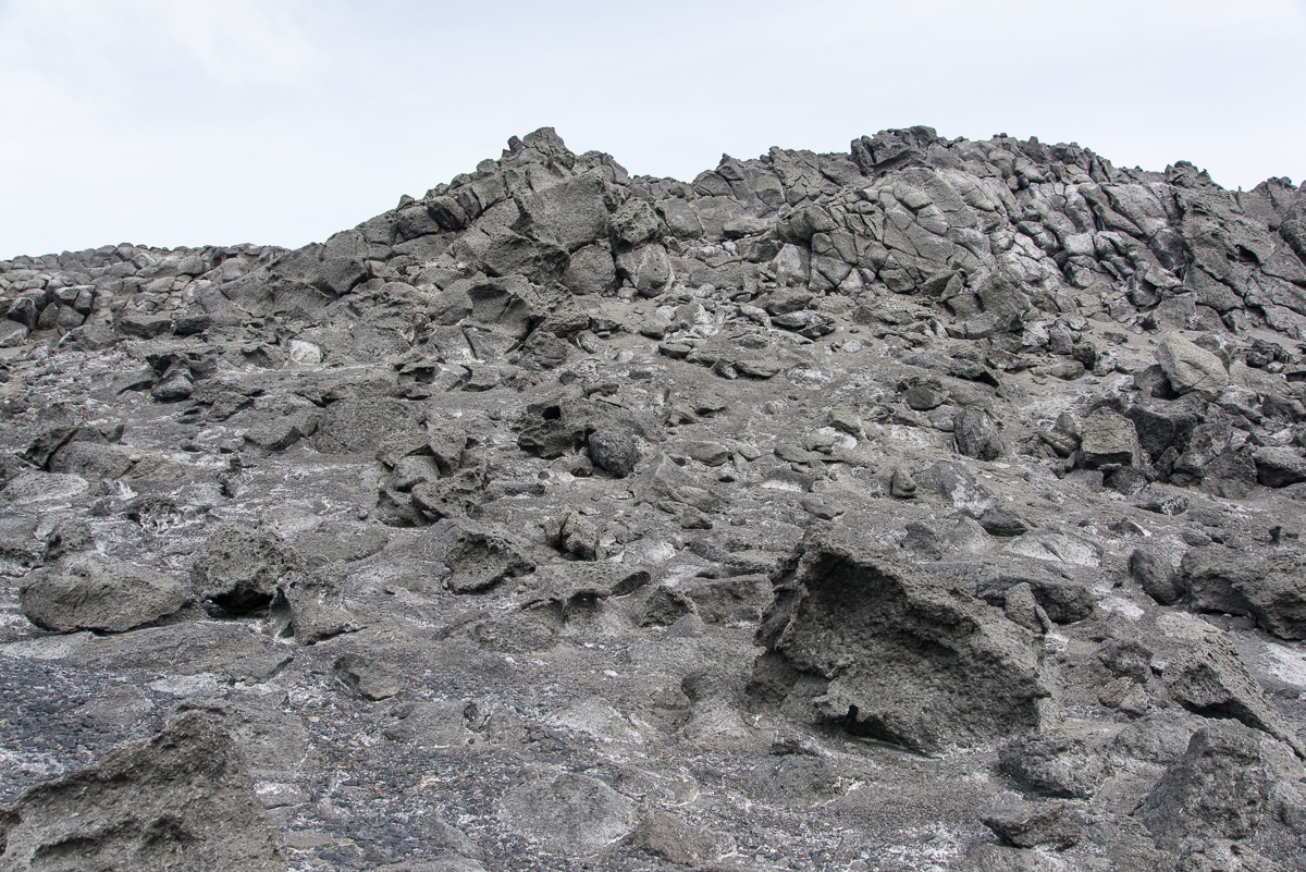
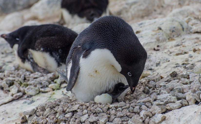
I can’t believe my luck. I mean, really. December 13th was my last full day at Cape Royds. It was overcast and the coldest day since I’d been at Royds and I had to keep stopping to warm up my hands. Not to sound melodramatic or anything, but I also had a cold and wasn’t feeling 100 percent. But I went out for a couple of afternoon walks with my camera and tripod anyway — one in the direction of the volcanic landscape, then after a pit stop at the field camp tent to warm up, one to the penguin colony. I have been told by the research team here that this is the time of year they typically see the first chicks. Nobody saw them yesterday, but Katie thought she heard a faint peeping and that there might have been some pecking their way out of their shells. Since I knew I would be getting picked up late morning the next day, I knew this would be my last chance to see chicks and I was on the alert for sounds. It started getting windy and I thought I heard something a couple of times but when I went over to investigate didn’t see anything. I wasn’t sure if it was my camera bag strap squeaking in the wind, which it does sometimes. After watching a colony that sounded like the direction it was coming from, I did catch a glimpse of an egg with a hole in it when a penguin stood up briefly and then settled back on top of it. But after waiting several minutes in the cold, I decided it wasn’t happening, my fingers were frozen and started walking in the direction of the path to the campsite. As I passed the neighboring subcolony, I heard an unmistakable peeping sound, looked to my left and saw this scene. It only lasted about 2 minutes — I took a few stills, turned on the video, and watched the penguin feed the chick and settle back down on it. You can see the video on YouTube.

Penguin subcolony at Cape Royds
The subcolonies are distributed throughout the colony. Some have numerous nesting pairs, like this one, others only have a few. I saw one with just four nests.

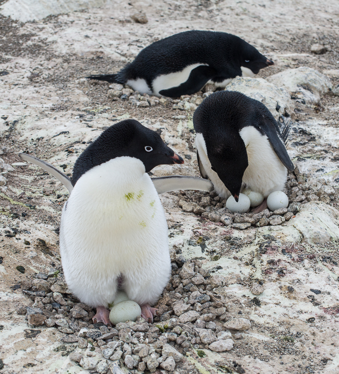
Mostly what I saw while I was here were behaviors related to nesting. All the penguins who will breed this year have paired up, created little stone nests in their subcolony groups, and laid the eggs. The male does most of the nest-building, but once the female lays the eggs, they trade places sitting on the eggs. One goes down to the water to forage for food while the other sits on the eggs. When the foraging penguin returns, they great each other with a little dance where they swoop their necks up and down in unison and call out loudly. Then they switch places and the other parent goes off to feed.

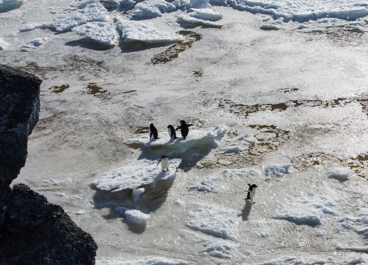
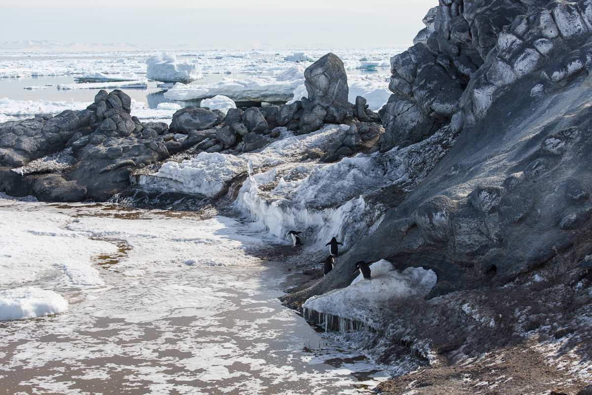
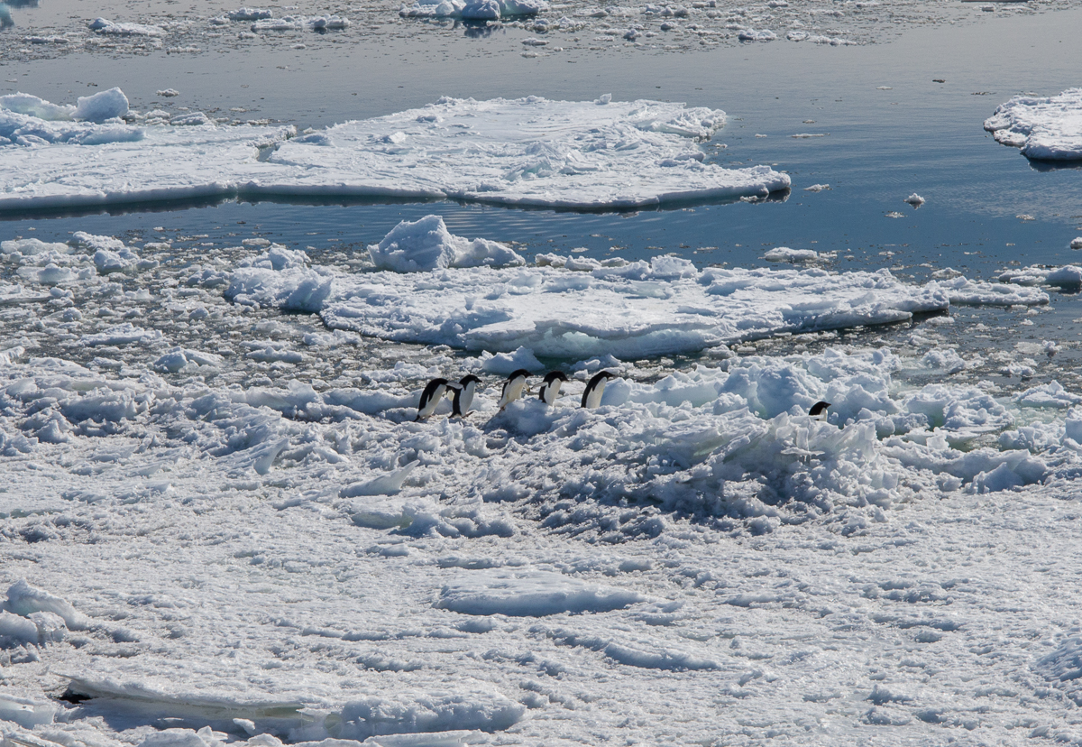
I was hanging out on the bluff overlooking the water watching the penguins form little groups to go in the water. They just go down there and join with others who happen to be on their way, and walk more or less single file.

Penguins at Cape Royds
Penguins travel single file to the water to feed.
A lot of pack ice had blown in from the north, so they had to make their way across that to get to the water.


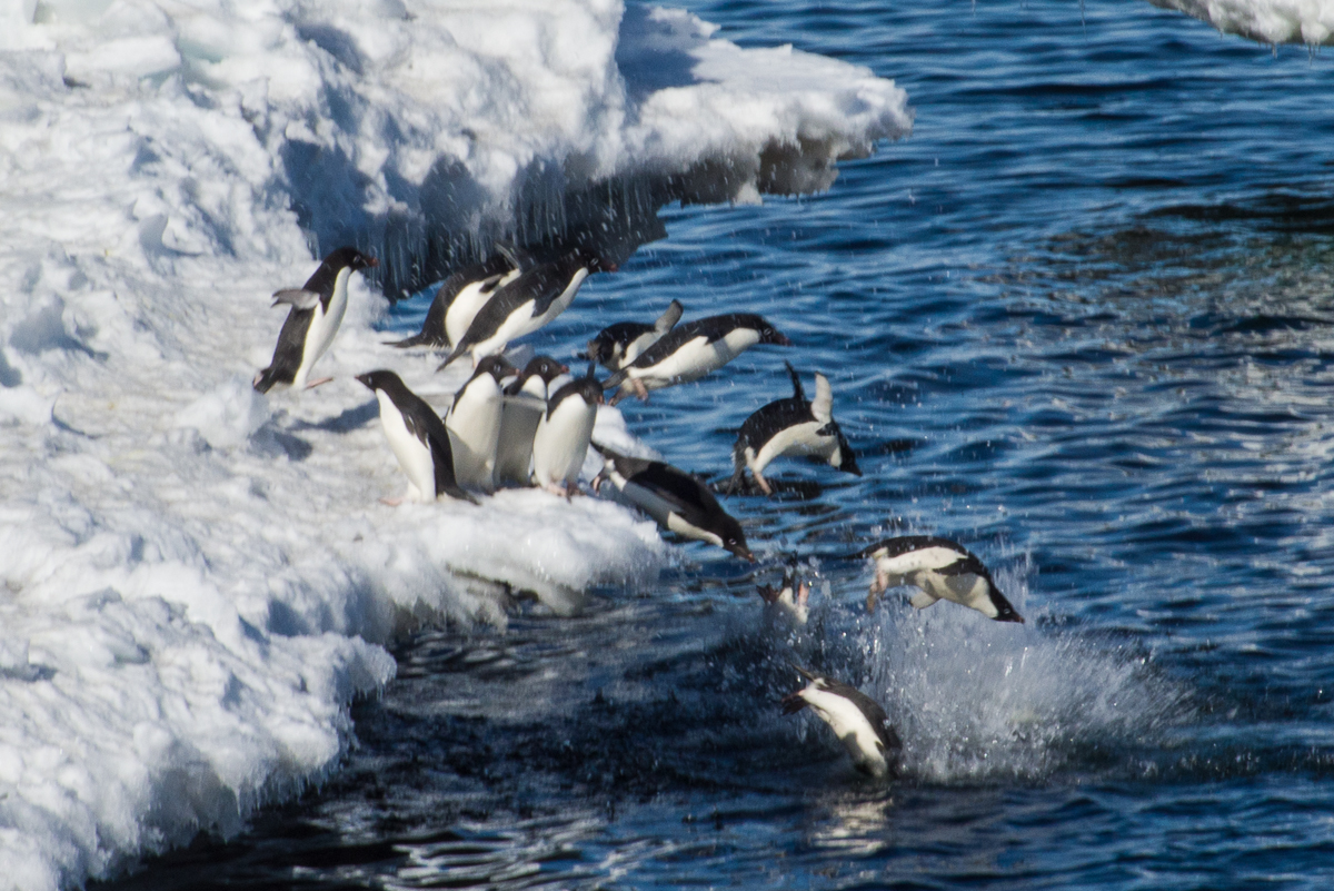
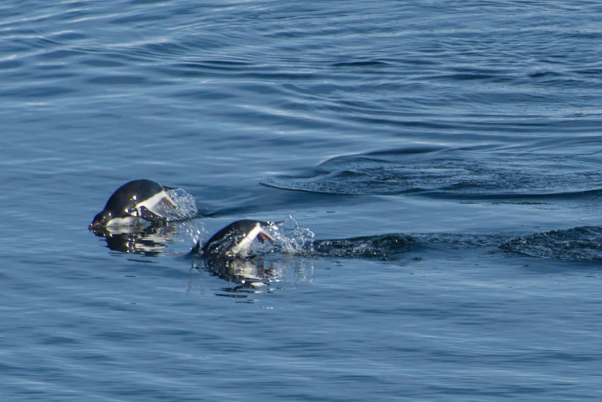
They’re fast swimmers and sometimes leap in and out of the water like a dolphin. I fired away with my camera and got some shots of wet, fast moving penguins that make them look like rubber dolls:

Penguin swimming
Catching air: this penguin leaped pretty high.
Penguins swimming
Synchronized swimming, penguin style.

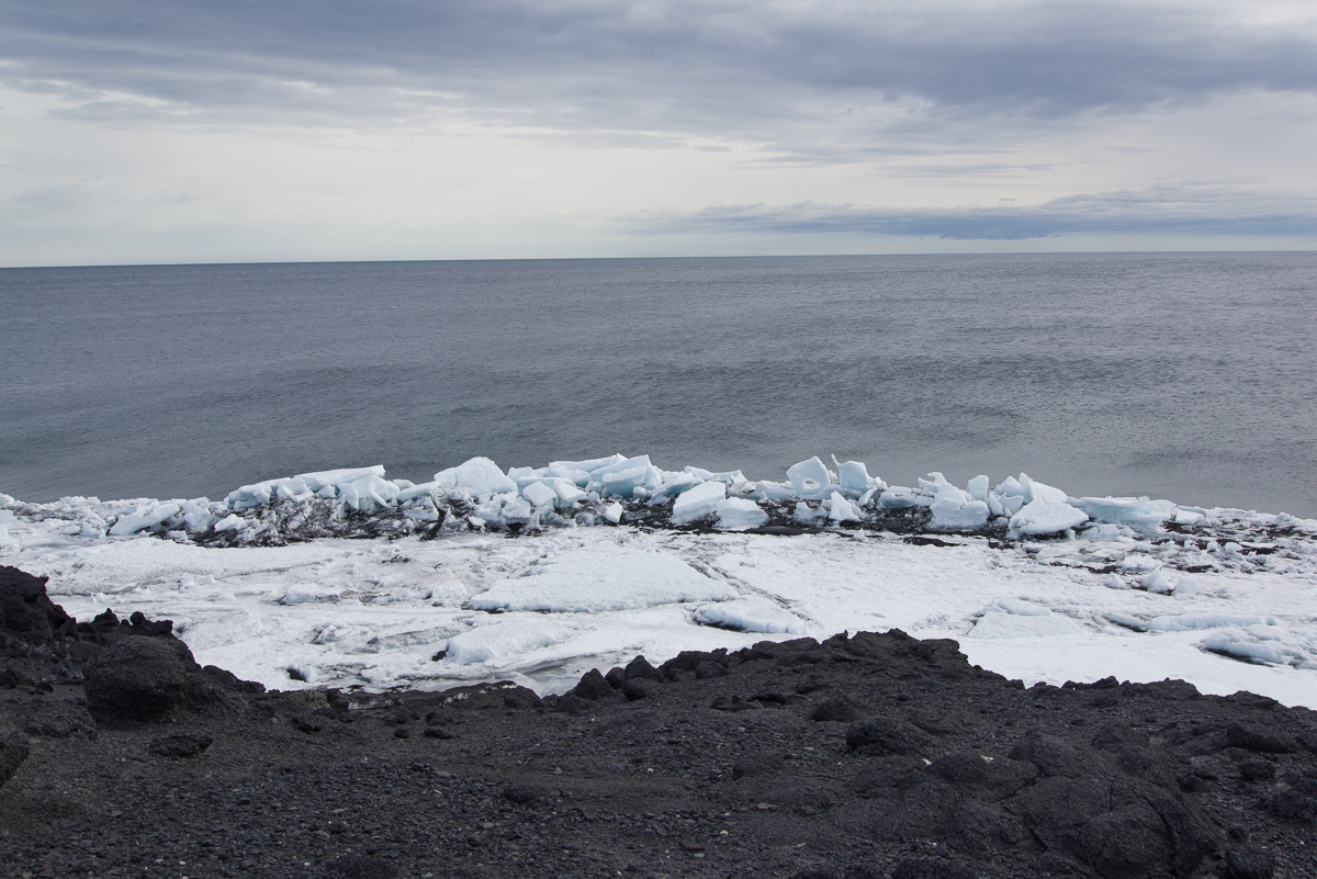
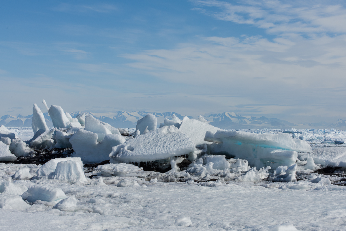
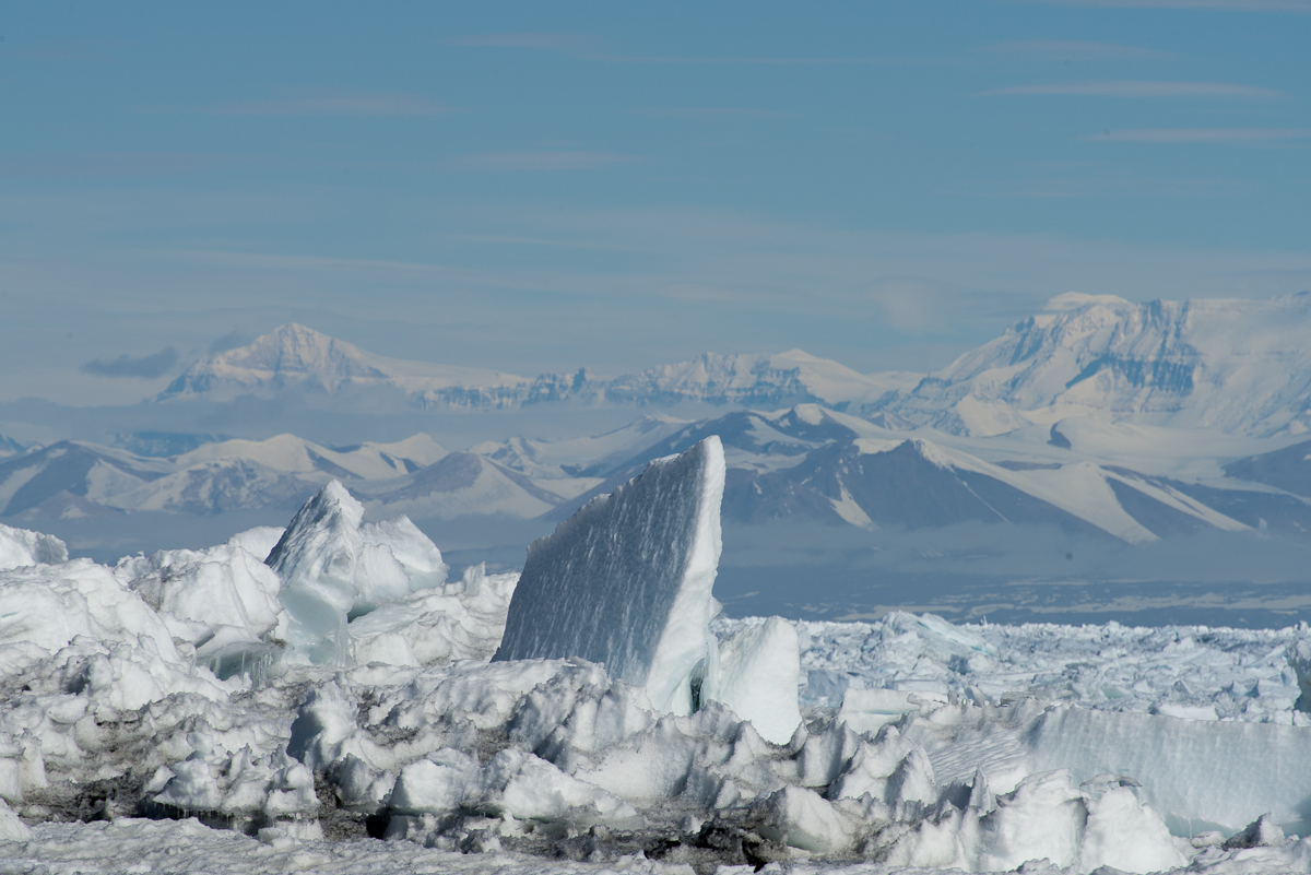
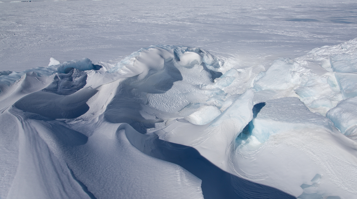
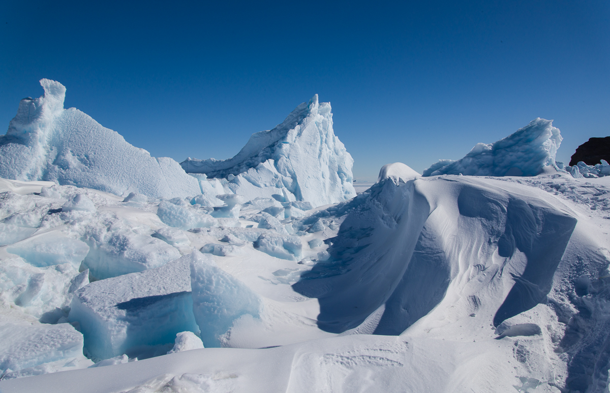
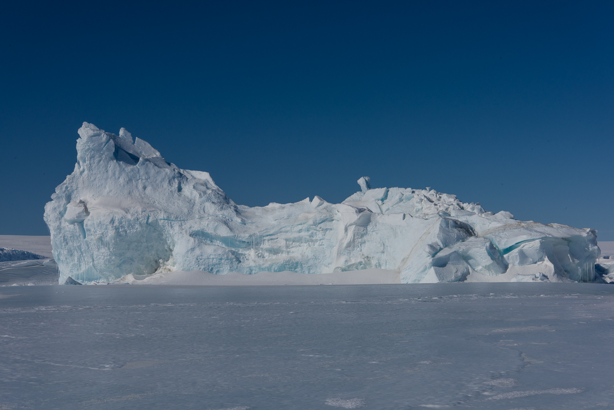
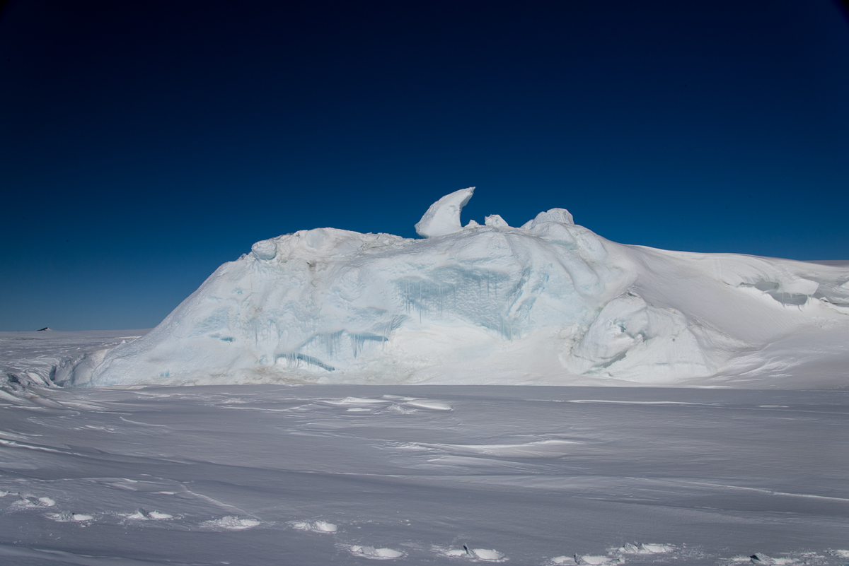
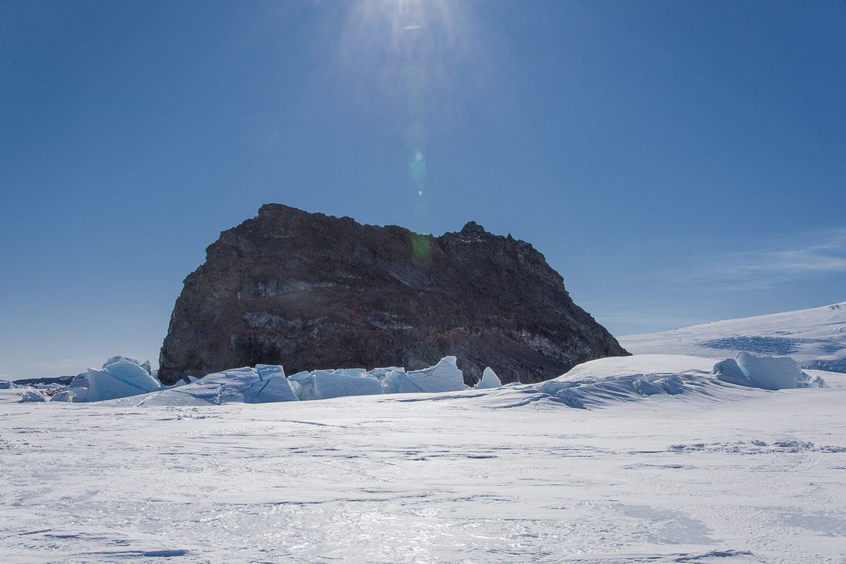
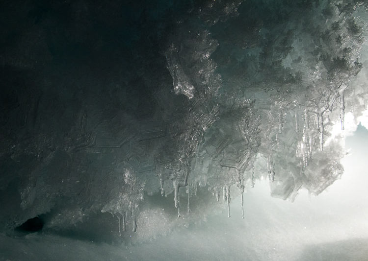
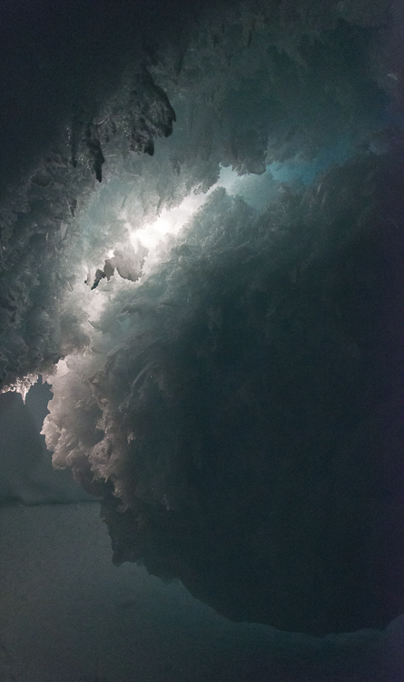
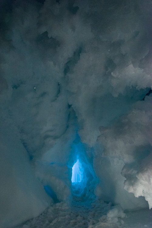
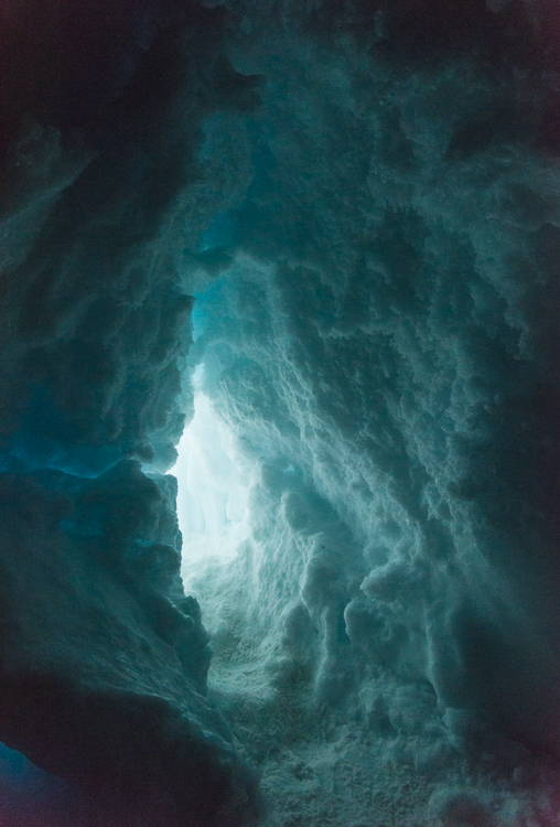
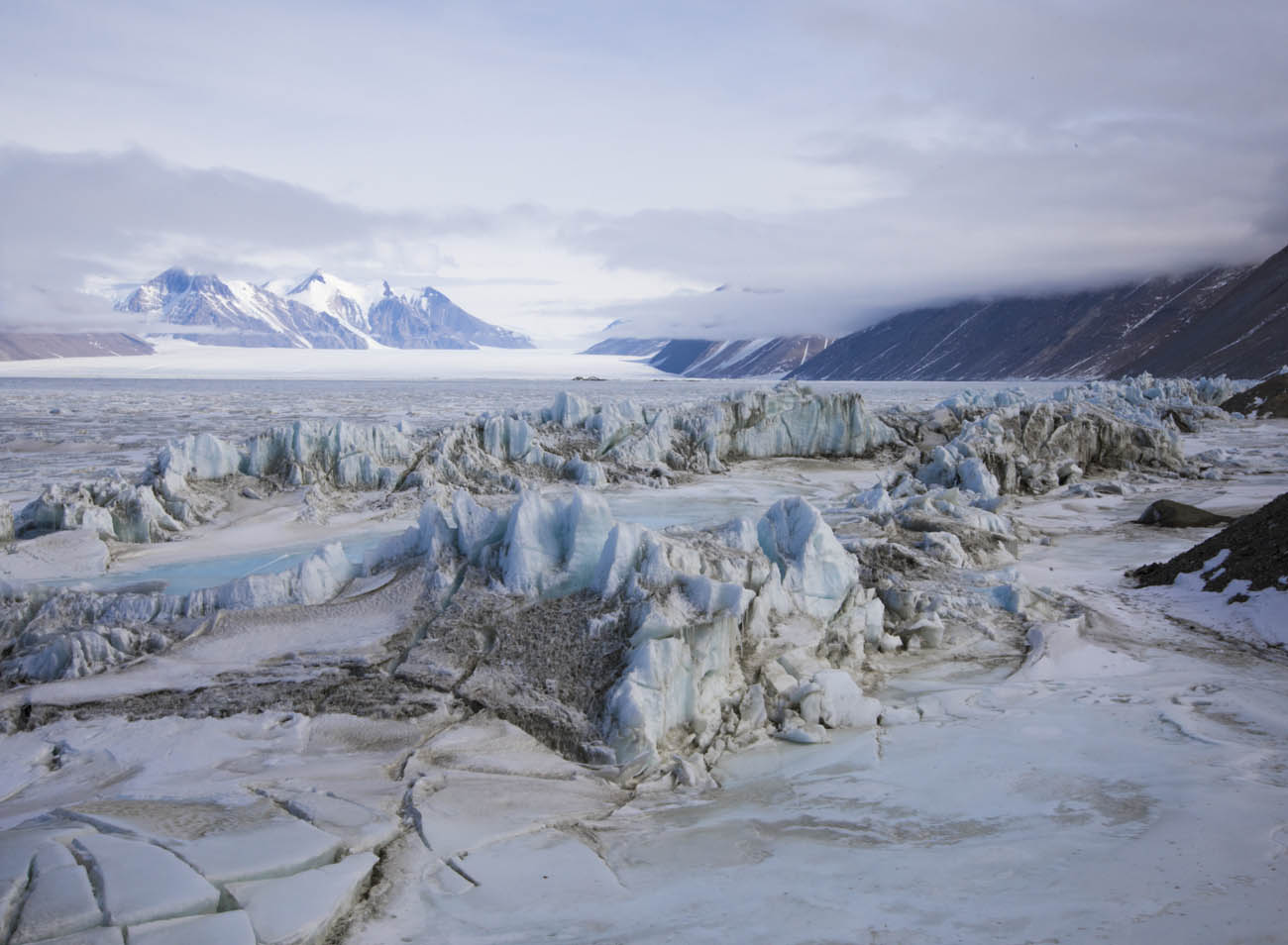
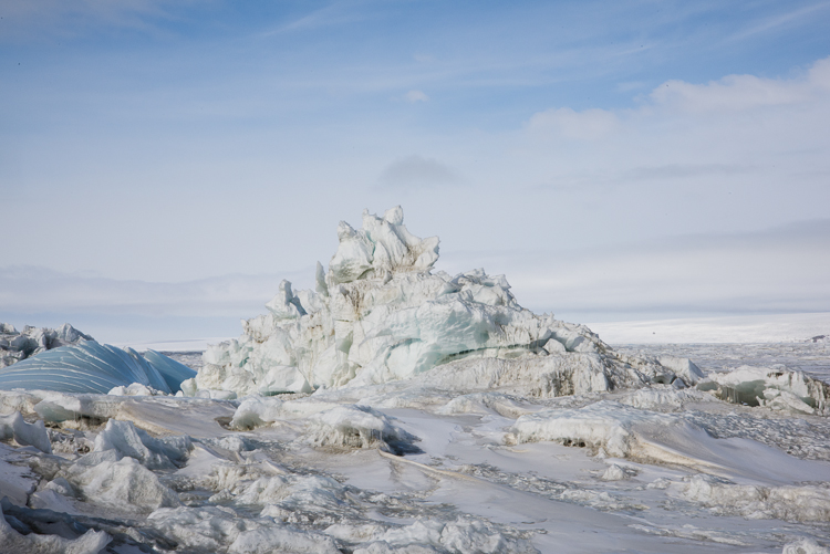
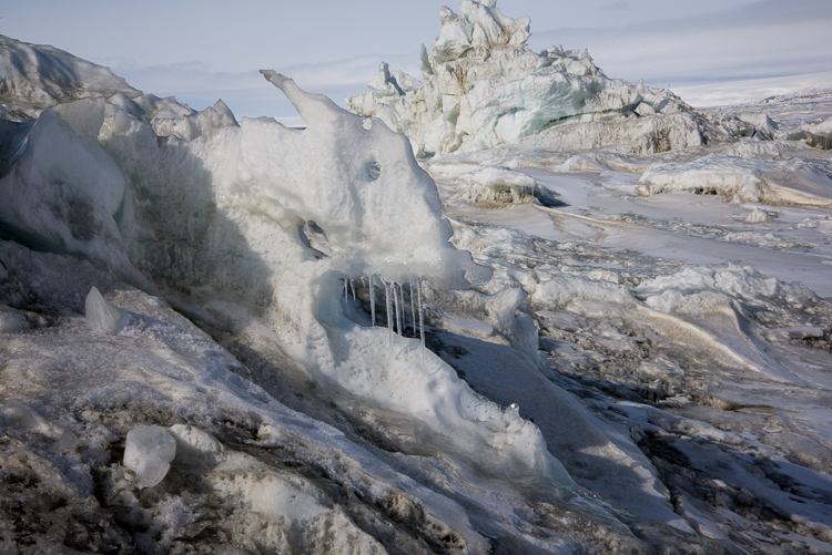
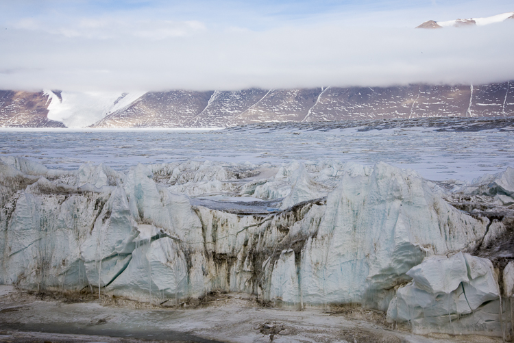
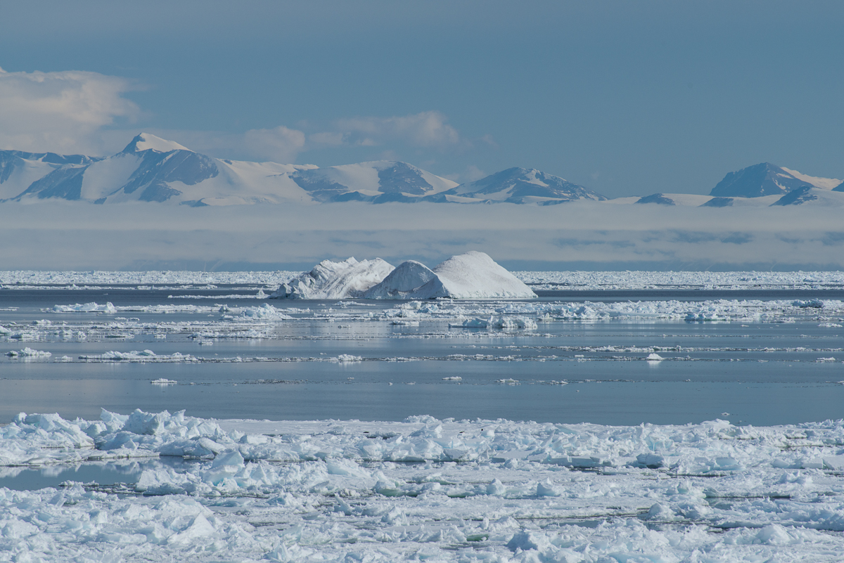
The pack ice floated at a good clip. Every day it looked different. On the 12th this iceberg showed up:

Iceberg, Cape Royds
Iceberg that suddenly appeared at Cape Royds.


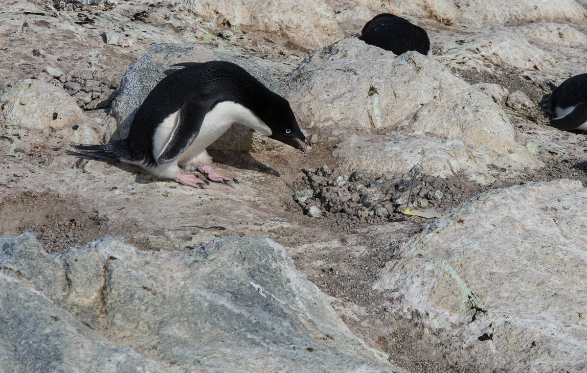
I tracked a penguin with my camera as he ran up a steep hill with a rock in his beak, which he presented to his mate in the subcolony at the top of the hill. There was an enthusiastic greeting between them. The landscape is rocky, he’s carrying a rock and something about the whole triumphant climb reminded me of the scene in the movie “Rocky” where Sylvester Stallone runs to the top of the long flight of steps at the Philadelphia Museum of Art. So I titled the video “Rocky.” Watch it on YouTube.

Penguin building nest
Don’t be fooled by the rocks that I got: this penguin is probably too young to mate and is just practicing nest building.

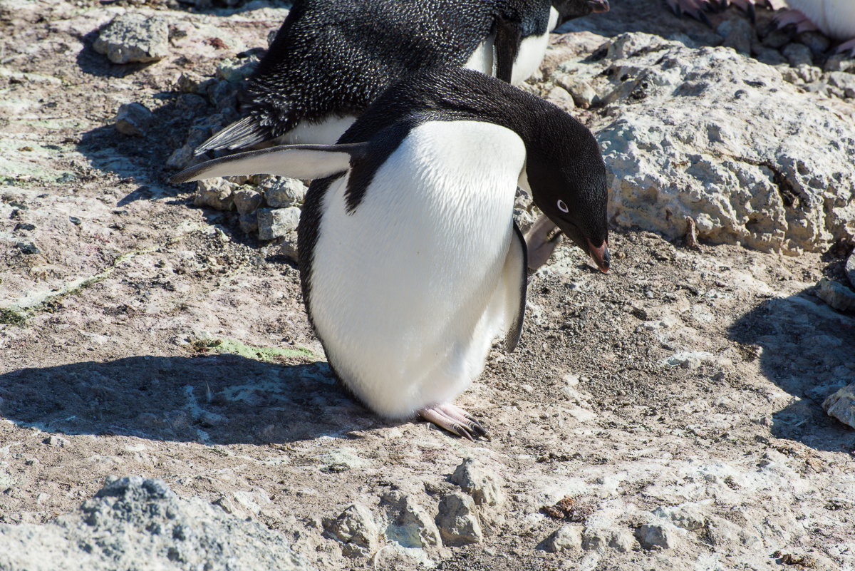
Young penguins three to five years old play at nest building, picking up stones and dropping them in a pile. Sometimes they even pair up, and do the whole greeting and changing places routine, but they are too young to breed and don’t lay eggs. Sometimes they make a nuisance of themselves and other penguins chase them away. I saw one in that situation running away who stumbled and slid about 8 feet down a slope on its belly.

Penguin with 3 eggs.
Too much of a good thing: the penguin on the right has three eggs in its nest. That’s too many to properly incubate and definitely too many to care for. [Note: Eventually two chicks hatched and survived.]
Most of the penguins had one egg, many had two, and the one in the photo at left has three. I asked David Ainley and Katie Dugger, lead researchers on the penguin study who were there, how that happened. They said that either the male had had a mate that left and then a new mate that between them had laid three eggs, or one rolled down an incline from another nest. But the prognosis for three eggs is not good. Even if they all hatch, they won’t be able to care for three chicks and they will likely die. [Note: In early January, David Ainley, told me that the penguin couple with three eggs had, against the odds, managed to successfully hatch and care for two chicks.]

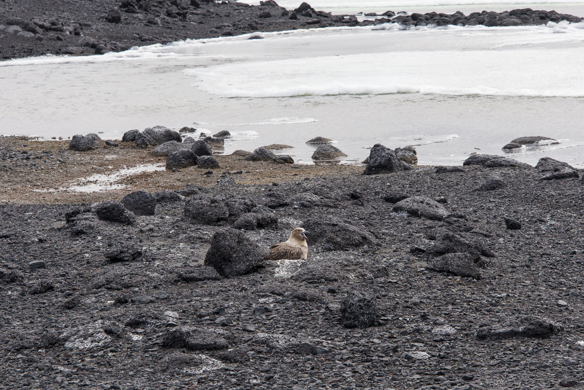
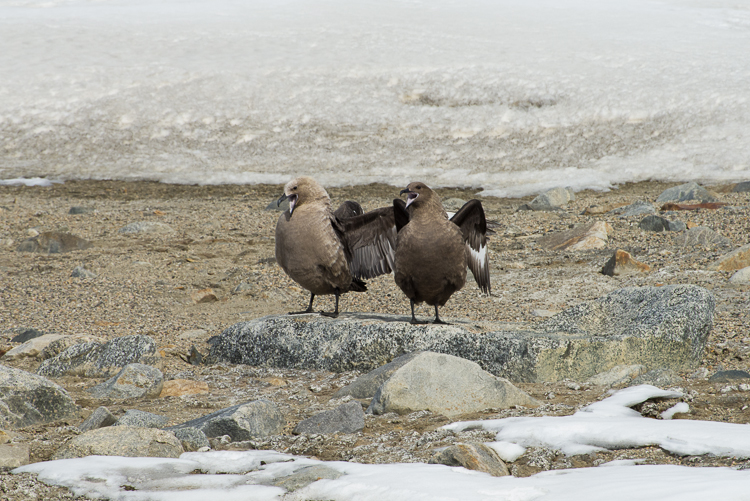
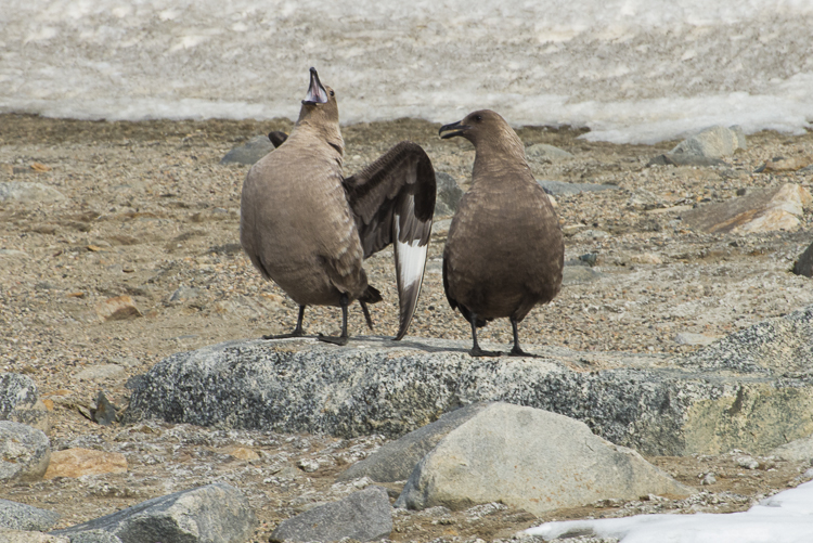
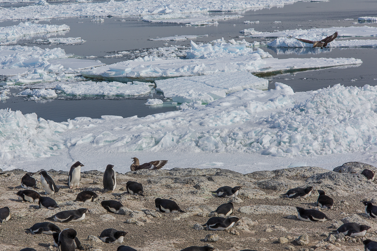
The only predator the penguins have to watch out for at Cape Royds, aside from orcas in the water, are skuas, who look for an opportune moment to steal eggs. I saw skuas swoop down and harass the penguins numerous times, but most of the time, the penguins are onto them, and squawk and lean toward them menacingly. The skuas may stand there for a while, but once they know they can’t catch the penguins unaware they tend to fly off.

Skuas harassing penguins
These skuas harassed the penguins to try to get at their eggs, but the penguins were having none of it.

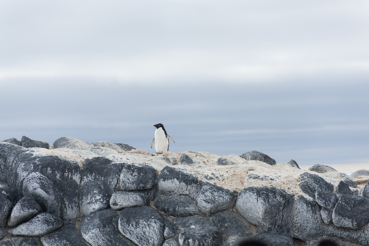
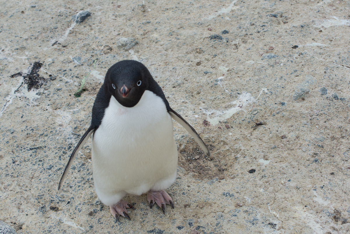
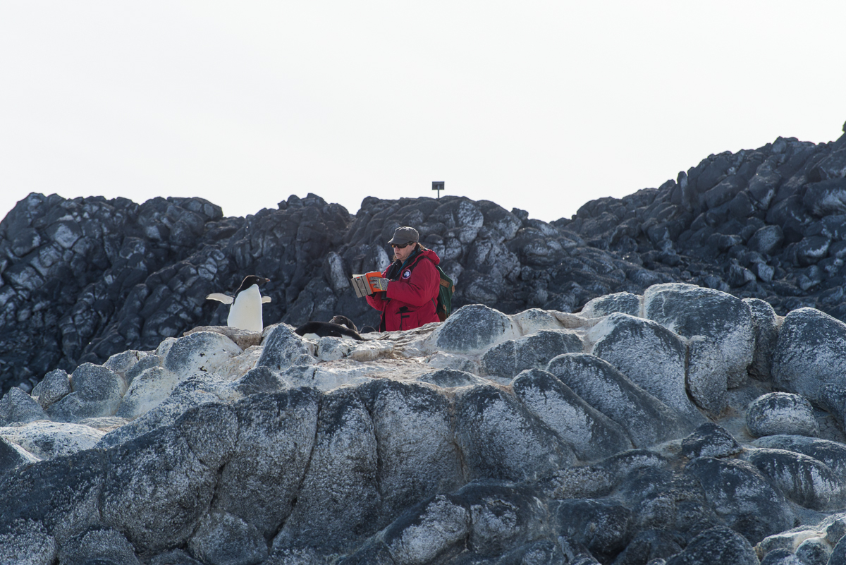
The penguins are unconcerned about the presence of people, however. Sometimes when I was standing in one place for a while, one or two would wander over to check me out. At one point I suddenly looked down to find I had company:

Penguin, Cape Royds
A curious penguin checks me out.

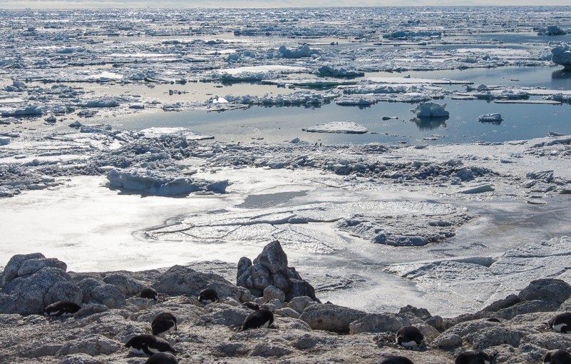
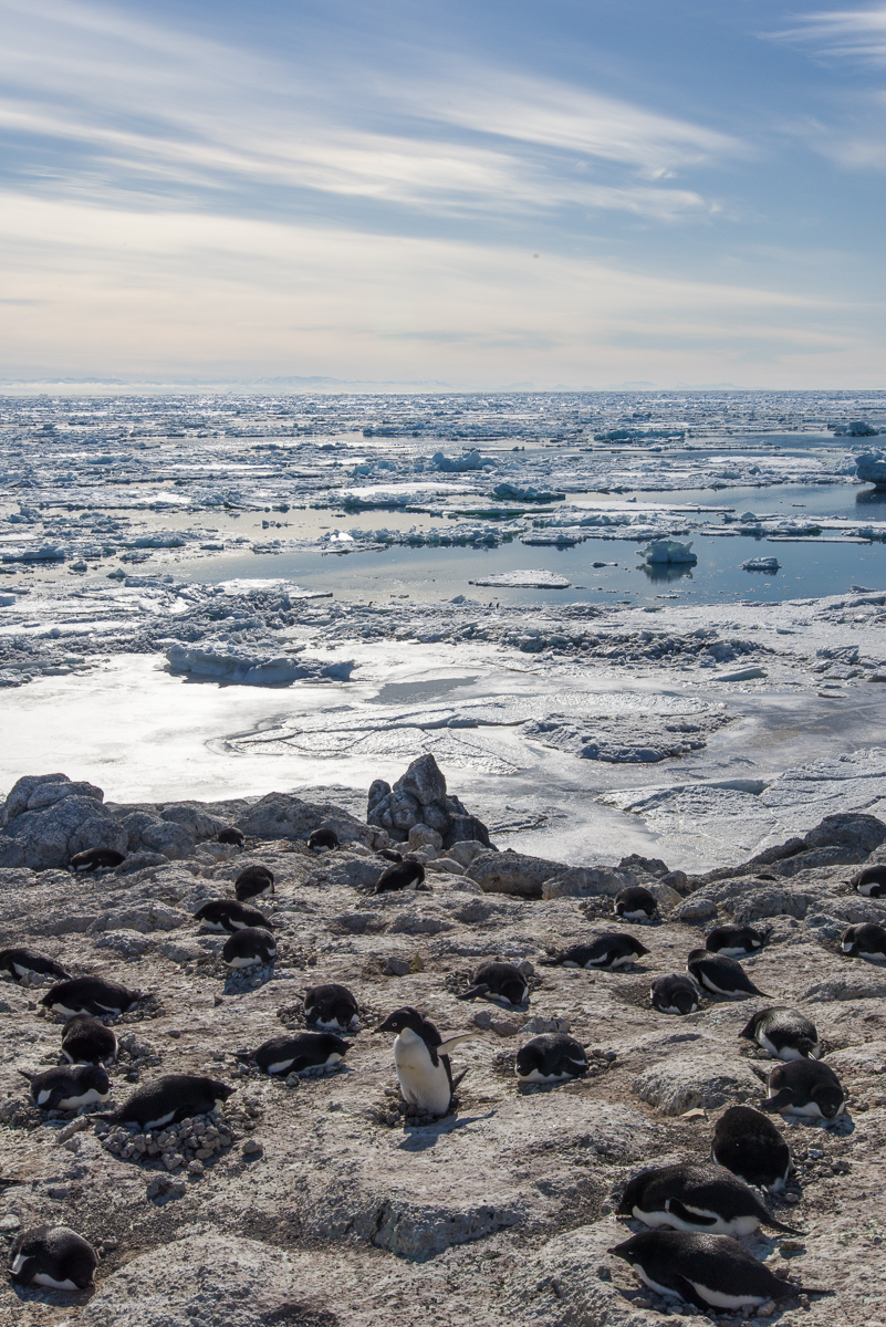
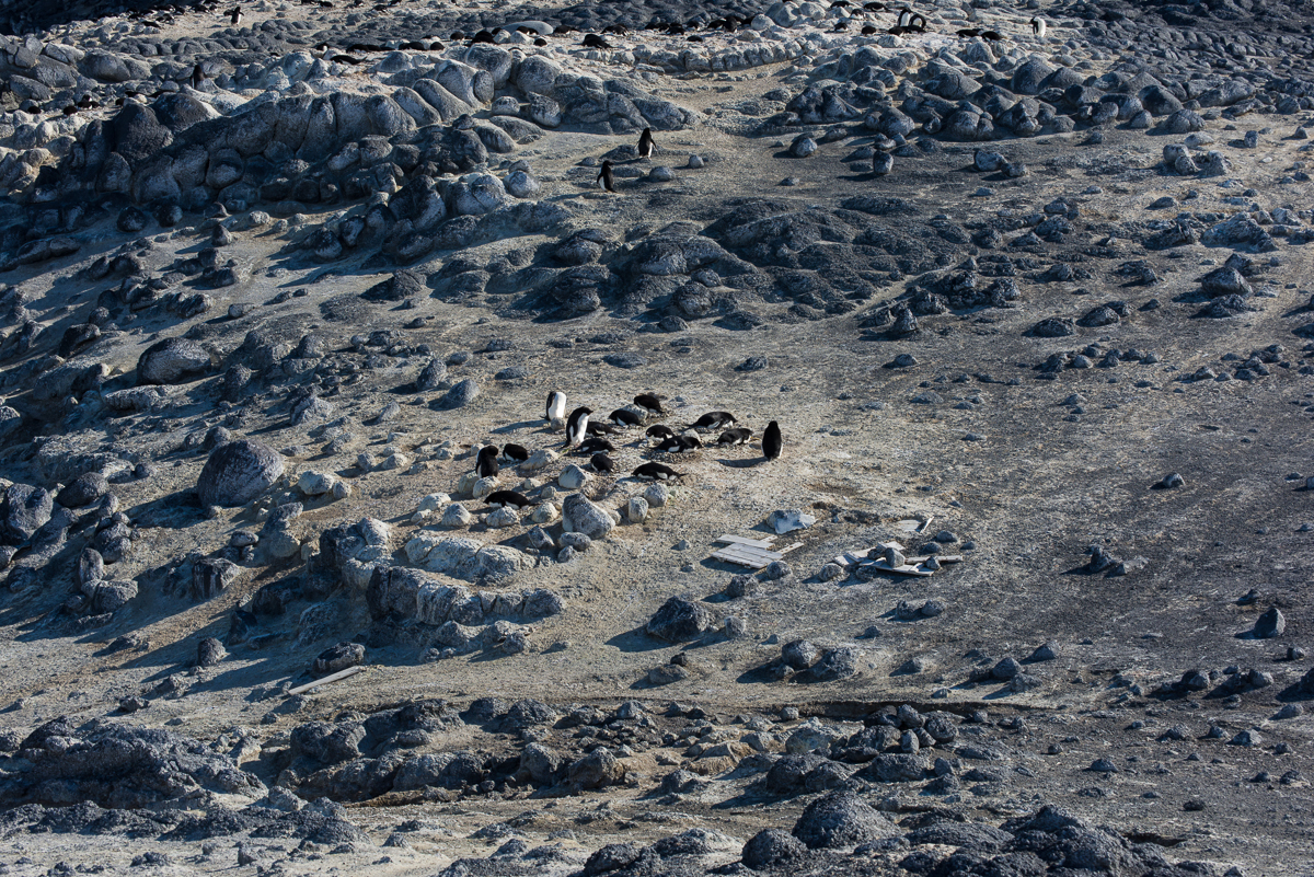
While I was there, Katie was making rounds every other day to check on the banded birds, making notes on the which ones were nesting and how many eggs they had. She has found that although the colony population hasn’t changed since last year, there are fewer nests and fewer eggs. Some nests were created but abandoned. Some pairs made nests but didn’t produce eggs and are just “playing house” as Katie put it. The scientists don’t know the cause of the lack of breeders, but one hypothesis is that something happened during the wintering over period that is making them struggle now.

Katie at work
Katie makes the rounds checking on banded birds, nests and eggs.

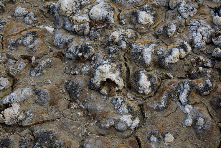
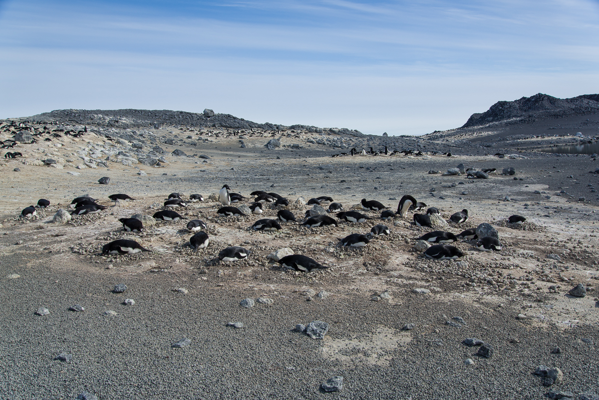
The colony at Royds took a major hit when an immense iceberg named B-15 broke off the Ross Ice Shelf and essentially iced in a huge area of McMurdo Sound year round, preventing the sea ice from breaking up in the Antarctic summer. After it broke up in 2005, the colony began to slowly recover, but it has still not achieved its original size, even though there should be enough krill and silverfish for them to eat. You can see that when you look at an overview of the colony and see all the empty spaces that are tan in color where penguins used to nest. More research is needed to understand what is happening in the wintering over period and to look at some of the environmental variables that could be affecting their ability to survive and breed.

Penguin at Cape Royds
Many mysteries remain about the lives of Adelie penguins, especially what happens during the Antarctic winter


Nesting Season

Cape Royds penguins
Nesting penguins overlook the sound, which filled with floating icebergs over the past few days. Small groupings like this are called subcolonies. They tend to distribute themselves fairly uniformly, a couple of penguin-lengths apart, and face different directions. Too close, and they get annoyed with each other, and push the interloper away with a squawk.
Banded Adelie penguin, Cape Royds
The researchers keep track of the banded birds to see if they are nesting and have eggs.

It’s my third day at the Cape Royds penguin colony, which consists of Adelie penguins. It’s a relatively small colony, with the larger ones at Cape Crozier and Cape Byrd, and Beaufort Island, which are all less severe environments than Cape Royds, which is basically further south. Katie Dugger, who has been keeping track of the banded birds this season and their nesting activity, estimates that there are a little less than 2,000 breeding pairs, i.e. 4,000 penguins. The ones that haven’t bred go out to sea, but will come back after the chicks have hatched. Right now, at any given time, about half of the birds are on land and their mates are in the water. The eggs have been laid, so they’re swapping places sitting on the nest about every other day. Katie knows this from keeping track of the banded birds. Chicks are banded at the end of each season.

Cape Royds penguin colony with Shackleton's hut.
Cape Royds penguin colony from the top of the trail. The Cape Royds hut used by Ernest Shackleton’s expedition is in the foreground on the left. The body of water in the foreground is a small lake. The sea is behind the hill. This was on one of the days when icebergs had blown in from the north. Where the ground is tan is where the penguins nest. As Jean Pennycook told me, the soil color results from “10,000 years of penguin poop.”

To get to the colony, you walk about 5 to 10 minutes down a trail past one of the historic huts used by Ernest Shackleton’s Antarctic expeditions. Like other historic huts in the area, the hut and the artifacts and supplies left behind by those early explorers some 100 years ago are maintained and conserved by New Zealanders. The huts are kept locked, and you may only enter with a trained hut guide, who could be a New Zealander or an American. I didn’t come with someone who had the training, so I haven’t been in, but if you’re curious, another photographer with the Antarctic Artists and Writers Program, Shaun O’Boyle, did a lot of shooting in there. I highly recommend his blog Portraits of Place in Antarctica. He got here in October and just left. His project involved the architecture and manmade structures here, and he does beautiful work.

Penguin with egg
This penguin has stood up to adjust its position on the egg. This penguin has one egg, but some have two.
Sign and tower at Cape Royds
A camera mounted on the other side of this tower takes the time lapse photos of the colony posted on penguinscience.com. A sign marks the beginning of the protected area. A permit is required to enter.

It’s a protected area, so not anyone can enter. Right now if you watch the penguins, their activities revolve around nesting. They’re either sitting on a nest, occasionally standing up to shift position and settle back down. Or they are picking up rocks in their beaks to add to their mate’s nest. Or they are in the water or coming and going from the water to eat krill and silverfish, their main diet.

Penguins on ice at Cape Royds
Penguins go down to the water to eat, then return to the nest to give their mate a turn.

When they go in the water, they tend to form little groups, then walk to the ice edge together and enter together. They just join whatever other penguins happen to be on their way down the slope to swim.

It’s entertaining to watch them dive into the water. They gather at the edge, mill around a bit, and then they dive in. Here are a couple where I’ve stopped the action:

Penguins at Cape Royds
Heading for the water. Look at those gestures. They’re very human-like. No wonder we are tempted to anthropomorphize them.
Penguins diving, Cape Royds
Semi-synchronized swimming: penguins take the plunge as a group.

So, friends and blog followers, yesterday I figured out how to shoot video with my Nikon SLR. I’m getting better at it as I go along, so I have some good footage already, but the Internet upload speeds are sloooowwww, so I can’t just put them all up at once. My first effort is admittedly not in as good focus as the ones I made today, but it gives you a look at penguins in action nonetheless, and they are, frankly, adorable. You can find the video on YouTube here. As I get them online, I’ll note them in this blog, or just subscribe to my YouTube channel. And of course, Jean Pennycook has posted a lot of photos and videos of this colony at PenguinScience.com.

Penguin on one foot.
This is the only time I saw a penguin get its foot that high, to scratch itself. Jean Pennycook, the PenguinScience.com educator, jokingly calls poses like this “penguin yoga.”
Penguin at Cape Royds
Looks like this bird is doing some Penguin Yoga, too (Sun Salutation?). Sometimes when they stretch like this they also make a sound as if to say, “I’m here!”

A Cape Royds Walk-Around

Penguin on volcanic rock, Cape Royds
Off the beaten track: Most of the penguins hang out in the penguin colony, but a few wander further afield.

On Dec. 9th, I went via helicopter with Evan Miller (the mountaineer you met in previous blog posts) to the Adelie penguin colony at Cape Royds. At the Royds field camp, you are between Mt. Erebus and the Ross Sea. It’s a short hop via helicopter from McMurdo, about 15 minutes, but a completely different landscape. For one thing, McMurdo is still iced in with a thick layer of sea ice but Royds is beyond the sea ice edge, so there’s open water (which is typical for this time of year, though the sea ice broke out here before mid-November, which is on the early side).  Erebus still looms in the distance, and you have more the feeling of being on the lower slopes of a volcano, since there are hills covered with black gravel and rounded stone formations they call volcanic pillows. The “pillows” have rounded protrusions so uniform in size it looks like an archaeological site where some ancient civilization had built stone walls by piling stones, but of course that’s not the case at all. Some of the structures that look like a wall made of a pile of stones are in face, one big rock.

Royds_1209-37
Evan walks through a typical landscape around here, filled with black volcanic rock.

Evan was sent to accompany me for the first 24 hours to explore the site so I knew where I could orient myself so I could walk safely on my own for the rest of my stay. So on that very windy afternoon when we arrived, after lunch we set off on a walk toward the small lakes to the north and then looped back along a ridge that overlooks the coastline. The penguin colony itself we decided to save for the next day, since that’s terrain that I would not need the know-how of an experienced mountaineer to explore.

Right now there are two women working here, field camp manager and outreach educator Jean Pennycook and wildlife biologist Katie Dugger. Katie is leaving in the next few days, and her colleague David Ainley, the scientist who established this study, will take over her daily monitoring of the penguins. Jean makes sure the camp is supplied and is busy with outreach activities, making Skype calls to classrooms all over the world from the colony via her iPad, communicating with schoolteachers and updating the Cape Royds penguin project’s fabulous web site at penguinscience.com, which I highly recommend if you have any interest in learning more about penguins. There is information there for any level of education, from kindergarten to college. If you have kids, show them the site and tell their teacher about it! You’re probably saying, all right already, enough with the exposition, let’s see some penguins! So, even though this is out of order, here’s a quick peek. I promise more penguins up close and personal in the next post.

Penguin colony, Cape Royds
A portion of the main penguin colony at Cape Royds with scattered remains of one of Antarctic explorer Ernest Shackleton’s structures. One of his huts is here, and as with all the early explorers’ huts, any debris that is scattered around the grounds, even broken glass or bits of bones from their dinner, is left undisturbed and you are not supposed to touch it. Why is the ground tan? As Jean put it, “That’s about 10,000 years of penguin poop.”


Evan and I found the larger lakes:

Cape Royds, frozen lake
Clear Lake, one of the frozen inland lakes.

…and smaller  ponds:

Cape Royds inland pond
The penguin folks call this one Skua Lake, since skuas often hang out here. You can see Inaccessible Island out in the Ross Sea in the distance on the right.


And volcanic rocks worn by the wind, called ventifacts:

Ventifact, Cape Royds
The vocabulary word of the day is “ventifacts.” These are rocks eroded by the wind into unusual and striking shapes.


Marker at Cape Royds
Evan and I also encountered this post on our walk. Jean didn’t recognize it. Maybe it’s a marker from a previous study. Anybody know what it is? Click image to enlarge it.

As we walked, Evan and I happened upon a nesting skua, sitting on an egg. She hyah-hyah-hyahed at us to warn us off for a while, and then stepped off the nest and took a few steps toward us as if to say, “Hey, I mean it, get the hell out!” So we made a big circle and ended up at a distance from the other side of the nest. Evidently that was good enough for her, and she walked back to her nest and settled back in, but we got a quick glimpse of the egg (photos below).

Skua on nest
If you know what’s good for you, you’ll leave me and my egg alone!
Skua returning to nest
Good, they’re going away! Don’t worry, little egg, Mommy’s back to keep you warm.

We had, it turns out, inadvertently walked into a major skua nesting area. We kept seeing nesting pairs. Most either ignored us or squawked a little as we walked by but suddenly Evan was being dive bombed by a skua, who kept swooping down within a few feet of his head. Why it went after him and not me, who knows? Maybe because he was taller? But we walked faster and got out of there.


Coming over the ridge we saw the sea. The open water was a contrast to the unending vista of flat sea ice from McMurdo:

Cape Royds view of sea
Our first day at Cape Royds, the wind was blowing from the south and beyond the pressure ridge was clear open water. See the pressure ridge formation a little to the right of center, where there’s a rectangular chunk with a hole in it and another piece with a little stalk to its right? Now look at the photo below from 24 hours later, after the winds had shifted.
Pressure ridge and floating ice, Cape Royds
What a difference a day makes: 24 hours later, the winds had shifted, blowing in sea ice. See the formations from the previous photo, now on the left in the foreground? Notice all the ice that’s come in behind them.


Cape Royds Camp
That’s my tent in the center, Jean’s on the left, and the main hut on the right, one roughly 9 x 15 foot room where we do all our cooking, working at our laptops, store the non-refrigerated food (a large picnic cooler set in the great outdoors serves as the camp “freezer”) and warm up if necessary — there’s a propane heater in the hut. The sleeping bags and fleece liners they gave us are incredibly warm and believe it or not, I’m completely comfortable sleeping in the tent in same short-sleeved PJs I wear at home, even though the tent is unheated and outdoors it’s probably been in the 20s with wind chill. An eyeshade is a must, though, as the bright yellow tent lets in the sunlight 24 hours a day.

The winds were blowing stiffly from the south all day. We kept waiting for them to calm down in order to set up my tent, but that wasn’t happening. So I got a one-on-one lesson from a certified National Outdoor Leadership instructor on best practices for setting it up in the wind.


Penguin, Cape Royds campsite
A penguin stopped by while I was putting my belongings in my tent. Now there’s a sentence I’ve never written before.


However, Katie assured us that the forecast called for the winds to die down and shift direction after midnight. The next day we were surprised to see that indeed they had, and the sound had filled with sea ice blown in by the winds coming from the north. Giant slabs of ice were moving briskly along.


Sea ice, Cape Royds
C the ICC: Another view of the sea ice that blew in overnight. Everything that’s clean and white beyond the dark ridge wasn’t there the day before.


Earlier on the second day that we were here, when the above photo was taken, I also took one looking south. It was a nice sunny day and you could see the sea ice edge, and the very same iceberg I photographed on the excursion several days ago that I spoke about in an earlier post:

Inaccessible Island from Cape Royds
The sea ice edge, Inaccessible Island, and the iceberg I photographed several days before were visible in the distance from Cape Royds.

On that second day’s walk, we also walked down the steep slope to a black sand beach. We encountered the lone penguin you see in the first picture in this blog post. Walking along the beach are interesting snow and ice formations, big and small. I’ll end this post with a couple more:

Cape Royds
Looking up from the black sand beach.
Pressure ridge, Cape Royds
I never get tired of pressure ridges! Across the sound are the mountains.
Mt. Erebus from Cape Royds campsite
The view I wake up to: lava pillows and Erebus. It’s an austere place, but a wonderfully peaceful one.


Grounded Icebergs Near the Dellbridge Islands

McM2015-1201-304-2
Am I the only one who sees a face on the left?

On December 1st, before visiting the Erebus ice cave, Evan and I went to see some icebergs that are stuck in the sea ice near the Dellbridge Islands. The Dellbridge Islands include Tent Island, Big Razorback and Little Razorback. The iceberg I photographed first is nearest to the island in the group with my favorite name, Inaccessible Island, named by the famous British Antarctic explorer Robert F. Scott because it was hard to reach. Of course, he didn’t have a Haagland tractor, which made the trip much easier. Not that a Haagland is a luxury vehicle by any means, but it’s great for traveling on ice and it gets warm inside. Big Red (as everyone calls the heavy parkas we were issued) comes off when you get in a Haagland. You’ll see the islands in the background of some of these photos. Also nearby was Mt. Erebus, but it’s so huge (over 13,000 ft.) that Erebus seems nearby wherever you go around here. The angle of the sun showed up the large crevasses on its lower slopes.

Crevasses on Mt. Erebus
It was so clear that even from a distance you could see the crevasses on Erebus’s lower slopes.

The plan was for me to circle the iceberg nearest Inaccessible Island, to take photos for a 3D file, which I did. I selected 162 to process and since there were so many, I carefully masked them in the software, which took several hours, and I’m processing the file as I type this. I’m optimistic it’ll come out, because the first stage of processing where I aligned the photos showed a generally recognizable shape, and the second stage, under way now, originally showed it would take a total of 12 hours, but it is now almost 60% finished and the estimated total is down to 7 1/2, so the fact that it’s going faster than the original estimate is a good sign. Stay tuned for the next post…

Iceberg, two kinds of ice
Two kinds of ice, matte and glossy, side by side. Click this and the other images to see larger views.

In the meantime, I’ll share with you photos I took after we left that iceberg and stopped at a spot where we could walk around a couple of smaller ones. One in particular had a lot of drifted snow around it, so I’m not sure if I’ll be able to get a 3D file of the whole thing, but it sure had a wide variety of ice formation and profiles that changed as you walked around it. The photos here show some of my favorite views.

Iceberg in sea ice with melt pool
A little pool of water had melted around one end. Our Haagland vehicle is in the distance on the right.
Iceberg frozen in sea ice
Wind-whipped snow and ice.
Iceberg and drifted snow
The drifting snow had curved into smooth, rounded forms.
Iceberg stuck in sea ice
A slight change in perspective shows a different view than the one above, although you can see the same large forms on the left.
Icerberg stuck in sea ice
But the opposite side of the iceberg looks totally different from the side catching the drifting snow.


Iceberg stuck in sea ice
This is the only shot I’ve included of the smaller of the two icebergs, because it wasn’t as interesting, although the hook-shaped protrusion popping from the top in this view is certainly quirky.


Little Razorback Island
The two smaller icebergs were closer to Little Razorback Island. You can see where pressure ridges have formed near the island.

Erebus Ice Cave: The Sequel

Ice cave
On my second visit to the ice cave, I experimented with indirect lighting and got some otherworldly images.
Mt. Erebus
Smokin’ hot: Tuesday you could see that Mt. Erebus is an active volcano, with a little puff of white smoke rising above the crater at the summit.

Tuesday I went out with Evan, one of the mountaineers on staff here, whose assignment for the day was to take me to any icebergs frozen in the sea ice that interested me and back to the ice cave in the Erebus Ice Tongue. We went in Gretel, the same Haagland tractor featured in my sea ice training blog post, so it was lot easier riding around than driving a snowmobile. Snowmobiles are fun, but they get somewhat less fun when you have to travel for an hour on one — your right hand gets tired from being on the throttle, and it’s obviously colder, too, though aside from inside the cave, it was a nice day with little wind. I photographed three icebergs that are frozen in the ice, so you can walk right up to and around them, certainly impossible when they’re floating because it’s too dangerous — a floating iceberg can flip unexpectedly. I’ll post those photos another time, because I haven’t really had time to go through them yet, but I’m certain I’ll get some 3D files from them. Also got to see Mt. Erebus with no clouds and little wind, so you could see a puff of smoke rising above it.

Hexagonal ice crystals
Evan checks out some unusually large hexagonal ice crystals.

Then we went back to the ice cave, and this time, it was just me and him instead of a group of 15 people, and he brought a couple of good lights, which helped me get some better results. It also was a few hours earlier in the day, and it seemed to me there was more light coming through the small opening (very small — you have to crawl through it on your belly). I had learned from the first visit that the flash lit things too evenly. They were nice exposures, but you couldn’t see the depth. Even when I tried notching the flash down, it didn’t look so great. So, we experimented with having him point the lights he’d brought in different places to see what would work best for photography, and I discovered that indirect light worked the best — bouncing it off a wall, backlighting formations, or aiming it so the center of the beam was hidden behind a feature. Aiming the lights in that manner, we lit up some crystalline formations that I hadn’t even noticed the last time I was there, including some very large hexagonal crystals, an inch or more across! This is Evan’s first season here in Antarctica, but he leads winter mountaineering and backcountry ski camping trips in Idaho and Wyoming, and though he was familiar with hexagonal ice crystals he was astonished by the size of these.

Ice cave, hexagonal crystals
A closer look at the giant hexagonal crystals.

Ice cave entrance

Being inside the cave was literally being inside a walk-in freezer so I had to pause periodically to warm up my hands — my glove liners are usually pretty good for photographing but it was very cold in there after a while. Evan showed me some tricks that helped — swinging arms or pumping your hands up and down with your palms facing down. But after we’d been in there for a little over an hour, my fingers and toes had had enough, so it was time to go. But I left with some magical and strange images. They did remind me of some of the photographs I’ve made of cloud formations:

Ice cave

Ice cave

McM_2015-1201-486

Ice cave

Ice cave
A change in the lighting makes this formation look different — see next photo.
Ice cave
A change in the lighting makes this formation look different — see previous photo.

Ice cave

Ice cave entrance
Approaching the entrance there’s a blue glow from the sunlight outside.
Sunlight illuminates the cave walls near the entrance
Leaving the ice cave


Antarctic Sports News

McMurdo tug of war team
Team USA with their captain and referee.
McMurdo tug of war
Part of the USA fan section.

ESPN isn’t here, but luckily for you, I am, to give you the latest Antarctic sports news. Last night was the annual tug-of-war competition between McMurdo Station and our New Zealand neighbors (aka the Kiwis) at Scott Base, which is a short drive away. Apparently New Zealand always wins. Could the Americans break their losing streak?

It was a total bro fest, at least on the American side, with much boisterous pre-game banter. There was a lengthy weigh-in before the competition, to make sure the teams were each 115 stone — New Zealand originally set up the competition, so that’s a British measurement. (“What’s a stone?!” someone called out during that announcement. Answer: 14 lbs.)


Weigh-in at tug of war
Our big man weighs in.

To make weight, or maybe just because bros will be bros, some of our guys stripped down to short pants and tanks or t-shirts, while the New Zealand team members were low-key in demeanor and stayed sensibly dressed for the 20-degree weather in long pants and jackets. Our biggest guy weighed in at 303 lbs. (A New Zealand guy standing nearby remarked, “Wow, that’s two of me.”)


McMurdo tug of war
Pull!

There were three pulls, so whichever team won two out of three would win. We definitely had the burlier team, with seven Americans facing off against eight Kiwis. Either they had better technique, or maybe distribution of weight between more guys gives the group better traction, because they won the first pull fairly quickly. And during the second pull the American team was on the verge of winning, until one of the Americans lost his footing and the Kiwis hauled it in. So New Zealand took home the trophy for yet another season.

McMurdo tug of war
The methodical and decidedly less flamboyant Kiwis got the job done for Team New Zealand.


The Road to Double Curtain Glacier

Antarctica sea ice
Sea ice pressure ridges looking toward the Ferrar Glacier.
Pair of skuas in Antarctica
What does the skua say?: Haw! Haw! Haw! Haw! Haw!

I’m back from Sam Bowser’s camp — helicopter picked me up at 5 p.m. yesterday. Sam, his wife Laura and the rest of the team were really welcoming and fun to be with, and took me to a couple of fantastic places. I’ve already posted the trip Laura and I made in the previous blog entry.

The next day Sam, Laura and I went by snowmobile to a fascinating scenic spot that doesn’t really have an official name, but unofficially they call it “the road to Double Curtain Glacier.” Comic relief near the beginning of our trip was provided by a pair of nesting skuas standing on a rock. We stopped the snowmobiles and I got out the telephoto lens. They looked at us, and we looked at them, and then another skua flew a few feet above them, to which they responded by cawing loudly, “Haw! Haw! Haw! Haw!” as if to say, “Don’t even THINK about landing here while we’re on this rock.” Then they calmed down, then they started up again. It sounds like someone laughing sarcastically.

Pair of skuas in Antarctica
We must protect this house!
Pressure ridge near Double Curtain Glacier
The “Road” to Double Curtain Glacier has a lengthy section that looks like this, with very high pressure ridges where the sea ice has been pushed up against the coastline.

What we traveled on was not really a road, of course, it’s a flat area of coastline around New Harbor that this time of year is covered with snow and ice, and it looks like someone plowed a flat area of snow for vehicles and left the piles of snow and ice in a very even line on the sea ice side of the lane. What those piles really are is a pressure ridge, which is a ridge of ice pushed up by the movement of the sea ice. I saw such ridges on the McMurdo Sound sea ice when I was doing my training, but they were only a few inches high. I saw them by the New Harbor camp but they were a few feet high. But as we got closer to the Double Curtain Glacier, the lane got narrower and the wall got higher, forming a crazy Baroque facade that I’m guessing was 20 feet high in places! At some point, the road became so narrowed and slanted we parked the snowmobiles and continued on foot.

Scallop shells
Sam was interested in the large numbers of scallop shells that had been carried to the shoreline by the ice.

The ice has begun to melt and form weird shapes of unending variety. You don’t want to walk too close to one of those towers in case it becomes unstable and collapses. The pressure ridges have carried along numerous scallop shells which are scattered in the ice.

Blue wave of ice
One of the odder sights was this blue curving wave of ice. I wanted to get a closer look, but it was hard to tell if the ice was stable enough to walk on, so I dared go no further.
Fang, the ice formation
I named this formation “Fang,” because it looks like a cartoon wolf in profile.

We eventually came to a place totally blocked off with ice. We climbed a little ways up the hill under the Double Curtain Glacier, and saw a mummified seal skeleton and some moss — the first plant life I’ve seen here. 

Ferrar Glacier, seal skeleton and pressure ridge
Mummified seal skeleton on the hillside above the pressure ridge. The Ferrar Glacier is in the distance.
Mummified seal skeleton
Close-up of the seal skeleton. The flipper anatomy is very clear on the right. There is some dried, mummified skin still attached. No telling how long it’s been here; could have been many years.
Double Curtain Glacier
The Double Curtain Glacier emerges from the fog above the seal skeleton. You can see how it has two different leading edges, hence the name “Double Curtain.”
Moss in Antarctica
There was no plant life in evidence except a patch of moss with white salt crystals on top, not far from the seal skeleton. This is a close-up. We took care not to walk on it because it’s very delicate.
Herbertson Glacier
From this elevated spot you get a good look at the Herbertson Glacier beyond the pressure ridge and across the sea ice from the Double Curtain Glacier.

Many of the photos shown here were from that slightly elevated vantage point on the side of the hill. It was a clear day and we could see the Herbertson Glacier (which was directly across the sea ice) and the Ferrar Glacier (to our right from that spot). As we were leaving, we also drove onto the sea ice about halfway between the Herbertson and the Double Curtain and I got another nice photo of the Ferrar.

Ferrar Glacier
The Ferrar Glacier in the distance, as viewed from the sea ice.

I am incredibly fortunate to have been able to visit this place, which one of Sam’s team told me very few people have gotten to see. Unless you are staying at the New Harbor camp, it is relatively inaccessible. I am working right now on processing some of the 3D captures I made there so I can bring back a little bit of the place for others to see. Once I clean up these files I’ll be able to fabricate them as sculptures with a 3D printer or router. I’ve got one capture processed already. Here are a couple of screenshots of it from the 3D file creation program:

3D file of pressure ridge
3D file of part of the pressure ridge, shown with the “texture layer” (the coloration).
3D file, untextured
3D file shown without the texture layer.