The Antarctic & Arctic Data Consortium has included two of my photos in its 2017 wall calendar (shown above and below). 7,000 calendars were printed; 3,500 were distributed at the 2016 American Geophysical Union Meeting in San Francisco. The remainder were shipped out to other organizations and collaborators.
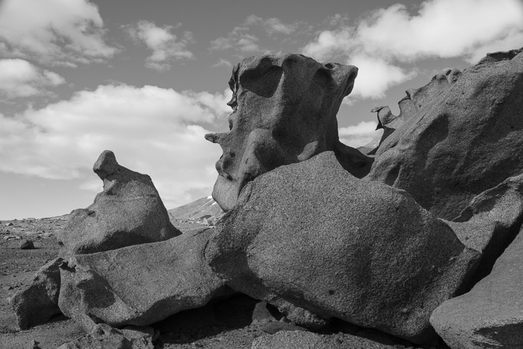
Both of the photos were taken in the McMurdo Dry Valleys when I spent a week there in December 2015. The photo above is of a ventifact field above Lake Bonney that I called the Surrealist Sculpture Garden (more about that here). The one below is a close-up of delicate ice designs that had formed over sediment atop the frozen surface of Lake Hoare (more photos here).
The surface of Lake Hoare near the field camp has an elaborate network of ablated ice structures. When the weather warms enough to melt them in December, they form intricate “drawings” in thin sheets of ice over the sediment that has blown there. This one reminded me of a skua, a gull-like bird seen along the Antarctic coast.
The a2dc (as they render their acronym) “was initiated to provide a centralized resource for scientists to submit, use, and discover polar data. The participating organizations provide the expertise and tools to support fellow polar researchers.” When I was in Antarctica, I met staff from two of the ten organizations, UNAVCO and the Polar Geospatial Center (PGC). Both organizations had offices in the Crary Science Labs at McMurdo, where their staff provided crucial mapping and geophysical data for the scientists. The PGC is based at the University of Minnesota and specializes in aerial views, assembling detailed maps from satellite photos of remote locations and have dozens of Antarctic maps online. UNAVCO works on the ground, doing GPS surveys, terrestrial laser scanning, and other kinds of measurements. An example is this two-year study which tracked the erosion of an ice cliff in the Dry Valleys and concluded that it was melting faster than anticipated due to climate change.
2017 Antarctic and Arctic Data Consortium Calendar
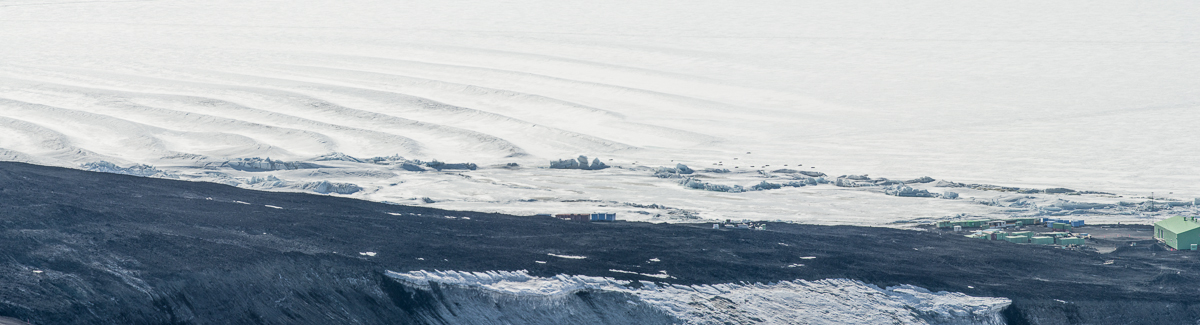
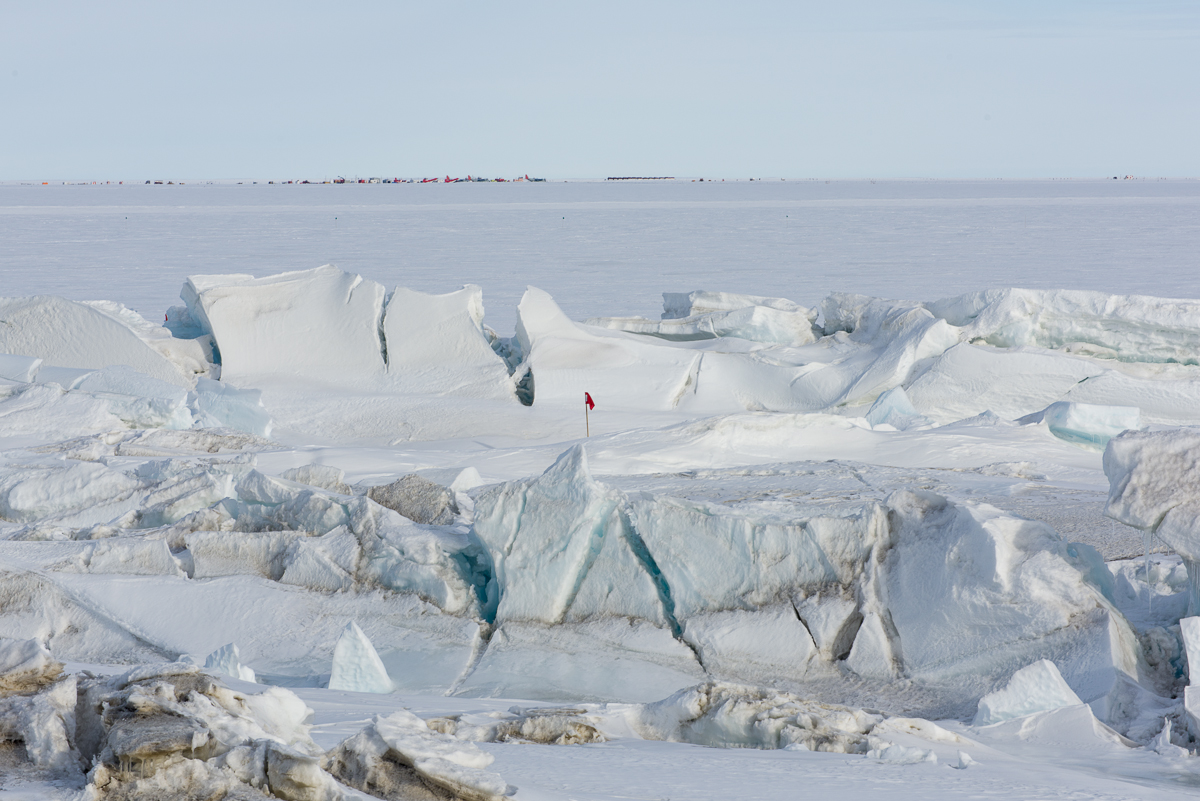
The Scott Base pressure ridges present an undulating landscape of unending variety. In the center of this photo is a melt pool.
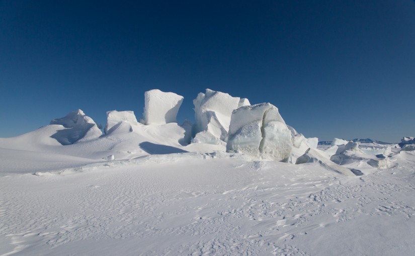
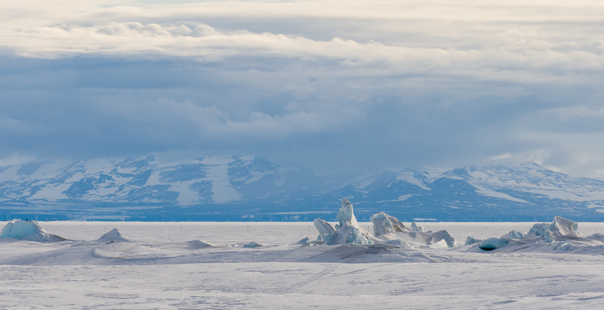
If you’ve been following this blog, you’ve been introduced to the pressure ridges near the Double Curtain Glacier, which is across McMurdo Sound from McMurdo Station in the New Harbor/Explorer’s Cove area of the Dry Valleys. During the seven weeks that I was based at the US Antarctic Program’s McMurdo Station, I also made two trips to visit the extraordinary pressure ridges at Scott Base, which neighbors McMurdo and is operated by New Zealand’s Antarctic program. If you’ve seen Anthony Powell’s excellent documentary film, Antarctica: A Year on the Ice, you may have noticed the Scott Base pressure ridges among the time-lapse photography sequences.
From the 754-foot-high summit of Observation Hill at McMurdo Station, you can see an aerial view of the Scott Base pressure ridges, including the undulations in the ice shelf that have helped form them. The little black dots on the ice a little left of center are Weddell seals. (Click on photo to see enlargement.) I also photographed the prominent formation in the center from the ground (next image) and made a 3D file of it (shown further down in this post):This formation is large enough to stand out even from the top of Observation Hill (see panoramic photo above). I also made a 3D file of it from 53 photographs taken while walking around it (scroll down further below).Scott Base pressure ridge with Scott Base in the background.
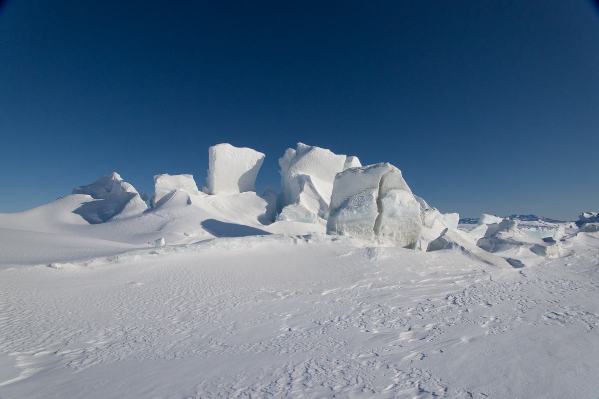
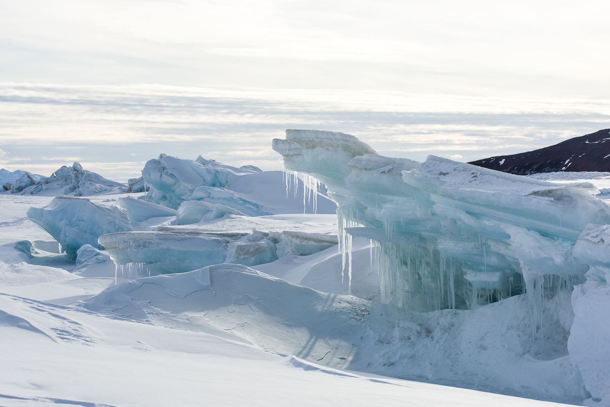
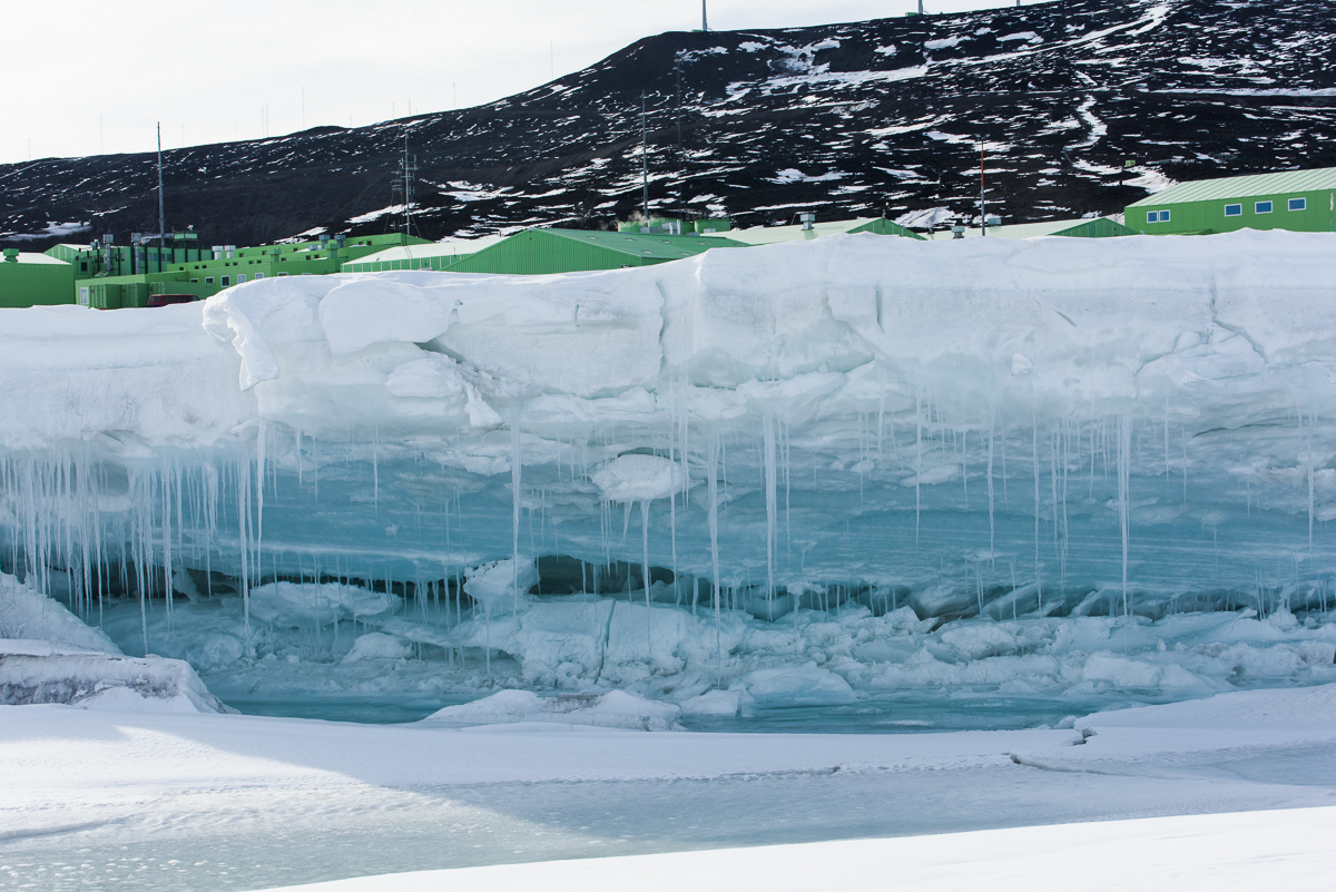
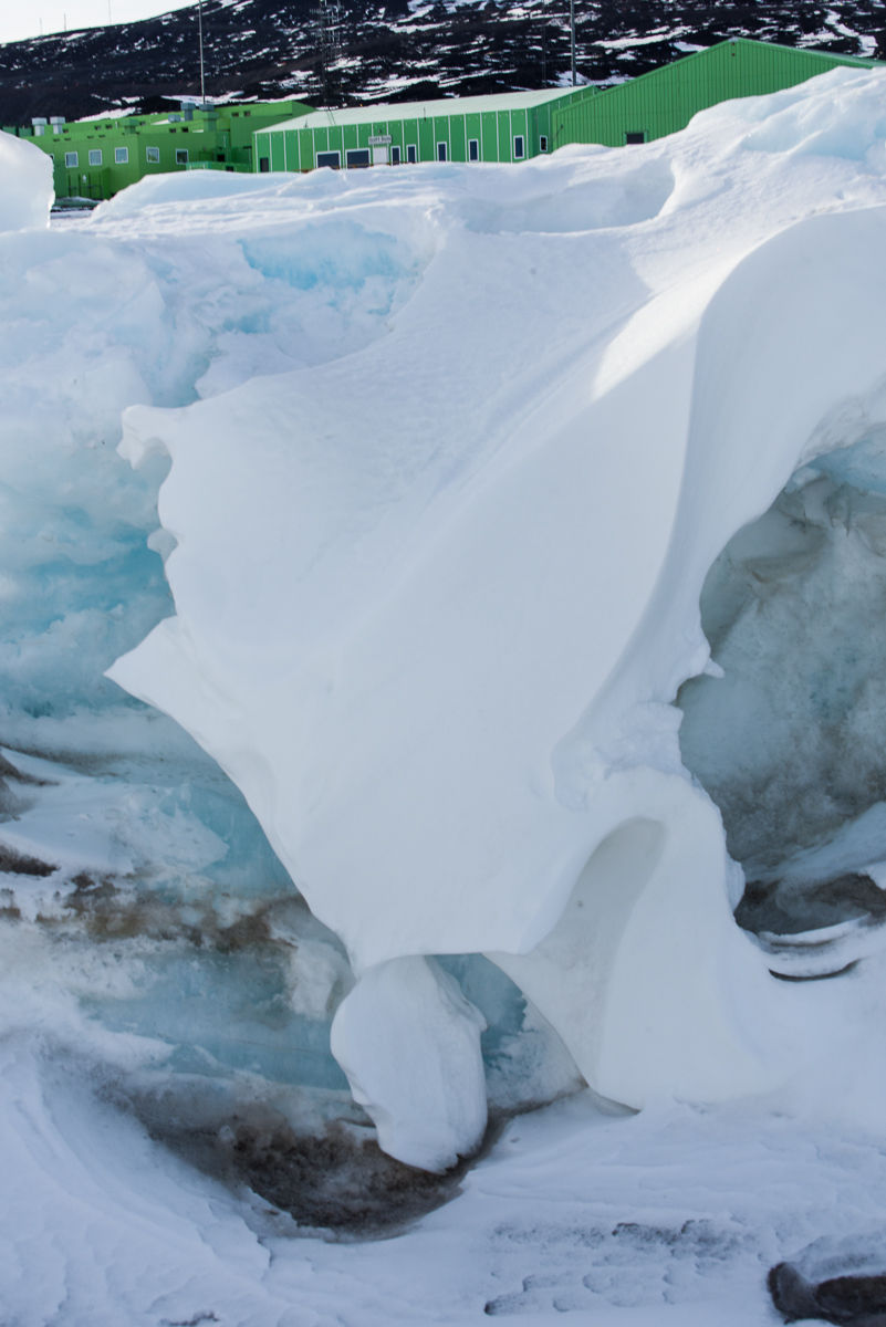
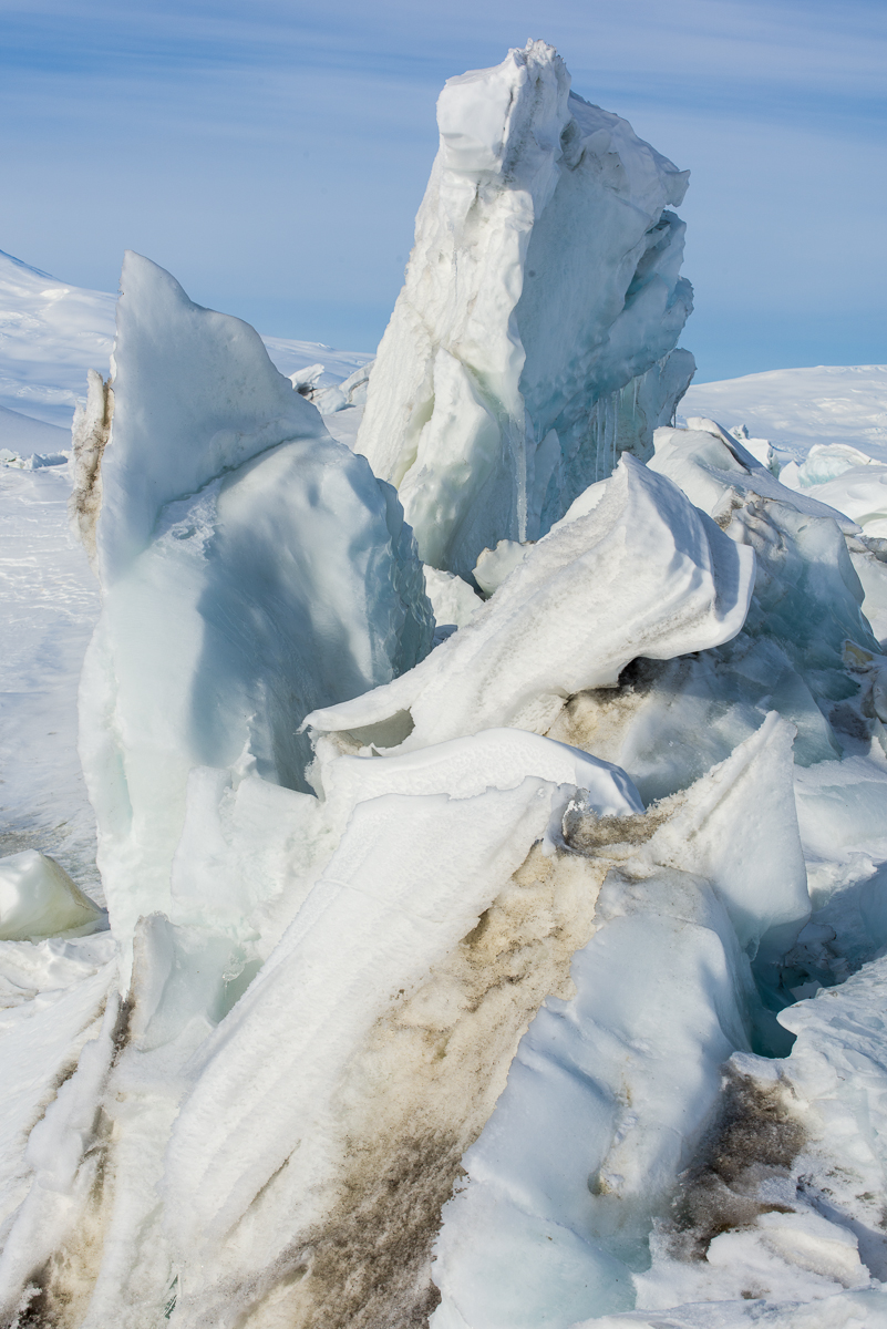
In Antarctica, the interaction of permanent thick ice shelf (that constantly floats atop the sea), sea ice (that is subject to melt cycles, and some years even melts to the point where it breaks up and floats out to the ocean) and the stationary rock of the coastline, can cause the ice near the shore to buckle and push up chunks into formations called pressure ridges. The pressure ridges are dynamic and constantly changing due to the action of the forces described above along with the 24-hour summer sun. Summertime temperatures at McMurdo when I was there mostly stayed in the 15 to 30 degree Fahrenheit range, and only a few times that I recall got into the upper 30s (and once a balmy 43 degrees — a few of the young guys took advantage of that heat wave to walk around in shorts!). But even in below-freezing air temperatures, when the sun beats down on the ice, it softens and sometimes melts. Then there are icicles, large chunks splitting off and falling, or gravity sometimes causes a chunk of snow to bend and flop over like a draped cloth.
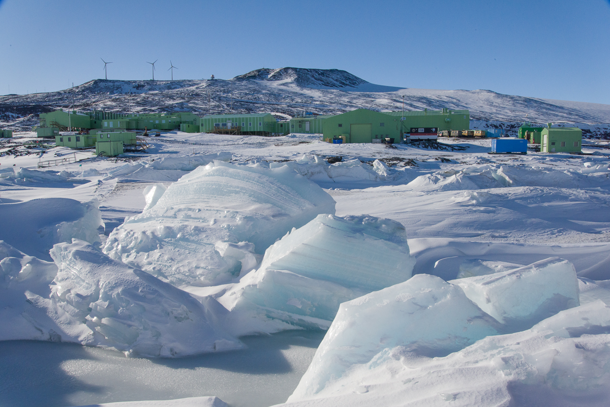
By November 30th, long icicles had formed beneath this this sheet of ice.The underside of this large chunk of ice was a deep blue and decorated with icicles. In the background are the green buildings of Scott Base.A thick mat of softened ice can bend like a draped cloth (lower right) and form graceful curved shapes.
Because of the ice shelf and sea ice dynamics, there are also cracks in the ice and melt pools on the surface that widen and deepen as the air warms (one of those was prominently featured in my post about Mt. Erebus). So there is a small window of time from November until mid-December when it is safe to walk out on the ice to get close to the pressure ridges. The McMurdo Recreation Department leads evening tours for the workers and others in residence there during that rare period. I went on two such trips, on November 24th and 30th. These photographs are, essentially, documentations of ephemeral formations: even though these photo sessions were only six days apart some of the ice had already changed in that brief time.
Another spot where the snow has drooped over like a towel on a rack (upper center).
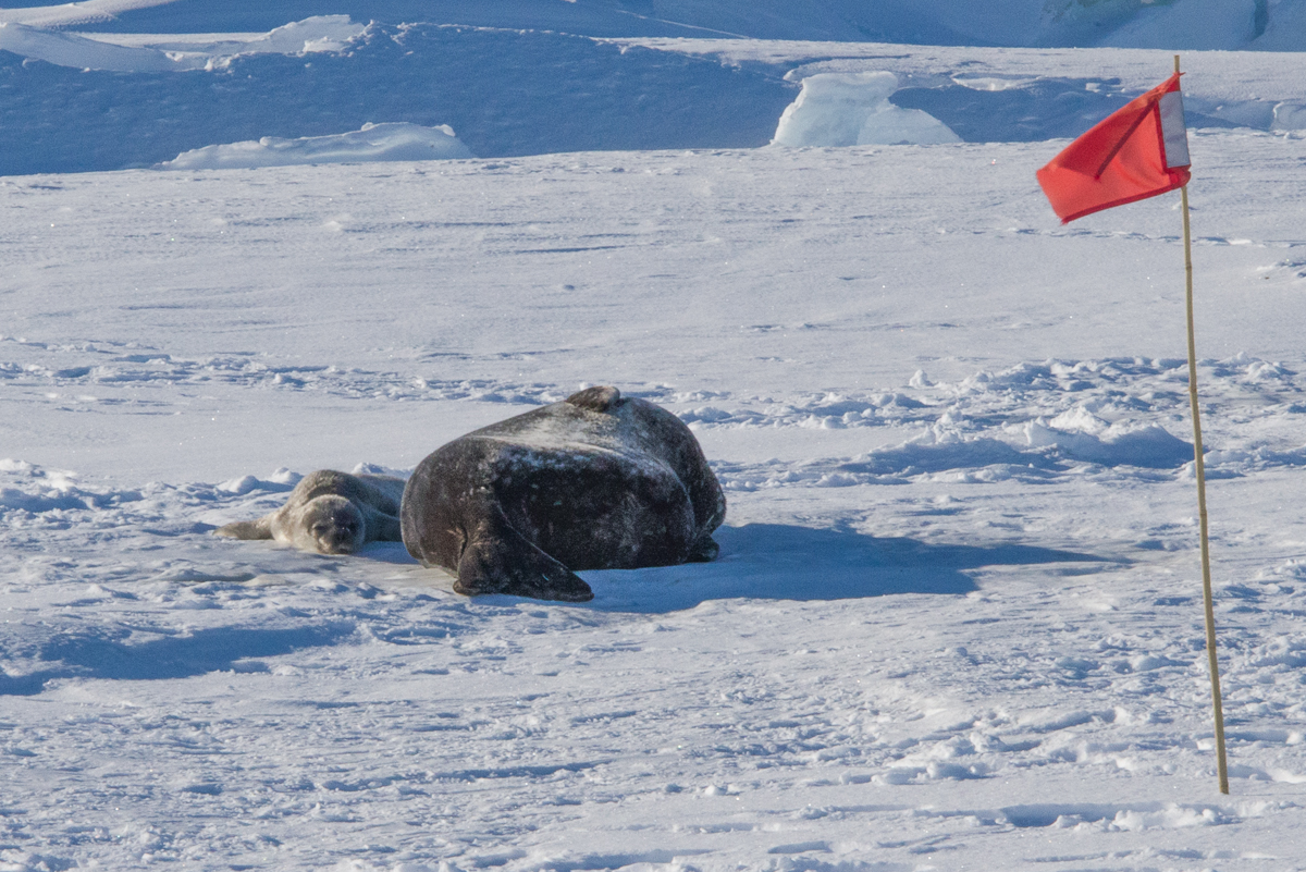
Where there is a nice-sized crack in the sea ice near the shore of McMurdo Sound or one of its islands, chances are you’ll find a group of Weddell seals laying out along it. Cracks give them a head start in chewing out a seal-sized hole in the ice where they can haul themselves out of the water for a break from non-stop swimming and foraging for food. I’ve never seen an animal that sleeps more soundly than a Weddell seal! They also give birth and nurse their pups on the ice. At least one of the Scott Base seals had a pup:
Baby Seal!: A Weddell seal and her pup chill out at the Scott Base pressure ridge.
From the shoreline, the ice formations are flatter and some have straight lines and more angular profiles:
Looking out from the Scott Base shoreline at angular pressure ridge formations. On the horizon is Willy Field, one of the airstrips that serves McMurdo and Scott Base. It’s probably about a 15- to 20-minute drive from that spot, i.e., not as close as it looks! It’s pretty much impossible to judge distances in Antarctica. You learn to not even try.Planar ice formations close up.
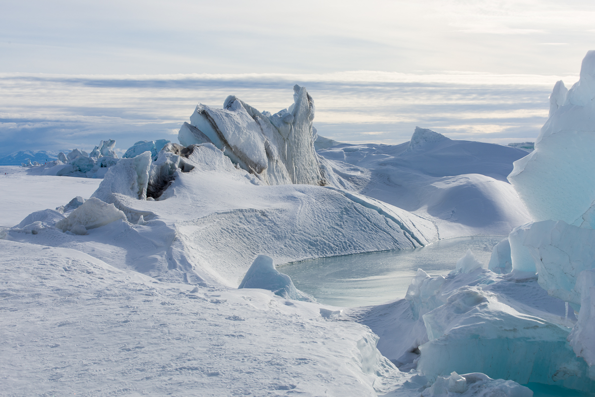
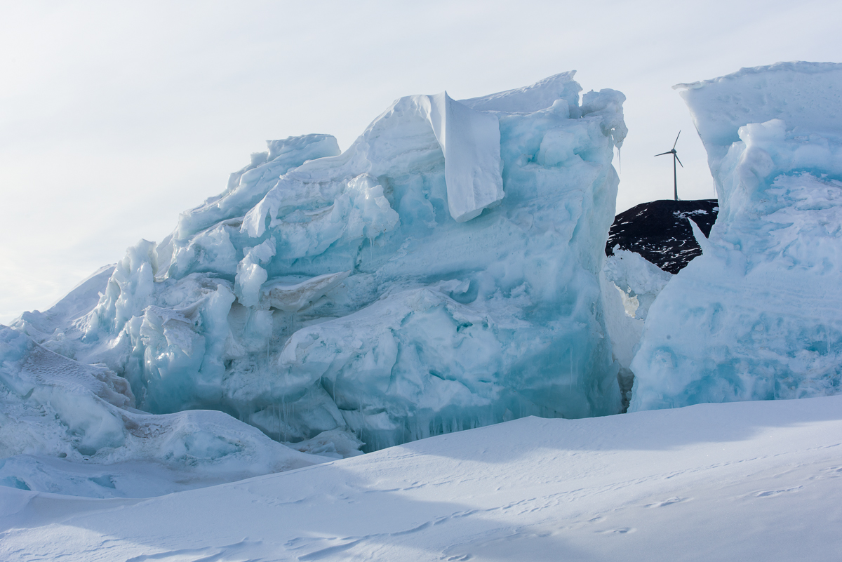
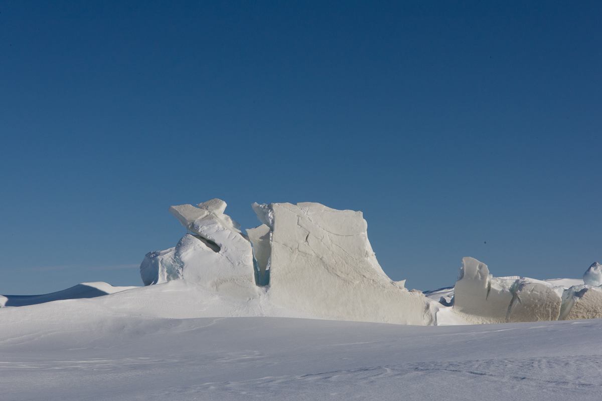
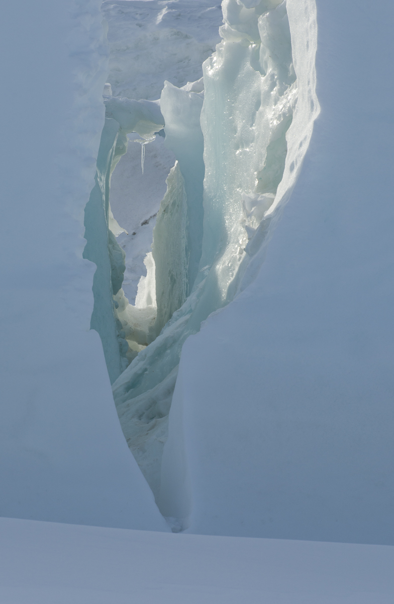
From other angles there were other formations to see, as in the two vertical photos below. I also did a few walk-arounds for photogrammetry captures. I’ve processed one of those files for a potential sculpture (horizontal image below those).
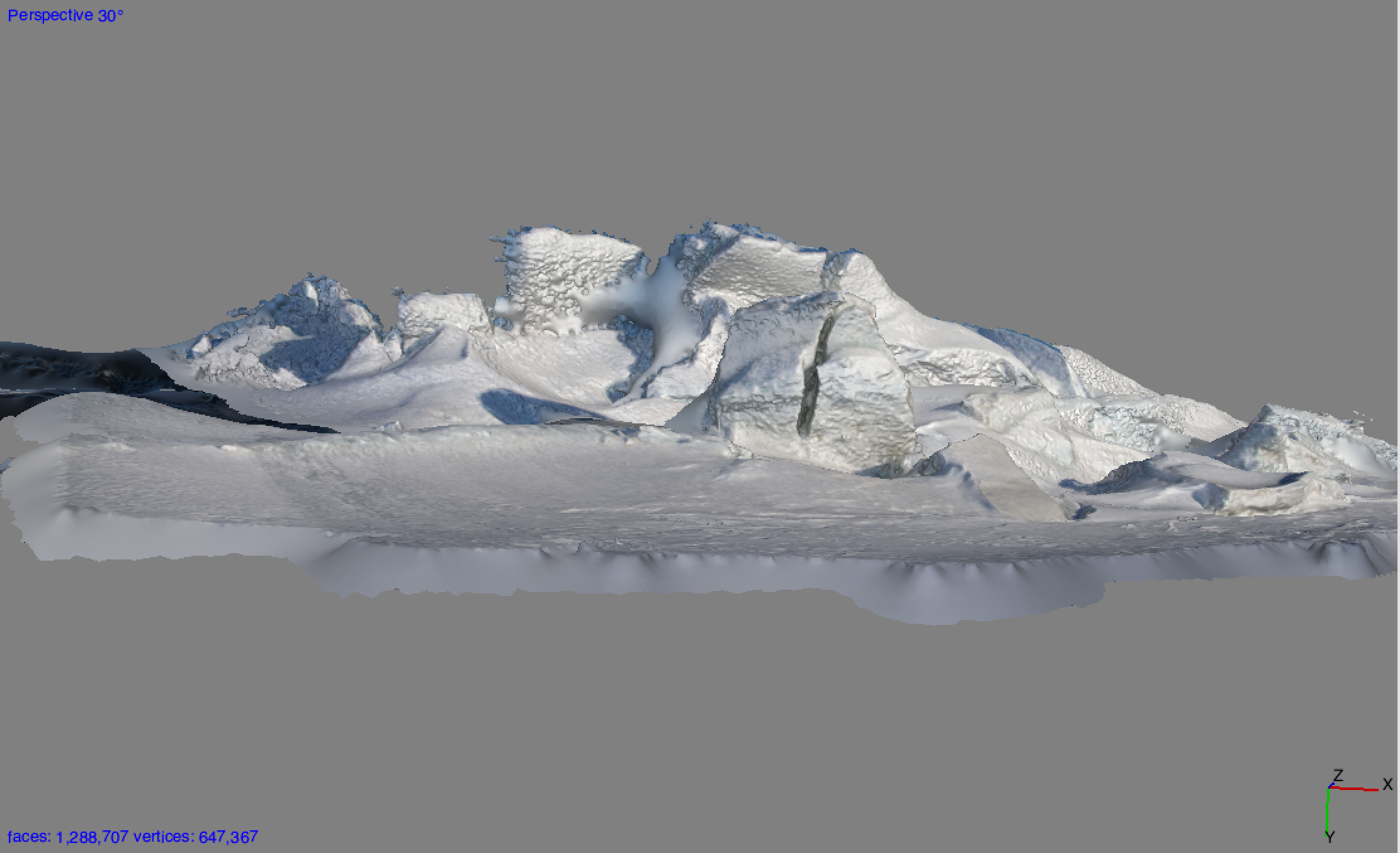
Peering through a crevice at the Scott Base pressure ridges results in a puzzling and ambiguous spatial reading.Another unexpected sculptural ice formation.A 3D file made from 53 photographs walking around a portion of the Scott Base pressure ridges. I need to edit out a few extraneous forms, but the capture came through mostly intact, with great detail and very few gaps.
At the end of this post is a photograph of another fascinating phenomenon we saw on the November 30th trip to Scott Base: a type of mirage called a fata morgana. It has nothing to do with pressure ridges, but it does have to do with looking across the wide flat expanse of the sea ice toward a distant shore. A young man in our group noticed it first. In a fata morgana, a strip at the bottom of the land seems to be stretched like Silly Putty. This one was subtle, but unmistakable. There are more dramatic examples online. Just search Google Images for “fata morgana Antarctica” or read this explanation.
Across the sea ice from the Scott Base pressure ridge there was a fata morgana effect that made the bottom strip of the Transantarctic Mountains across McMurdo Sound appear to be stretched into a horizontal band at the bottom. Fata morganas appear in Antarctica when a band of air just above the sea ice is a different temperature than the air above it, causing a temperature inversion and distorted reflection at the horizon. Fun fact: the name comes from the Italian for Morgan Le Fay, half-sister of King Arthur.
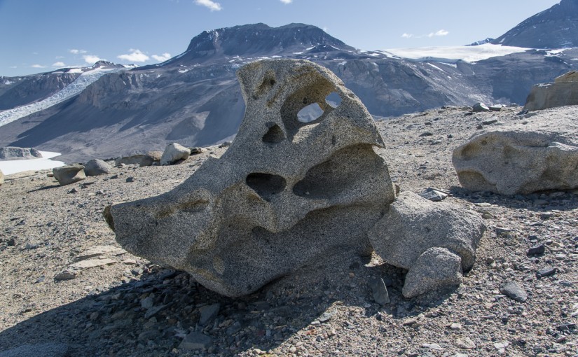
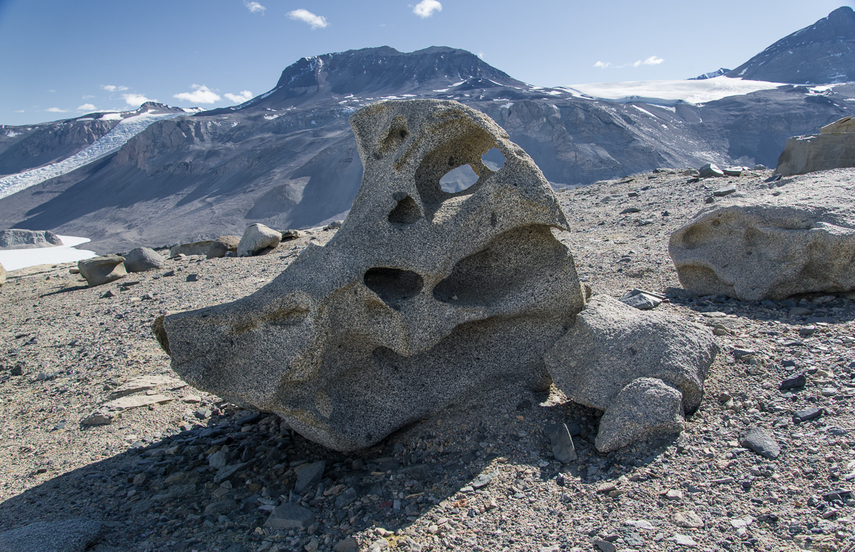
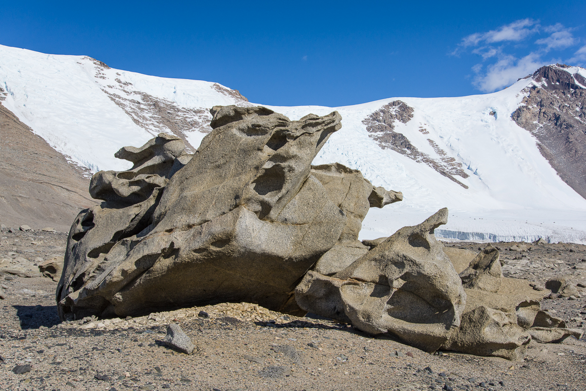
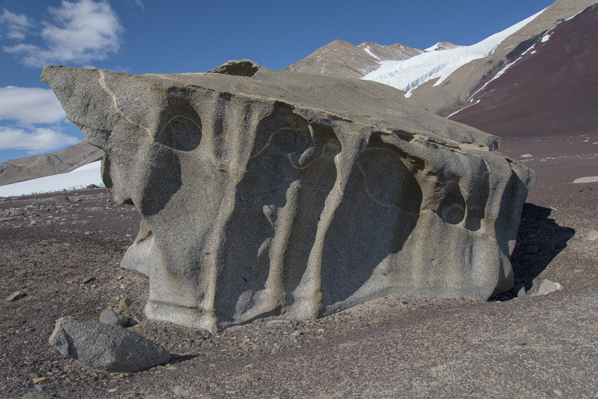
It’s a bird?: Granite boulders at the top of the ridge above Lake Bonney have been sculpted into strange shapes. From this angle, this one reminds me of a cartoon bird (beak on right).
On Dec. 17th, with Forrest McCarthy as my guide, I hiked up some steep gravel inclines in the Antarctic Dry Valleys above Lake Bonney to elevated ridges and plateaus to see the ventifacts. These are large granite boulders that have been pummeled by fierce winds picking up grains of gravel — imagine a giant sandblaster over millenia.
There are modestly-sized ventifacts at Cape Royds, carved from the black volcanic stone that dominates the landscape.
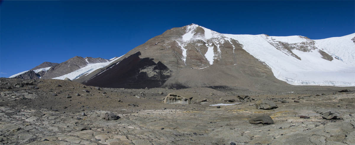
I saw smaller ventifacts at Cape Royds. Those were volcanic stone hollowed out into curved shapes, sometimes pierced with holes and generally in the one- to three-cubic-feet range, and mostly on the smaller side of that range. But nothing prepared me for the ventifacts of the Dry Valleys. It was a steady climb for some time and then we came over a ridge where the ground was strewn with huge granite boulders curved, hollowed and pierced into strange shapes. I felt like I’d entered the world’s largest Surrealist sculpture garden.
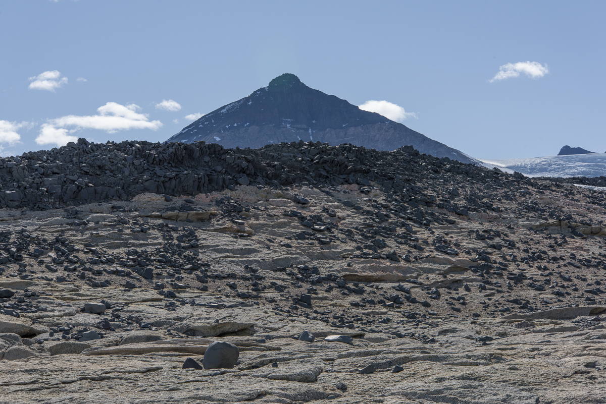
Surrealist sculpture garden: boulder-sized ventifacts are strewn across a rocky plateau. In the distance is a mountain with a huge expanse of deep black and dark red stone.Facing the opposite direction from the above photo, you see the ventifact field in the foreground, with the white expanse of one of the lobes of Lake Bonney below (the white line in the center is the part of the lake that connects them and you can see a sliver of the other lobe, blocked by the hill in the middle). There’s also the Rhone Glacier on the right, and beyond that, the huge Taylor Glacier, The Friis Hills, with their striking large horizontal stripes of contrasting shades of brown, rise above the Taylor.
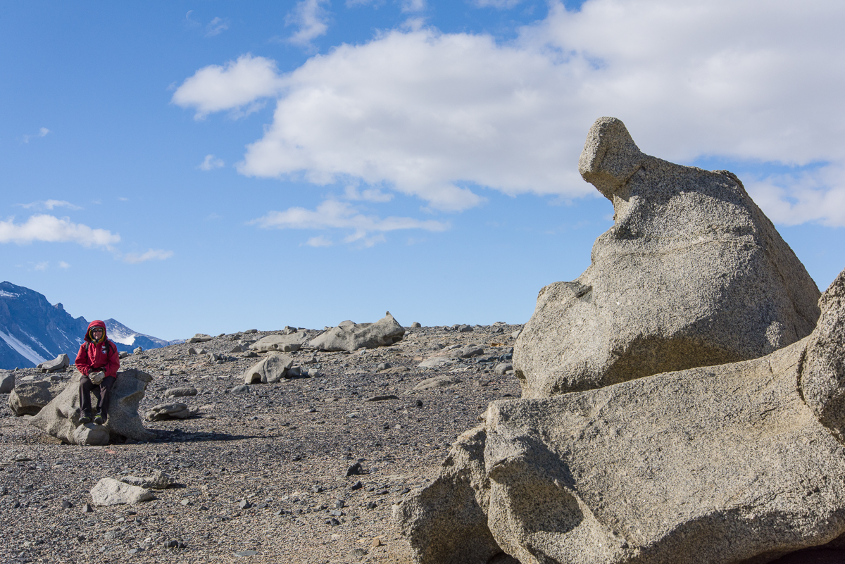
Many of these forms made me think of 20th-century Modernist art. This is kind of like an Arshile Gorky abstraction come of life. Or maybe Yves Tanguy.
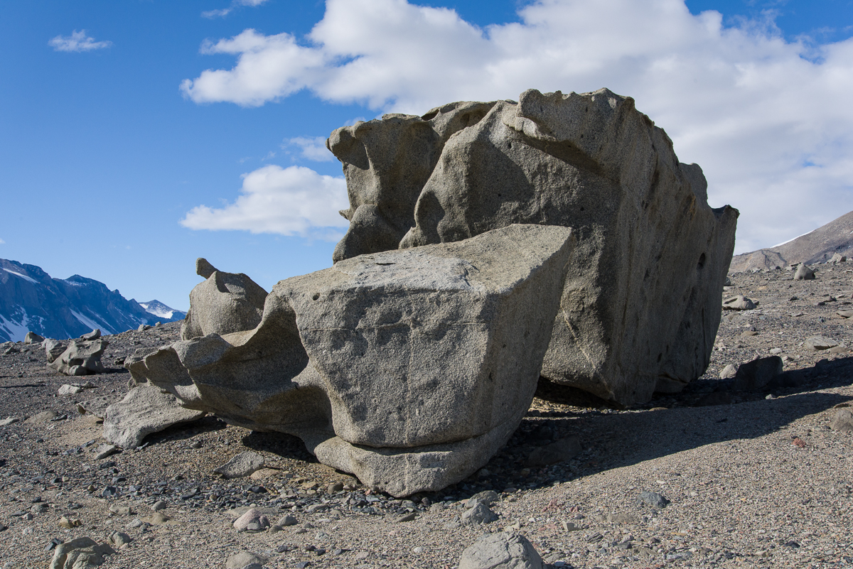
The ventifacts obey a cardinal rule of good sculpture — that it should present different forms as you walk around it. Believe it or not, these are two different views of the same ventifact:
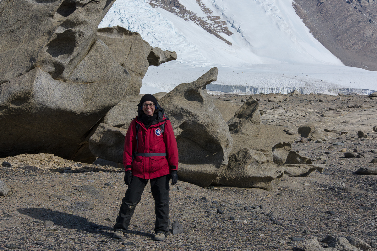
One side of a ventifact grouping……around the other side it looks completely different.Seated figures, real and abstracted: Forrest waits for me to walk around the ventifact making photos for the 3D file creation process. You can get an idea of the scale from this photo.Here it is again. Some of the carved forms are surprisingly thin and articulated.
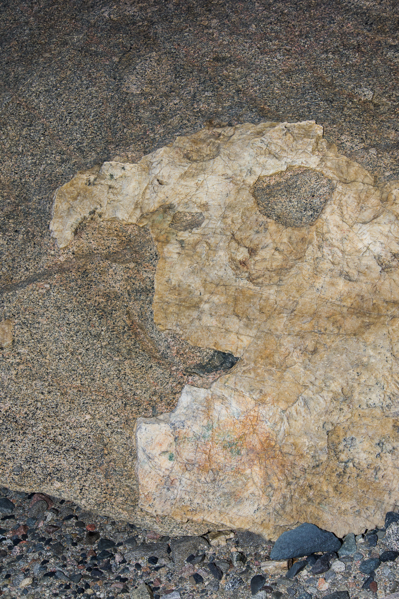
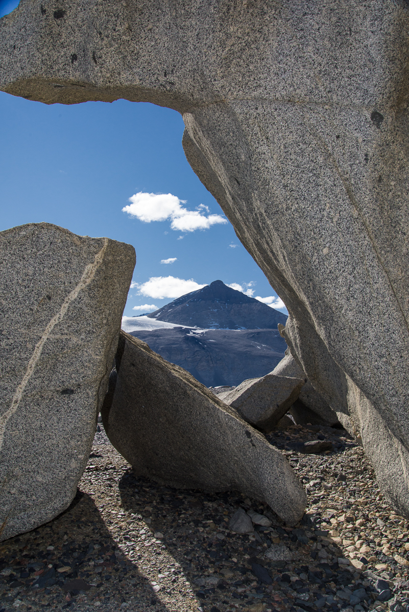
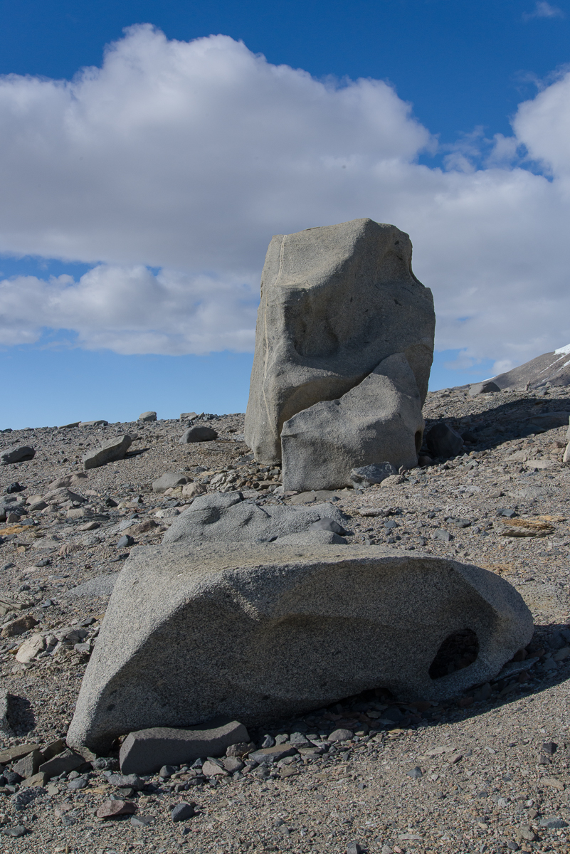
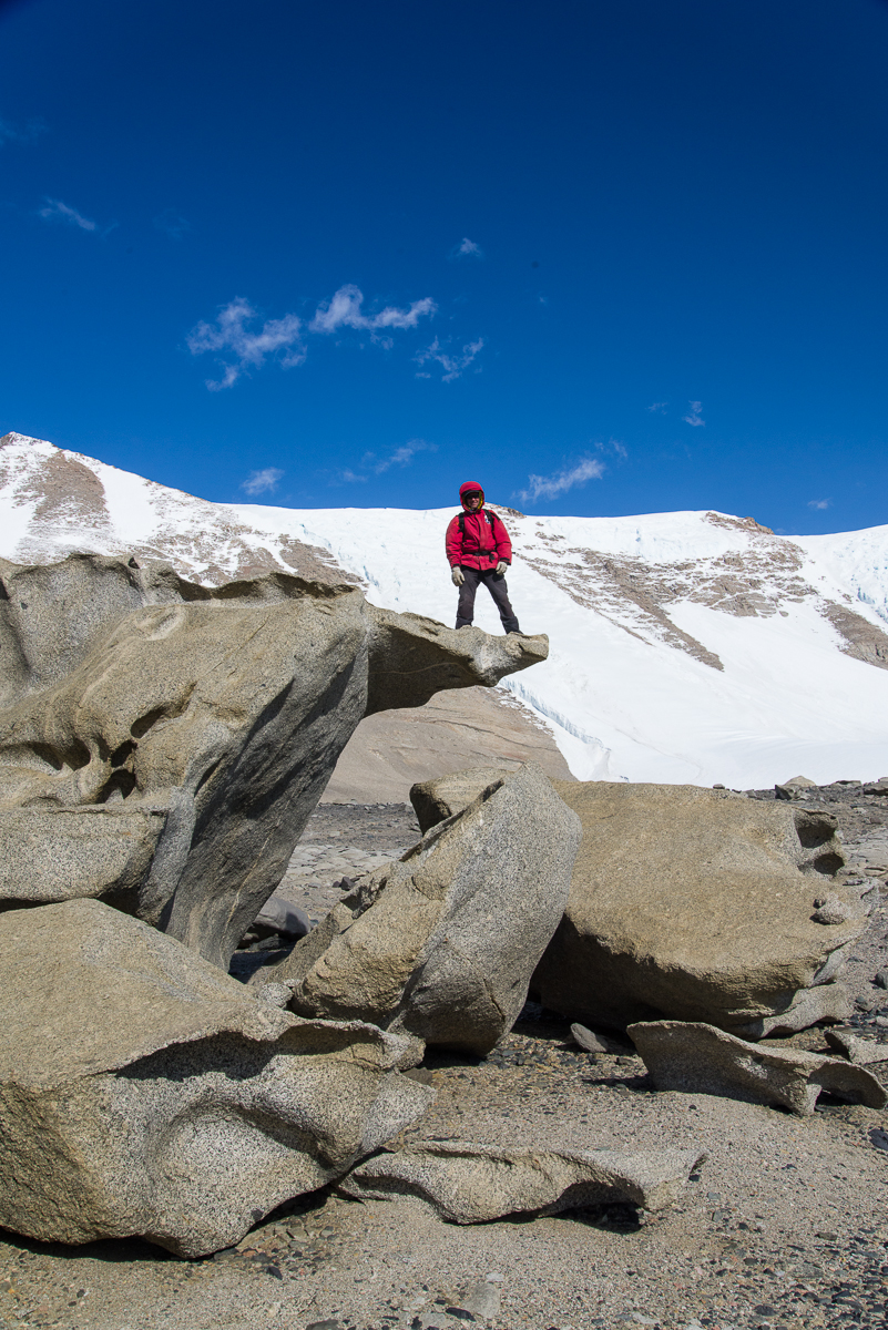
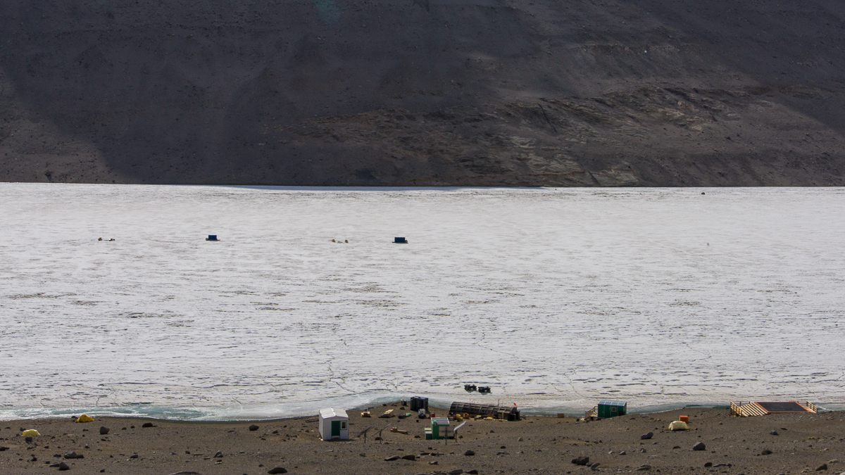
This one looks like rippled cloth with a line of a contrasting color running through it.This is the only one I saw with a large shape of a different stone mixed in.This one frames a vista of a mountain on the opposite side of Lake Bonney known as The Matterhorn.The tall one reminded us of a monolith.Forrest climbed up on the “diving board.”Stone wall: Black rocks piled on a ridge appear to be made of the same stone coloring the side of the mountain shown in one of the above photos. That’s the Matterhorn in the distance.Me among the ventifacts.Follow the yellow brick road: On our descent we saw a vein of yellow-orange rocks that stretched across the hillside in a fairly straight line.The Antarctic landscape makes you aware of how small you are in the scheme of things. It’s also really hard to judge distances. You walk and walk, and wonder why you aren’t there yet. Where this photo was taken we had about another 10 minutes of walking downhill to get to the camp. The second yellow tent from the left, closest to the lake edge, is mine. The main hut is in the middle near the shore, and the helo pad is on the right.