The Suess Glacier and the Silver Lining

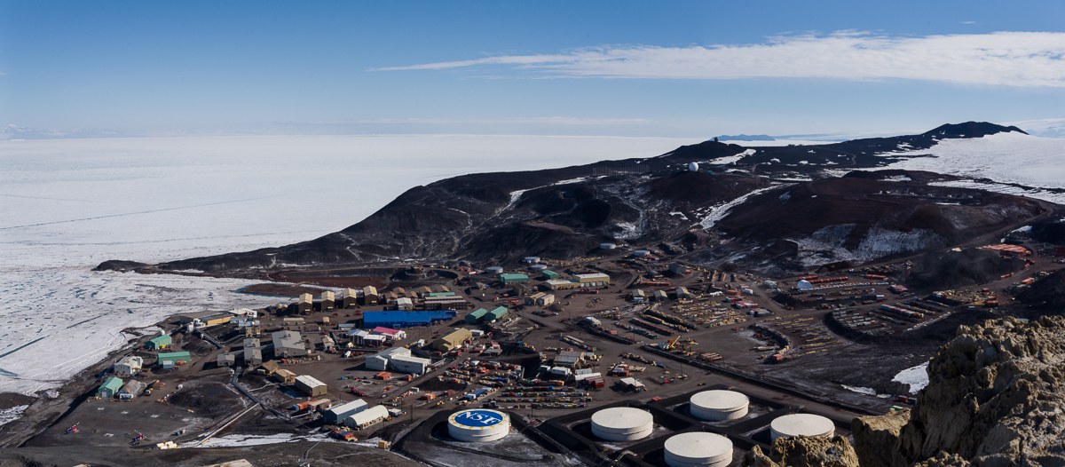
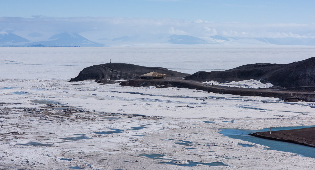
The Lake Hoare field camp in the McMurdo Dry Valleys, where I spent five days, sits at the east end of the lake right next to the immense Canada Glacier. At the opposite end of the lake is the smaller Suess Glacier. When I first heard the name, it would not have surprised me if a glacier in Antarctica had been named for the children’s book author Dr. Seuss, given the odd landscape features that resemble some of his fanciful illustrations. But no, the 1910-13 British Antarctic expedition led by Robert F. Scott named it for Professor Eduard Suess (1831-1914), a prominent Austrian geologist and paleontologist who helped lay the basis for paleogeography and tectonics.

Lake Hoare looking toward Suess Glacier
View up Lake Hoare from the field camp. The tiny inverted white triangle at the end is the Suess Glacier.

One day I hiked there accompanied by Mari, a young woman who normally worked at McMurdo in the field camp supply center, but was spending a couple of weeks at the Lake Hoare camp assisting camp manager Rae during a particularly busy period of the research season. There are many people in their twenties who work 10-hour shifts, six days a week at McMurdo during the austral summer as dining hall workers, supply staff, janitors, cargo loaders, etc., but their opportunities to travel beyond the base are limited. So Mari was thrilled to be in the Dry Valleys and enthusiastic about hiking to the Suess. We followed a path of sorts that had evolved from the walks of other researchers, which wound around the perimeter of the rocky north shore of the lake (on the right in the photo above).

Mummified seal near Suess Glacier
As we approached the Suess Glacier, we came upon a mummified seal.

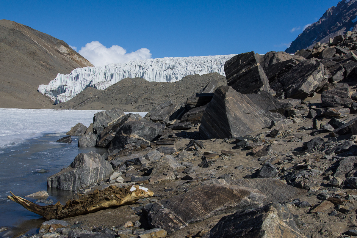
After about an hour, we came across a mummified seal. Positioned on its belly rather than laying on its side made it look curiously animated, as if it was in the process of clambering out of the water. The mummified seals strewn throughout the Dry Valleys are an enduring mystery, and one I plan to write more about in a future blog post. Suffice to say, the icy climate and lack of organisms to break down dead animals keeps them in a state of preservation such that it’s difficult to know if that seal has been there a few years or a few hundred.

Gravel hill near Suess Glacier and Lake Hoare
Mari scouts the best path around a large hill of gravel.

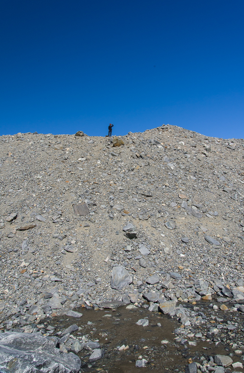
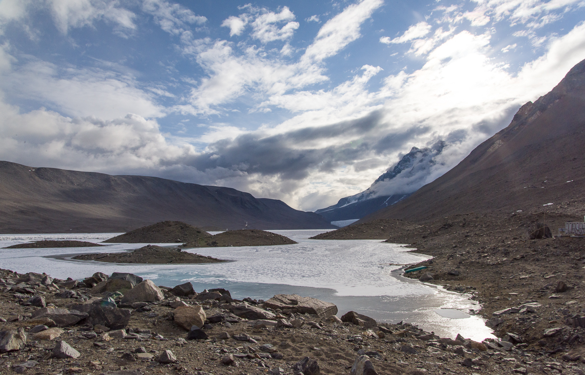
As we continued following the lake’s shoreline, we soon reached a very tall gravel hill that blocked our view of the glacier. Mari climbed to the top to scout the best route around it (remarkably quickly, too — it’s hard to get a footing on steep, loose gravel). As you can see in the photo at left, a stream of water was running downhill off the glacier into the lake. Mari had determined there was no shortcut to the glacier from where we were so we continued around the lake side of the hill.


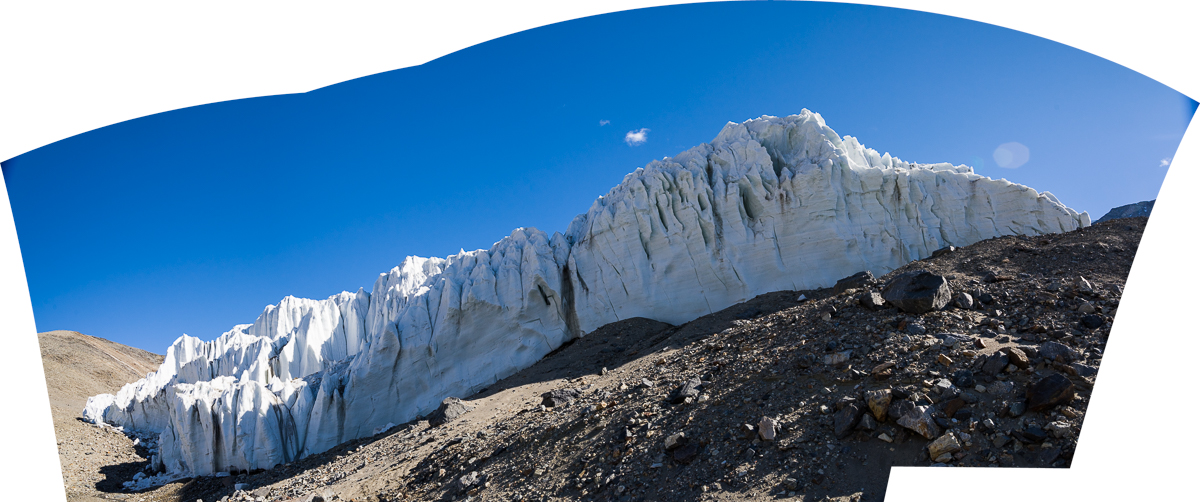
From the Lake Hoare side, the Suess glacier is not nearly as impressive as the Canada Glacier in size or height. This panorama made from three negatives is pretty much what you see as you approach from the lake:

Suess Glacier from Lake Hoare
Panorama of the Suess Glacier from the end of Lake Hoare. The glacier flows downhill from the right and comes to rest against the steep gravel hill on the left.

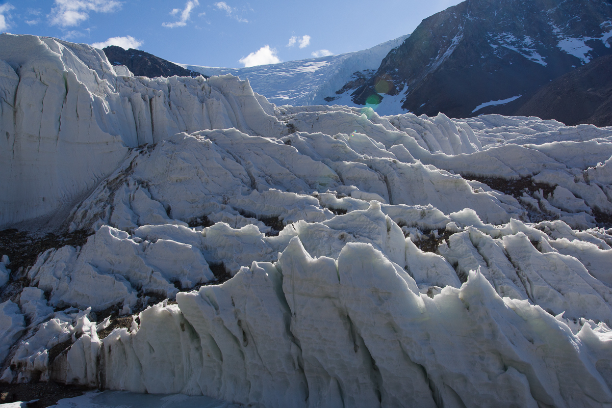
Walk around to the left of it and you can look uphill to see it flowing from the crest of the hill on the right:

Suess Glacier
The Suess Glacier, looking uphill to where it begins.


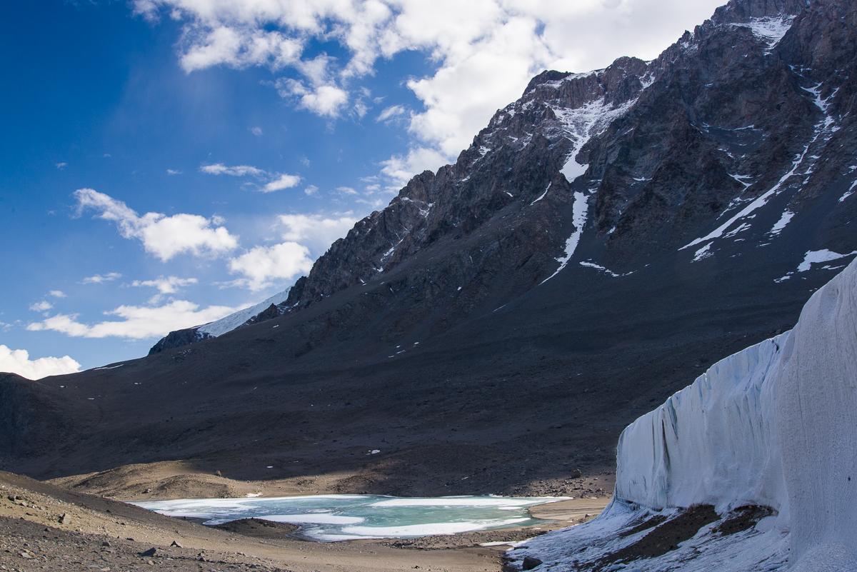
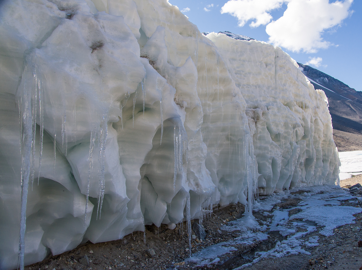
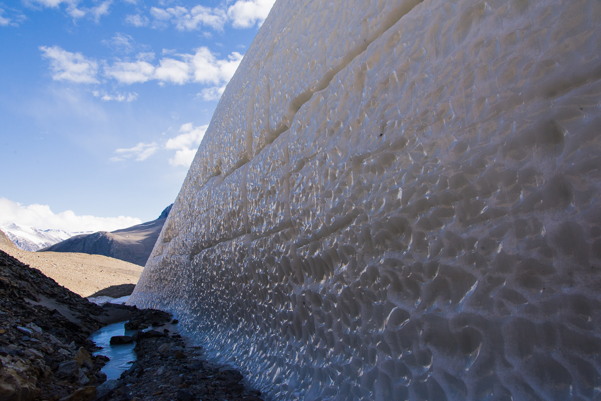
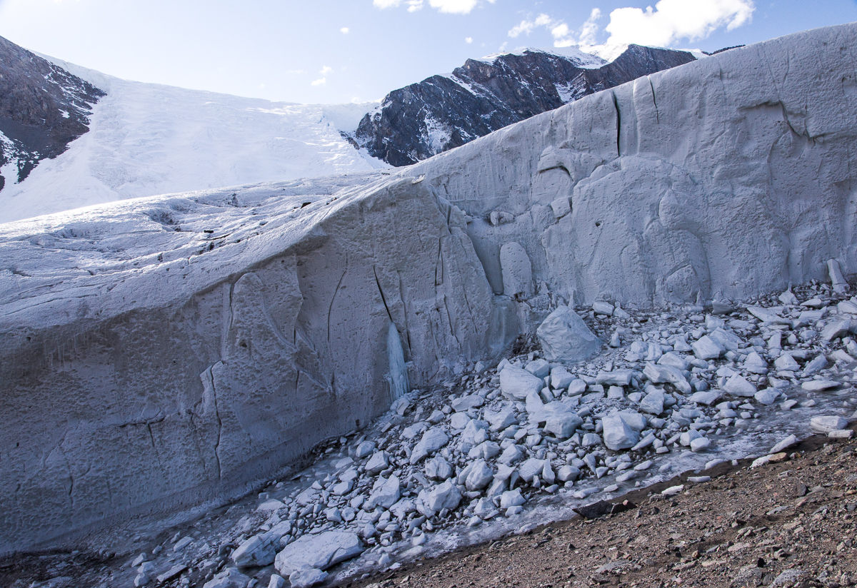
But the really good stuff was just around the corner. The Suess flows down one steep hill and comes to rest where another steep hill meets it, forming a narrow passage called a defile. Once you enter the defile, you encounter another side of the Suess, a towering wall of glistening scalloped ice. It glowed with a peachy color reflected off the gravel hill:

Suess Glacier, defile
At the beginning of the defile, looking back toward Lake Hoare, the Suess turns into a wall of wind-scalloped ice and icicles.
Griffith Taylor's sketch of "The Compleat Explorer."
Griffith Taylor’s sketch of “The Compleat Explorer” was made on February 8, 1911, in the midst of exploring the valley that came to be named after him.

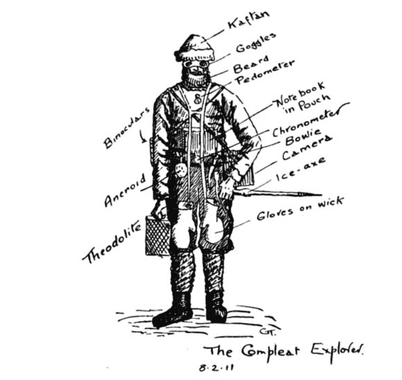
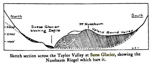
One of Scott’s party in the 1910-13 expedition, the geologist Griffith Taylor, described the discovery of the Suess in his 1916 book With Scott: The Silver Lining (you can find the section referred to here on Google Books). The title implies a motivation to spotlight the expedition’s accomplishments and successes, which had been to some degree overshadowed by its sad ending, when Scott and four of his men died on their way back from the South Pole. The following year, World War I broke out and was still raging when the book was published. As the book’s editor, Leonard Huxley, put it in the Introduction, “It is for Mr. Griffith Taylor to tell of the daily life of that company from within, to tell in careless detail its lighthearted cheerfulness lining solid effort, which the cloud of English earnestness so constantly turns out upon the night.” The section on the journey through what is now known as the Taylor Valley exudes the joy of discovery and is illustrated with Taylor’s charming drawings, including a humorous depiction of “The Compleat Explorer” wearing the state-of-the-art cold weather gear for 1911. (This includes “Beard,” which continues to be a popular male accessory in Antarctica. Once somebody said, “You know who I mean? The tall guy with the beard,” and the rest of us started laughing since that did not narrow it down at all.) At any rate, I’m guessing the Dry Valleys were associated with particularly fond memories for Taylor, because along the way Scott informed him he was naming the magnificent Taylor Glacier after him! Taylor’s book also includes his sketch of the Suess:

Suess Glacier by Griffith Taylor
Sketch of the Suess Glacier by Griffith Taylor, made in 1911 when he explored the area with Robert F. Scott.

Taylor and company approached the Suess from the west, i.e. the opposite direction we took. His description remains apt today: “a face of ice forty feet high; but just where it butted into the steep south slope of the defile, there was a narrow gap where thaw-ice had filled in the interspaces between the cliff debris.” Mari and I put on crampons (velcro sandals with spikes on the soles) over our boots to walk on the icy passage where it narrowed to the width of a typical sidewalk.

We walked alongside a wall of ice with such hard, polished surfaces that it looked like it had been cast from a mold:

Suess Glacier, defile
The side of the Suess Glacier bordering the defile is very different in appearance from any other glacier I saw: an icy, dimpled wall. Maybe it has to do with facing the defile, where it gets little sun and the wind is funneled through the narrow gap.

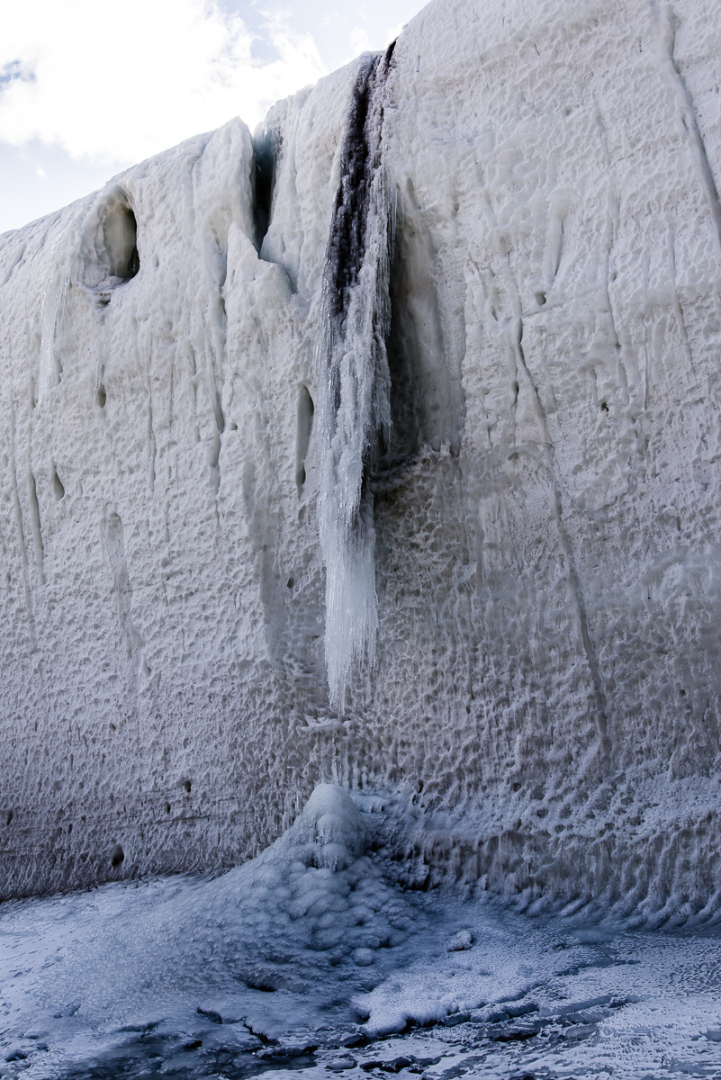
We also encountered the most impressive frozen waterfall I saw anywhere in Antarctica:

Frozen waterfall, Suess Glacier
Freezing the action: a frozen waterfall of ice and sediment was an impressive sight.
Frozen waterfall, Suess Glacier
The other side of the frozen waterfall along the defile.

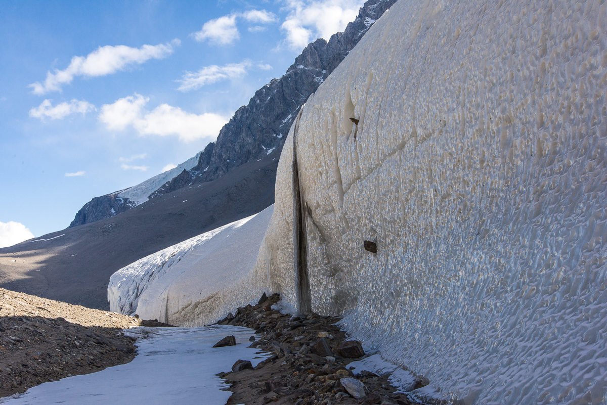
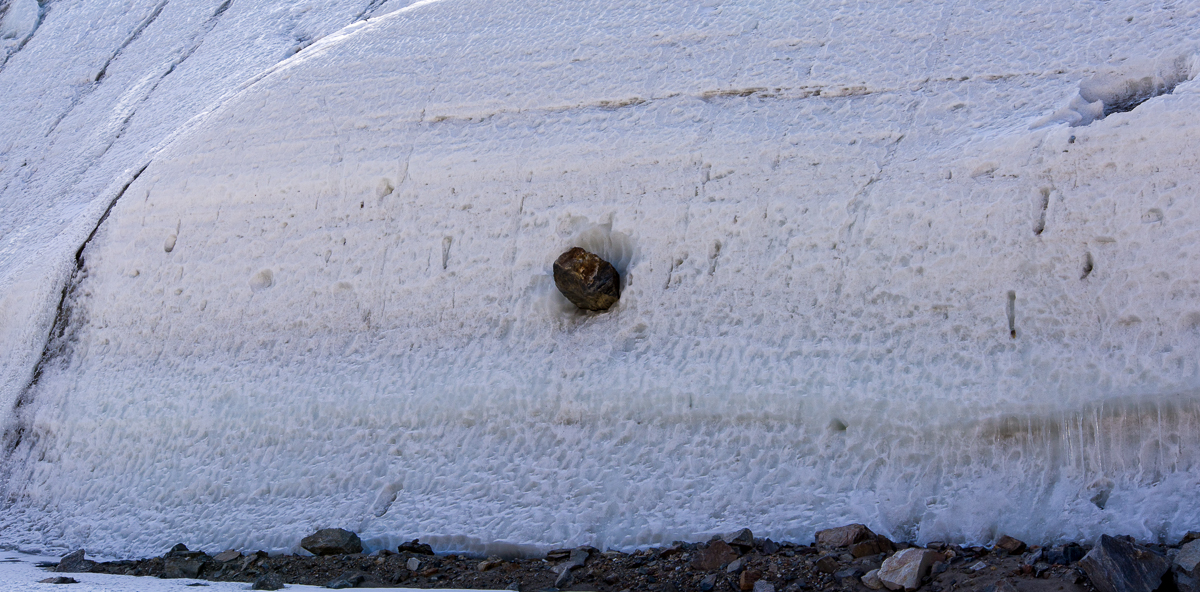
I was fascinated by the large rocks protruding from the icy wall that had apparently been swept up by the slow-moving glacier long ago. You see a couple of them in the photos of the waterfall above. The one below had to weigh several hundred pounds, and yet was somehow securely frozen in place in its icy niche:

Rock embedded in Suess Glacier
That’s a big rock! And it looks like it’s not going anywhere anytime soon.

Toward the end of the defile, where the narrow space opened up and the glacier height tapered off, another frozen waterfall had formed an ice stalactite and stalagmite:

Frozen waterfall, Suess Glacier
A smaller frozen waterfall gives an idea how the larger one probably looked before it connected into a column.

Once out of the defile, the Suess presents yet another aspect, a frieze of rounded shapes:

Suess Glacier looking north
The icy dimpled surface gives way to a frieze of smoother, rounded shapes.

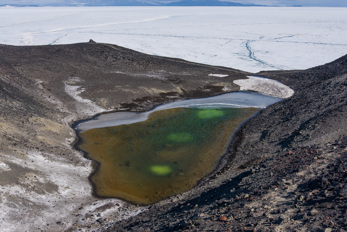
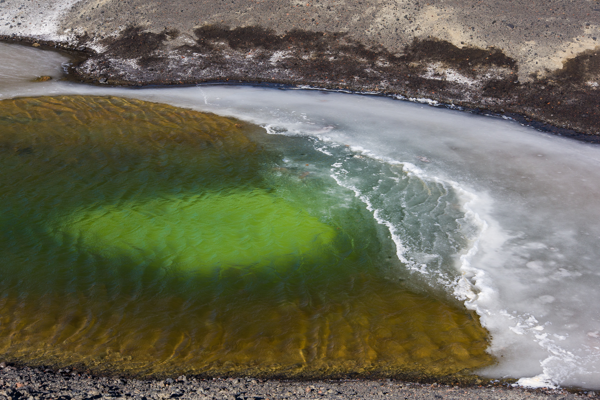
We reached the end of the defile, and looked down at the small blue lake on the other side (below). It was 5 p.m., we’d been out for four hours and decided to go back to the camp, figuring we’d be there in 90 minutes, just time for dinner. That was the time we decided to take a direct route back across the lake ice which turned out to be, ah, no shortcut at all for us lake ice rookies. If you haven’t read that story, you can find it here. Long story short, we made it back, albeit almost three hours later with wet socks. It was unnerving while we were in the middle of it, but funny once it was over: silver lining!

Suess Glacier and lake.
The west side of the Suess Glacier faces a small lake.


Walking McMurdo, from Ridge to Ridge

Our Lady of the Snows Shrine
The Our Lady of the Snows shrine is one of the many memorials atop hills along McMurdo Sound to men who lost their lives in Antarctica. This view of the statue is framed by Observation Hill in the background.

It was late in my stay at McMurdo when I finally got around to walking the hiking trails at two places I could see every time I walked out of my dormitory: Hut Point and Observation Hill — Ob Hill as the McMurdites call it. These photos were taken on two different days. When I arrived in November, the Ob Hill loop trail that circles it about one-third the way up was open, but the trail to the steep summit was closed due to ice. On December 29, six days before I left, I took advantage of a mild day (i.e. it was 20 degrees F with no wind — that counts as mild at McMurdo) and walked up to the top of Ob Hill, which has an elevation of about 750 feet. There it is on the right in the photo below.

McMurdo Station, Antarctica, vista
Panorama of McMurdo from the Hut Point ridge, with Observation Hill on the right.


It took 15 minutes to walk to the Ob Hill loop from my dormitory (I lived in one of the four identical brown buildings near the large blue building that you can see in the photos above and below; click any photo to see an enlargement). It took 20 more minutes to get to the summit on a progressively narrower trail that is very steep with a lot of loose, gravelly volcanic rock surrounded by larger volcanic rocks. If you see the shaded ridge up the center of the hill in the photo above, that’s pretty much the line of the trail. The further up you climb, the steeper it gets. I had flashes of mental images of myself skidding off it and bouncing off rocks on the way down like a playground ball, so I tread carefully, pausing frequently to make sure I was on the best path, and reassuring myself periodically, “You’ve got this.” A few days earlier the annual Ob Hill Uphill, a competitive race to the top, had taken place. Hopefully, the racers spread out before they got to the upper part, because I cannot imagine how you’d pass someone on that trail. No, I don’t have that need for speed. But hey, I’ve got this. I made it to the top without a mishap. There, wedged between two rocks, I found a new black water bottle with a McMurdo emblem that sold in the station store for $30 (left from the race?). As my good deed of the day, I brought it down and handed it in to the Recreation Office. If that was your bottle, you’re welcome!

From the summit, you have an excellent view that encompasses McMurdo, New Zealand’s Scott Base, the golfball-shaped observatories, the Dellbridge Islands and Mount Erebus.

McMurdo Station from Observation Hill
Looking down at McMurdo from the opposite direction, standing on the Observation Hill summit, with Hut Point on the left.
Scott Base from Observation Hill
The green buildings of Scott Base from Observation Hill. Beside the base are the Scott Base pressure ridges. The black dots are Weddell seals.
View from Observation Hill
Beyond the hills topped with “golf balls,” one of the Dellbridge Islands is silhouetted against the sea ice.


Memorial cross atop Observation Hill
The wooden cross atop Observation Hill.

At the top of Observation Hill is a nine-foot wooden cross, built in 1913 and hauled there by sledge by the crew of the Terra Nova, the ship that carried British explorer Robert F. Scott and his party to Antarctica for their attempt to become the first to reach the South Pole. Scott and four men reached the pole in January 1912, only to find that Norwegian Roald Amundsen had beat them to the record by five weeks. All five of them died in March on the return trip. Their tent, containing their bodies and belongings, was discovered by a search party eight months later, including Scott’s last diary, where he recorded their final days and ended his last entry, “For God’s sake look after our people.” The sad story is summarized here.

McMurdo Hut Pt 2015-1226-18
George Vince’s cross at Hut Point memorializes another unfortunate explorer from the early Antarctic expeditions.

The other place to take in a view of McMurdo is from Hut Point, so named for the historic Discovery Hut that sits at the end of it, which was built in 1902 for Scott’s first Antarctic expedition, in 1903-07 and used by subsequent exhibitions until 1917. Below is the view of Hut Point from the back door of my dormitory. You can see the hut and another melancholy monument, this one dedicated to George Vince, a member of Scott’s party who died in an accident in 1904, when he fell off the cliffs into the McMurdo Sound while trying to make his way back to the hut during a blizzard.

Hut Point from McMurdo
Hut Point extends out into the sea ice, which by late December had numerous melt pools. In the right foreground is part of the ice pier where the cargo ship brings supplies to McMurdo in January.


The Hut Point Trail winds along the top of the ridge you see to the right of the hut in the photo above. I walked the trail on a cold Sunday afternoon. It was around 20 degrees that day, too, but strong gusts of wind made it feel much colder, unlike the mellow morning I climbed Ob Hill. As you climb the trail, the most prominent landmarks ahead of you are the “golf balls.”

McMurdo, "The Golf Ball"
Tee time: the large white geodesic dome housing one of the observatories is known around town as “the Golf Ball.”


Looking back toward the sea ice gave me a good look at the cracks and melt pools that were developing as the ice thawed. A large number of Weddell seals had congregated there. Shaun O’Boyle, who was also photographing in McMurdo this season for an Antarctic Artists and Writers Program project, arrived before I did and has posted his photos from these two hikes. Comparing his photos from late October and early November to mine, you can see the changes in the landscape and the sea ice that took place within about two months.

Hut Point sea ice
Looking down at Hut Point from the trail. Cracks had opened in the sea ice, leaving ample room for Weddell seals to come out of the ocean and rest.


Climbing further up the ridge, I looked down at the other side and found a small pond with three glowing green spots. You seldom — or never — see anything green in the Antarctic landscape, so it was a weird sight. I assume there is some algae growing there, because no green plants grow in Antarctica.

Pond from Hut Point Trail
A small pond seen from the Hut Point Trail has three glowing green spots of what I assume is algal growth.
Pond near Hut Point
A closer look at the luminous green Rothko-esque patches from the pond’s shore made them no less mysterious.

Another oddity I spotted: a small volcanic rock that had been eroded and hollowed out to the point of resembling a sponge:

Ventifact
A  volcanic rock on the windswept Hut Point Trail has an intricate pattern of perforations.

The ridge trail leads to the small, dark “golf ball” and then winds back into town. I planned to walk the entire loop, but the wind kicked up with 20-knot gusts coming from the sea ice. Not only was it making my eyes water, but as I walked along the top of the ridge, I had to brace myself to keep my footing. I decided that it was time to turn back. As I headed back, I came upon another hilltop memorial, Our Lady of the Snows. A statue of the Madonna on a ironwork frame topped by a cross, and held in place by a pile of volcanic rocks. Beside it, a plaque explains that during the construction of McMurdo in 1956, Petty Officer Richard T. Williams of the U.S. Navy Seabees was part of a crew bringing supplies across the sea ice from a ship anchored 30 miles away, when the tractor he was driving broke through the sea ice north of Cape Royds and “plunged 350 fathoms to the bottom of McMurdo Sound. His body was never recovered.” I hadn’t realized until reading the plaque that Willy Field, one of two airfields used by the U.S. and New Zealand Antarctic Programs, was named for him. It’s formal name is the Williams Air Operating Facility.

Our Lady of the Snows shrine
Our Lady of the Snows gazes northwest across the sea ice, where a Navy construction worker drowned 60 years ago during the building of McMurdo Station. This shrine was erected the following year, in 1957.

I walked back to the dorms, following the road up from the ice pier. Now that the sea ice was breaking up near shore, the colorful fishing huts used by seal researchers and dive teams studying underwater creatures during the first part of the research season had been pulled off the ice and stored along the road:

Fishing hut, McMurdo Station
A fishing hut is stored uphill from the ice pier during the off-season.


I also noticed for the first time that there was a pink flamingo outside the Fuels Building:

Pink flamingo, McMurdo Station
Paging John Waters: a pink flamingo perches on a pipe outside the Fuels building.

Nearby is a perky welded sculpture along the road overlooking Hut Point and the ice pier of what I take to be a whale, made by an anonymous worker out of chains and rods. While clearly playful in intent, it struck me as in its own way congruent with the other monuments erected around McMurdo by grieving men. The wooden cross dedicated to Scott and his comrades is inscribed with a quote from a poem by Alfred Lord Tennyson: “To strive, to seek, to find, and not to yield.” Made from discarded found objects, the whale embodies a similar ingenuity, optimism and creativity that the people on base find within themselves. Sometimes, you just have to smile and say, “I’ve got this.”

Whale sculpture, McMurdo Station
An anonymous worker made a sculpture of a whale that sits on a berm beside the road from the ice pier to the main area of the station.