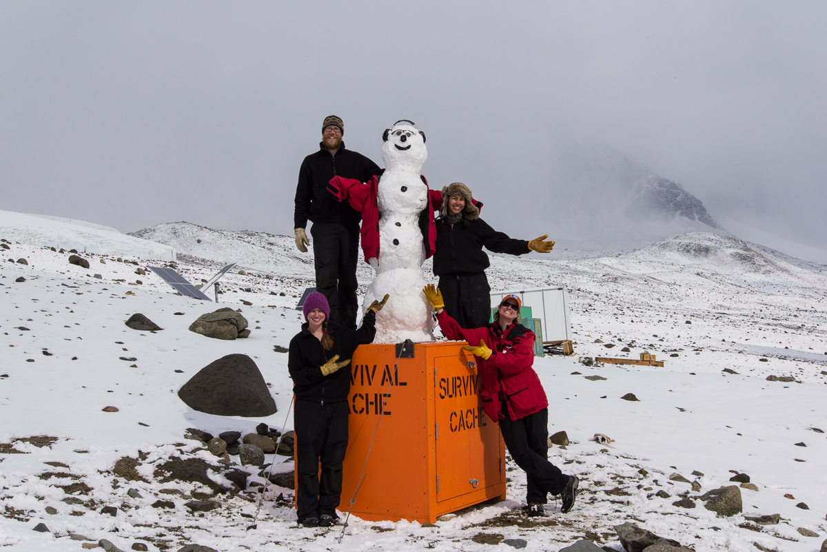
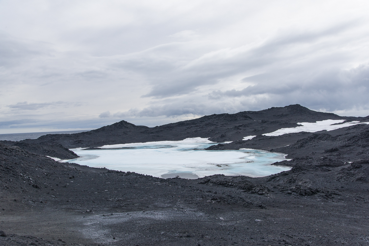
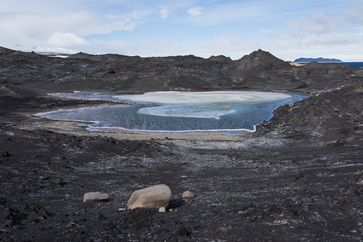
My Baby Thinks He’s a Plane: Refueling stops on the Dec. 30, 2015 US Antarctic Program flight manifest including Roseanne Cache and June Carter Cache. Still trying to find out if there’s also a Johnny Cache. Here’s music by Rosanne to read this blog post to.
I was looking at the daily flight schedule and noticed some refueling stops at a fuel cache named Roseanne Cache. “Rosanne Cash,” I thought, “Like the singer.” Then I noticed there’s another fuel cache on the list called June Carter Cache (abbreviation: JCC). There are GPS coordinates for both of them. Someone has a whimsical sense of humor. I wonder if Rosanne Cash knows there’s a place in Antarctica named after her, even if they gave her name an extra “E.” I asked one of the contractors who works here about them and he said he thinks there is also a Johnny Cache. He also explained that the caches are used as refueling stops between the South Pole Base and remote field camps, and that the Roseanne and June Carter Caches have been in existence for a while.
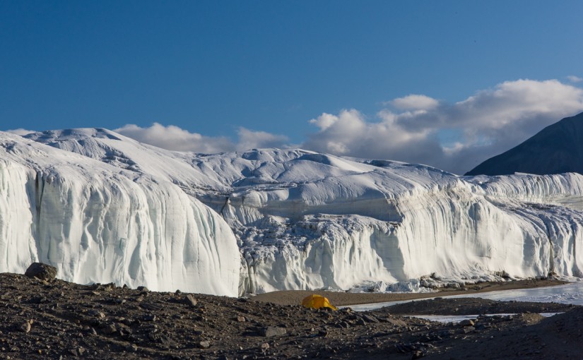
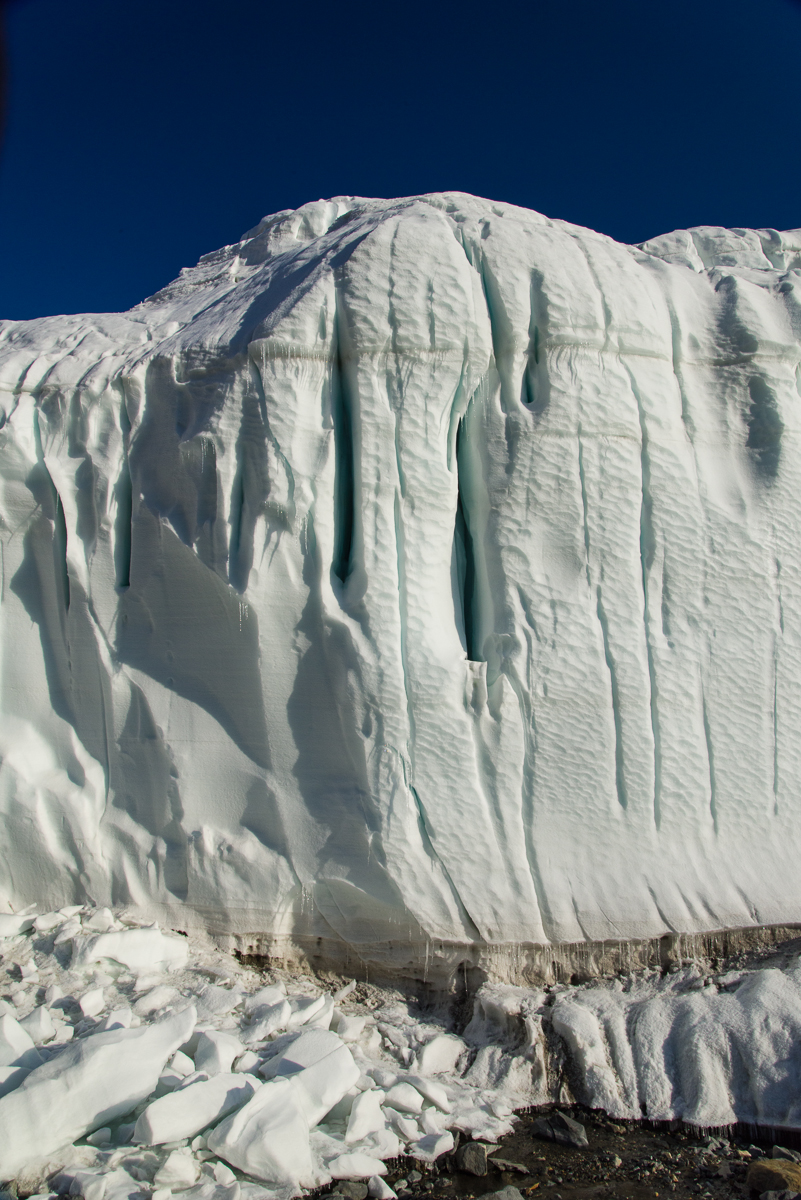
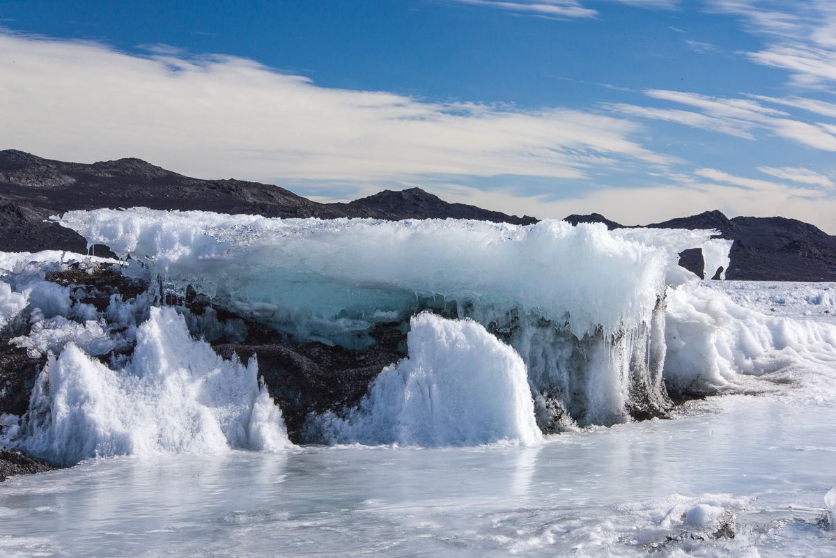
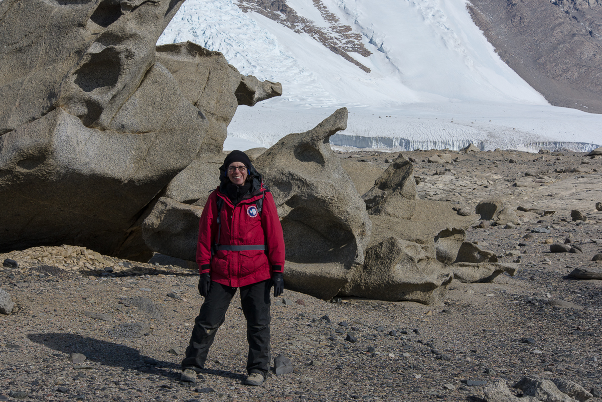
Drop dead gorgeous: The Lake Hoare camp is nestled beside the Canada Glacier at one end of the lake. That’s the tent where I slept in the center.
I spent Dec. 18 to Dec. 23 at what may be the most beautiful field camp site in Antarctica. Having seen a grand total of four field camps, I am admittedly not in the best position to judge the fairest of them all, and certainly they all provide fabulous scenery. But when you come out of your tent and towering over you a mere matter of yards away are the glistening white walls of the Canada Glacier with inset vertical crevices of blue ice emitting a turquoise glow, that’s hard to beat. I mean, check out that photo above. That little yellow tent in the middle is where I slept. Now look at the photo below — you crawl out of that tent turn around, and you are that close to it.
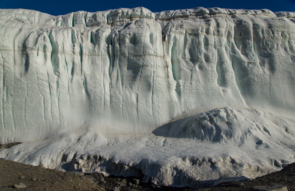
White walls with glowing blue crevices — right outside the tent.
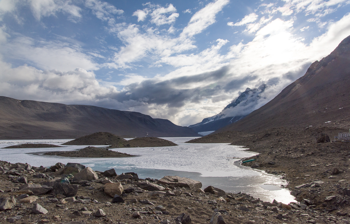
The view down the lake from the campsite toward the Suess Glacier (that light-colored triangle you can glimpse at the end of the lake) is not too shabby either:
View up Lake Hoare from the field camp.The main hut at Lake Hoare contains the kitchen, a long table for eating and hanging out, cubbies for keeping items you don’t want to freeze, and plenty of space to work at your laptop or the communal computer. Click this or any of these images to see enlargement.
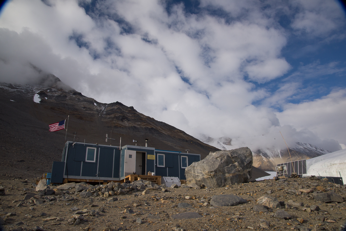
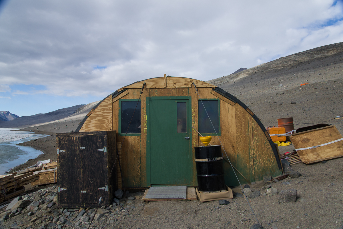
The Lake Hoare field camp is the first to have the vintage Korean-War-era Jamesway huts replaced. You’ve seen the Jamesways in my posts about New Harbor and Lake Bonney. In the near future, word is that all will be replaced with this more functional rectangular design, that allows for more wall storage, higher ceilings, and windows that you could more easily hang curtains on if you wanted to shut out the 24-hour light. Lake Hoare is a busy camp with three small lab buildings, two “rocket toilets” (outhouses with the capability of incinerating human waste and transforming it to non-polluting ash) plus a standard Antarctic camp outhouse as a backup. The camp is presided over by Rae Spain, a 35-year US Antarctic Program veteran who coordinates the various activities of the Dry Valleys LTER camps, which include Lake Bonney and Lake Fryxell — the comings and goings of the researchers, some of whom move from camp to camp throughout the season, the helicopter supply schedules (due to the number of people working in the area there are frequent visits from helicopters, ferrying passengers, food, water, supplies and waste between McMurdo and the Dry Valleys camps as well as short hops between the camps). Rae is an imposing-looking woman, about six feet tall, who wears her hair in a thick braid that reaches to her hips. She’s organized, efficient, and a masterful cook, one night transforming the field camp ingredients into a tasty dinner of Indian curry. (And in between analyzing soil samples in the lab, Dave, one of the scientists, whipped up some naan dough, which he baked on the outdoor grill to complement the meal. That’s right!) Then there’s Renee, Rae’s assistant and all-around field camp utility player, who, when not occupied with assisting Rae at the hut or the researchers in the field, enjoys baking cookies and other desserts with an attention to detail that would impress Martha Stewart. I digress — but it’s hard not to talk about Lake Hoare without mentioning the food.
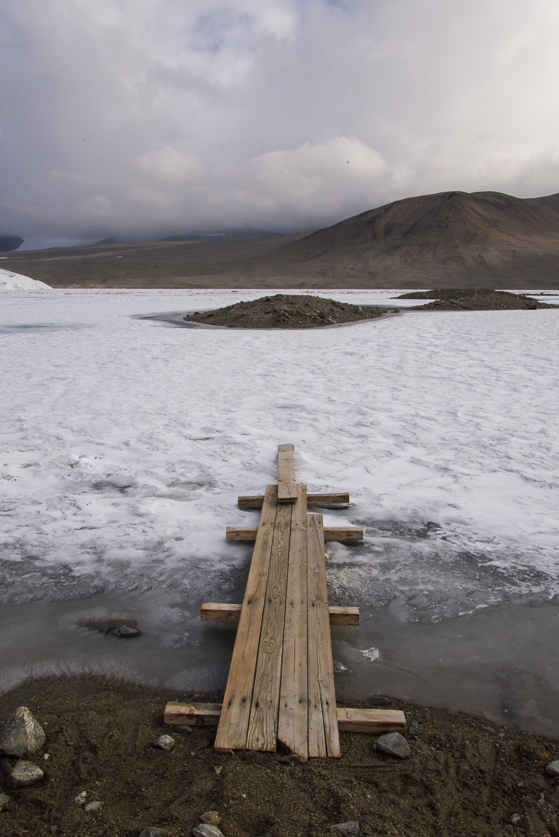
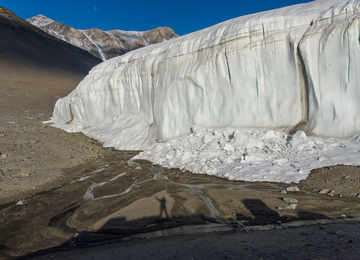
Thin ice: during the Antarctic summer sometimes you need to use the bridge to get onto the lake ice.
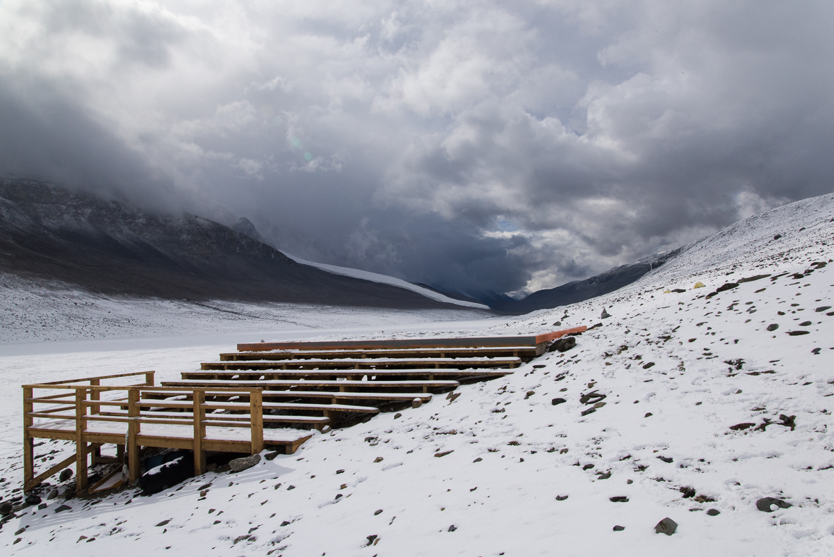
The research at the Dry Valleys LTER centers on the unusual polar dessert ecosystem, with its mostly ice-free terrain, the stationary Canada Glacier (in other words, it’s grounded and not sliding out to sea) and three perpetually frozen lakes: Lake Bonney, Lake Hoare and Lake Fryxell. (Fryxell is on the other side of the Canada Glacier from Hoare.) The lakes are covered with ice that is about four meters thick, in other words, about 13 feet. That’s just the ice — there’s deep water beneath that. Lake Hoare, for example, has an average depth of 30 feet and a maximum depth of 112 feet. This time of year, the ice at the edges, which is over shallower water, melts in the sun, so there are makeshift bridges to get across to the thicker ice without getting your feet wet, like the one shown at left.
Midnight on a clear night is a great time to photograph this side of the Canada Glacier.
Anyway, late on the evening of the 21st, one by one the camp denizens closed up their laptops, finished their tea or whatever they were doing in the hut and brushed their teeth (field camp life breeds a peculiar intimacy where you floss, brush and spit out your toothpaste into a bucket in front of people you’ve known for all of three days) and went off to their tents to sleep. By about 11:45 p.m. only Dave and I were left, working at our laptops. “The light is really beautiful out there,” Dave remarked. I’d been thinking that I should photograph the glacier in the evening when the light was on it, because in the morning it’s in shadow. The wind was calm, it wasn’t bitter cold, and he was right, the glacier was glowing in the sun against a sapphire sky. So even though I’d hiked to the Suess Glacier and back between 1 and 8:30 p.m. that day, I decided I should take advantage of the conditions and just sleep in the next day. From midnight to almost 2 a.m. I roamed around the campsite taking most of the pictures you see here. The only ones with this post that weren’t taken then are the ones above of the bridge, the hut and the view down the lake toward the Suess Glacier.
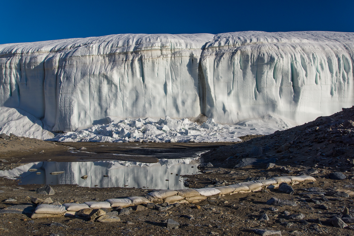
‘Round midnight: Glacier reflected in a pool of water in the vicinity of the stream gauge. In the foreground is a row of sandbags.A metal plaque on the stream gauge box gives pertinent info about the gauge and where to learn more online (click image to read it), as well as noting the box “may be used as emergency shelter by one or two persons.”
This being a LTER (long-term ecological research site) there is a stream gauge to capture the flow of the stream of glacial meltwater that flows down the hill alongside the glacier and into the end of the lake. I came across the above plaque on the side of the gauge box atop one of mounds overlooking the stream, which explains that the stream has a name: Anderson Creek at H1. It also helpfully notes that “This gage [sic] box may be used as an emergency shelter for one or two persons.” That struck me as an odd kind of qualification. What do they mean by one or two? Depending on overall size, shape, interpersonal compatibility and relative degree of distress of said persons? I hadn’t even noticed the gauge before coming across the plaque because it’s tucked behind a mound. It’s not a tall structure so the flow must never get very high:
The stream gauge is in the lower center of the picture.
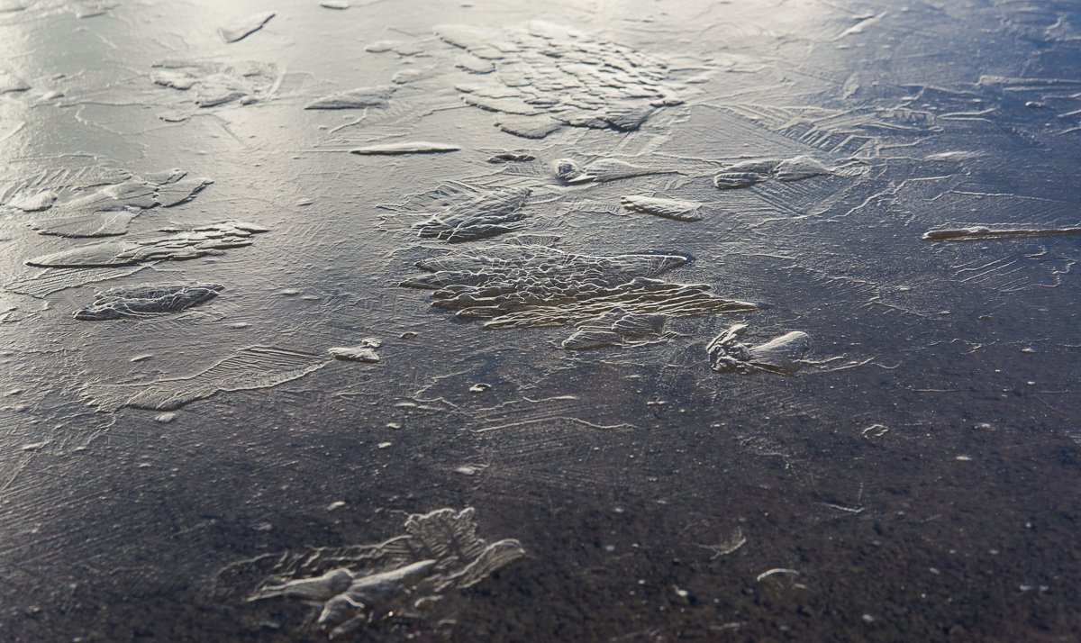
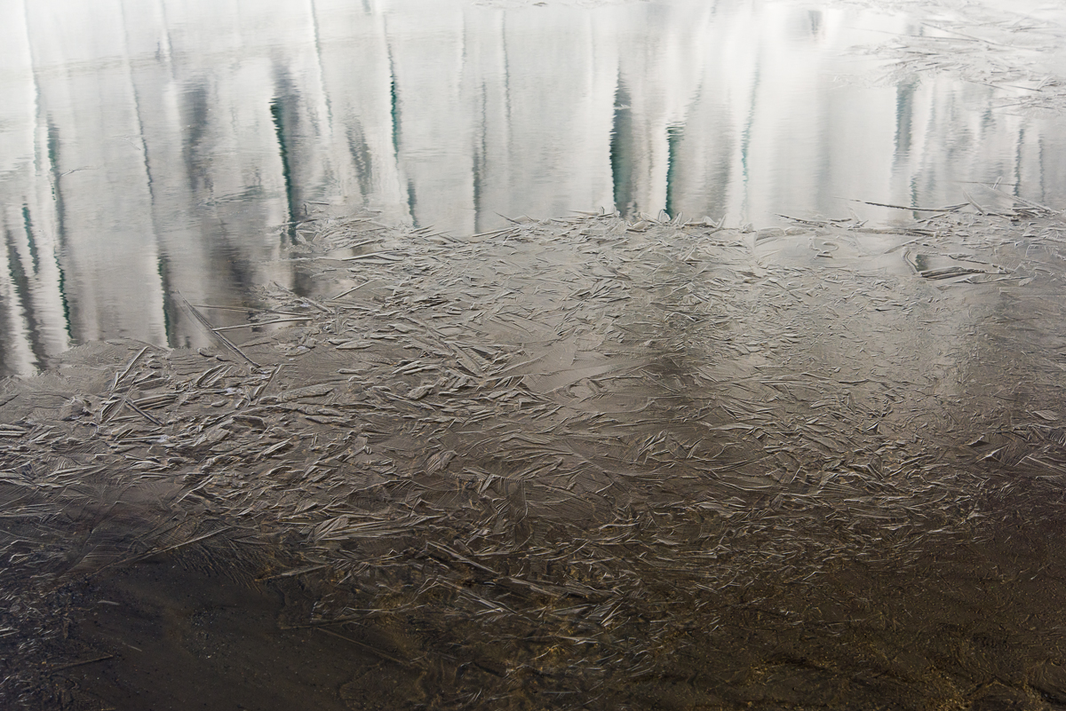
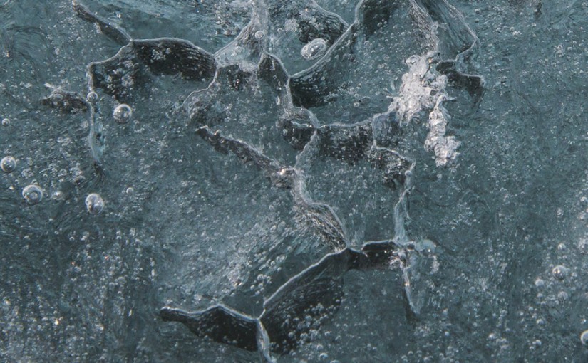
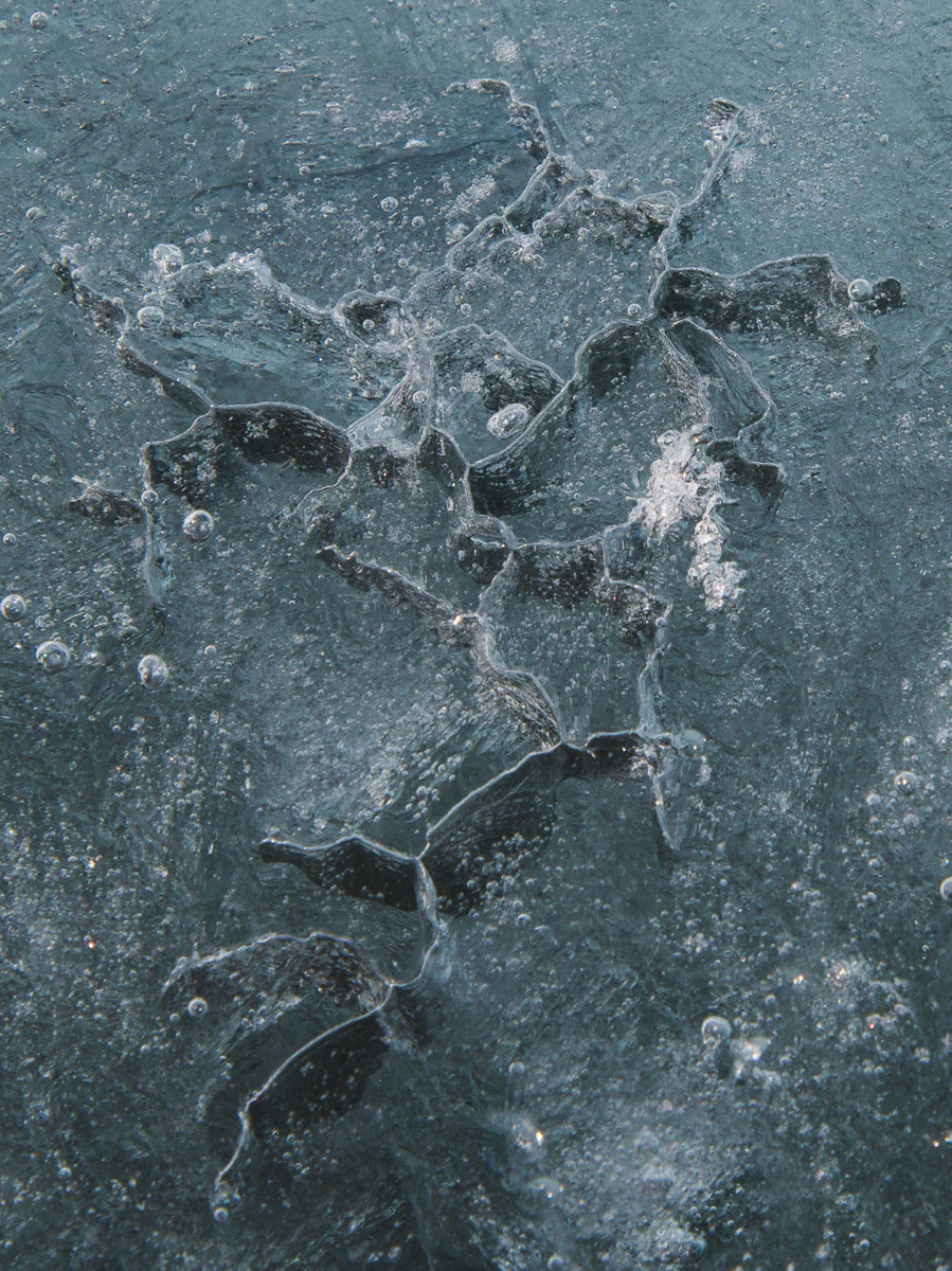
My initial plan was just to photograph the side of the glacier. But as I was walking around the shoreline, I noticed a lot of beautiful forms in the surface of the lake ice that were thrown into low relief by the light of the midnight sun. Here are a few of my favorites. An NSF glaciologist on station referred me to a lake ice web site where I found some of them:
This is an ice star, also known as an ice spider or ice octopus. According to the lake ice web site, they are holes “associated with water flowing upwards through a hole or crack as the ice sheet is being submerged by the weight of a new snow cover.” We did have a significant snowfall a few days before.
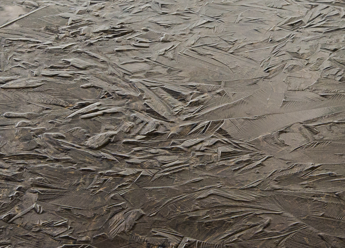
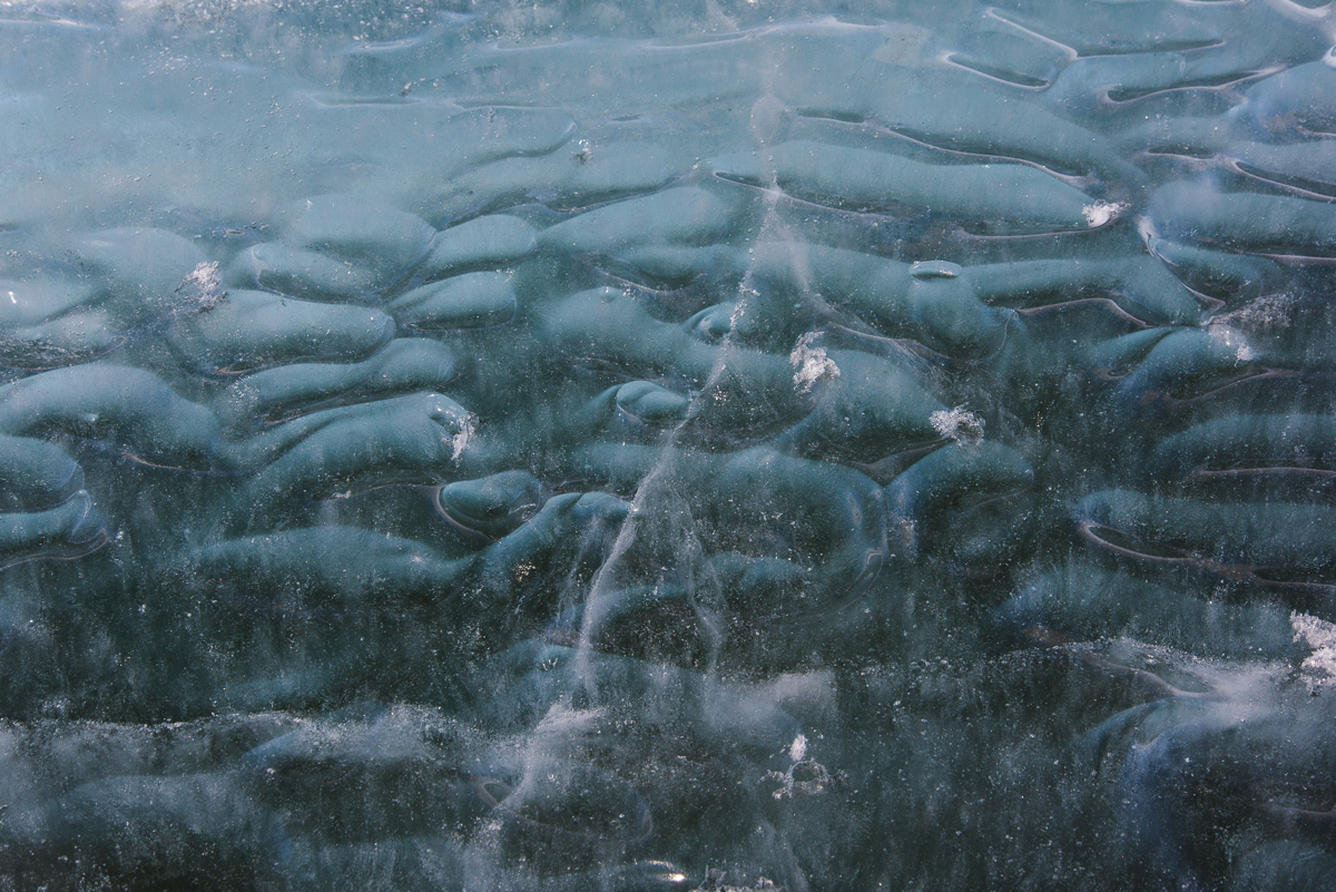
The lake ice web site says this is called “primary ice of the P1 variety” and that it forms in calm conditions moderately below freezing, which is right on target for that day.The lake ice web site goes on to explain, “P1 ice starts as needles growing across a thin, moderately supercooled layer on the surface of the water. They grow until they run into each other. After that, dendritic growth fills in the space between the needles.” In other words, the ice crystals keep branching until they touch other crystals. But it looks like they also grow vertically as well as laterally.More fun with reflections.A detail of the above photo so you can get a sense of the complexity and variety of the ice surface. Reminds me of Asian ceramics.A puddle in the stream bed reflects the bright blue morning sky — 1:30 in the morning that is.
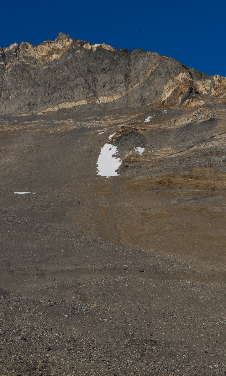
This patch of snow was a Rorschach blot that brought back a repressed memory from my childhood.
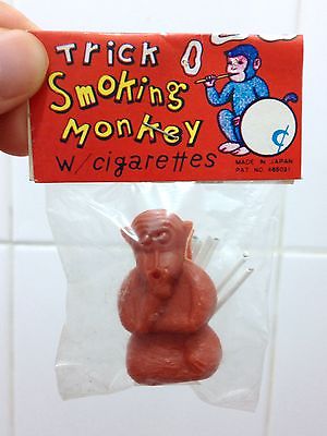
This patch of snow high on a slope above the campsite (left) never changed the entire five days I was there. I privately referred to it as “The Smoking Monkey.” If you’re too young to remember them, Smoking Monkeys were a novelty item for children during the “Mad Men” era, made in Japan — a little plastic monkey with a set of tiny cigarettes the thickness of a toothpick. Put one in its mouth, light it, and the monkey blew tiny smoke rings. For some reason nobody thought this was an inappropriate toy. You think I’m just blowing smoke? Here’s one that’s for sale on eBay:
Enough about smoking monkeys. I’ll bring this post to a close by waving goodbye:
Glacier with the shadows the stream gauge box and me.
This bumpy ice at the edge of one of the inland lakes at Cape Royds looked like flash-frozen oblong bubbles.
For my Antarctic Artists and Writers Program project, I expected to be photographing glaciers and large ice formations, but once I got to Cape Royds and the Dry Valleys, I also discovered some small scale — even tiny — ones that fascinated me in their variety and the unexpected shapes or colors. It seems that the extreme cold of Antarctica generates some peculiar ice formations in the freshwater lakes fed by glaciers.
Looks like waves lapping on the lake shore, but they’re completely frozen.One of the large lakes at Cape Royds. Mt. Erebus is in the distance. The first couple of days I was there, the lake was frozen and you could walk right onto it from the shore and cross to the middle. That’s when I took these photos. But a couple of days later, the edges had thawed and there was no way to get to the ice without wading across a few feet of water.
Some of these lakes melt around the edges this time of year (December-January), but never thaw completely. I don’t know if the kind of ice formations you’ll see in the photos that follow are found elsewhere in other places that are cold much of the year, for example, the Arctic. Nobody I’ve asked so far could tell me, but then again, most people who are working in those places as mountaineer guides or researchers aren’t attending to that ice, except as a practical matter to check out if it’s safe to walk on it. So if anyone reading this has more information about what physical processes are causing these shapes, feel free to comment!
A close-up of a jagged ice pattern found walking along the black sand beach at Cape Royds. It’s pretty much all straight lines.
It also could be at Cape Royds that because of its proximity to the sea, there are salts in the water that are contributing to some of these effects. This cracking pattern at the left was not photographed at the lake, but at the edge of a black sand beach where there was a pressure ridge and sea ice. But snow was melting from a ridge above the beach so it’s hard to say if it’s frozen freshwater or frozen sea water or a combination.
Ice structure in the middle of a lake at Cape Royds. The ice around it was thick and solid enough to walk on.
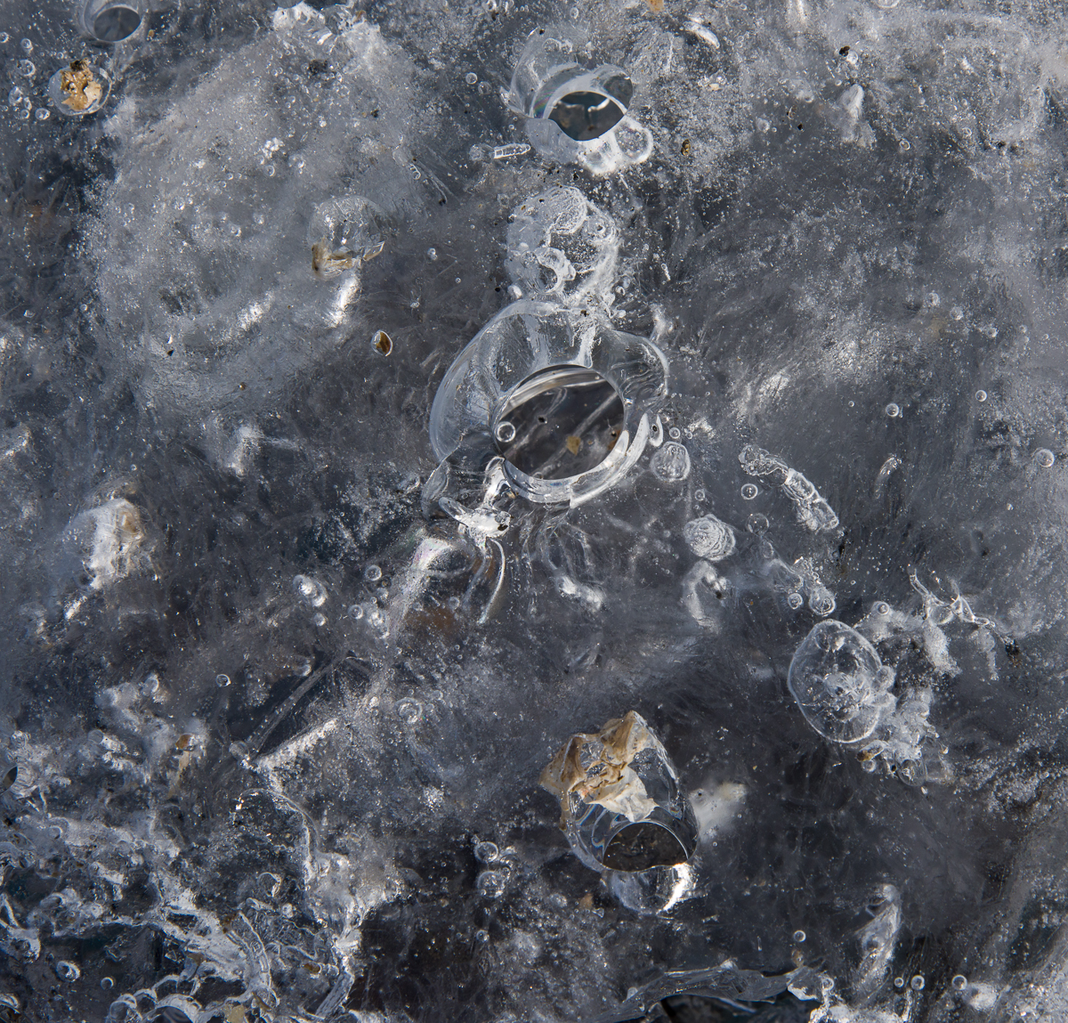
Some of the unusual patterns I found were at the center of one of the inland lakes at Royds, where gravel from the surrounding hills had blown onto the ice, piled up there, and there was a frozen flat-topped ice structure sitting on top of it. There were a lot of these isolated flat-topped ice structures at Lake Hoare in the Dry Valleys, too. The ice designs I found at Lake Hoare will be the subject of a later blog post. The explanation I got at Hoare was that while the ice forms from the bottom (and in the Dry Valleys the lake ice is a few meters thick), the frozen surface of the lake ice ablates — that is, vaporizes into the air — but sometimes leaves areas that haven’t ablated still sticking up above the frozen lake surface. The next few photos were taken near one of those structures, shown in the above photo. It was probably about three feet high, several feet wide and extended for several feet in the middle of the lake. You can see in the photo there was a lot of sediment around it.
This design, photographed near the formation shown above, has rounded shapes, within which are a combination of straight lines and curves. And it has distinct layers at different depths, presumably from freezing and melting and refreezing at different times.
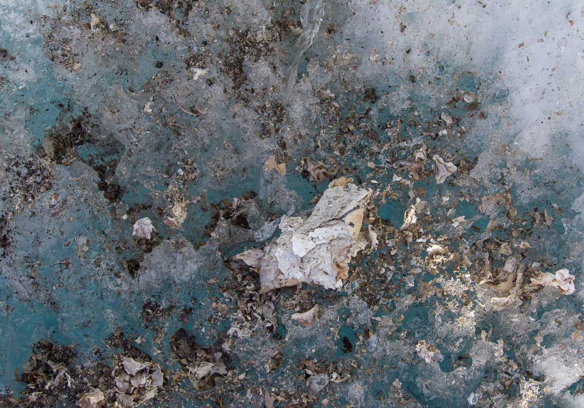
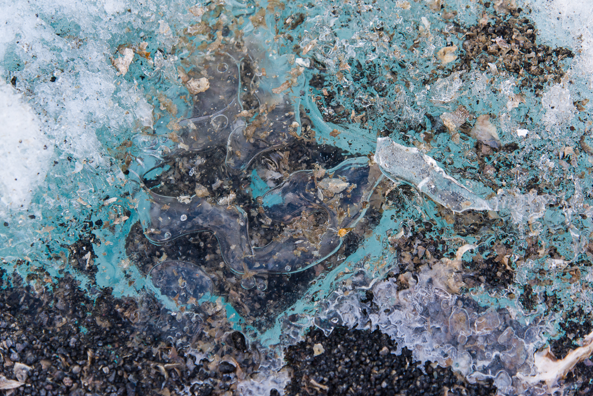
In the lakes at Cape Royds you’ll also find what looks like torn up bits of cream, tan and orange paper scattered on top of and within the ice. Those are algal mats. Around that tabletop shaped formation at the center of the lake were these “collages”:
An algal mat “collage” in the lake ice.This one looks like someone splattered turquoise paint on it. You can see where gravel has blown onto the ice and piled up. The gravel melts holes in the ice, too.This microworld of a thick layer of ice on top of sediment has some scattered fragments of algal mat, frozen bubbles of varying size and holes. It was taken nearby the two photos above.
I’ve saved the strangest formation for last. This one was by the shore. The ice was a deep shade of turquoise, and inside were vertical ribbons caused by…what? They were definitely three-dimensional as you moved around them. I’m trying to find out what causes them. They looked to be about 3/4 of an inch wide. Here’s an overall photo and a detail:
Ribbons in the ice: anyone know what causes these? I also saw similar patterns in Lake Hoare but the ribbons were not nearly as wide, nor were they colorful, just plain white.Detail of the ice ribbons.
In a future post I’ll show some of the small surface ice formations from Lake Hoare, which were different than these. I’ve encountered much more variety of ice in Antarctica than I had expected, a happy discovery.
One of 162 photos I took while walking around an iceberg stuck in the sea ice near the Dellbridge Islands.
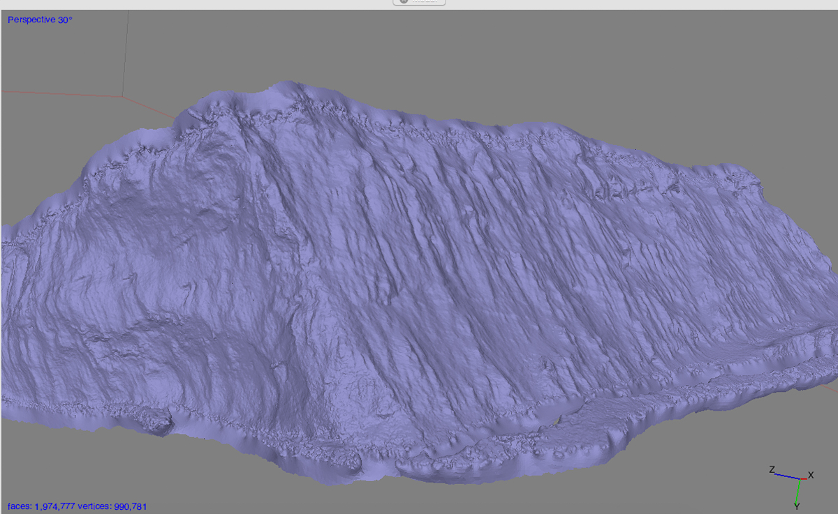
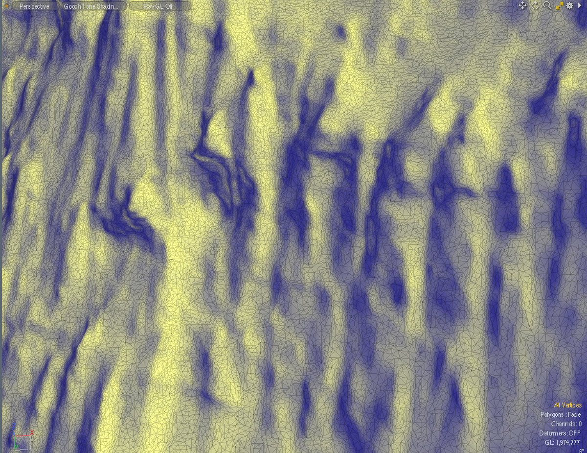
Screenshot of PhotoScan 3D file, with the “texture layer” (the colors from the original photos).Close-up of the left half, just showing the form without the texture layer. Gaps will be filled in later in Modo, the 3D editing program I use. Gaps are areas the software can’t resolve. I think that some may not have been visible from the angles I photographed, while others were rather flat and didn’t offer enough cues for the software to match points between photos. But those are minor issues to fix.
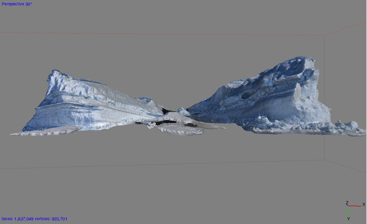
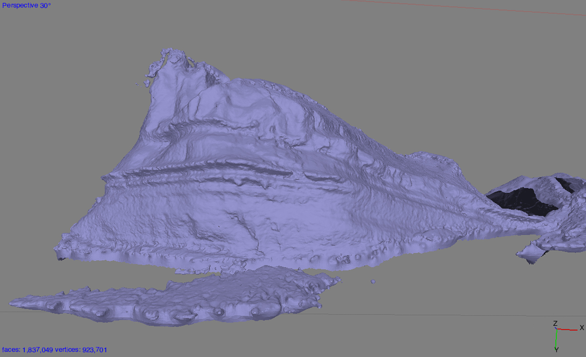
Part of my project here involves capturing forms in 3D. There have been plenty of photographs taken in Antarctica, within and outside the Antarctic Artists and Writers Program, but relatively little sculpture, and the sculpture that has been done has been more inspired by the landscape than an attempt to capture the specifics of the marvelous forms and textures produced by the interaction of wind and water in this unusual environment. My method for doing so involves taking a series of overlapping still photos of an object or scene from different angles and processing them with photogrammetry software into a 3D file. I edit that file in 3D design software and then fabricate it as a sculpture generally using a CNC router at Fab Lab Baltimore, though they can also be 3D printed. The three photos above show stages in processing my most ambitious capture thus far completed: 162 photos of a large iceberg stuck in the sea ice near Inaccessible Island in McMurdo Sound that I shot on December 1st. I blogged about that day in an earlier post — Evan and I went out there in a Haagland tractor and this iceberg was our first stop. There’s no way it would be possible to make a 3D capture like this with an iceberg floating in the water. Also when you’re in a zodiac boat near a floating iceberg, you have to keep your distance because it can flip without notice, causing dangerous waves. This photo gives you an idea of the scale:
Me and my iceberg. It’s stuck in the sea ice near Inaccessible Island (my favorite island name in Antarctica — sounds so…remote). When the ice around it melts, it probably will start floating again eventually. See the diagonal lines, especially noticeable on the left side? Those are earlier float lines. As icebergs melt in open water they shift position, sometimes tilting, sometimes doing an abrupt flip. You wouldn’t want to be this close to it if that happened. But stuck in six feet of sea ice this one wasn’t going anywhere!
Up until recently I used Autodesk 123D Catch to create the 3D files, which is very good free software. Right before leaving for Antarctica, I purchased Agisoft PhotoScan Standard, which can handle larger files, and, I hoped, the larger number of images and greater detail I intended to throw at it with my Antarctic images.
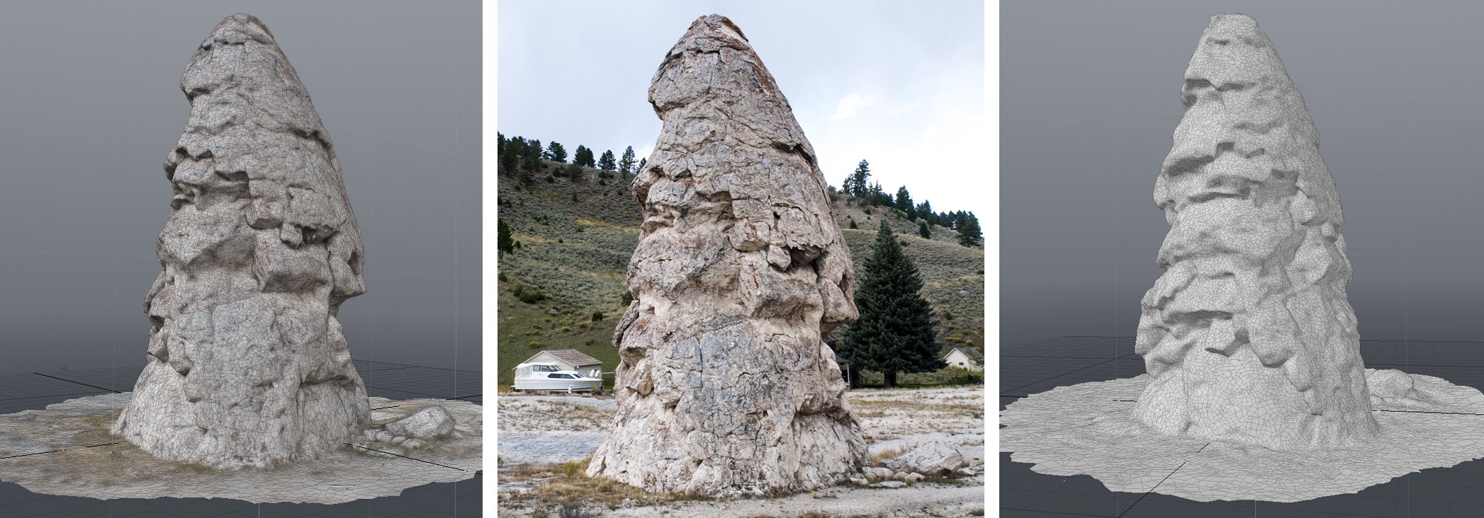
The largest object I’d ever processed a 3D file of before was the Liberty Cap at Yellowstone. One of the source photos is in the center, with two views of the 3D file in Modo on either side.
Turns out PhotoScan is up to the task, although it takes several hours of cranking away in the background for the 3D captures to process. That’s why I haven’t processed that many yet. But I wanted to try a few to make sure it would work. Up until now, the largest natural object I’ve made a capture of is the Liberty Cap, a rock formation called a hot spring cone in Yellowstone National Park that’s 37 feet high. I made that file with 123D Catch and it came out so well I was reasonably confident that the formations would, too.
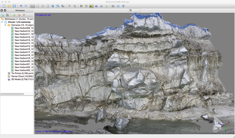
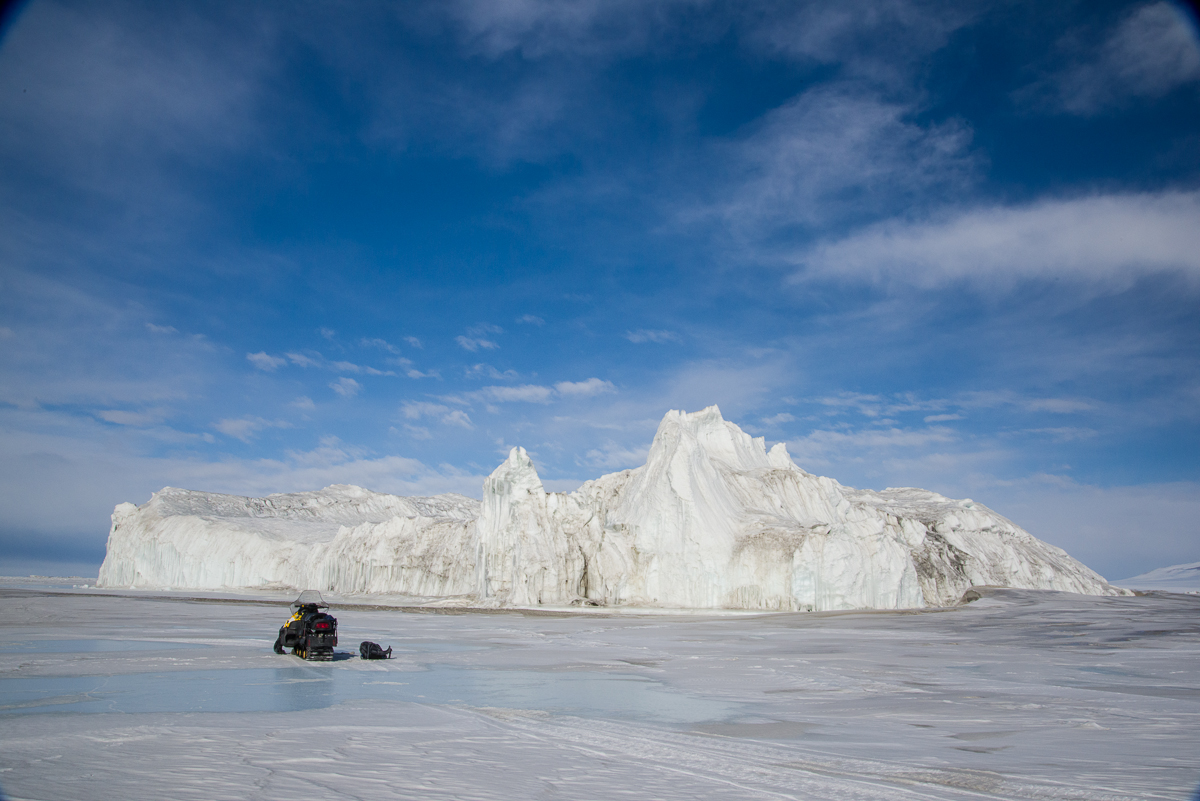
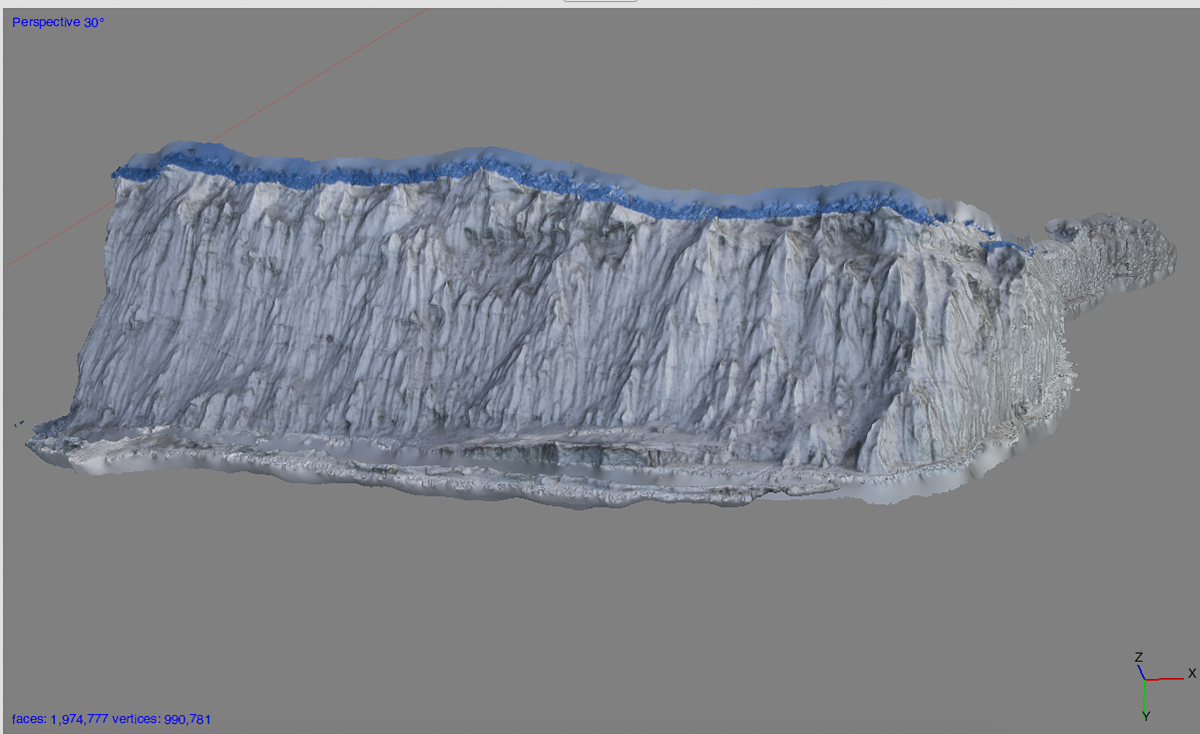
I started with this pressure ridge by the Double Curtain Glacier, which I also talked about in an earlier post. It wasn’t a huge number of photos, but extraordinarily complex. I was excited to get this result:
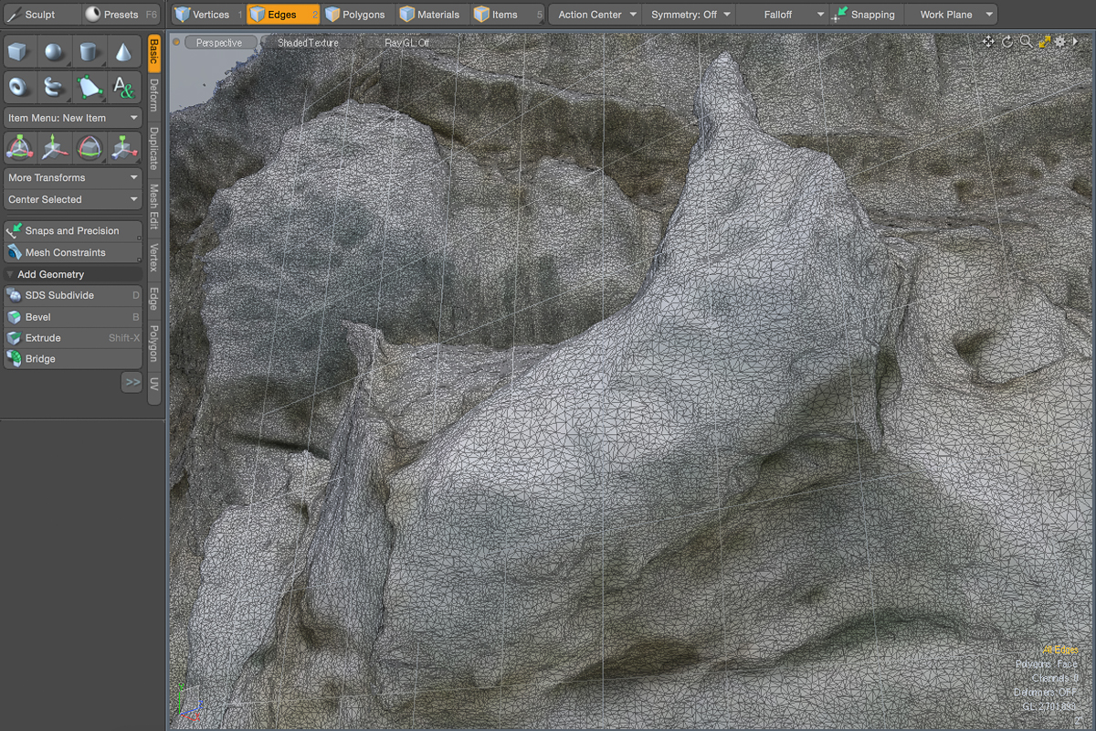
PhotoScan was able to process the elaborate quasi-Baroque facade of this pressure ridge.This Modo screenshot shows a detail of the center of the above 3D file. You can see how photogrammetry software makes a polygon mesh, breaking the form into little triangles. These triangles can be moved, deleted, or otherwise edited.
Before tackling the iceberg at the top of this post, I tried processing a portion of an enormous iceberg stuck in the sea ice that Laura Von Rosk and I traveled by snowmobile to see. I wasn’t sure if anything that large could be processed, so although I spent a half hour taking about 170 photos of it from every angle, I only processed 44 of the photos of one side and a bit of its adjacent sides. Here are some screenshots from that experiment. Check out the amazing detail captured from this huge object:
This is an iceberg stuck in the sea ice between New Harbor and Cape Bernacchi. The snowmobile in the foreground gives you an idea of how enormous this iceberg is.PhotoScan processed 44 of the photos into an excellent 3D version of this portion of the iceberg. No gaps!Another side of the iceberg, shown without the texture layer.This is a Modo screenshot of a detail of the mesh of the above 3D file. Check out the detail!
I have many captures ready to process as 3D files, including the Scott Base pressure ridge, the Canada Glacier, Blood Falls, ventifacts, even a penguin subcolony (we’ll see if the penguins moved around too much to process). I’ll share them on this blog as I complete them, though it will be some time before I get to them all because it takes a few to several hours for PhotoScan to go through its paces. But I’m positive I’ll be bringing back many pieces of 3D Antarctica from this trip.
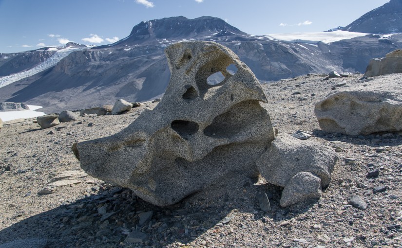
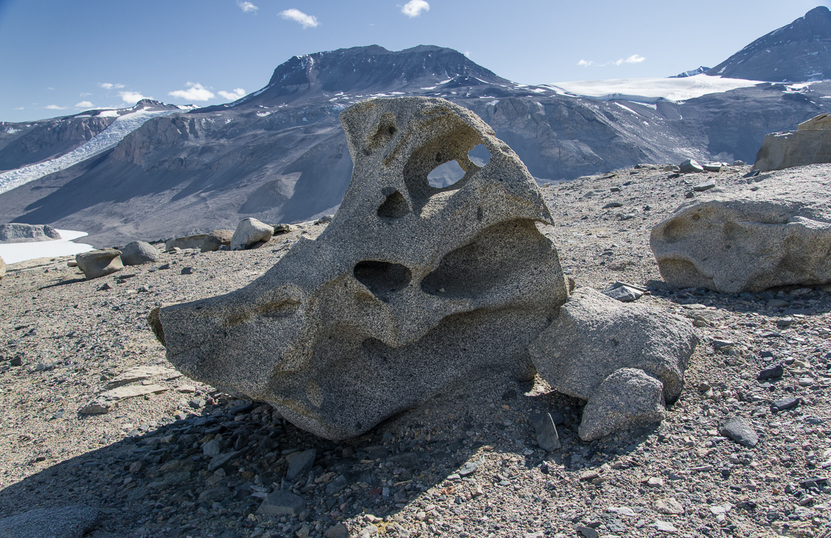
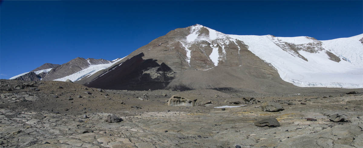
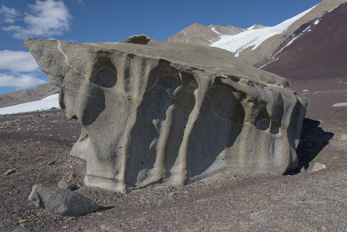
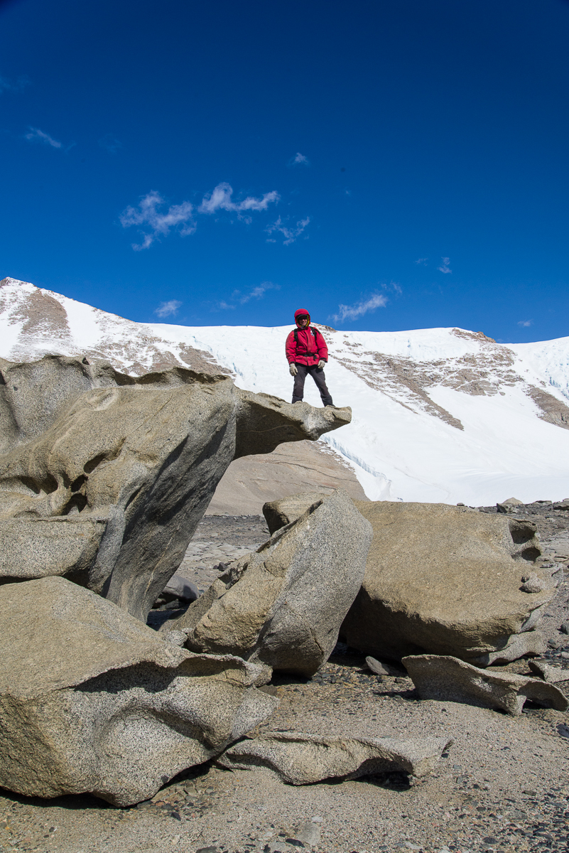
It’s a bird?: Granite boulders at the top of the ridge above Lake Bonney have been sculpted into strange shapes. From this angle, this one reminds me of a cartoon bird (beak on right).
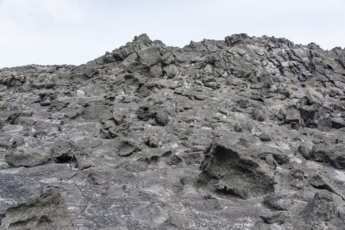
On Dec. 17th, with Forrest McCarthy as my guide, I hiked up some steep gravel inclines in the Antarctic Dry Valleys above Lake Bonney to elevated ridges and plateaus to see the ventifacts. These are large granite boulders that have been pummeled by fierce winds picking up grains of gravel — imagine a giant sandblaster over millenia.
There are modestly-sized ventifacts at Cape Royds, carved from the black volcanic stone that dominates the landscape.
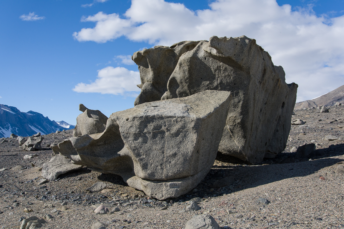
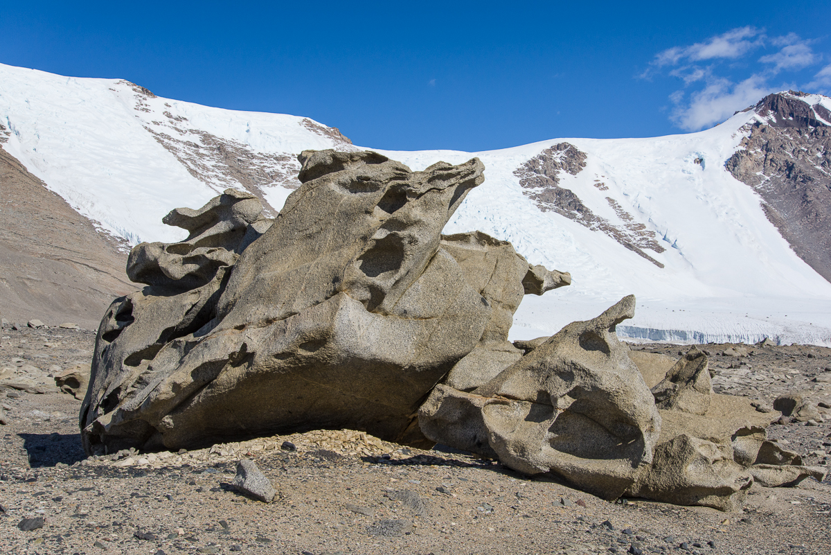
I saw smaller ventifacts at Cape Royds. Those were volcanic stone hollowed out into curved shapes, sometimes pierced with holes and generally in the one- to three-cubic-feet range, and mostly on the smaller side of that range. But nothing prepared me for the ventifacts of the Dry Valleys. It was a steady climb for some time and then we came over a ridge where the ground was strewn with huge granite boulders curved, hollowed and pierced into strange shapes. I felt like I’d entered the world’s largest Surrealist sculpture garden.
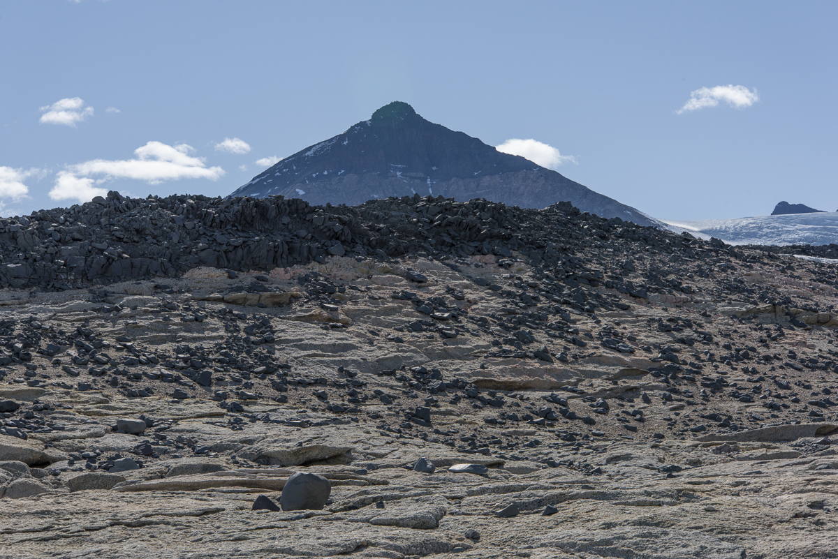
Surrealist sculpture garden: boulder-sized ventifacts are strewn across a rocky plateau. In the distance is a mountain with a huge expanse of deep black and dark red stone.Facing the opposite direction from the above photo, you see the ventifact field in the foreground, with the white expanse of one of the lobes of Lake Bonney below (the white line in the center is the part of the lake that connects them and you can see a sliver of the other lobe, blocked by the hill in the middle). There’s also the Rhone Glacier on the right, and beyond that, the huge Taylor Glacier, The Friis Hills, with their striking large horizontal stripes of contrasting shades of brown, rise above the Taylor.
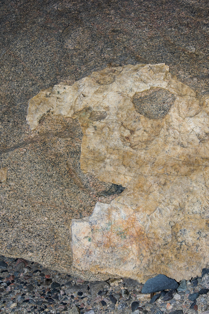
Many of these forms made me think of 20th-century Modernist art. This is kind of like an Arshile Gorky abstraction come of life. Or maybe Yves Tanguy.
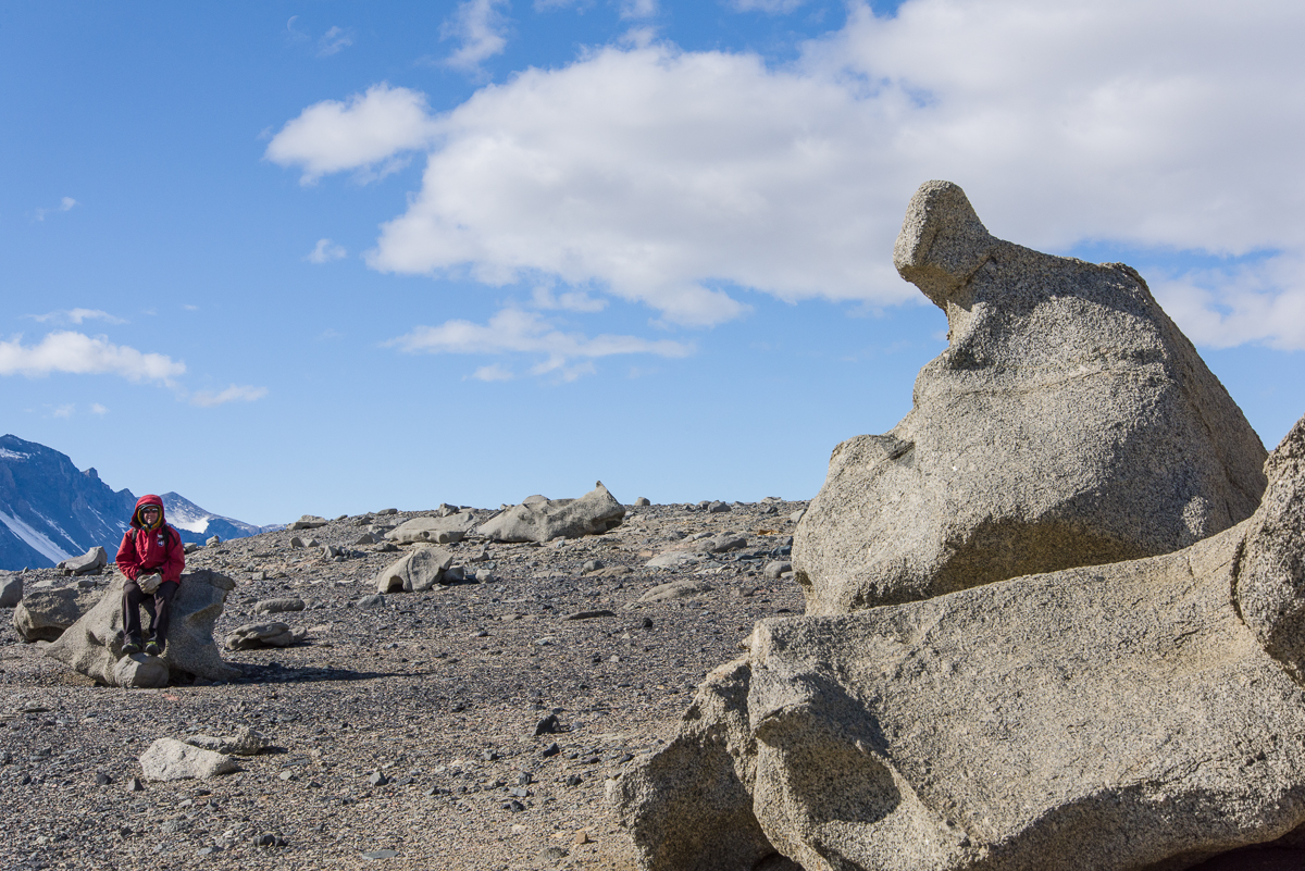
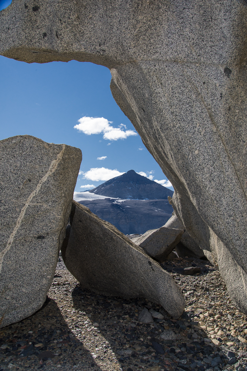
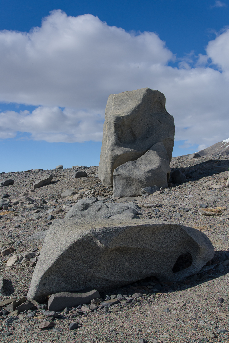
The ventifacts obey a cardinal rule of good sculpture — that it should present different forms as you walk around it. Believe it or not, these are two different views of the same ventifact:
One side of a ventifact grouping……around the other side it looks completely different.Seated figures, real and abstracted: Forrest waits for me to walk around the ventifact making photos for the 3D file creation process. You can get an idea of the scale from this photo.Here it is again. Some of the carved forms are surprisingly thin and articulated.
This one looks like rippled cloth with a line of a contrasting color running through it.This is the only one I saw with a large shape of a different stone mixed in.This one frames a vista of a mountain on the opposite side of Lake Bonney known as The Matterhorn.The tall one reminded us of a monolith.Forrest climbed up on the “diving board.”Stone wall: Black rocks piled on a ridge appear to be made of the same stone coloring the side of the mountain shown in one of the above photos. That’s the Matterhorn in the distance.Me among the ventifacts.Follow the yellow brick road: On our descent we saw a vein of yellow-orange rocks that stretched across the hillside in a fairly straight line.The Antarctic landscape makes you aware of how small you are in the scheme of things. It’s also really hard to judge distances. You walk and walk, and wonder why you aren’t there yet. Where this photo was taken we had about another 10 minutes of walking downhill to get to the camp. The second yellow tent from the left, closest to the lake edge, is mine. The main hut is in the middle near the shore, and the helo pad is on the right.
Lakefront lodging: my tent pitched on the shore of Lake Bonney in the Dry Valleys, the way the site looked the day before it snowed.
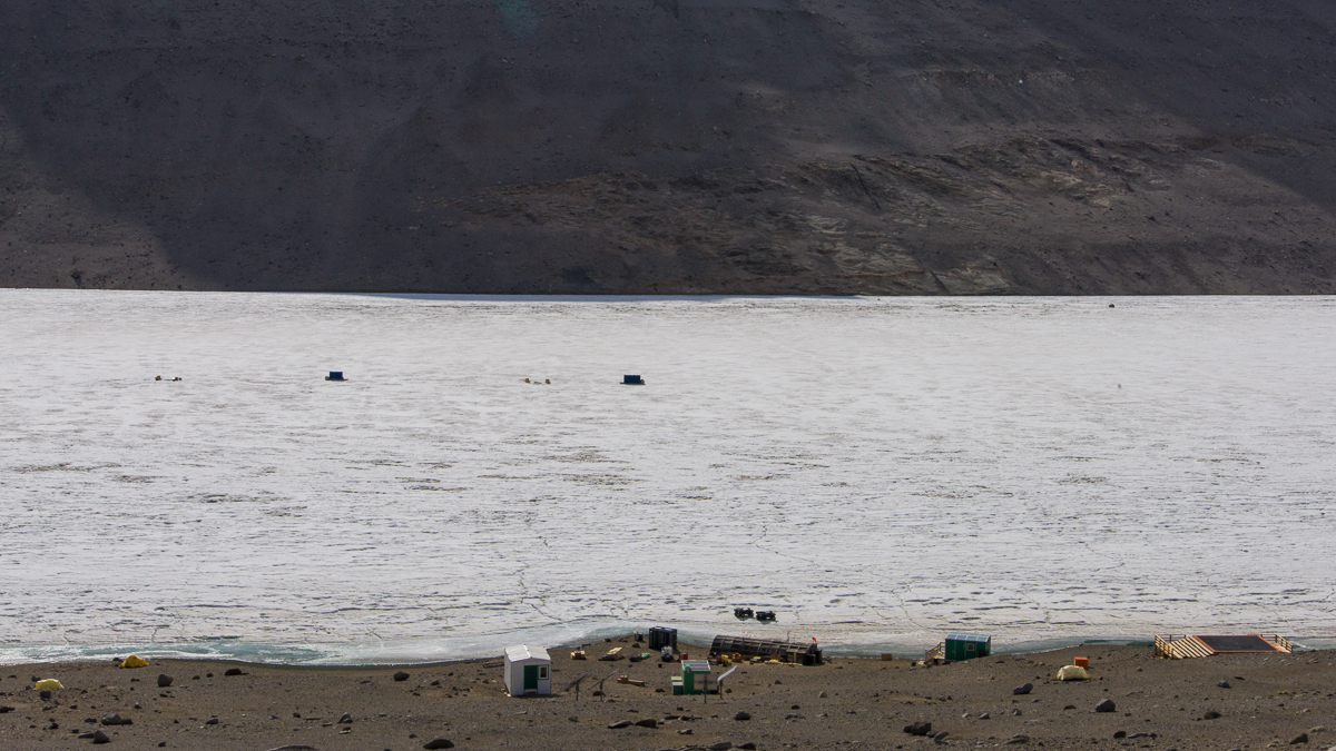
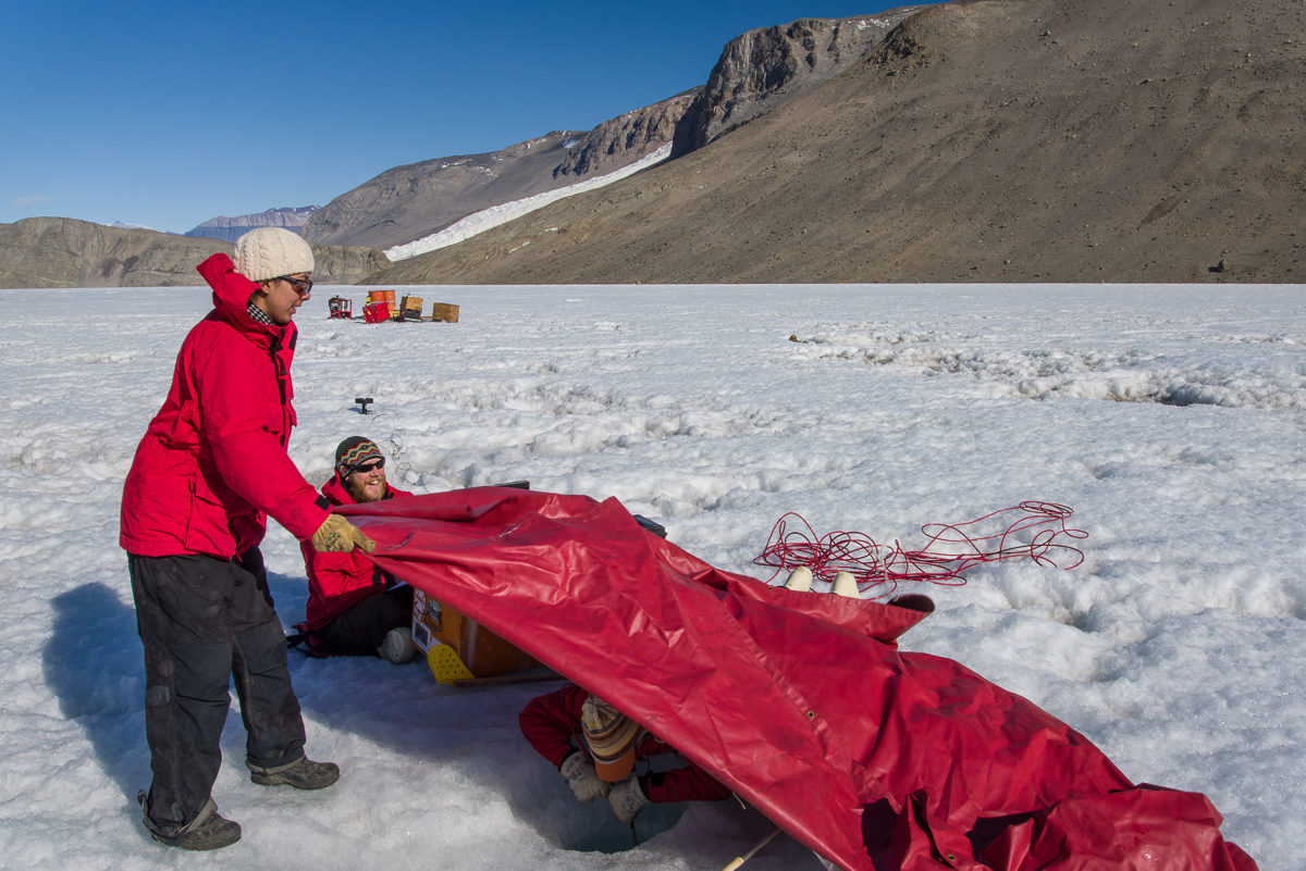
I arrived in the Dry Valleys on Dec 16th with mountaineer Forrest McCarthy. We were dropped off at Blood Falls, a spectacular site (and sight) with a glacier stained orange from iron in the soil. I’ll post those photos another time, as well as photos I took on a hike at the top of a steep ridge where there are ventifacts — large granite boulders carved by the wind into surreal shapes. But today I’ll just post a few photos of the site and the limnology team of the Dry Valleys LTER (long-term ecological research site) at work. Limnology is the study of inland waters as ecological systems interacting with their drainage basins and the atmosphere. The Dry Valleys limnology team takes water samples from the various lakes in the area, all of which are mostly ice covered: including Lake Bonney, Lake Hoare and Lake Fryxell. They move from one to the other throughout the season.
Lake Bonney Jamesway where the science teams cook and relax — slated to be replaced with a more modern structure in the near future. The lab is in a separate structure on the far side of this structure.
The limnology team consists of research leader Amy and three grad students, Jeff, Maddie and Noelle. On collection days they work long days, getting up at 4 a.m. to collect samples at specific times and filtering them into the evening. The first two days I was there, they had a lot of work to do. When I wasn’t out hiking and photographing, I watched them collect samples.
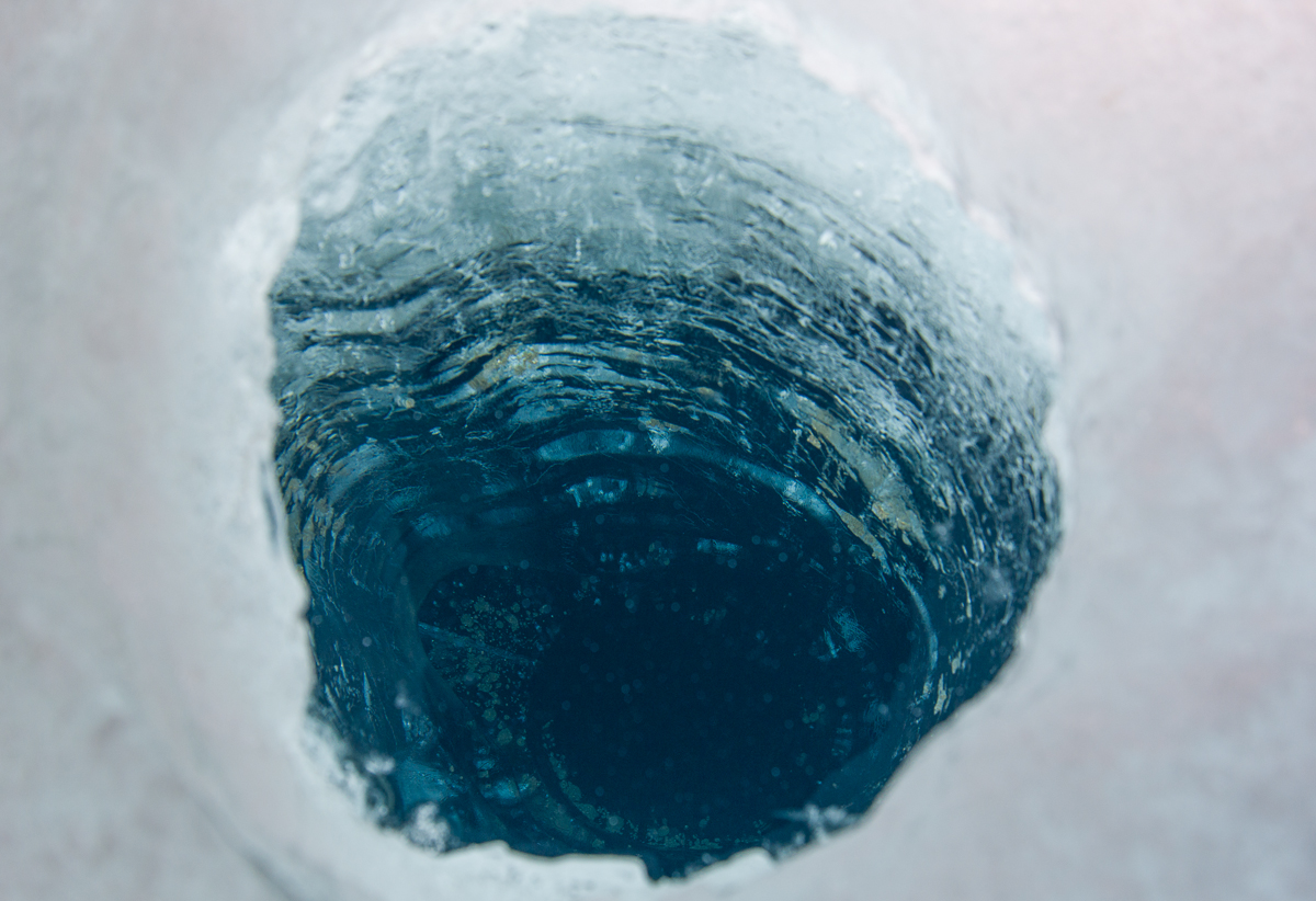
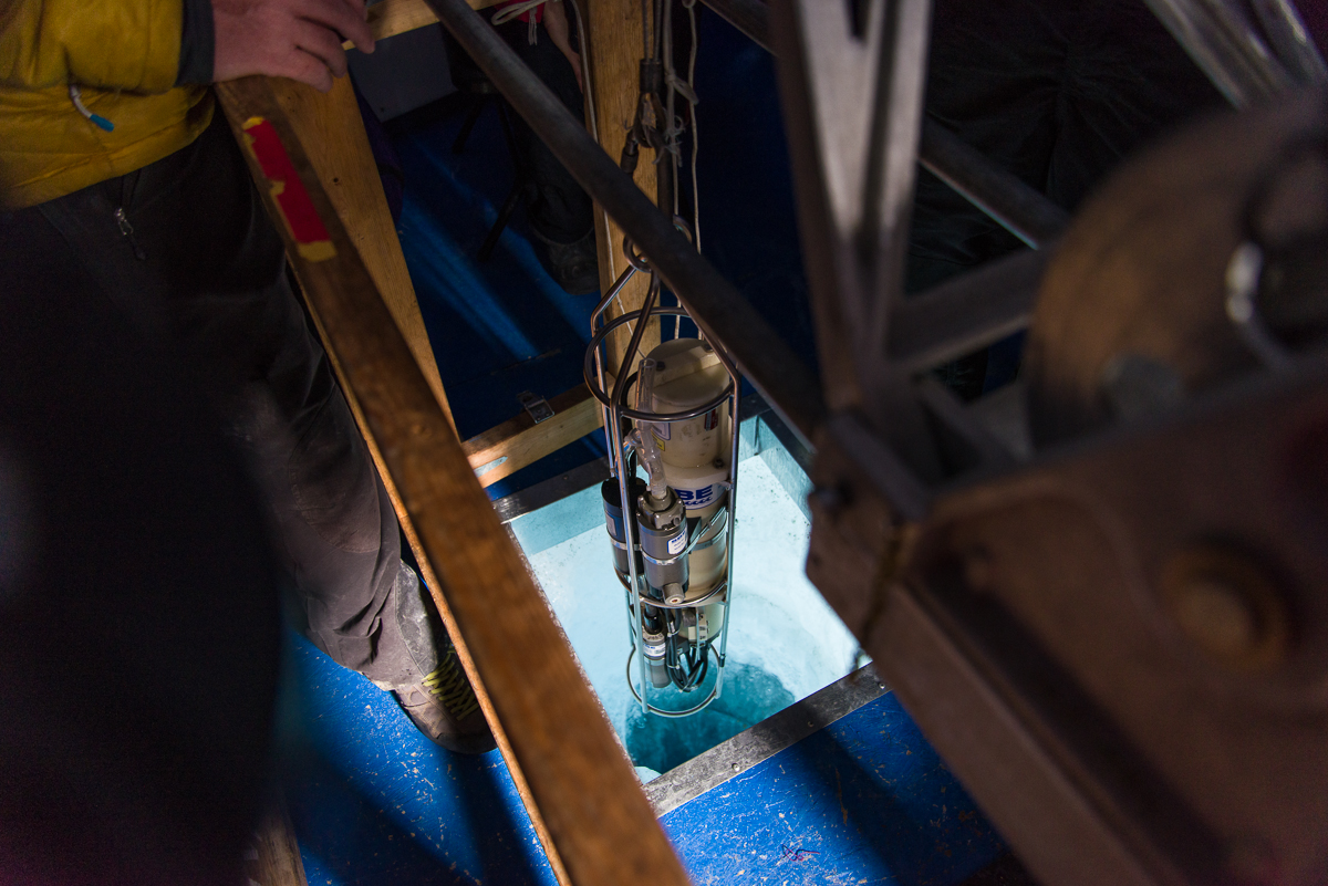
Amy lies on the ice ready to lower the sample bottles into the hole, while Noelle and Jeff assist. The lake is about 4 meters thick. She’s going to bring up samples of phytoplankton so it has to be dark.After she was done, I sat under the tarp and took some photos of the inside of the hole in the ice.Amy prepares a measuring instrument to be lowered into a hole in the ice inside a small hut. This one attaches to a cable and measures various aspects of the water at different depths.Instrument being lowered into the water.
Those crazy kids of the Lake Bonney limnology team took advantage of a sudden wet snowstorm and a day off from filtering samples to build a snowman.
Amy also showed me an instrument that is lowered by a cable into a hole in the ice to take measurements at various depths of the water. She tested it first and made some adjustments to make sure it was pumping properly. This instrument has been around for at least a couple of decades.
My last day there, Forrest and I took down my tent and packed up our stuff. We were scheduled to get a helicopter ride to a different camp in the Dry Valleys this afternoon, at Lake Hoare, where I’ll spend the next four days. We were going to hike to another ventifact spot but decided against it when a sudden shower of an unusually large amount of unusually wet snow just wouldn’t quit. It was the limnology team’s day off from sampling, and on the spur of the moment they decided to build a snowman with snow collected from the helo pad, which they dressed in a regulation USAP “little red” jacket. Naturally, a snowball fight followed.
Looking in the direction of Lake Hoare, the sky was clearing, so the helicopter came to drop off passengers and pick us up. That’s the helo pad in the foreground. Most camps just have a patch of flat ground, but since there isn’t one large enough at Bonney, a wooden platform serves as the helo pad.
The weather cleared and the helicopter pilot arrived with two grad students from a different water-sampling research project, on their way to a site on the other lobe of the lake. Forrest and I boarded the helo and rode to Lake Hoare. As we landed, it started snowing hard there, fog rolled in and pilot ended up waiting in the Lake Hoare hut for about three hours before deciding it was clear enough to take off again. Fortunately, they had a tent set up that nobody is using so I didn’t have to pitch mine on snowy ground!
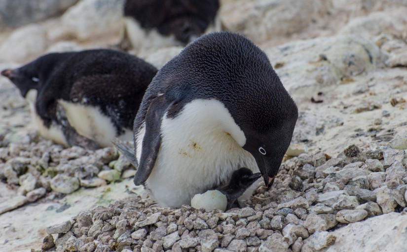
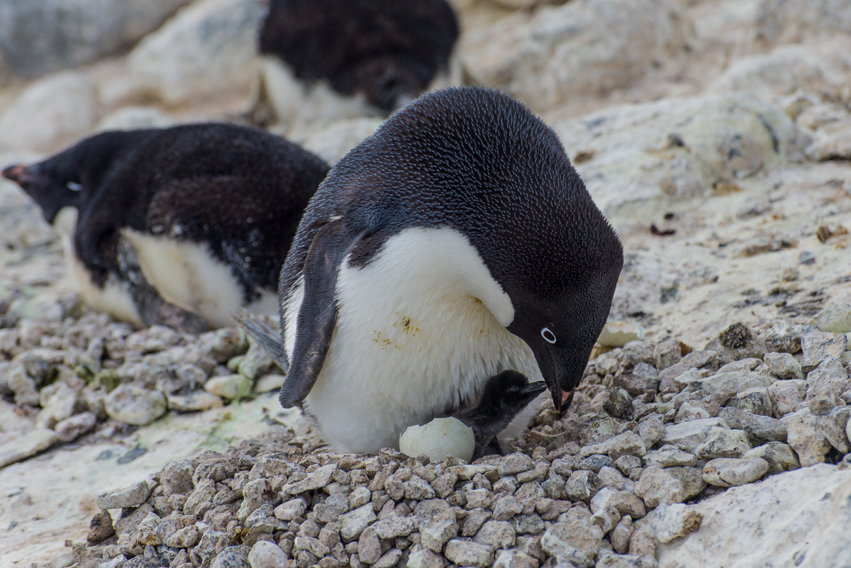
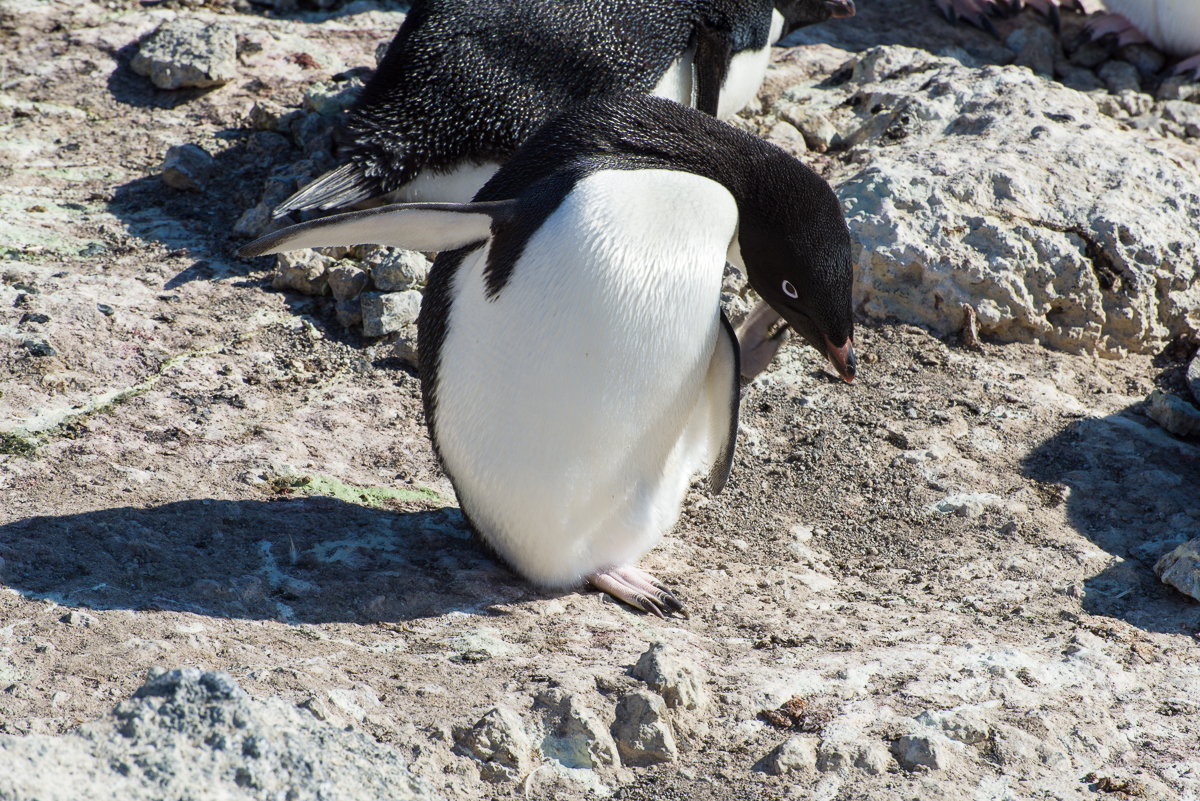
Newborn penguin chick — one of the first if not the first to hatch this season — greets its parent.
I can’t believe my luck. I mean, really. December 13th was my last full day at Cape Royds. It was overcast and the coldest day since I’d been at Royds and I had to keep stopping to warm up my hands. Not to sound melodramatic or anything, but I also had a cold and wasn’t feeling 100 percent. But I went out for a couple of afternoon walks with my camera and tripod anyway — one in the direction of the volcanic landscape, then after a pit stop at the field camp tent to warm up, one to the penguin colony. I have been told by the research team here that this is the time of year they typically see the first chicks. Nobody saw them yesterday, but Katie thought she heard a faint peeping and that there might have been some pecking their way out of their shells. Since I knew I would be getting picked up late morning the next day, I knew this would be my last chance to see chicks and I was on the alert for sounds. It started getting windy and I thought I heard something a couple of times but when I went over to investigate didn’t see anything. I wasn’t sure if it was my camera bag strap squeaking in the wind, which it does sometimes. After watching a colony that sounded like the direction it was coming from, I did catch a glimpse of an egg with a hole in it when a penguin stood up briefly and then settled back on top of it. But after waiting several minutes in the cold, I decided it wasn’t happening, my fingers were frozen and started walking in the direction of the path to the campsite. As I passed the neighboring subcolony, I heard an unmistakable peeping sound, looked to my left and saw this scene. It only lasted about 2 minutes — I took a few stills, turned on the video, and watched the penguin feed the chick and settle back down on it. You can see the video on YouTube.
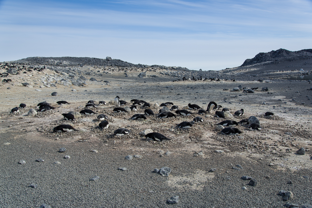
The subcolonies are distributed throughout the colony. Some have numerous nesting pairs, like this one, others only have a few. I saw one with just four nests.
Mostly what I saw while I was here were behaviors related to nesting. All the penguins who will breed this year have paired up, created little stone nests in their subcolony groups, and laid the eggs. The male does most of the nest-building, but once the female lays the eggs, they trade places sitting on the eggs. One goes down to the water to forage for food while the other sits on the eggs. When the foraging penguin returns, they great each other with a little dance where they swoop their necks up and down in unison and call out loudly. Then they switch places and the other parent goes off to feed.
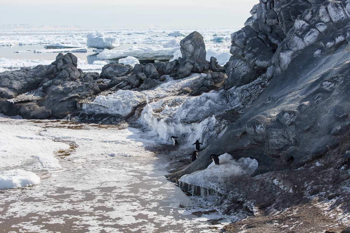
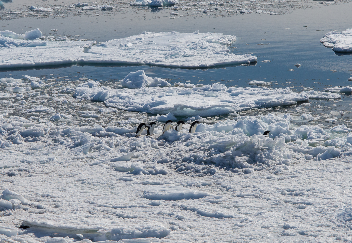
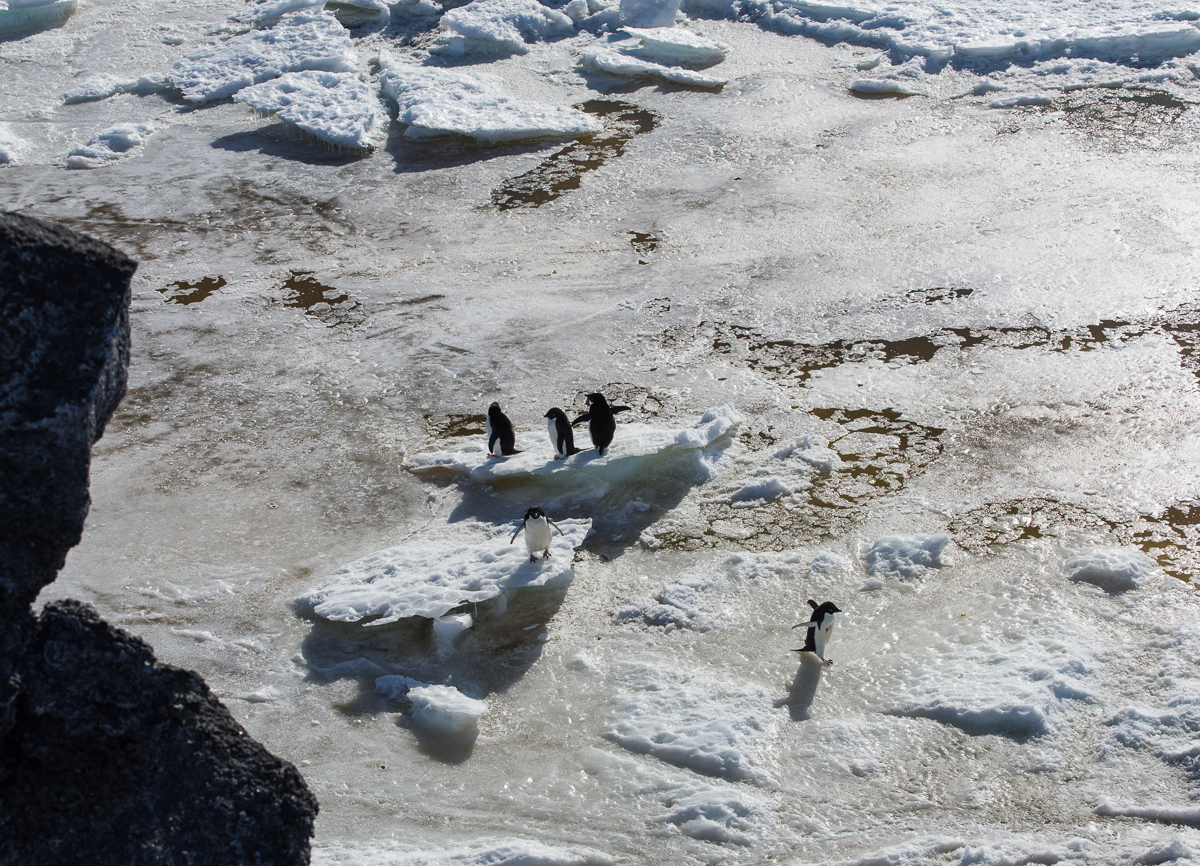
I was hanging out on the bluff overlooking the water watching the penguins form little groups to go in the water. They just go down there and join with others who happen to be on their way, and walk more or less single file.
Penguins travel single file to the water to feed.A lot of pack ice had blown in from the north, so they had to make their way across that to get to the water.
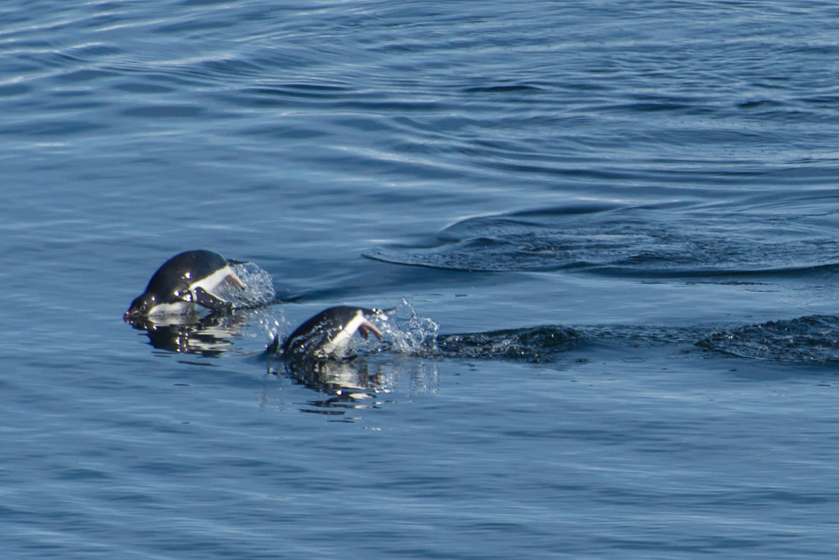
They’re fast swimmers and sometimes leap in and out of the water like a dolphin. I fired away with my camera and got some shots of wet, fast moving penguins that make them look like rubber dolls:
Catching air: this penguin leaped pretty high.Synchronized swimming, penguin style.
The pack ice floated at a good clip. Every day it looked different. On the 12th this iceberg showed up:
Iceberg that suddenly appeared at Cape Royds.
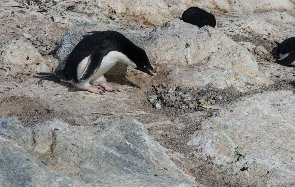
I tracked a penguin with my camera as he ran up a steep hill with a rock in his beak, which he presented to his mate in the subcolony at the top of the hill. There was an enthusiastic greeting between them. The landscape is rocky, he’s carrying a rock and something about the whole triumphant climb reminded me of the scene in the movie “Rocky” where Sylvester Stallone runs to the top of the long flight of steps at the Philadelphia Museum of Art. So I titled the video “Rocky.” Watch it on YouTube.
Don’t be fooled by the rocks that I got: this penguin is probably too young to mate and is just practicing nest building.
Young penguins three to five years old play at nest building, picking up stones and dropping them in a pile. Sometimes they even pair up, and do the whole greeting and changing places routine, but they are too young to breed and don’t lay eggs. Sometimes they make a nuisance of themselves and other penguins chase them away. I saw one in that situation running away who stumbled and slid about 8 feet down a slope on its belly.
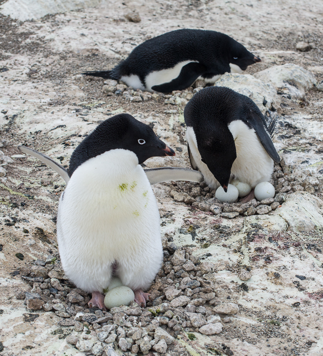
Too much of a good thing: the penguin on the right has three eggs in its nest. That’s too many to properly incubate and definitely too many to care for. [Note: Eventually two chicks hatched and survived.]Most of the penguins had one egg, many had two, and the one in the photo at left has three. I asked David Ainley and Katie Dugger, lead researchers on the penguin study who were there, how that happened. They said that either the male had had a mate that left and then a new mate that between them had laid three eggs, or one rolled down an incline from another nest. But the prognosis for three eggs is not good. Even if they all hatch, they won’t be able to care for three chicks and they will likely die. [Note: In early January, David Ainley, told me that the penguin couple with three eggs had, against the odds, managed to successfully hatch and care for two chicks.]
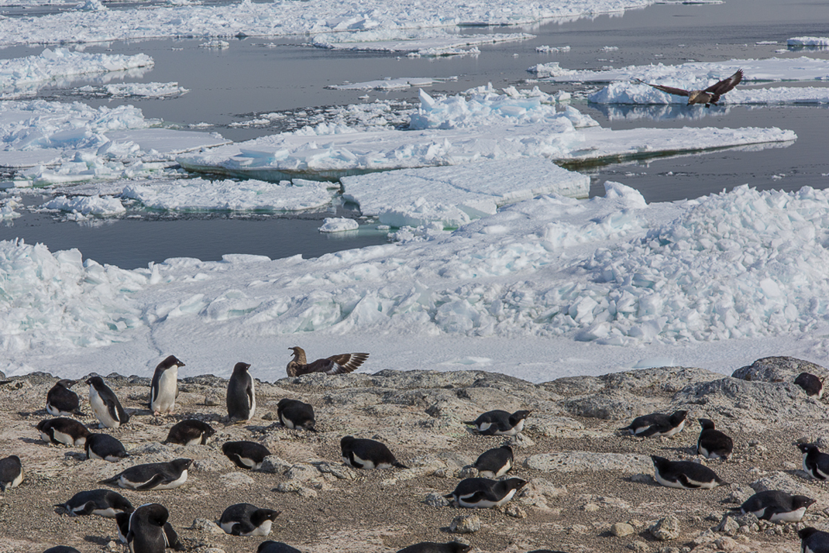
The only predator the penguins have to watch out for at Cape Royds, aside from orcas in the water, are skuas, who look for an opportune moment to steal eggs. I saw skuas swoop down and harass the penguins numerous times, but most of the time, the penguins are onto them, and squawk and lean toward them menacingly. The skuas may stand there for a while, but once they know they can’t catch the penguins unaware they tend to fly off.
These skuas harassed the penguins to try to get at their eggs, but the penguins were having none of it.
The penguins are unconcerned about the presence of people, however. Sometimes when I was standing in one place for a while, one or two would wander over to check me out. At one point I suddenly looked down to find I had company:
A curious penguin checks me out.
While I was there, Katie was making rounds every other day to check on the banded birds, making notes on the which ones were nesting and how many eggs they had. She has found that although the colony population hasn’t changed since last year, there are fewer nests and fewer eggs. Some nests were created but abandoned. Some pairs made nests but didn’t produce eggs and are just “playing house” as Katie put it. The scientists don’t know the cause of the lack of breeders, but one hypothesis is that something happened during the wintering over period that is making them struggle now.
Katie makes the rounds checking on banded birds, nests and eggs.
The colony at Royds took a major hit when an immense iceberg named B-15 broke off the Ross Ice Shelf and essentially iced in a huge area of McMurdo Sound year round, preventing the sea ice from breaking up in the Antarctic summer. After it broke up in 2005, the colony began to slowly recover, but it has still not achieved its original size, even though there should be enough krill and silverfish for them to eat. You can see that when you look at an overview of the colony and see all the empty spaces that are tan in color where penguins used to nest. More research is needed to understand what is happening in the wintering over period and to look at some of the environmental variables that could be affecting their ability to survive and breed.
Many mysteries remain about the lives of Adelie penguins, especially what happens during the Antarctic winter
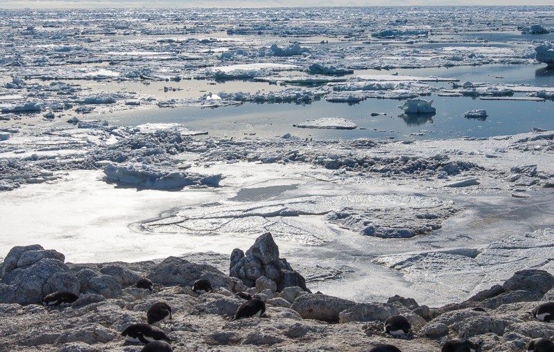
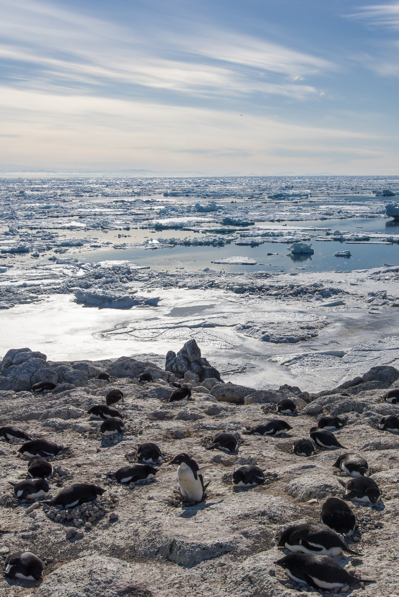
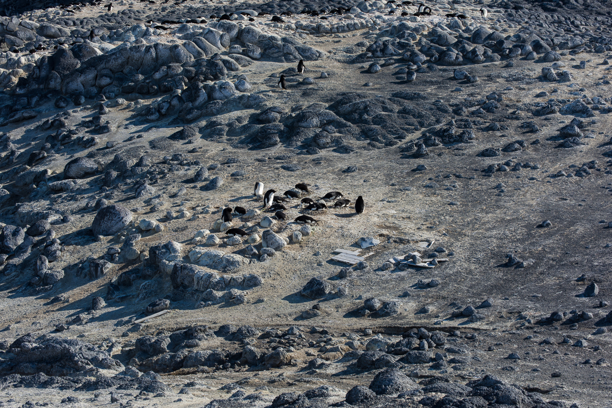
Nesting penguins overlook the sound, which filled with floating icebergs over the past few days. Small groupings like this are called subcolonies. They tend to distribute themselves fairly uniformly, a couple of penguin-lengths apart, and face different directions. Too close, and they get annoyed with each other, and push the interloper away with a squawk.The researchers keep track of the banded birds to see if they are nesting and have eggs.
It’s my third day at the Cape Royds penguin colony, which consists of Adelie penguins. It’s a relatively small colony, with the larger ones at Cape Crozier and Cape Byrd, and Beaufort Island, which are all less severe environments than Cape Royds, which is basically further south. Katie Dugger, who has been keeping track of the banded birds this season and their nesting activity, estimates that there are a little less than 2,000 breeding pairs, i.e. 4,000 penguins. The ones that haven’t bred go out to sea, but will come back after the chicks have hatched. Right now, at any given time, about half of the birds are on land and their mates are in the water. The eggs have been laid, so they’re swapping places sitting on the nest about every other day. Katie knows this from keeping track of the banded birds. Chicks are banded at the end of each season.
Cape Royds penguin colony from the top of the trail. The Cape Royds hut used by Ernest Shackleton’s expedition is in the foreground on the left. The body of water in the foreground is a small lake. The sea is behind the hill. This was on one of the days when icebergs had blown in from the north. Where the ground is tan is where the penguins nest. As Jean Pennycook told me, the soil color results from “10,000 years of penguin poop.”
To get to the colony, you walk about 5 to 10 minutes down a trail past one of the historic huts used by Ernest Shackleton’s Antarctic expeditions. Like other historic huts in the area, the hut and the artifacts and supplies left behind by those early explorers some 100 years ago are maintained and conserved by New Zealanders. The huts are kept locked, and you may only enter with a trained hut guide, who could be a New Zealander or an American. I didn’t come with someone who had the training, so I haven’t been in, but if you’re curious, another photographer with the Antarctic Artists and Writers Program, Shaun O’Boyle, did a lot of shooting in there. I highly recommend his blog Portraits of Place in Antarctica. He got here in October and just left. His project involved the architecture and manmade structures here, and he does beautiful work.
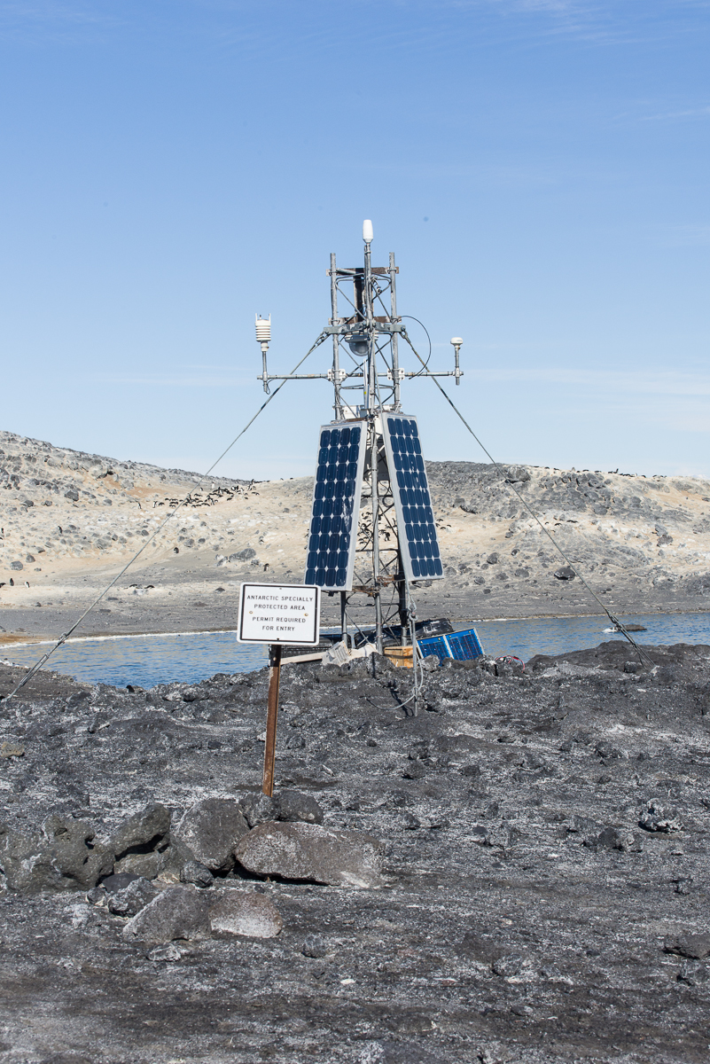
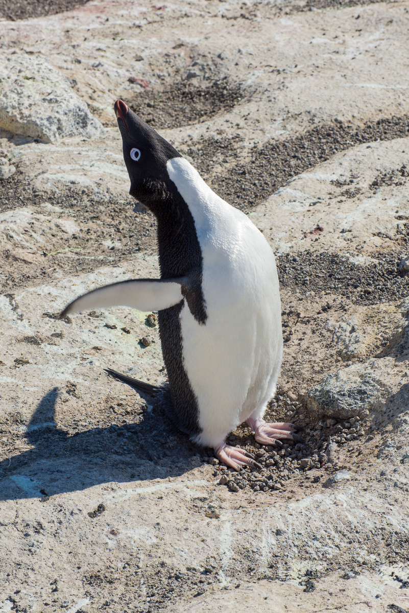
This penguin has stood up to adjust its position on the egg. This penguin has one egg, but some have two.A camera mounted on the other side of this tower takes the time lapse photos of the colony posted on penguinscience.com. A sign marks the beginning of the protected area. A permit is required to enter.
It’s a protected area, so not anyone can enter. Right now if you watch the penguins, their activities revolve around nesting. They’re either sitting on a nest, occasionally standing up to shift position and settle back down. Or they are picking up rocks in their beaks to add to their mate’s nest. Or they are in the water or coming and going from the water to eat krill and silverfish, their main diet.
Penguins go down to the water to eat, then return to the nest to give their mate a turn.
When they go in the water, they tend to form little groups, then walk to the ice edge together and enter together. They just join whatever other penguins happen to be on their way down the slope to swim.
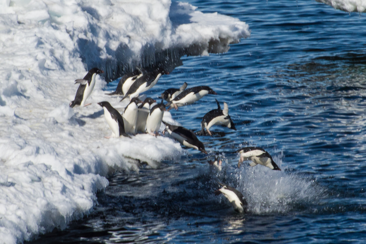
It’s entertaining to watch them dive into the water. They gather at the edge, mill around a bit, and then they dive in. Here are a couple where I’ve stopped the action:
Heading for the water. Look at those gestures. They’re very human-like. No wonder we are tempted to anthropomorphize them.Semi-synchronized swimming: penguins take the plunge as a group.
So, friends and blog followers, yesterday I figured out how to shoot video with my Nikon SLR. I’m getting better at it as I go along, so I have some good footage already, but the Internet upload speeds are sloooowwww, so I can’t just put them all up at once. My first effort is admittedly not in as good focus as the ones I made today, but it gives you a look at penguins in action nonetheless, and they are, frankly, adorable. You can find the video on YouTube here. As I get them online, I’ll note them in this blog, or just subscribe to my YouTube channel. And of course, Jean Pennycook has posted a lot of photos and videos of this colony at PenguinScience.com.
This is the only time I saw a penguin get its foot that high, to scratch itself. Jean Pennycook, the PenguinScience.com educator, jokingly calls poses like this “penguin yoga.”Looks like this bird is doing some Penguin Yoga, too (Sun Salutation?). Sometimes when they stretch like this they also make a sound as if to say, “I’m here!”
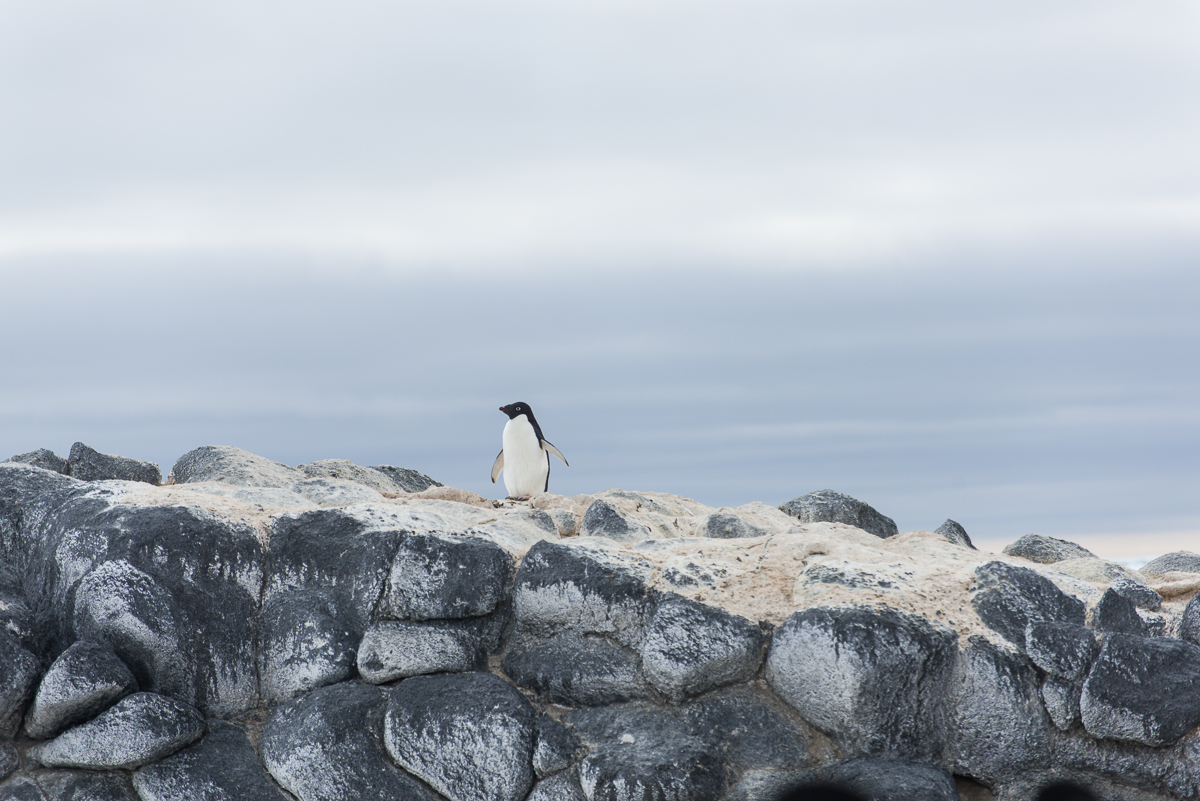
Off the beaten track: Most of the penguins hang out in the penguin colony, but a few wander further afield.
On Dec. 9th, I went via helicopter with Evan Miller (the mountaineer you met in previous blog posts) to the Adelie penguin colony at Cape Royds. At the Royds field camp, you are between Mt. Erebus and the Ross Sea. It’s a short hop via helicopter from McMurdo, about 15 minutes, but a completely different landscape. For one thing, McMurdo is still iced in with a thick layer of sea ice but Royds is beyond the sea ice edge, so there’s open water (which is typical for this time of year, though the sea ice broke out here before mid-November, which is on the early side). Erebus still looms in the distance, and you have more the feeling of being on the lower slopes of a volcano, since there are hills covered with black gravel and rounded stone formations they call volcanic pillows. The “pillows” have rounded protrusions so uniform in size it looks like an archaeological site where some ancient civilization had built stone walls by piling stones, but of course that’s not the case at all. Some of the structures that look like a wall made of a pile of stones are in face, one big rock.
Evan walks through a typical landscape around here, filled with black volcanic rock.
Evan was sent to accompany me for the first 24 hours to explore the site so I knew where I could orient myself so I could walk safely on my own for the rest of my stay. So on that very windy afternoon when we arrived, after lunch we set off on a walk toward the small lakes to the north and then looped back along a ridge that overlooks the coastline. The penguin colony itself we decided to save for the next day, since that’s terrain that I would not need the know-how of an experienced mountaineer to explore.
Right now there are two women working here, field camp manager and outreach educator Jean Pennycook and wildlife biologist Katie Dugger. Katie is leaving in the next few days, and her colleague David Ainley, the scientist who established this study, will take over her daily monitoring of the penguins. Jean makes sure the camp is supplied and is busy with outreach activities, making Skype calls to classrooms all over the world from the colony via her iPad, communicating with schoolteachers and updating the Cape Royds penguin project’s fabulous web site at penguinscience.com, which I highly recommend if you have any interest in learning more about penguins. There is information there for any level of education, from kindergarten to college. If you have kids, show them the site and tell their teacher about it! You’re probably saying, all right already, enough with the exposition, let’s see some penguins! So, even though this is out of order, here’s a quick peek. I promise more penguins up close and personal in the next post.
A portion of the main penguin colony at Cape Royds with scattered remains of one of Antarctic explorer Ernest Shackleton’s structures. One of his huts is here, and as with all the early explorers’ huts, any debris that is scattered around the grounds, even broken glass or bits of bones from their dinner, is left undisturbed and you are not supposed to touch it. Why is the ground tan? As Jean put it, “That’s about 10,000 years of penguin poop.”
Evan and I found the larger lakes:
Clear Lake, one of the frozen inland lakes.
…and smaller ponds:
The penguin folks call this one Skua Lake, since skuas often hang out here. You can see Inaccessible Island out in the Ross Sea in the distance on the right.
And volcanic rocks worn by the wind, called ventifacts:
The vocabulary word of the day is “ventifacts.” These are rocks eroded by the wind into unusual and striking shapes.
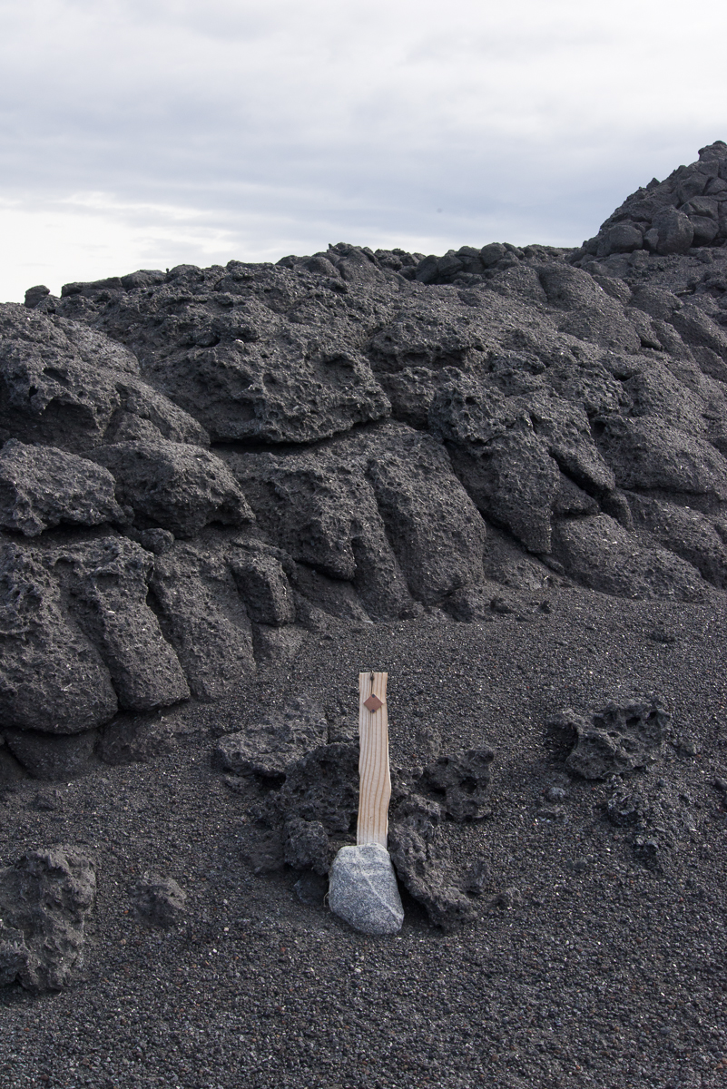
Evan and I also encountered this post on our walk. Jean didn’t recognize it. Maybe it’s a marker from a previous study. Anybody know what it is? Click image to enlarge it.
As we walked, Evan and I happened upon a nesting skua, sitting on an egg. She hyah-hyah-hyahed at us to warn us off for a while, and then stepped off the nest and took a few steps toward us as if to say, “Hey, I mean it, get the hell out!” So we made a big circle and ended up at a distance from the other side of the nest. Evidently that was good enough for her, and she walked back to her nest and settled back in, but we got a quick glimpse of the egg (photos below).
If you know what’s good for you, you’ll leave me and my egg alone!Good, they’re going away! Don’t worry, little egg, Mommy’s back to keep you warm.
We had, it turns out, inadvertently walked into a major skua nesting area. We kept seeing nesting pairs. Most either ignored us or squawked a little as we walked by but suddenly Evan was being dive bombed by a skua, who kept swooping down within a few feet of his head. Why it went after him and not me, who knows? Maybe because he was taller? But we walked faster and got out of there.
Coming over the ridge we saw the sea. The open water was a contrast to the unending vista of flat sea ice from McMurdo:
Our first day at Cape Royds, the wind was blowing from the south and beyond the pressure ridge was clear open water. See the pressure ridge formation a little to the right of center, where there’s a rectangular chunk with a hole in it and another piece with a little stalk to its right? Now look at the photo below from 24 hours later, after the winds had shifted.What a difference a day makes: 24 hours later, the winds had shifted, blowing in sea ice. See the formations from the previous photo, now on the left in the foreground? Notice all the ice that’s come in behind them.
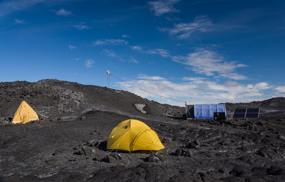
That’s my tent in the center, Jean’s on the left, and the main hut on the right, one roughly 9 x 15 foot room where we do all our cooking, working at our laptops, store the non-refrigerated food (a large picnic cooler set in the great outdoors serves as the camp “freezer”) and warm up if necessary — there’s a propane heater in the hut. The sleeping bags and fleece liners they gave us are incredibly warm and believe it or not, I’m completely comfortable sleeping in the tent in same short-sleeved PJs I wear at home, even though the tent is unheated and outdoors it’s probably been in the 20s with wind chill. An eyeshade is a must, though, as the bright yellow tent lets in the sunlight 24 hours a day.
The winds were blowing stiffly from the south all day. We kept waiting for them to calm down in order to set up my tent, but that wasn’t happening. So I got a one-on-one lesson from a certified National Outdoor Leadership instructor on best practices for setting it up in the wind.
A penguin stopped by while I was putting my belongings in my tent. Now there’s a sentence I’ve never written before.
However, Katie assured us that the forecast called for the winds to die down and shift direction after midnight. The next day we were surprised to see that indeed they had, and the sound had filled with sea ice blown in by the winds coming from the north. Giant slabs of ice were moving briskly along.
C the ICC: Another view of the sea ice that blew in overnight. Everything that’s clean and white beyond the dark ridge wasn’t there the day before.
Earlier on the second day that we were here, when the above photo was taken, I also took one looking south. It was a nice sunny day and you could see the sea ice edge, and the very same iceberg I photographed on the excursion several days ago that I spoke about in an earlier post:
The sea ice edge, Inaccessible Island, and the iceberg I photographed several days before were visible in the distance from Cape Royds.
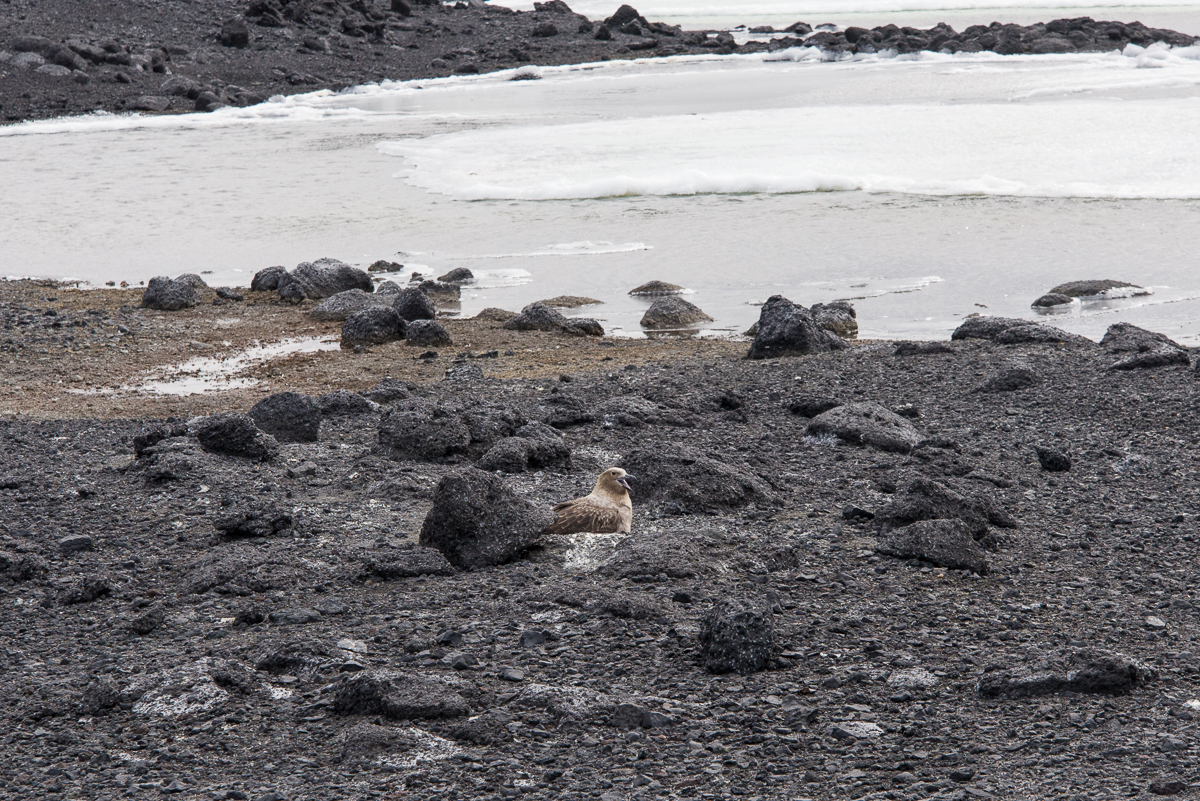
On that second day’s walk, we also walked down the steep slope to a black sand beach. We encountered the lone penguin you see in the first picture in this blog post. Walking along the beach are interesting snow and ice formations, big and small. I’ll end this post with a couple more:
Looking up from the black sand beach.I never get tired of pressure ridges! Across the sound are the mountains.The view I wake up to: lava pillows and Erebus. It’s an austere place, but a wonderfully peaceful one.
On December 1st, before visiting the Erebus ice cave, Evan and I went to see some icebergs that are stuck in the sea ice near the Dellbridge Islands. The Dellbridge Islands include Tent Island, Big Razorback and Little Razorback. The iceberg I photographed first is nearest to the island in the group with my favorite name, Inaccessible Island, named by the famous British Antarctic explorer Robert F. Scott because it was hard to reach. Of course, he didn’t have a Haagland tractor, which made the trip much easier. Not that a Haagland is a luxury vehicle by any means, but it’s great for traveling on ice and it gets warm inside. Big Red (as everyone calls the heavy parkas we were issued) comes off when you get in a Haagland. You’ll see the islands in the background of some of these photos. Also nearby was Mt. Erebus, but it’s so huge (over 13,000 ft.) that Erebus seems nearby wherever you go around here. The angle of the sun showed up the large crevasses on its lower slopes.
It was so clear that even from a distance you could see the crevasses on Erebus’s lower slopes.
The plan was for me to circle the iceberg nearest Inaccessible Island, to take photos for a 3D file, which I did. I selected 162 to process and since there were so many, I carefully masked them in the software, which took several hours, and I’m processing the file as I type this. I’m optimistic it’ll come out, because the first stage of processing where I aligned the photos showed a generally recognizable shape, and the second stage, under way now, originally showed it would take a total of 12 hours, but it is now almost 60% finished and the estimated total is down to 7 1/2, so the fact that it’s going faster than the original estimate is a good sign. Stay tuned for the next post…
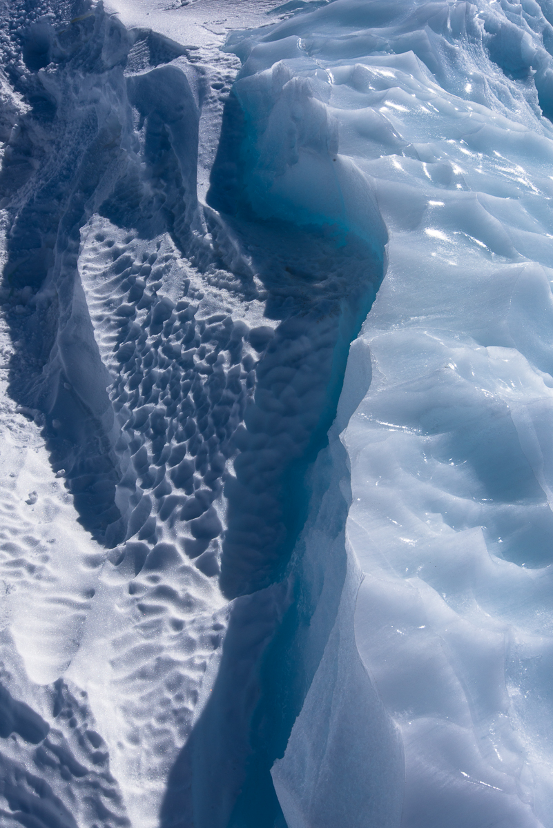
Two kinds of ice, matte and glossy, side by side. Click this and the other images to see larger views.
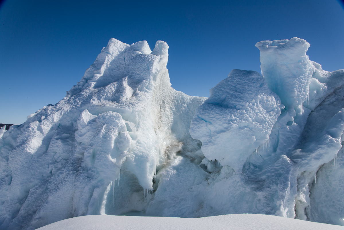
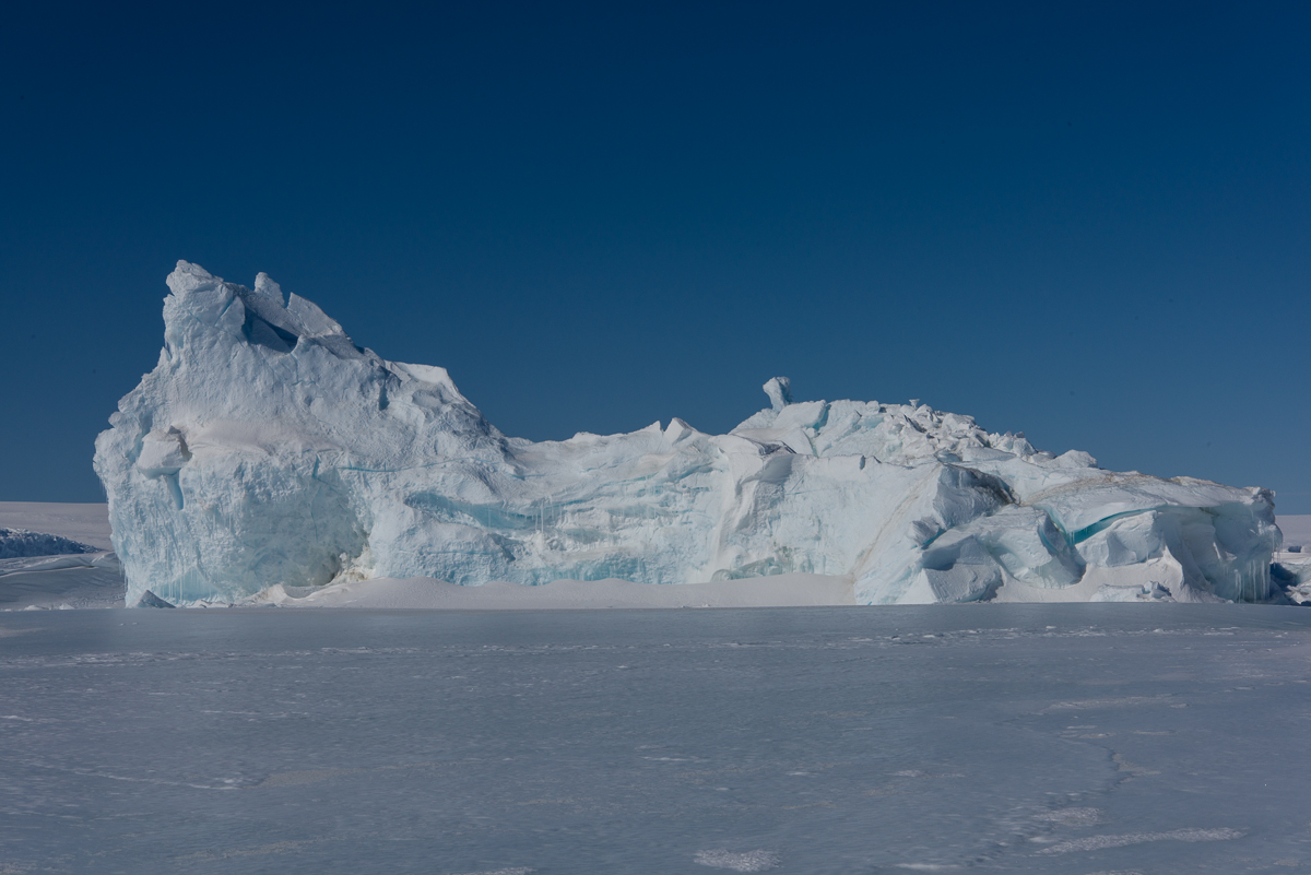
In the meantime, I’ll share with you photos I took after we left that iceberg and stopped at a spot where we could walk around a couple of smaller ones. One in particular had a lot of drifted snow around it, so I’m not sure if I’ll be able to get a 3D file of the whole thing, but it sure had a wide variety of ice formation and profiles that changed as you walked around it. The photos here show some of my favorite views.
A little pool of water had melted around one end. Our Haagland vehicle is in the distance on the right.Wind-whipped snow and ice.The drifting snow had curved into smooth, rounded forms.A slight change in perspective shows a different view than the one above, although you can see the same large forms on the left.But the opposite side of the iceberg looks totally different from the side catching the drifting snow.
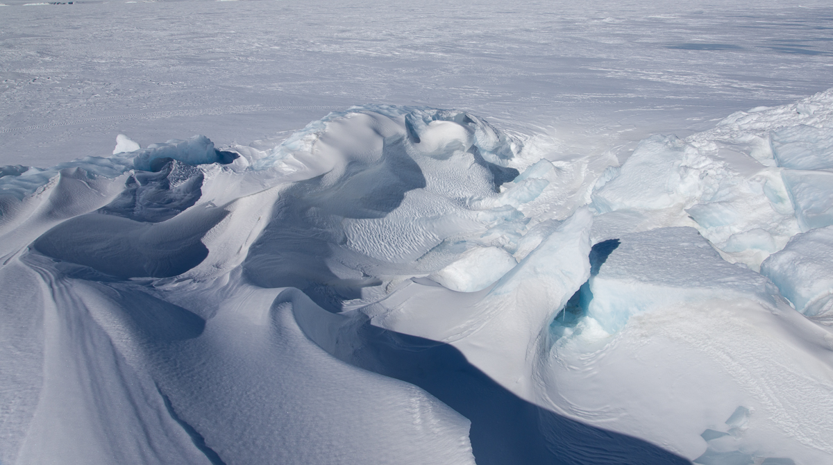
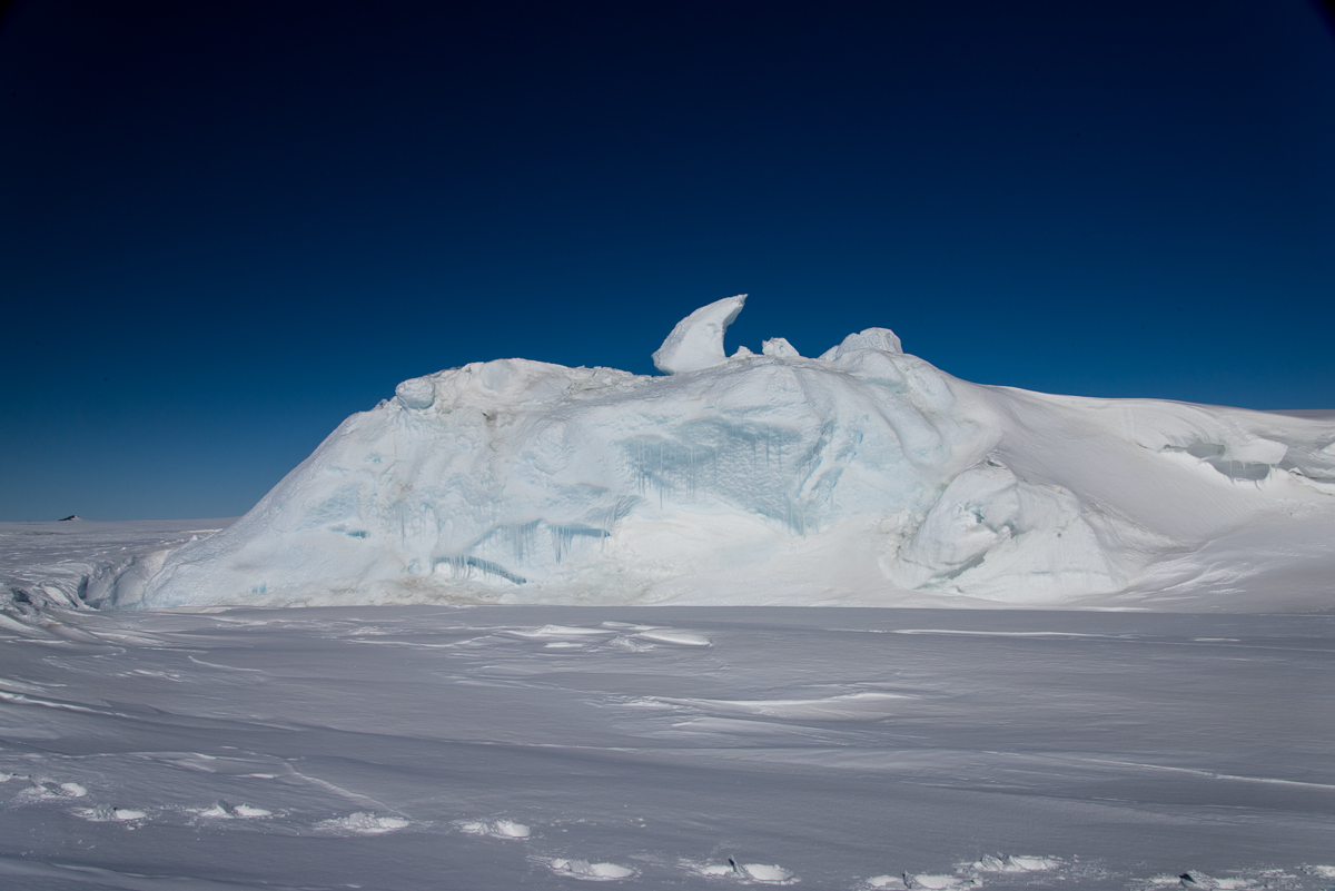
This is the only shot I’ve included of the smaller of the two icebergs, because it wasn’t as interesting, although the hook-shaped protrusion popping from the top in this view is certainly quirky.
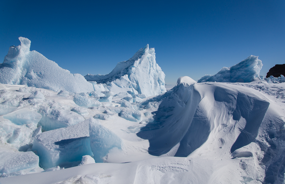
The two smaller icebergs were closer to Little Razorback Island. You can see where pressure ridges have formed near the island.