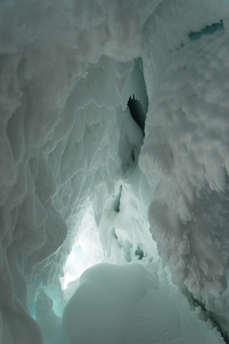
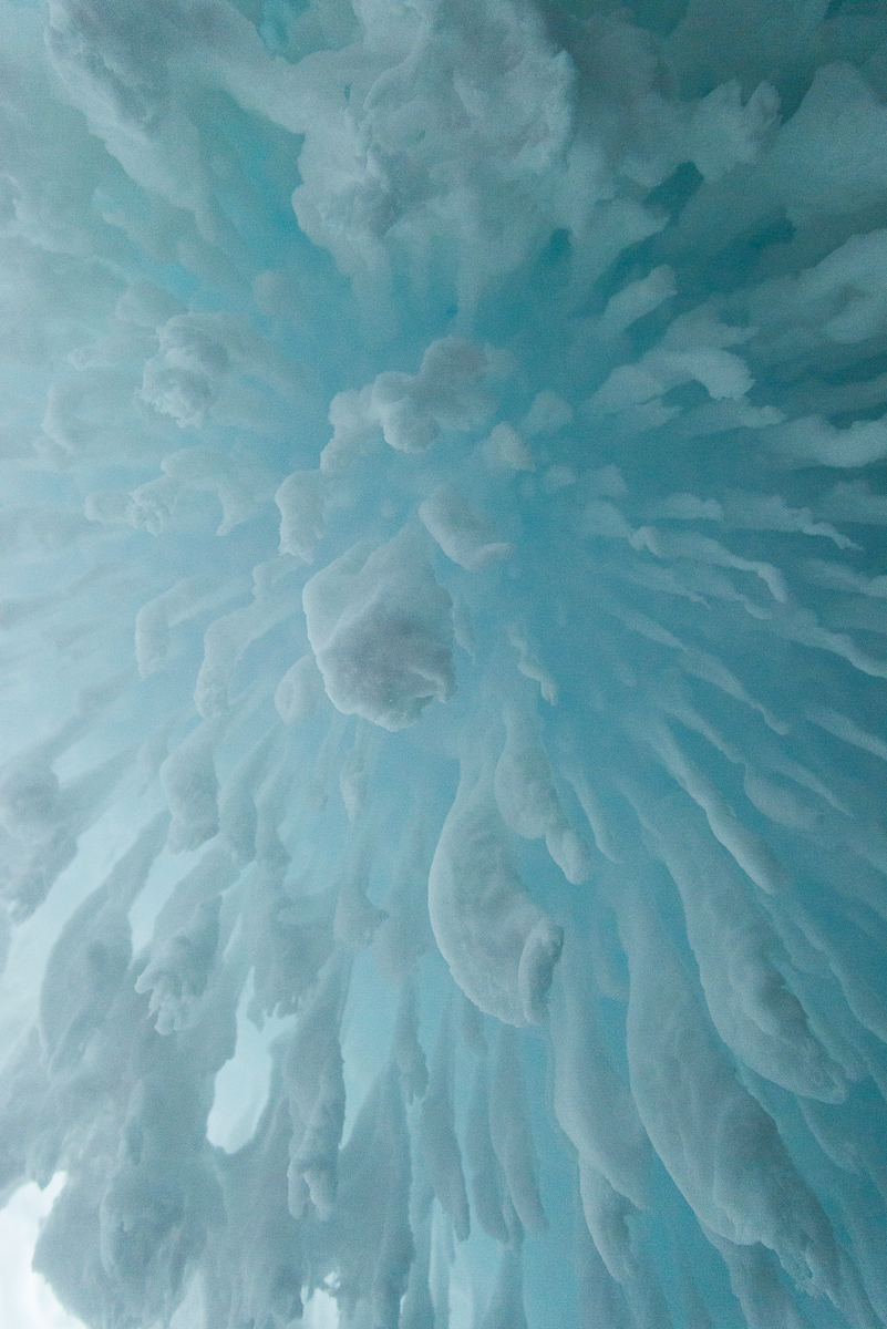
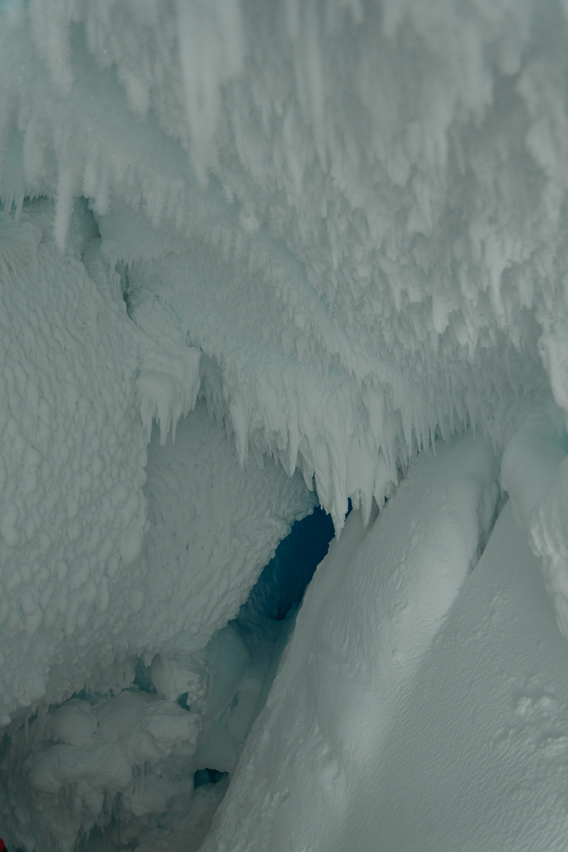
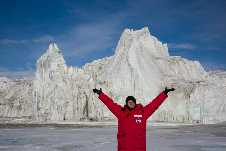
Inside the ice cave are a remarkable array of ice formations, awesome in the original sense of the word.
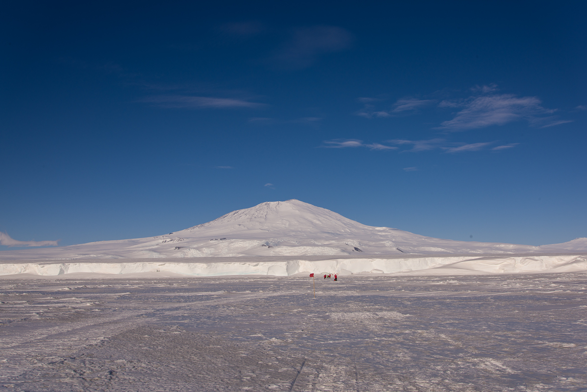
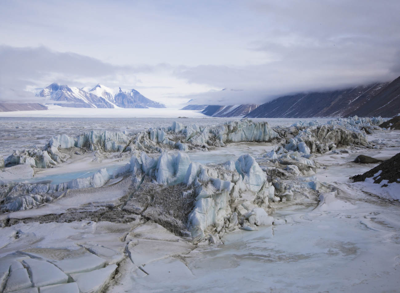
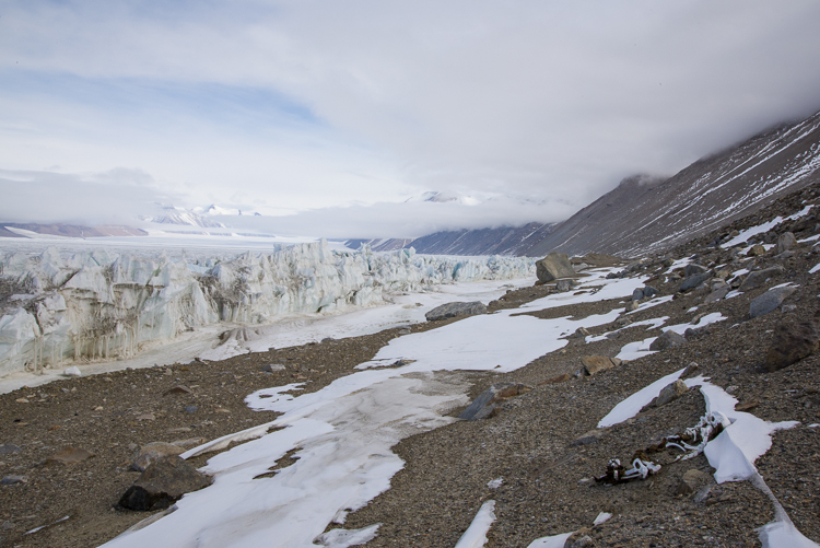
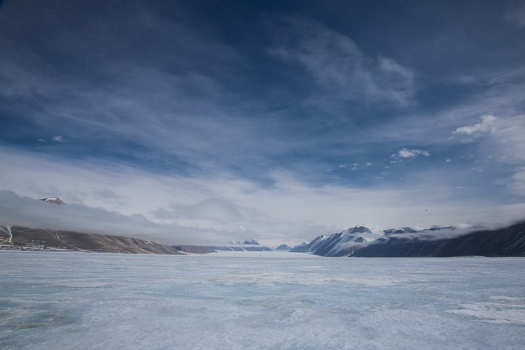
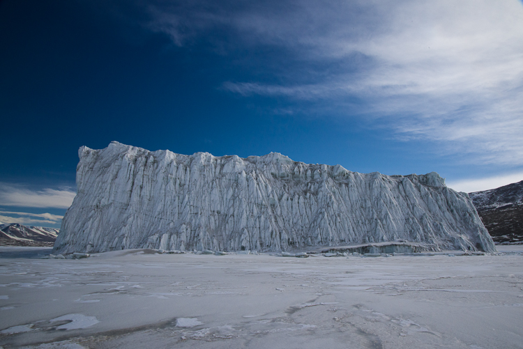
This week the mountaineers investigated the ice cave in the Erebus ice tongue, a glacier coming off Mt. Erebus, and declared it safe to visit, so the Recreation Department here began offering group trips there. Mt. Erebus is the southernmost active volcano, and despite the boiling lava inside it, the outside is ice covered. (See an aerial shot of the ice tongue.)
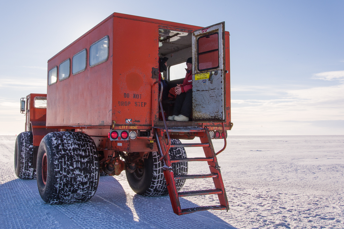
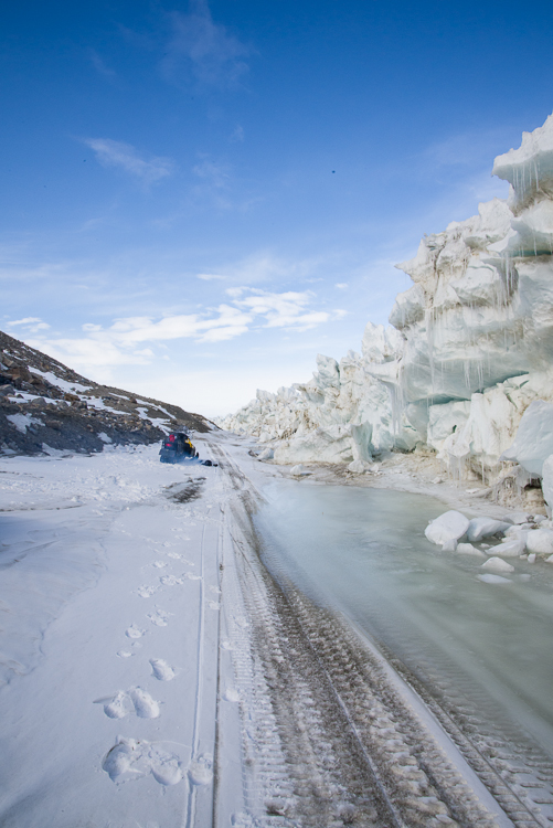
We traveled about an hour in the back of a Delta to reach the ice caves.
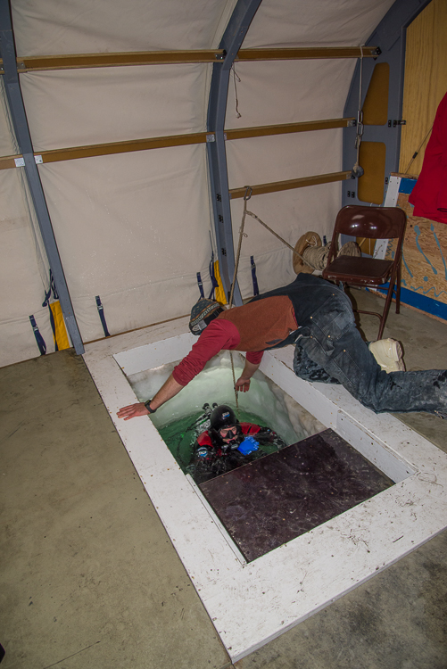
On the night of Nov. 27, 14 people who had signed up for the trip plus a mountaineer boarded a transport vehicle with huge tires called a Delta, driven by a woman named Serena over the sea ice to the cave. We were instructed to bring full ECW (extreme cold weather gear), which turned out to be a good thing, because when we got there, a stiff breeze added significant wind chill, and once at our destination, we had to walk about a half mile from the vehicle to the cave entrance.
The flagged path from the Delta to the ice tongue, with Mt. Erebus towering over it. Somewhere up there is a team of volcanologists measuring gases — one of them was my roommate here for the first week.
Our instructions were to stick strictly to the flagged path across the sea ice on the way there and back, and make sure not to brush up against any of the delicate formations on the cave walls once inside, as well as to watch our footing in case it was slippery in spots. I was assisted in the latter by a great accessory for walking on ice called Yaktrax — they are stretchy plastic straps with wire springs wrapped around them that slip over the soles of your hiking boots and give you considerably more traction. They’d be useful for those winter days in the Northeast when you have to traverse an icy parking lot with bags full of groceries. Hey, holidays are coming up — looking for a good stocking stuffer?
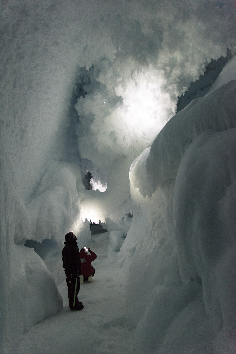
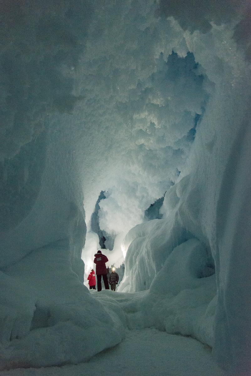
From inside the ice cave looking out toward the entrance.Some of the formations inside the cave were otherworldly. Click image to enlarge.
Once at the entrance we divided into two groups so there wouldn’t be too many people inside at a time. Each group was inside for about 25 minutes. Serena was stationed by the entrance and summoned us one at a time to slide on our bellies through a small opening and down a slight incline for about 8 feet into the first “room” of the cave. It’s a cave, so once you get further from the entrance it’s dark inside, but the mountaineer and Serena had lamps they could aim around to provide some light. Inside were a remarkable variety of ice and snow formations.
Once inside we could stand up and walk around a cathedral of ice.
It had never occurred to me that you could ever walk inside a portion of a glacier, or that there would be soaring open spaces that you could stand in. Indeed, from the small outside entrance, there’s no clue that anything like this awaits. The photos with people in them give you a sense of the scale. Those photos that are evenly lit were taken with a flash, the others with just the light from the head lamps, which give you a more accurate picture of the lighting inside, but are a little grainy because of the dim light.
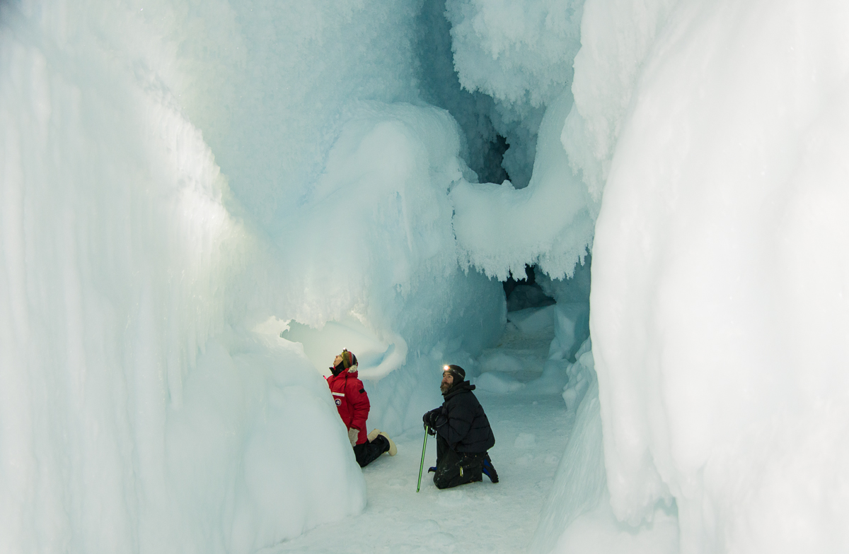
Beautiful but unapproachable: the hanging ice “bridge” is behind the mountaineer kneeling in the center.
The mountaineer stood at the far end of where we could safely go, which was just before a suspended “bridge” of ice. “You have to stay on this side of the bridge,” he told each of us as we approached. “That’s okay,” I told him, “I don’t want to be under that thing if it chooses that moment to come crashing to the ground.” “You have good survival instincts,” he replied.
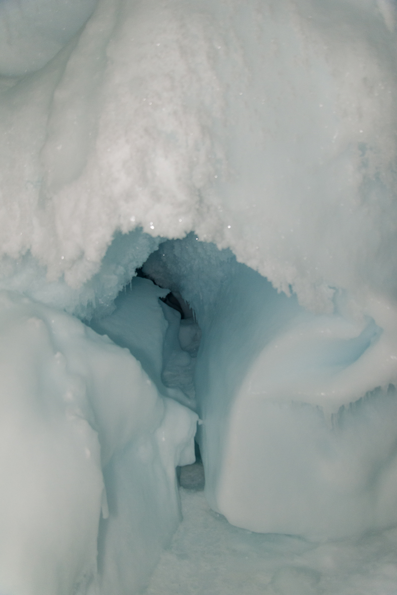
Here are some other nooks and crannies:
An interior ice formation that Georgia O’Keeffe might have appreciated.Ice cave “stalactites.”
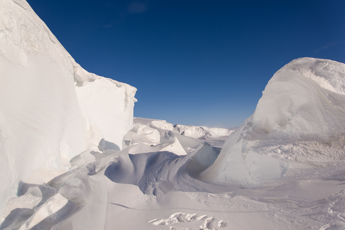
I emerged at around 9:15 p.m. The sun was shining brightly. I took a few photos of the brilliantly lit windswept forms around the entrance and of the stark expanse of sea ice on the walk back to the Delta. The next sundown at McMurdo will be February 21, 2016, but the light does change in a 24-hour period, and at this time of night forms had more depth than they do at other times of day. Here are photos from the walk back:
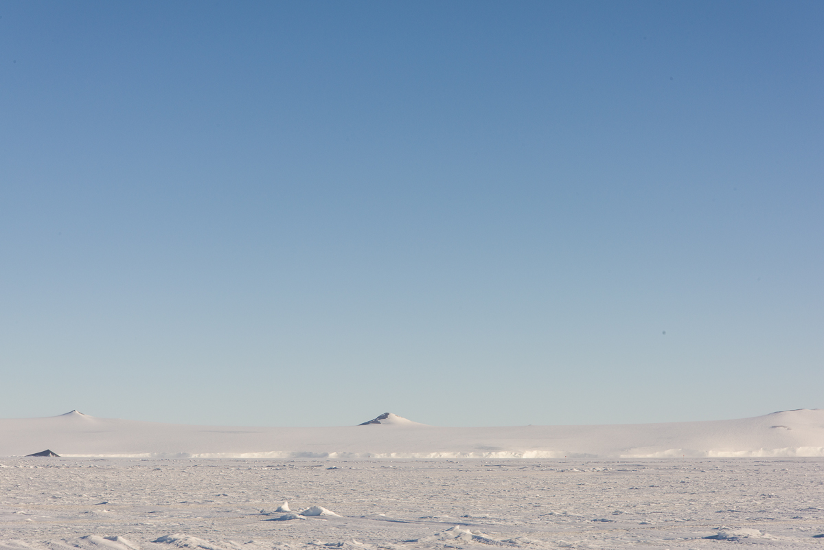
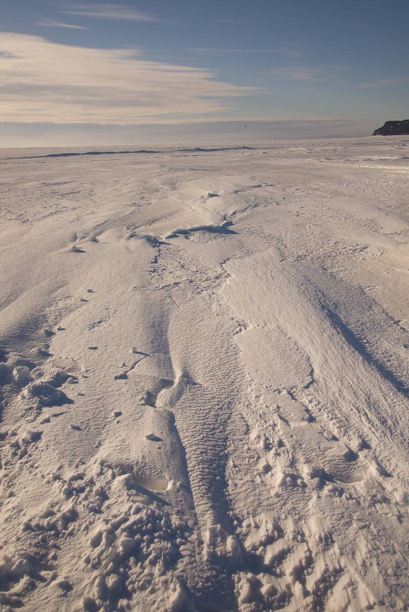
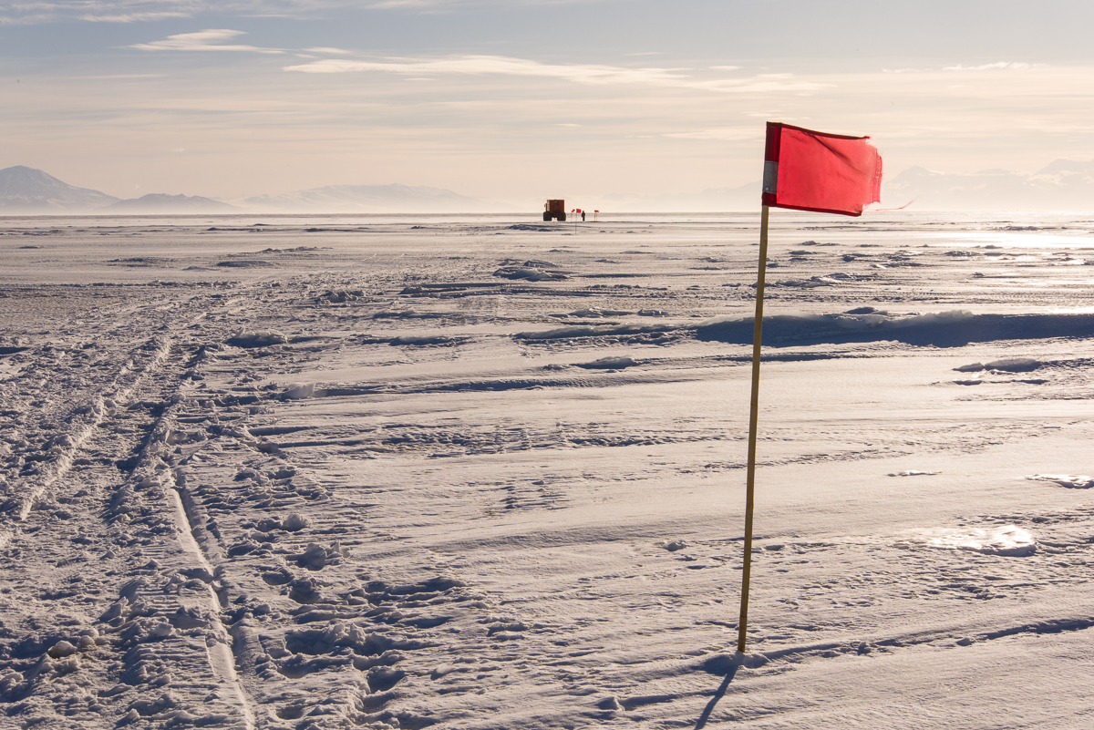
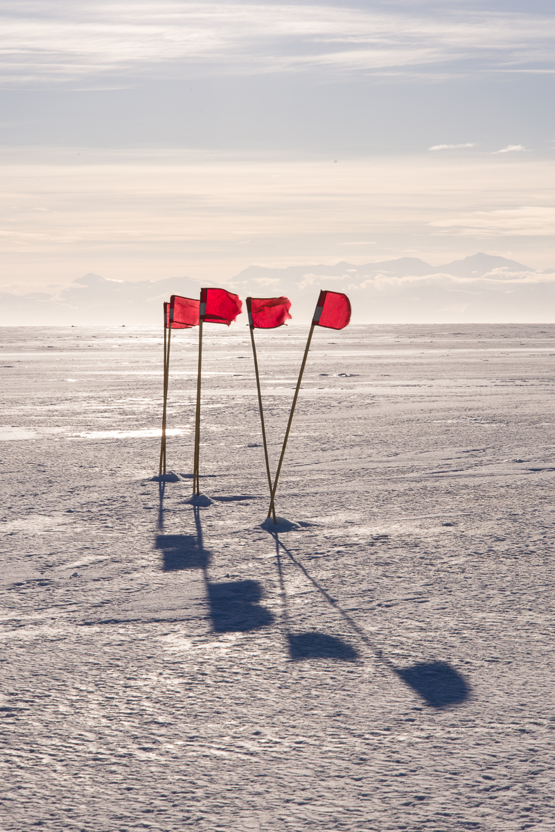
There were striking windswept forms outside the cave entrance.To one side of the path was a vista like something from another planet.On the other side of the path, the low sun threw the surface snow into relief, revealing patterns similar to what you find on a sandy beach. The rocky outcropping in the distance on the right is a small island that will be surrounded by water when the sea ice thaws in January.Ahead was the Delta, with flags marking the path. The flag indicates how windy it was.
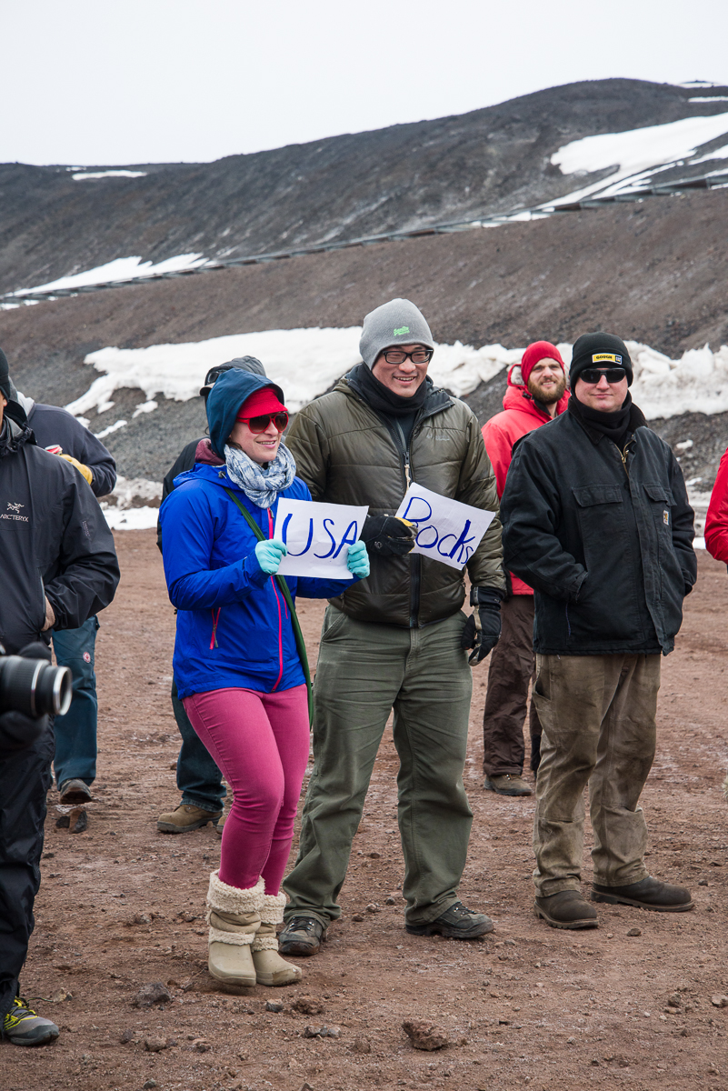
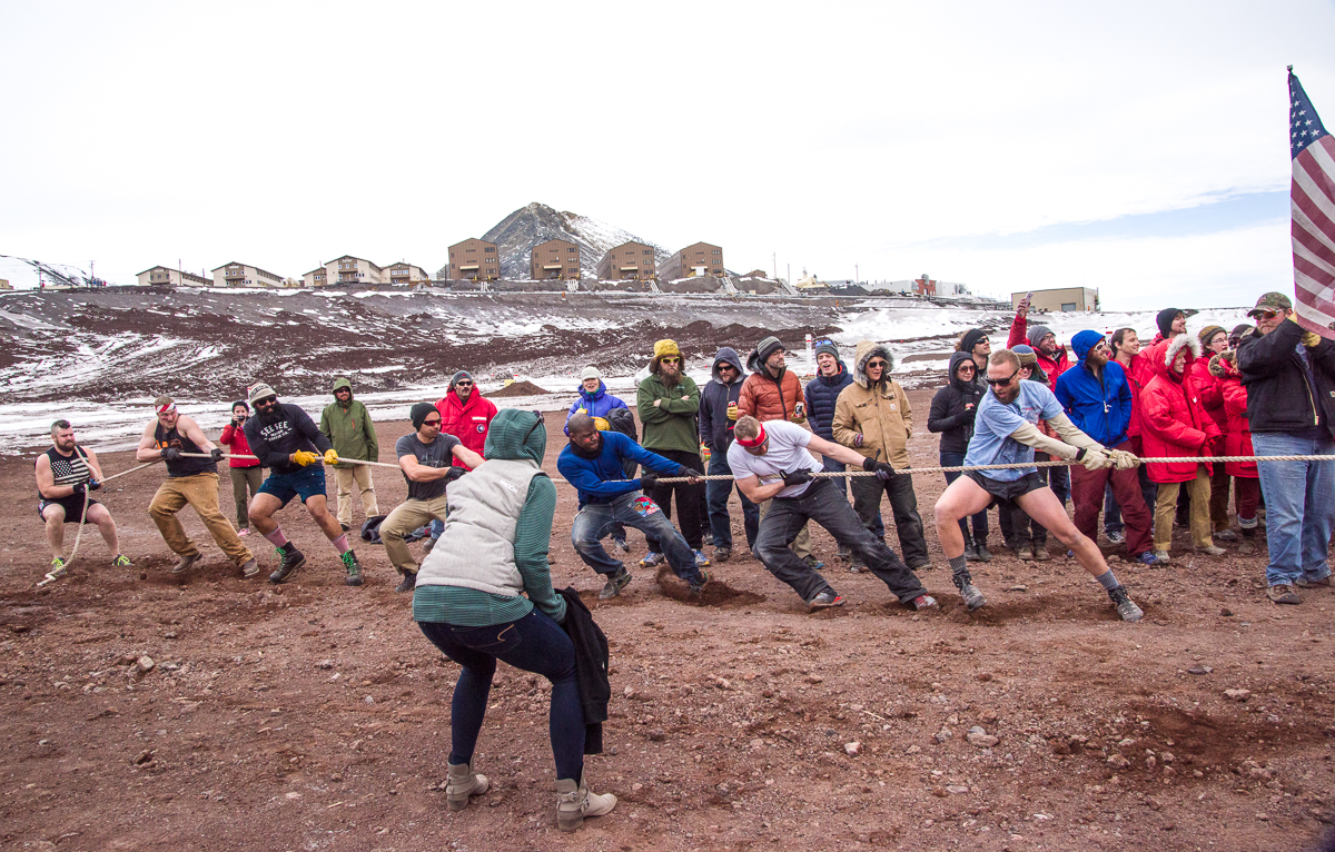
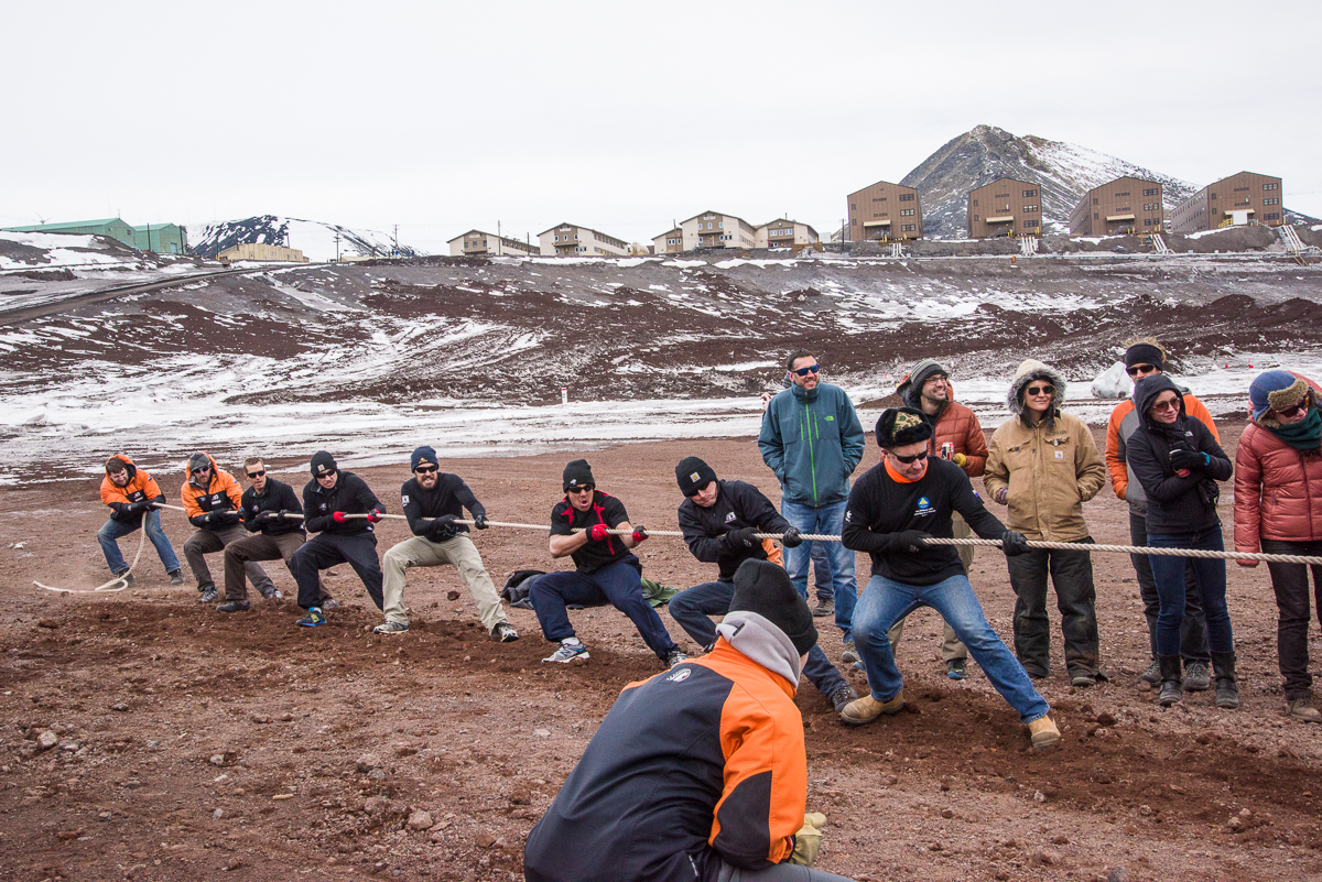
Team USA with their captain and referee.Part of the USA fan section.
ESPN isn’t here, but luckily for you, I am, to give you the latest Antarctic sports news. Last night was the annual tug-of-war competition between McMurdo Station and our New Zealand neighbors (aka the Kiwis) at Scott Base, which is a short drive away. Apparently New Zealand always wins. Could the Americans break their losing streak?
It was a total bro fest, at least on the American side, with much boisterous pre-game banter. There was a lengthy weigh-in before the competition, to make sure the teams were each 115 stone — New Zealand originally set up the competition, so that’s a British measurement. (“What’s a stone?!” someone called out during that announcement. Answer: 14 lbs.)
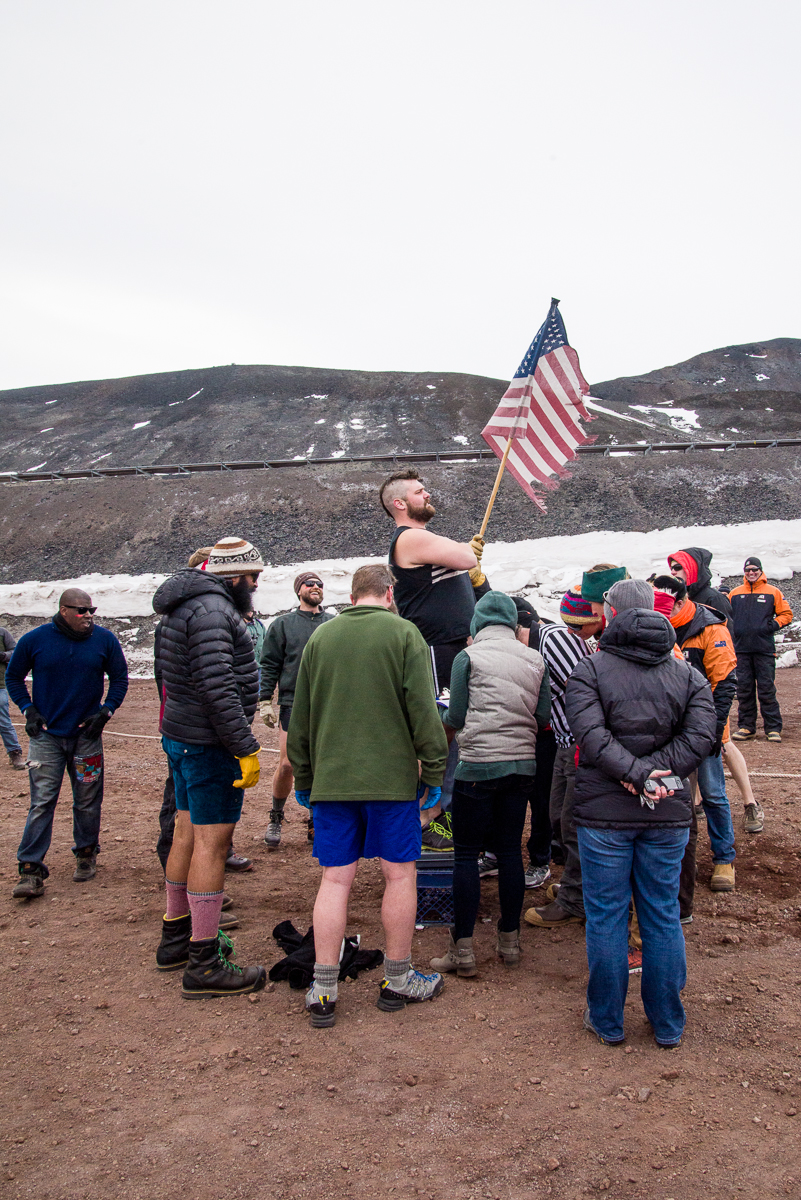
Our big man weighs in.
To make weight, or maybe just because bros will be bros, some of our guys stripped down to short pants and tanks or t-shirts, while the New Zealand team members were low-key in demeanor and stayed sensibly dressed for the 20-degree weather in long pants and jackets. Our biggest guy weighed in at 303 lbs. (A New Zealand guy standing nearby remarked, “Wow, that’s two of me.”)
Pull!
There were three pulls, so whichever team won two out of three would win. We definitely had the burlier team, with seven Americans facing off against eight Kiwis. Either they had better technique, or maybe distribution of weight between more guys gives the group better traction, because they won the first pull fairly quickly. And during the second pull the American team was on the verge of winning, until one of the Americans lost his footing and the Kiwis hauled it in. So New Zealand took home the trophy for yet another season.
The methodical and decidedly less flamboyant Kiwis got the job done for Team New Zealand.
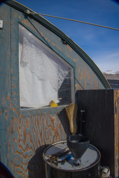
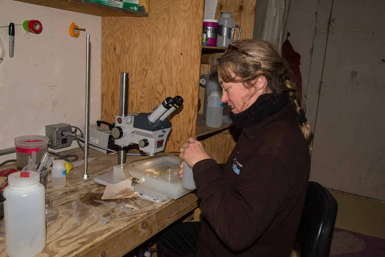
The New Harbor hut has character, with an accretion of knick-knacks added over many years by the dive teams that have come and gone, like the rubber ducky in the kitchen window.Laura removes a sample from one of the specimen jars.
Sam Bowser and his team of five other people at New Harbor camp are getting ready to wrap up their season after almost 7 weeks on the ice. So what occupied them all that time you might ask? While I was there, they were kept busy all day and into the evening with tasks related to Sam’s research on one-celled marine organisms called foraminifera (which they call “forams” for short) as well as the daily chores of living at an Antarctic field camp.
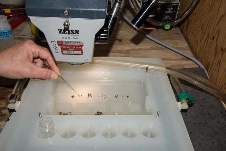
Different types of foraminifera in a lab tray.
Science-related tasks include diving beneath the sea ice to collect samples of forams from the upper centimeter of mud on the ocean floor, sieving the samples to find the forams, and then sorting them beneath a microscope into the different types they find there. When camp is closed up, they bring the specimens back to McMurdo where some are preserved and others are prepared to be shipped back live to the lab in Albany, NY, where Sam and two of the team members, Mike and Amanda work. Amanda worked with Laura and Sam in the lab, sorting specimens. They sometimes also note and take a look at other creatures that turn up in the collection bucket, such as scallops. Like a lot of ocean creatures in Antarctica, such as sea spiders, Antarctic forams are larger than elsewhere in the world, which is a major advantage if you want to study a one-celled organism. Amazingly enough, you don’t even need a microscope to see them, once they’re sorted. Some of them look like little white beads, and are rounded and smooth. Others, and these are the ones Sam’s particularly interested in, secrete an adhesive with which they manage to glue together grains of sand to form little shells for themselves — a remarkable enough feat, but they do this in icy ocean water. (That’s what I mean by “tiny stonemasons of the deep.”) Sam is working to figure out how. Laura laid some out for me to look at in a tray, picking them up with tweezers (they’re also surprisingly sturdy and don’t break when handled carefully). Different species can be identified by their characteristic shells — some only use very fine grains of sand, some use larger ones, some are rounded, some are branch-shaped, and one is sort of star-shaped. As you can see in these photos, you don’t need any special magnification to see them, although the microscope helps to see the structures in detail — above is a photo I took of the tray (click to enlarge all the smaller photos) and below is a close-up.
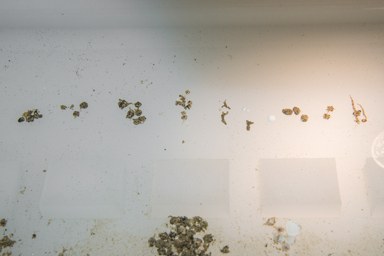
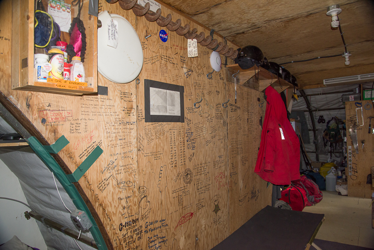
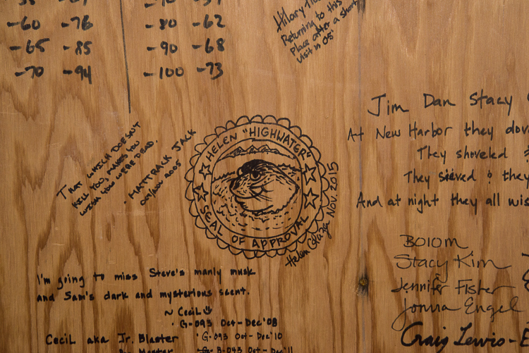
Those are Foram-stone houses, hon! (That’s a pun for you Baltimoreans; if you’re not from Baltimore, never mind.) Different types of foraminifera make different-shaped shells by gluing together grains of sand. The little white spherical ones that are above and to the right of the branching ones are species of forams with calcium carbonate shells.Home away from home at New Harbor.The lab (orange) and the outhouse (blue) with the dive hut on the sea ice in the distance to the right.The kitchen has a number of skylights and pretty much looks like this at 4:35 a.m. as well as 4:35 p.m., when the photo was taken, since the sun never sets. The gray bag hanging from the ceiling is where you can wash your hair, after a fashion, if you’re living there a long time.I slept on the guest cot, under a graffiti wall signed by research teams and visitors since at least the early 1990s.
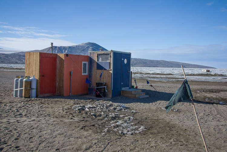
Camp chores include fixing meals and cleaning up, waste disposal, getting chunks of sea ice to melt for washing hands and dishes (bleach solution is added to disinfect it for that purpose), and meeting the helicopters that periodically deliver supplies and take away waste, because no waste, including used washing water, pee, poop, or trash that can or cannot be recycled is left anywhere in Antarctica. (That goes for McMurdo, too, with the exception that the station has a water treatment plant so the water and sewage isn’t shipped off site, but all other waste is ultimately sent off in container ships to California for processing.) All seven of us slept, cooked and ate in a pair of connected Jamesway huts. There is a separate structure that houses the outhouse on one side and the lab on the other. There is also a Jamesway on the ice that serves as the dive hut (it will be brought ashore when they close up the camp) and has all the diving equipment, as well as a hole in the floor where they can dive. But sometimes the divers travel to other dive holes they made elsewhere in the sea ice. I was surprised to hear that the ocean depth at the dive hut is 80 feet, because you can walk there in about 10 minutes from the shore. I also watched them dive from a hole they called the “tile hole” that is over water 40 feet in depth and those are the pictures you see here.
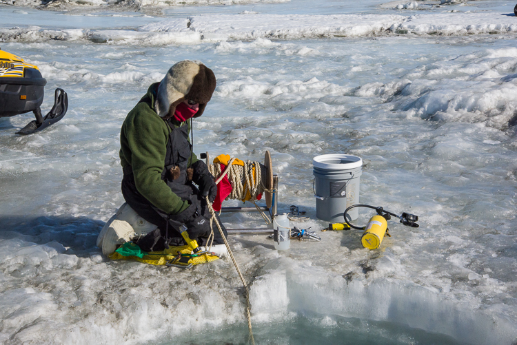
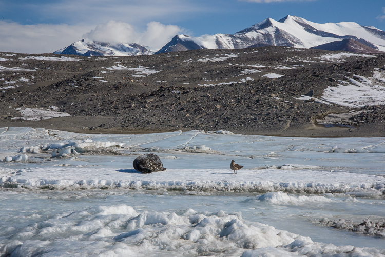
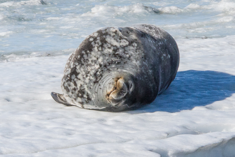
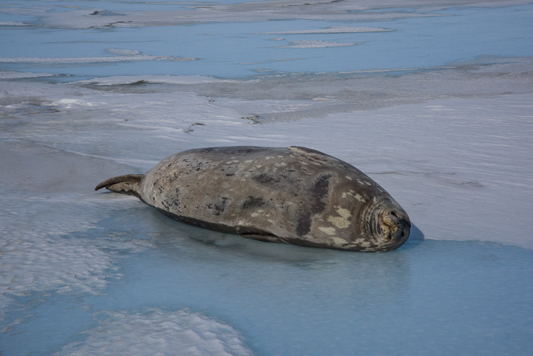
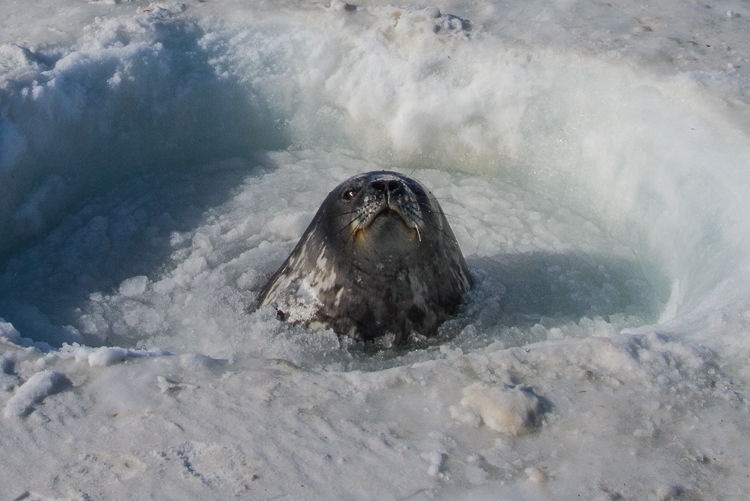
It’s not unusual to see Weddell seals around the dive holes — they normally have to laboriously chew holes in the ice to have a place to get in and out of the water, and having a human-made hole saves a lot of work! Mike pulled up on a snowmobile with scuba gear, but the seal wasn’t bothered and slept peacefully throughout the entire hour or so we were there.Henry lowers a rope with lights on it that will mark the spot so the divers know where to return.
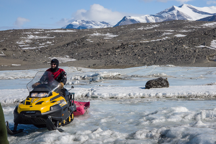
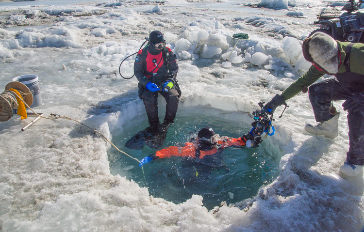
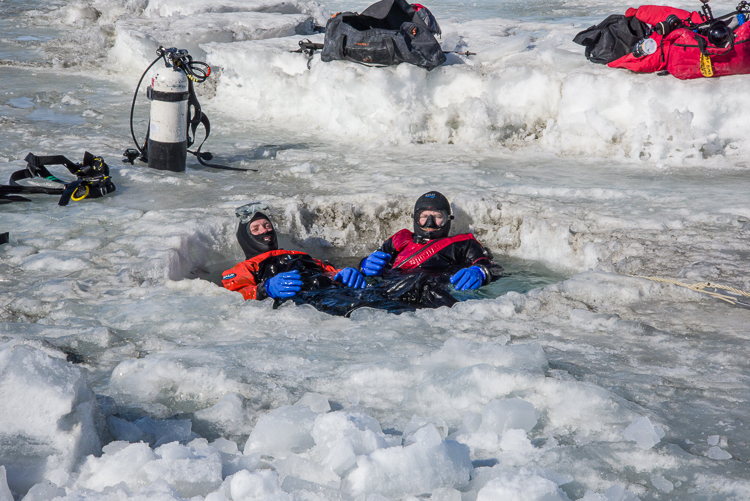
If the weather is “Condition 3” (i.e. good enough weather to safely go outdoors) the divers typically make two dives a day to collect samples. There were three divers this season who took turns diving, once in the morning and once in the afternoon. Two dive and one stays above ground to set up and help them in and out of the water. On my last day at the camp, Sam wanted some more samples from the area near what they referred to as the “tile hole,” so they brought their gear over the sea ice from the dive hut via sleds attached to snowmobiles. I walked over there along the shoreline and then carefully shuffled across the sea ice to the dive hole because there are lots of cracks you don’t want to get your foot stuck in, ice is slippery, and the surface is tilted and uneven in places. That day, Henry stood watch and Mike and Paul dove.
The seal didn’t stir when a skua landed nearby. Henry said to see a skua land so close to a seal was an unusual sight, but maybe the skua was looking for something it could scavenge, like blood or placenta from a newborn.Mike and Paul are ready to descend. Henry hands Paul the underwater video camera.
Now, I snorkeled once in a cenote (underground cavern) in the Riviera Maya in Mexico where we wore wet suits because the water temperature was in the 60s. And that was fun. But putting on a dry suit and entering 28.5 degree F water under a few meters of ice when the air temperature is in the upper teens sounds daunting, like the kind of thing you do because you have to as part of your job, not because you want to. But these guys live for it. I saw them come up from two different dives, and both times the divers came out saying, “That was great! I didn’t want to get out!” The dive durations are limited by the amount of air the tanks hold. After they came up and Henry helped them get the tanks off their backs, they hung out for a couple of minutes in the dive hole, as if they were sitting in a hot tub, and chatted about the octopus they’d seen in the same spot it had been several days ago. “It’s alive, it waved one tentacle,” one of them said.
Mission accomplished. Happy divers!The seal was still asleep when we left.
Laura has been posting photos of the camp’s activities all season on Facebook under their National Science Foundation as “Bravo! 043” (Bravo 043 being their radio handle when they communicate with the base camp.) See them here.
Before I left, I added my “Seal of Approval” to the graffiti wall in the Jamesway.
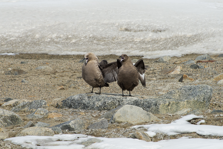
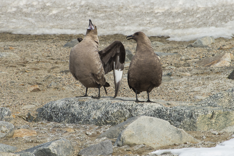
Sea ice pressure ridges looking toward the Ferrar Glacier.What does the skua say?: Haw! Haw! Haw! Haw! Haw!
I’m back from Sam Bowser’s camp — helicopter picked me up at 5 p.m. yesterday. Sam, his wife Laura and the rest of the team were really welcoming and fun to be with, and took me to a couple of fantastic places. I’ve already posted the trip Laura and I made in the previous blog entry.
The next day Sam, Laura and I went by snowmobile to a fascinating scenic spot that doesn’t really have an official name, but unofficially they call it “the road to Double Curtain Glacier.” Comic relief near the beginning of our trip was provided by a pair of nesting skuas standing on a rock. We stopped the snowmobiles and I got out the telephoto lens. They looked at us, and we looked at them, and then another skua flew a few feet above them, to which they responded by cawing loudly, “Haw! Haw! Haw! Haw!” as if to say, “Don’t even THINK about landing here while we’re on this rock.” Then they calmed down, then they started up again. It sounds like someone laughing sarcastically.
We must protect this house!The “Road” to Double Curtain Glacier has a lengthy section that looks like this, with very high pressure ridges where the sea ice has been pushed up against the coastline.
What we traveled on was not really a road, of course, it’s a flat area of coastline around New Harbor that this time of year is covered with snow and ice, and it looks like someone plowed a flat area of snow for vehicles and left the piles of snow and ice in a very even line on the sea ice side of the lane. What those piles really are is a pressure ridge, which is a ridge of ice pushed up by the movement of the sea ice. I saw such ridges on the McMurdo Sound sea ice when I was doing my training, but they were only a few inches high. I saw them by the New Harbor camp but they were a few feet high. But as we got closer to the Double Curtain Glacier, the lane got narrower and the wall got higher, forming a crazy Baroque facade that I’m guessing was 20 feet high in places! At some point, the road became so narrowed and slanted we parked the snowmobiles and continued on foot.
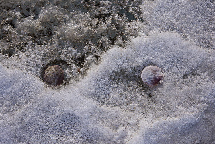
Sam was interested in the large numbers of scallop shells that had been carried to the shoreline by the ice.
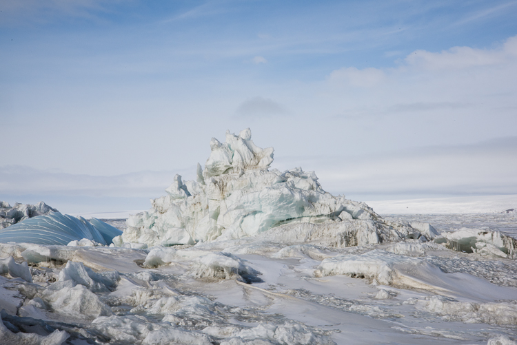
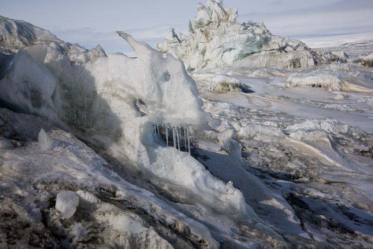
The ice has begun to melt and form weird shapes of unending variety. You don’t want to walk too close to one of those towers in case it becomes unstable and collapses. The pressure ridges have carried along numerous scallop shells which are scattered in the ice.
One of the odder sights was this blue curving wave of ice. I wanted to get a closer look, but it was hard to tell if the ice was stable enough to walk on, so I dared go no further.I named this formation “Fang,” because it looks like a cartoon wolf in profile.
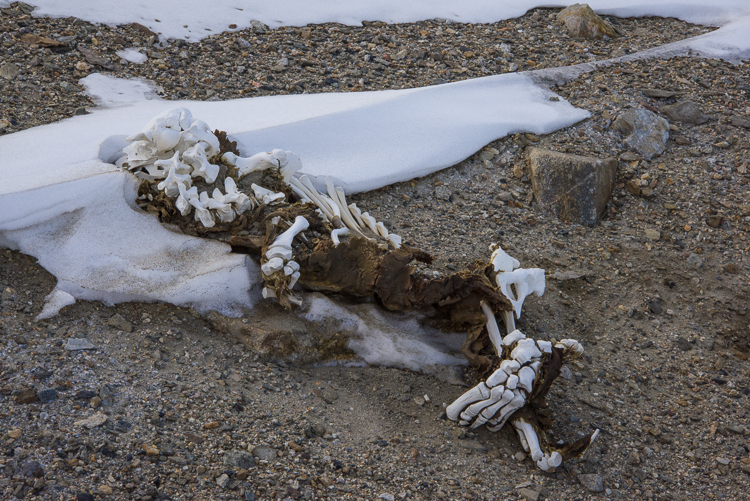
We eventually came to a place totally blocked off with ice. We climbed a little ways up the hill under the Double Curtain Glacier, and saw a mummified seal skeleton and some moss — the first plant life I’ve seen here.
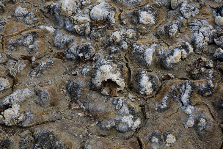
Mummified seal skeleton on the hillside above the pressure ridge. The Ferrar Glacier is in the distance.Close-up of the seal skeleton. The flipper anatomy is very clear on the right. There is some dried, mummified skin still attached. No telling how long it’s been here; could have been many years.The Double Curtain Glacier emerges from the fog above the seal skeleton. You can see how it has two different leading edges, hence the name “Double Curtain.”There was no plant life in evidence except a patch of moss with white salt crystals on top, not far from the seal skeleton. This is a close-up. We took care not to walk on it because it’s very delicate.From this elevated spot you get a good look at the Herbertson Glacier beyond the pressure ridge and across the sea ice from the Double Curtain Glacier.
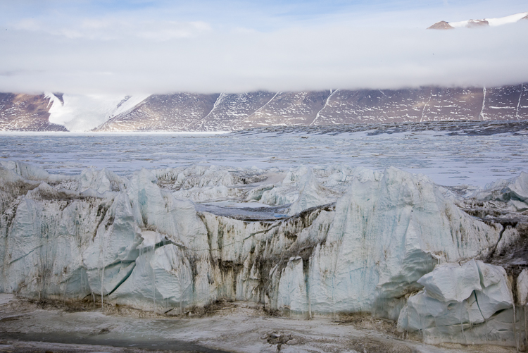
Many of the photos shown here were from that slightly elevated vantage point on the side of the hill. It was a clear day and we could see the Herbertson Glacier (which was directly across the sea ice) and the Ferrar Glacier (to our right from that spot). As we were leaving, we also drove onto the sea ice about halfway between the Herbertson and the Double Curtain and I got another nice photo of the Ferrar.
The Ferrar Glacier in the distance, as viewed from the sea ice.
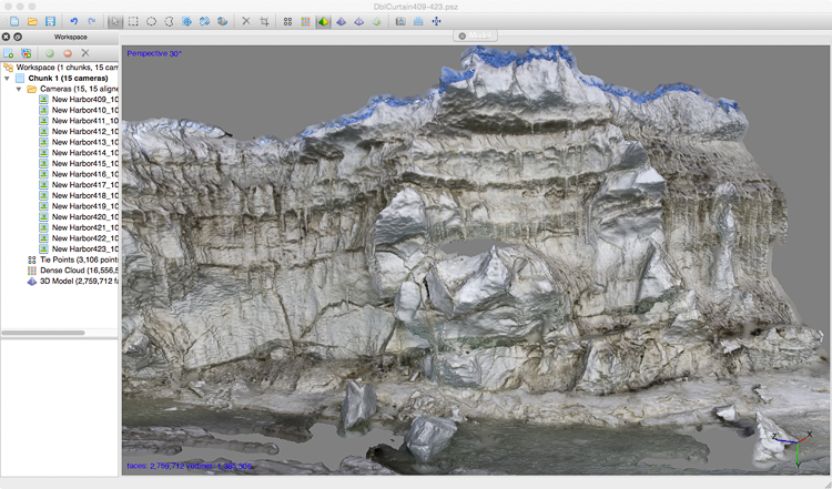
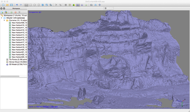
I am incredibly fortunate to have been able to visit this place, which one of Sam’s team told me very few people have gotten to see. Unless you are staying at the New Harbor camp, it is relatively inaccessible. I am working right now on processing some of the 3D captures I made there so I can bring back a little bit of the place for others to see. Once I clean up these files I’ll be able to fabricate them as sculptures with a 3D printer or router. I’ve got one capture processed already. Here are a couple of screenshots of it from the 3D file creation program:
3D file of part of the pressure ridge, shown with the “texture layer” (the coloration).3D file shown without the texture layer.
Friday, Nov. 20th, I arrived at Sam Bowser’s camp at New Harbor (also known as Explorer’s Cove). The campsite is on the shore of the sea ice. They need access to the water because they scuba dive under the ice to collect mud from the bottom which they sieve in the lab to collect foraminifera, the one-celled creatures Sam studies. The Antarctic variety are particularly large and easier therefore to study, which is why he’s been coming here for years. He’s interested in their adhesive properties, because they secrete an adhesive that securely glues grains of sand together to form protective shells, and they do all that underwater (and the Antarctic variety do that in 28.5 degree F water to boot). How do they do it? The answer could have practical applications — imagine having an adhesive that would work while submerged that could be used during surgery, for example.
Paul helps Mike exit the dive hole. The divers can stay down about 20 minutes.
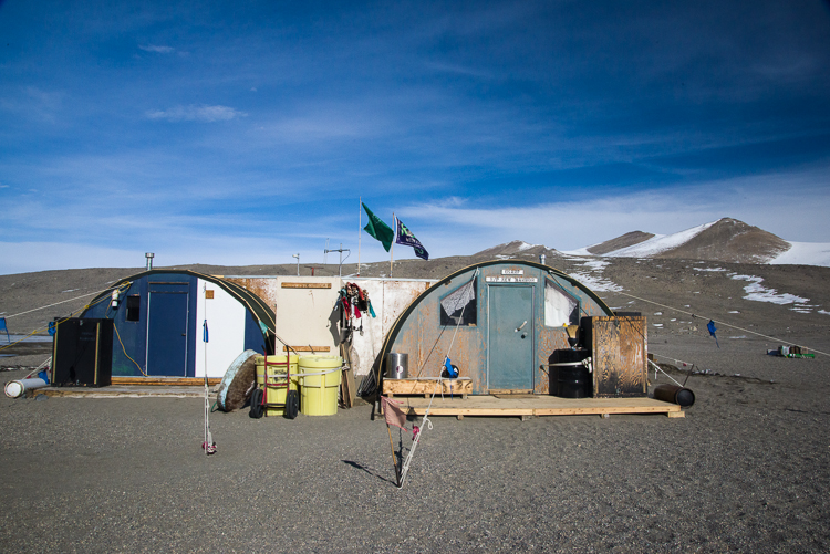
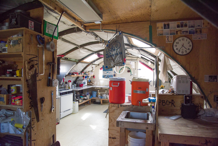
At the camp are Sam’s wife, Laura Van Rosk, an artist who while here assists in the sieving, sorting and organizing of the foraminifera samples, Amanda, also a lab assistant, and Henry, Mike and Paul, who take turns diving. We are all living in a structure that has been here for many years that has a kitchen and dining table in one section, cots set up for sleeping in the other, and a passageway in between, which is where the visitor’s cot is; that’s where I’ve been sleeping. The lab and the outhouse are each separate buildings. Everyone has been very welcoming and helpful.
There’s also a dive hut on the sea ice, although sometimes they dive from different holes. Amazingly, even though the dive hut isn’t that far from shore, the water is 80 feet deep beneath it. The sea ice closest to the shore is very rough, much more choppy and irregular than at McMurdo, because it’s multi-year sea ice as opposed to ice that freezes and melts every year. There’s a pressure ridge they call “the moat” where the multi-year ice meets and ice that thaws and melts, and is therefore flatter. Riding a snowmobile across the multi-year ice was a bumpy ride; walking on it takes extreme care as it is also quite slippery.
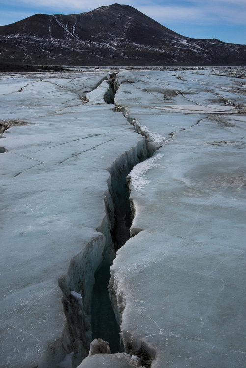
Multi-year sea ice cracks and heaves and is very bumpy and irregular.
On Saturday, Laura took me out on the sea ice on a snowmobile. We visited a couple of spots, including an enormous iceberg that is frozen into the sea ice. I walked all the way around it taking pictures from every angle for a potential capture (i.e. 3D scan). I’m not sure if my software will process the entire iceberg as a single object, but I should be able to at least get 3D files of portions of it. Certainly, if I’m ever going to do a 3D iceberg, that’s a good way to do it, walking on solid ground as opposed to being in a Zodiac boat. It took me about 40 minutes to walk around the whole thing, taking a shot every few feet. We also saw a young seal napping on the ice, and later another one popped his head out of one of the diver’s old dive holes. Got photos of all that. I’ve posted a selection from the day here.
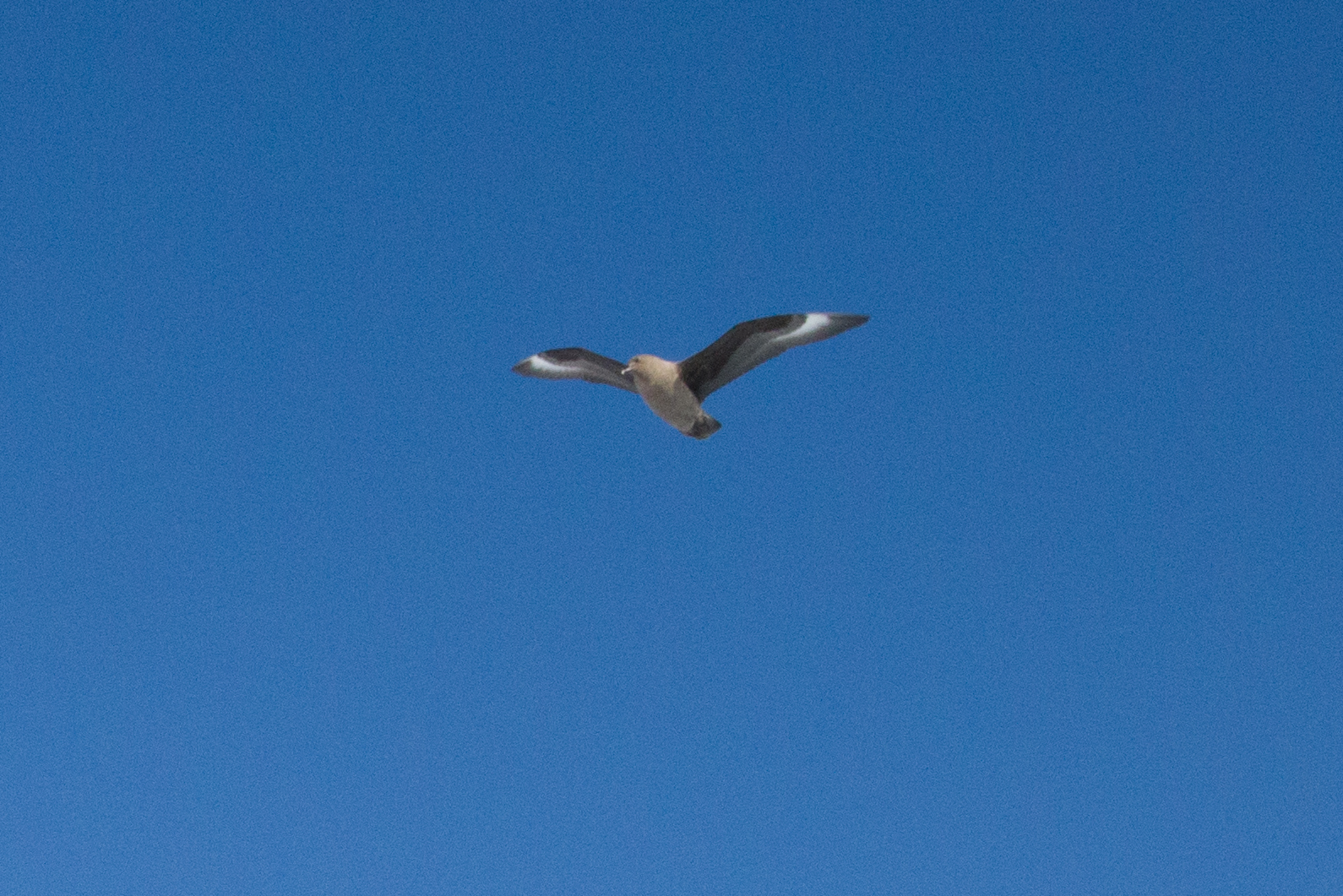
Iceberg stuck in the sea ice. It was about a 30 minute snowmobile ride across the sea ice to get there, and then I spent about 40 minutes tramping around it shooting it from every angle. You can see this iceberg from the camp way in the distance.The sea ice is a great place to chill — if you’re a Weddell seal. We found a young Weddell seal resting on the sea ice near Cape Bernacchi. Here’s a video clip Laura shot:A different seal pops its head out of a dive hole at Cape Bernacchi used by Sam’s team a few weeks ago. It took a few breaths of air before submerging again.Skua flying overhead. It’s just begun to be warm enough for the skuas to return to the area.
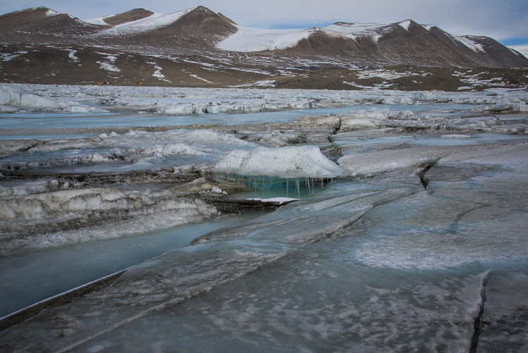
Melting sea ice creates unusual formations, like this shelf delicately held up by icicles.
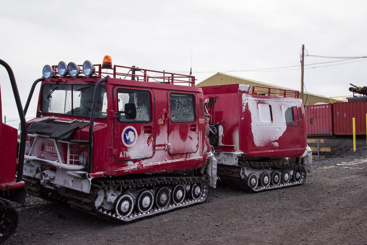
We traveled on the sea ice in this tractor, called a Haagland. We sat up front, and the equipment rode in the back section. If you look closely at the front, you see it’s named Gretel. There is another Haagland named Hansel.Ben drills into a small area where we’ve cleared away the snow to measure the thickness of the sea ice.The drill is pushed as far as it will go or until it hits water. If it doesn’t hit water but goes all the way in, we know that the ice is thick enough to support the heaviest vehicle.Ben has lowered a tape measure into the hole he just drilled to measure the ice thickness. It was 240 cm thick.It’s hard to read distances in Antarctica. This picture of Turtle Rock (the small dark mound at the end of the road) was taken at about 1 p.m. ……and this picture was taken 27 minutes later. It was much farther away than it had seemed, even taking into consideration we were probably going about 15 mph. There are Weddell seals in the center and off to the left.
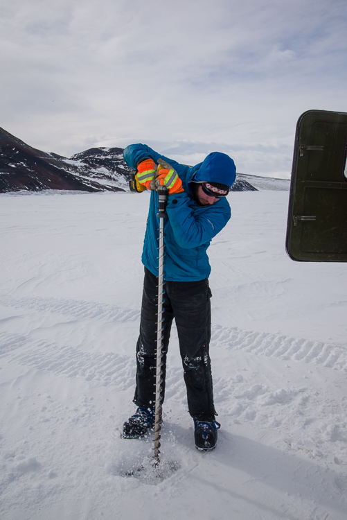
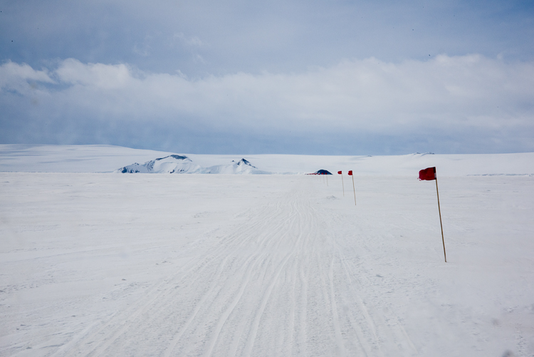
Before joining Sam Bowser’s camp beside the sea ice at New Harbor, which is the first field camp I plan to visit, in addition to the prior day’s trainings, sea ice training was required. That involves learning to recognize and measure cracks in the ice, so you know if it is safe to cross with a snowmobile or a heavier vehicle such as a Haagland, a tractor used to transport materials to field camps. My logistics coordinator arranged for me to get the training by assisting Ben, one of the mountaineers, who measures the thickness of the sea ice in the Ross Sea weekly until it breaks up sometime in January and floats away. He had also been tasked with going to Turtle Rock, an island that is iced in, because a seal study wanted to cross an area that has begun to crack nearby, and they wanted to know where it would be safe to drive a Haagland or a larger and heavier vehicle called a Challenger. So my training ended up not just being an academic exercise but actually assisting with gathering information needed by the science program. We were out for about 3 hours.
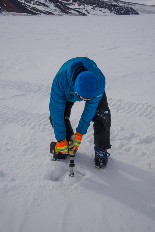
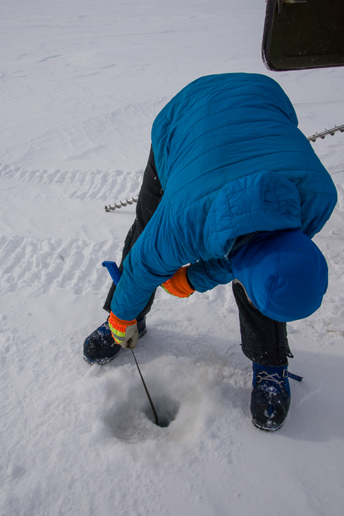
I took some pictures of Ben checking the thickness at one the sites he measures weekly, a feature known as Big John’s Crack (see above). First we shoveled the snow away from a small area. Then he attached a long bit to the drill (actually the one he was using in those photos is two bits hooked together), and drilled a hole. When water comes gushing up the hole, you know you’ve drilled through the ice. Then you lower a tape measure through the ice that has a collapsible brass bar at the end. You reel the bar up and it catches against the underside of the ice. Then you look at the measurement. All three places he monitored that day were very close in measurement — 237 cm or 240 cm each. That tells you the sea ice is very uniform in its thickness, which surprised me because the monitoring spots were so far apart there was a lot of driving between them.
The thickness of the ice below the cracks near Turtle Rock were not nearly as thick. Some were more than 140 cm, which is more than enough for the heavy vehicles, but a few were not, so we knew which areas the vehicles would have to avoid.
At Turtle Rock, I saw my first Weddell seals which was very exciting! They were lined up along a long crack that paralleled the shoreline, just lying still. Every once in a while, one would raise its head when we passed, but most of them just lay there. Seals are a good indicator of where the deepest cracks and therefore the thinnest ice is, because they chew holes through the ice to come in and out of the water, and they don’t want to work any harder than they have to. As we drove along in the Haagland and I looked at the seals I found myself amazed to be there.
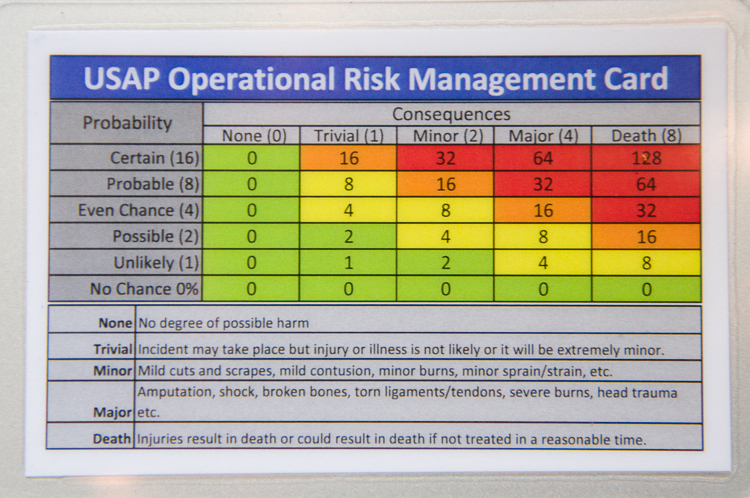
A wallet-sized laminated card to help answer the question, “Um, should I really do this?”
The past couple of days have been devoted to completing required trainings for going out into the field. As has been constantly stressed to us, Antarctic can be a harsh environment with rapidly changing weather conditions, so safety and proper preparation are primary concerns. The temperature on the base has been in the mid to upper teens. The sun has been shining every day (and every night — it’s a bit freaky to wake up in the middle of the night, notice a bit of light leaking in from around the edge of the window shade, check the time, and discover it’s 3:30 a.m.). Yesterday was so windy that even though it was bright and sunny all day, they cancelled the incoming flight from Christchurch, and the stiff wind certainly made it seem colder than the other days. The ECW gear (as in “extreme cold weather”) they give you is very effective.
Yesterday’s first training was snowmobile driving. Learned how to perform the safety checks, free the runners if their iced to the snow, and then how to drive it. Drove it up and down a gentle incline a few times, practiced turning, and then practiced how to shift my weight to keep it upright when riding over an incline such as a mogul (lean uphill, and swing both legs over to that side if necessary, in case you were wondering). Took that baby up to 15 mph — the local speed limit. Feels a lot faster when you’re riding the Skidoo than it does in a car though. Brought a helmet back to my room to have available for the duration. Add that to my resume!
The afternoon was survival training for people going into the field, in case you’re dropped off somewhere and say, bad weather grounds your flight back so you have to use your survival kit. The survival kit is a duffel bag containing a bright yellow tent that’s easy to set up quickly, a camp stove, food, sleeping bags and other necessities. We practiced pitching the tent and lighting the camp stove in a large indoor area outside the classroom. The teacher is a mountaineer who works on the Search and Rescue Team here during the research season and at Yosemite the rest of the year. In between the hands-on portions were slide lectures, including some truly disgusting photos of frostbite that I could barely stand to look at (e.g. a large swollen foot the color of grape jelly), the point being to drive home the consequences of being unprepared to cope with the cold. Point taken: gotta take the ECW and the survival kit when you’re heading out, even if you ultimately don’t need all of it.
We were all given a little card (shown above) with a chart to help assess risks in advance — the idea being if it’s in the red zone, nooooo, what? are you crazy?! And if it’s in the yellow zone, that doesn’t necessarily mean you don’t do it, but you do pause to think through ways to lower the risks. We broke into small groups to read a scenario apparently based on an actual incident, in which a group of six workers got themselves stranded a couple of hours drive out of town in bad weather and had to be rescued, after making a series of bad decisions. What was interesting to me is that part of what got them into the terrible situation was what the instructor called being too “mission-focused” — i.e. they really wanted to get the job finished having come all that way to do it, so they pushed their luck instead of resigning themselves to having to leave it undone for another day with better conditions. Though the consequences haven’t been anything like life or death, I must admit I can get caught up in the quest for completion at times when it would be better to stop for the moment. Note to self: watch for those times when your “mission-focused” streak stops being an asset.
On a lighter note, the air is so dry here that my hair has been completely straight, instead of the usually springy curls. There was a time in my teen years I yearned for straight hair and subjected myself to hot electric curlers to get it, but now that I have it without effort, I’m not exactly embracing the look. As I looked at my lank, flat hair in the mirror last night I suddenly realized that a lot of the people I’ve noticed walking around wearing hats constantly while indoors are neither cold nor making a fashion statement, but are doing their best to cope with a permanent bad hair day. This morning I hit it hard with conditioner, but I’m keeping the Indoor Hat Option, as I have named it (or IHO — everything here has an acronym), available if I start looking the way I did by the end of yesterday!
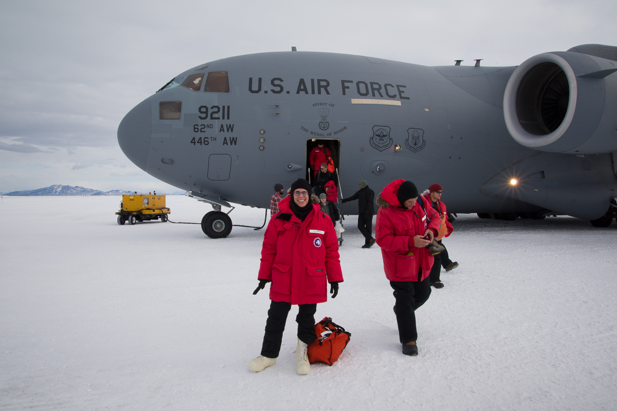
Pre-flight briefing room at the Antarctic Center in ChristchurchWaiting to take off in the military transport planeWe sat along the sides with cargo containers in the center.Setting foot in Antarctica for the first time!Boarding Ivan the Terra Bus for the drive to McMurdo
Today (Monday, Nov. 16) was a long day. I got up at 4 a.m., checked out of my room at the Quality Inn in Christchurch, and rode a shuttle with two astronomers to check in for our flight to McMurdo at the Antarctic Center. After having our bags weighed (mine, with the extra gear they’d given us, came to 83 lbs. which is a good thing, since the limit is 85!) we assembled in a room for a pre-flight briefing with information about how the general rules of conduct regarding waste disposal, energy use, contact with wildlife, etc. Then we boarded a military transport plane that was large enough to fit a big metal storage container and lots of pallets of supplies. All the pipes and cables that are hidden in a commercial airplane were exposed. There were a number of US Air National Guard people on the flight; they fly some of the planes to ferry people around here. We were handed earplugs as we got on, and once the engines started I could see why. So there wasn’t any conversation. I managed to doze for the first couple of hours with the white noise.
The flight was about 5 hours. We’d been instructed to pack a “boomerang bag” in case the plane encountered bad weather and had to turn around and fly back to Christchurch. The bag was supposed to contain items we’d want if we had to spend the night in Christchurch. At some point, I looked at my watch and realized we’d been flying more than 3 hours, which meant we were going all the way, for which I was glad.
We touched down on an airfield called Pegasus on the sea ice. A videographer from New Zealand named Rachael, who’d been sitting next to me, took my picture and I took hers. Then we all boarded the bus known as “Ivan the Terra Bus” for an approximate 90 minute ride to McMurdo. It isn’t that McMurdo is that far away, but vehicles can’t ride more than 25 mph on the packed snow, and Ivan was loaded down so was even slower, especially when we started climbing hills. We dropped off the Kiwis (New Zealanders) at Scott Base and continued on to McMurdo.
I was greeted by Elaine, my logistics coordinator from Lockheed Martin, which does the logistics for the program. There was another briefing, then I went up to my dorm room, which is pretty much like a college dorm room, with two beds, beat up furniture, and a bathroom that we share with the room on the other side. My roommate turned out to be a young woman who is a volcanologist and post-doctoral fellow from the University of New Mexico, who arrived on the same flight as me. This is her second trip to Antarctica and she expects to leave for the volcano Mt. Erebus by the end of the week.
Tomorrow I start field training bright and early — a 7:30 briefing, snowmobile training all morning, and an indoor field safety class all afternoon. At 7 p.m. I’ll have another lecture to attend. Wednesday will be an easier day, with only an hour’s worth of trainings in the morning. Thursday I have sea ice training all day. After that, hopefully I can join Sam Bowser’s team at New Harbor out in the field.
It’s amazing to actually be here. Almost hard to process after all the anticipation and planning that I’m really here.
Yesterday I arrived in New Zealand after a very long two days of travel: a 3 1/2 hour flight from Baltimore to Dallas, 7 hours at the Dallas airport, an 18-hour flight to Sydney, which was an hour longer than it was supposed to be because of headwinds. I was lucky that the middle seat in my row of three was empty. I did my best to sleep. After landing in Sydney, a 2 1/2 hour layover, and then got on the plane to Christchurch, New Zealand, from where the US Antarctic Program stages. That flight was on Emirates Air, which was the nicest economy flight I’ve been on in a long time — comfortable, roomy, lunch included, and they even brought us warm washcloths to freshen up before lunch!
This morning was a briefing, a laptop check to make sure our antivirus protection was up to date, and the main event, being given our polar clothing and trying it on to make sure it fit. There were a couple of young women scientists in the changing room with me who had been there before and so I got some good tips about gloves. One will be at McMurdo and then other is a volcanologist and will be going up onto the volcano.
Tomorrow we are scheduled to leave for Antarctica early in the morning. Check-in at the US Antarctic Center is at 5:30 a.m., so the shuttle is picking us up at 4:45 from the hotel. Normally I’d dread getting up that early, but I’m still not adjusted to the time zone and have been waking up around 3:30 a.m. anyway!
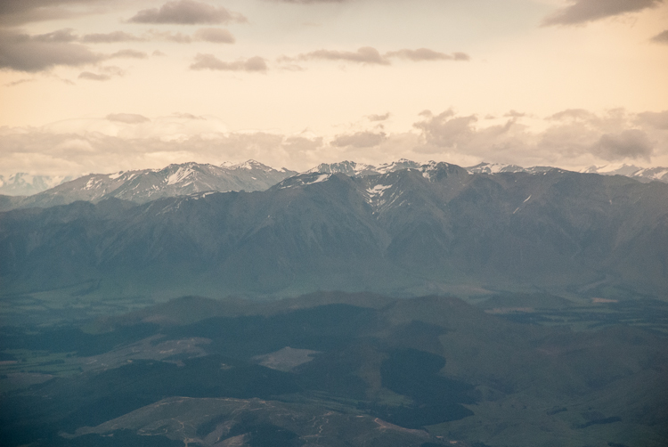
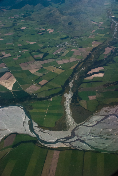
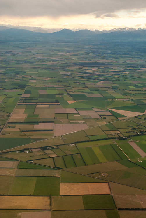
Here are some photos I took from the plane as we flew over New Zealand. The mountains are the Southern Alps on the west coast of the South Island. The flatter areas are the farmlands you see as you approach Christchurch, which is on the east coast.
Southern Alps on New Zealand’s west coastSouthern Alps on New Zealand’s South IslandAerial view of New Zealand countrysideFarmland in New Zealand toward the east coast of the South Island.